Plato’s tale of Atlantis, told in Timaeus and Critias, has fascinated readers for over two millennia. Yet Plato was not writing in a vacuum. Across the world, from India to Mesopotamia, from Egypt to Tamil traditions, we find stories that sound strangely familiar. These are not “proofs” of Atlantis, but parallels—echoes of catastrophe, paradise, or vanished lands.
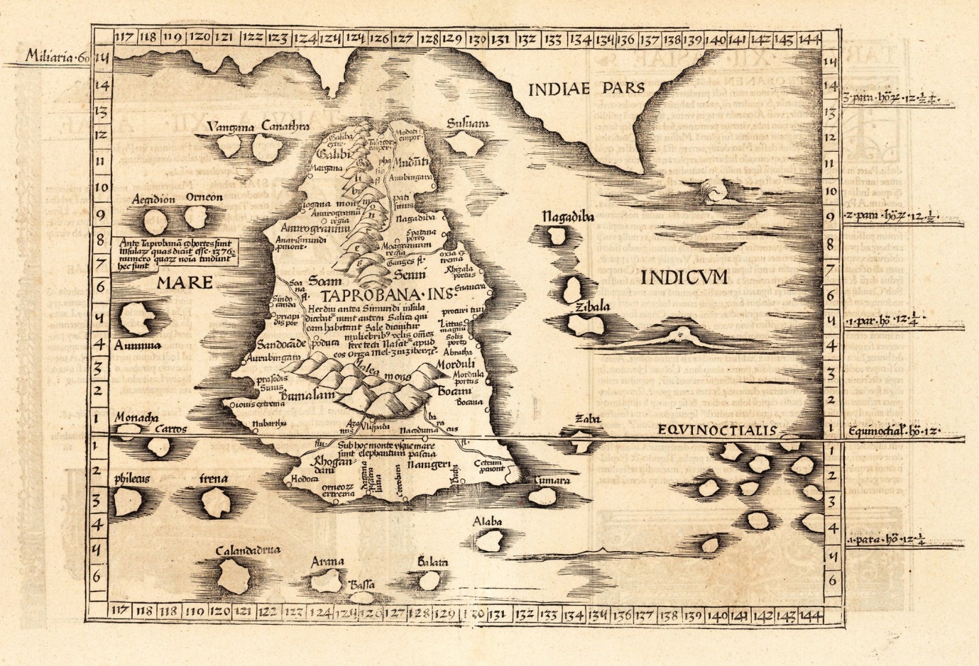
Kumari Kandam (Tamil Memory of a Sunken Land)
The Tamil tradition speaks of Kumari Kandam, a lost landmass once ruled by the Pandyan kings. Ancient Tamil texts like Silappatikaram and Kaliththokai describe Sangam academies—gatherings of poets—some of which were said to have been drowned by the sea. Later Puranic texts placed Kumari Kandam in the deep south, now swallowed by the ocean.
It was imagined as a vast territory divided into 49 regions, crossed by mountains with 48 peaks, irrigated by channels from four great rivers. Mining of gems and gold was central. Eventually, the land was said to have been “swallowed by the sea” (Katalkol).
In modern times, revivalists fused this myth with the Victorian hypothesis of Lemuria, a now-abandoned scientific theory about a sunken Indian Ocean continent. Tamil nationalists embraced it as ancestral memory. In my earlier article on Lemuria, I showed how Kumari Kandam became conflated with Lemuria and even Mu, giving the myth a global spin.
Atlantis echo: A golden civilization, irrigated plains, gem mines, destroyed by rising seas.
Kangdez (Iranian Fortress-Paradise)
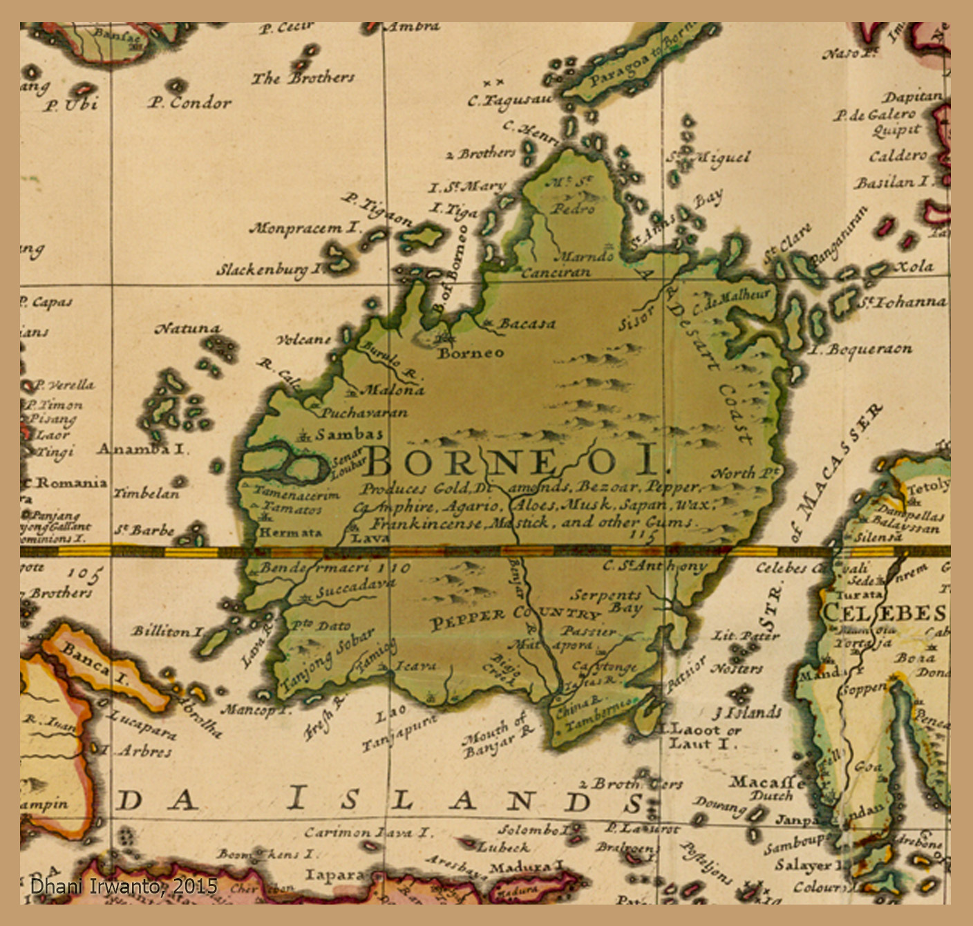
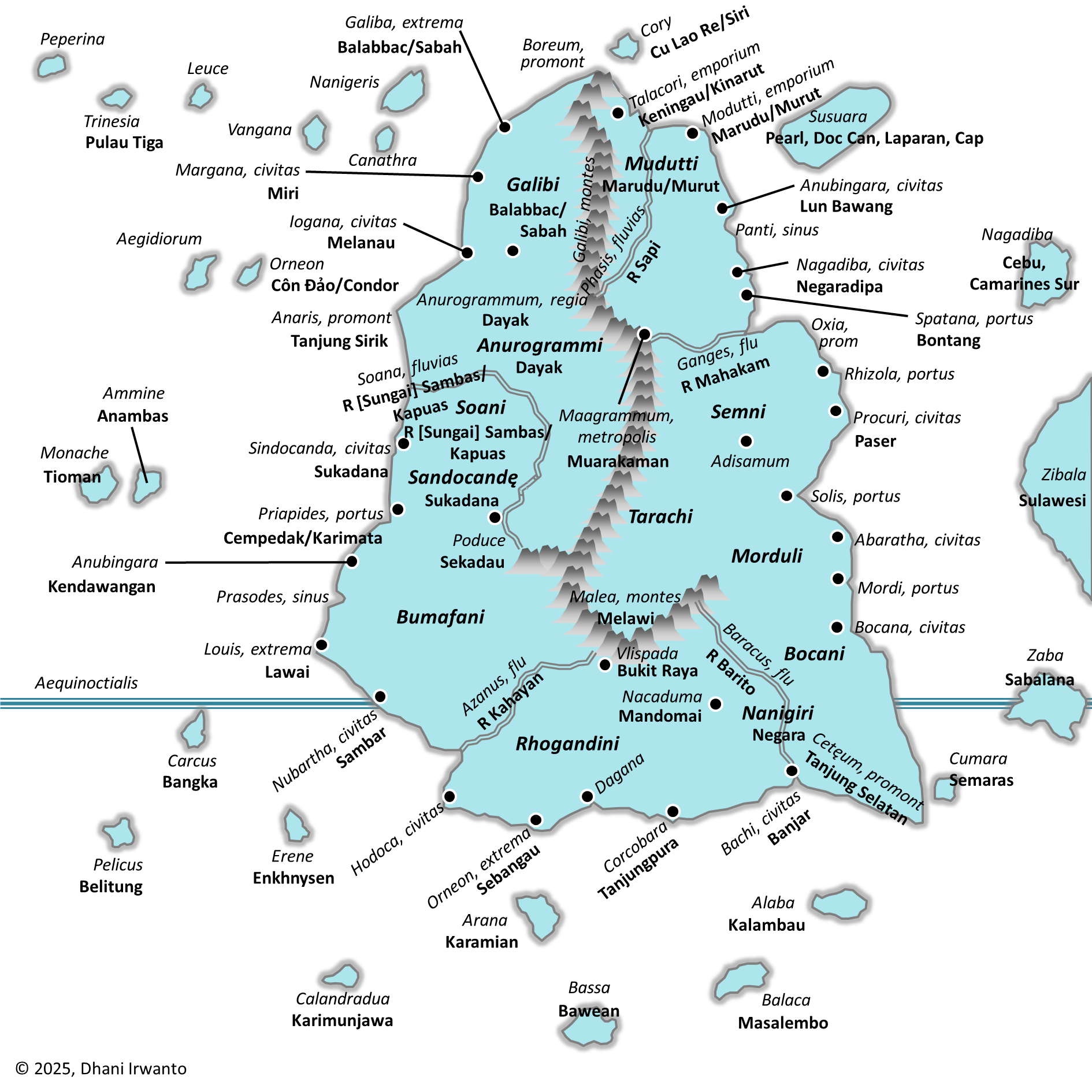
Iranian epic literature preserves the memory of Kangdez (Fortress of Kang). In the Shāhnāmeh and Bundahishn, Kangdez appears as a miraculous walled city in the Far East. Slides highlight its placement: “at the far eastern ocean, about six months to a year’s voyage from Iran, near the equator, outside China, east of India.”
Descriptions of Kangdez include concentric rings of walls layered with metals and precious stones, plentiful waters, eternal springs, and places of play, silver and gold towers, and a great plain influenced by the sea’s tides with rivers flowing south from volcano-studded mountains.
Atlantis echo: Both traditions emphasize concentric fortifications, gleaming metals, abundance of water, and a paradisal yet precarious geography.
Neserser (Egypt’s Island of Osiris)
In the Book of the Dead (Papyrus of Nu), we encounter Neserser—“the Island of Fire” in the far East, where the sun rises. It is the dwelling place of Osiris (Ausares, Asar) and Thoth. The imagery is vivid: Osiris enthroned in the center of six or seven concentric circles on a sacred lake, a volcanic-like “island and lake of fire” dedicated to Ra, floods that reshape the landscape, and Thoth residing nearby, keeper of divine knowledge.
Later Egyptologists described these circles as “hidden after the flood.”
Atlantis echo: Here again are concentric circles, a sacred island, a great flood, and divine kingship.
Mount Nisir (Mesopotamian Flood Memory)
The Epic of Gilgamesh recounts a great flood, where Utnapishtim builds an ark. After seven days, the boat grounds on Mount Nisir. Slides add color: the land in the Far East was like paradise, with forested mountains, rivers, vast plains, noisy birds, cicadas, and monkeys screaming in the trees.
This imagery is tropical—not the dry Mesopotamian steppe, but a lush, equatorial realm. Some scholars note that “Nisir” is phonetically close to “Neserser” and even “Nusasura.”
Atlantis echo: The flood, the grounding of survivors on a mountain, the paradise-like tropical plain.
The Asuras and the Ahuras
In early Vedic India, the Asuras were not evil—Varuna, guardian of cosmic law and the waters, was chief among them. Later texts, however, cast the Asuras as enemies of the Devas, while Varuna retained dignity as a god of oceans.
In Iranian religion, the cognate term Ahura (as in Ahura Mazda) was elevated as the supreme god, while the Daevas (same root as Devas) became demons.
India (early Vedas): Asuras = powerful lords, led by Varuna
India (later): Asuras = demons
Iran: Ahuras = good, Daevas = bad
Assyria: Ashur = supreme deity
Egypt: Osiris (Asar, Asari) = supreme deity with concentric-circle symbolism
Atlantis echo: The Atlantean kings were “Poseidon’s sons.” Poseidon parallels Varuna/Baruna, lord of seas and boundaries. The name “Atlas” recalls “Asura/Ashur/Osiris.” We glimpse a very old naming web that Solon may have repurposed.
“Atlas” and “Poseidon” as Borrowed Names
Plato openly said he borrowed names “to make the tale intelligible to his audience.” Thus Atlas and Poseidon may be Greek masks for older gods.
Atlas: The mountain-bearing Titan in Greek myth; but also linked to the root “Asura/Asar.”
Poseidon: God of seas and quakes, mirroring Varuna/Baruna/Vouruna—Indo-Iranian lords of waters and oaths.
These echoes suggest that Solon translated Near Eastern deities into Greek equivalents. The concentric rings, sacred kingship, and sea-lord all survive the translation.
The Garden of Eden
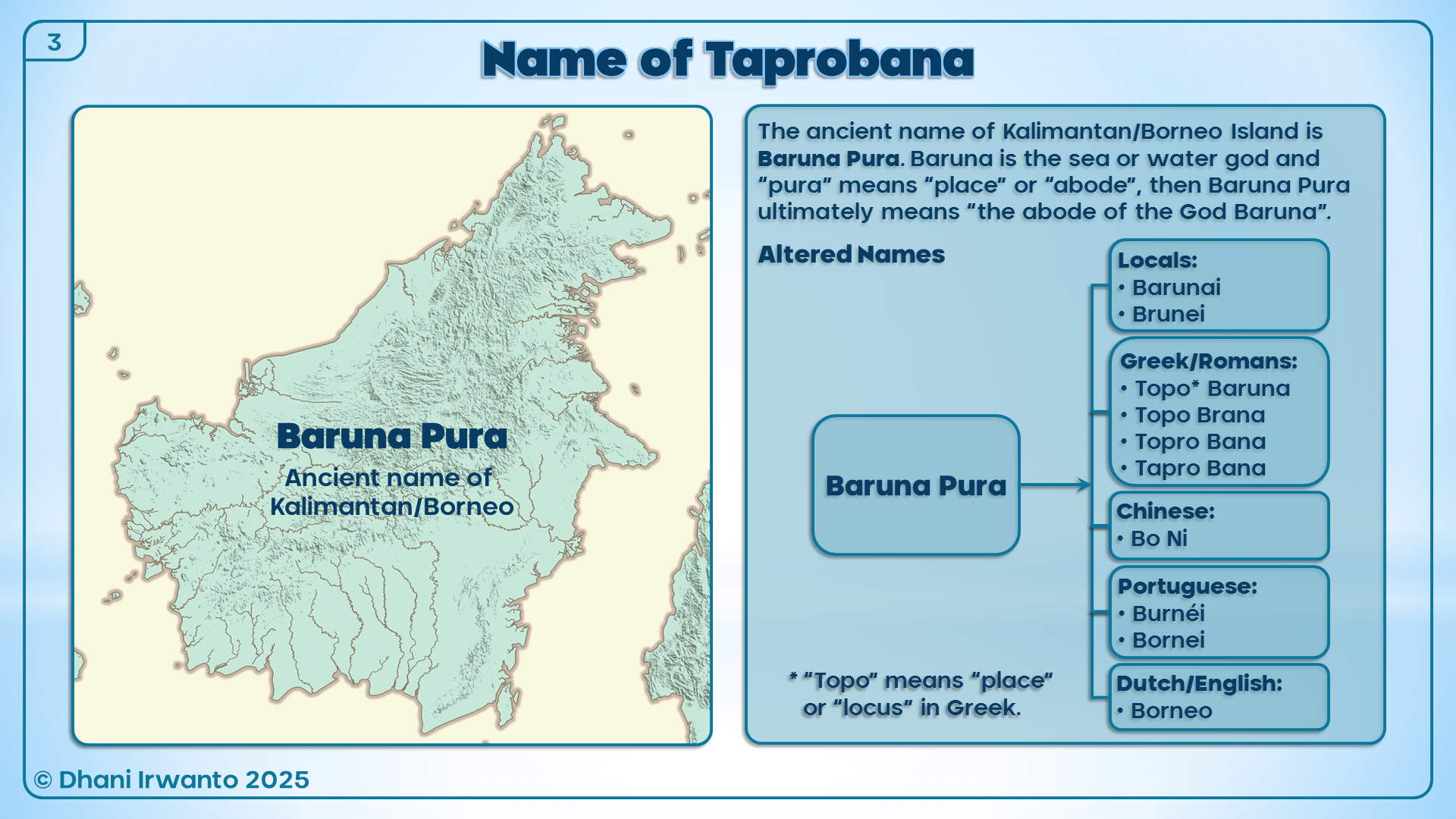
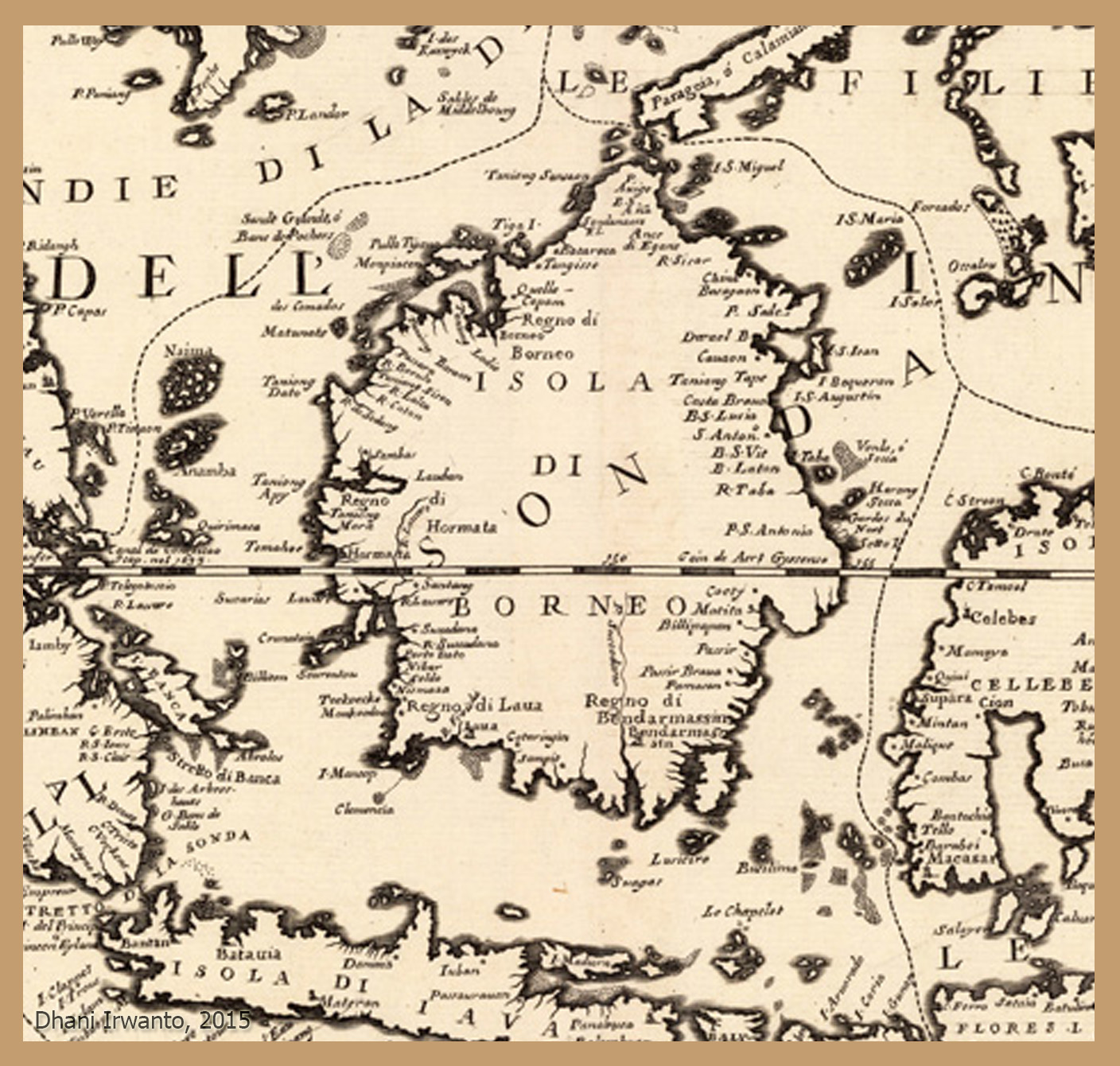
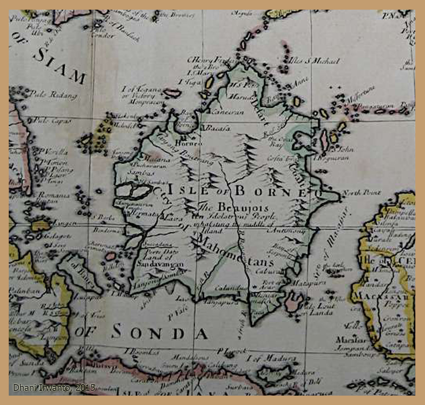
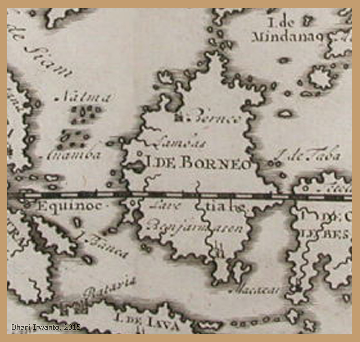
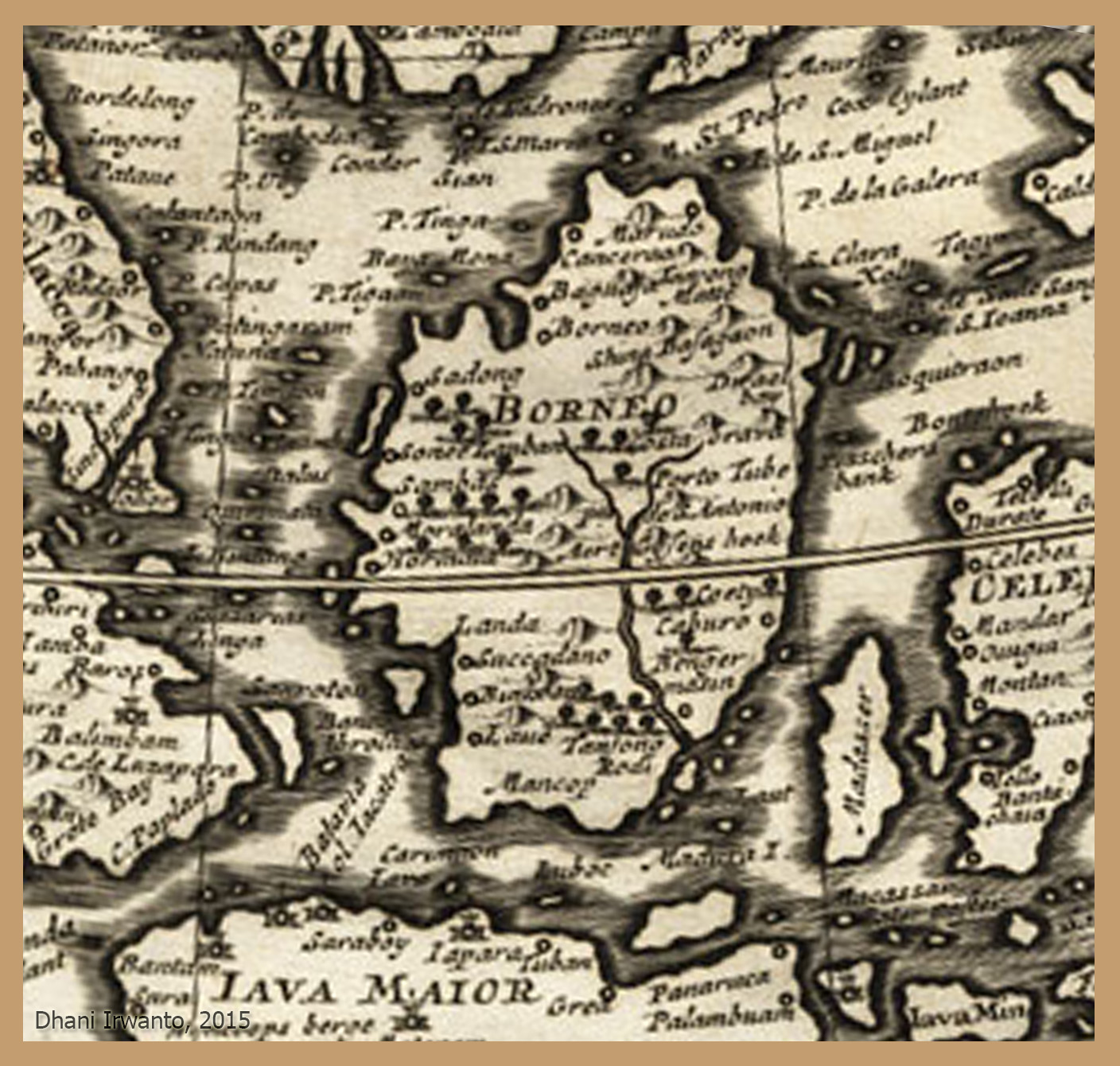
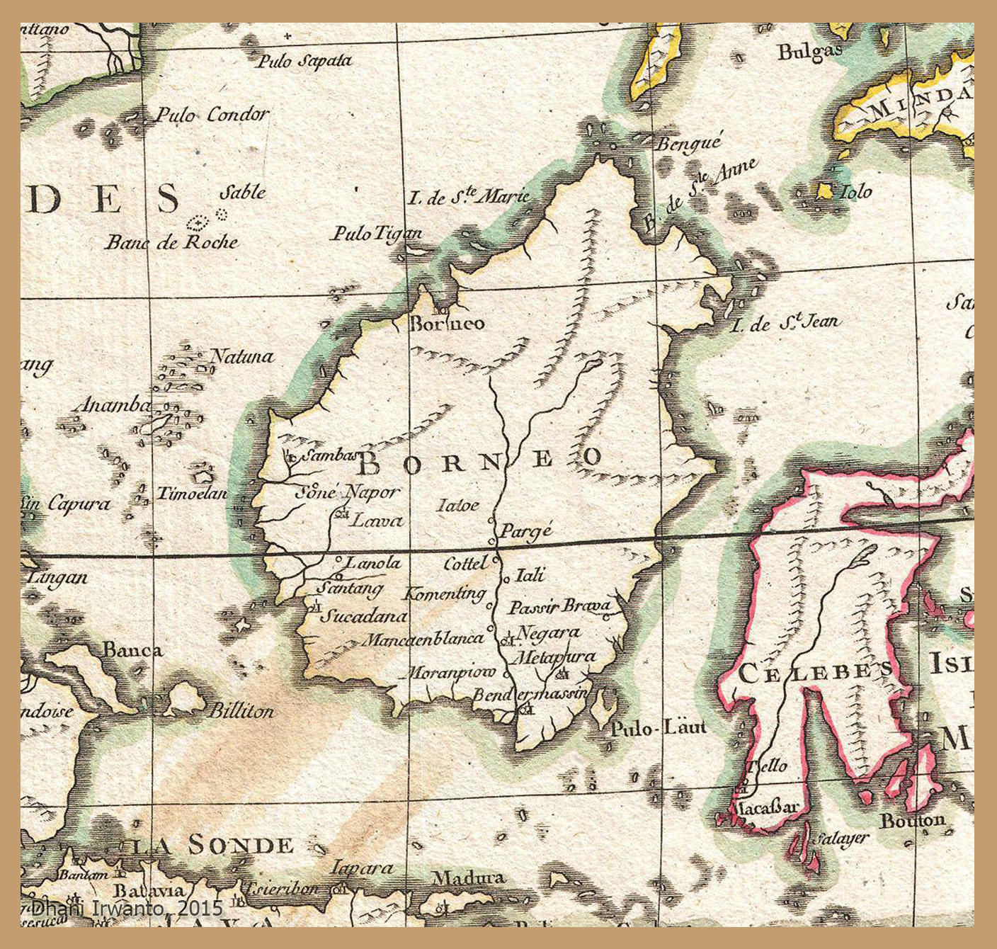
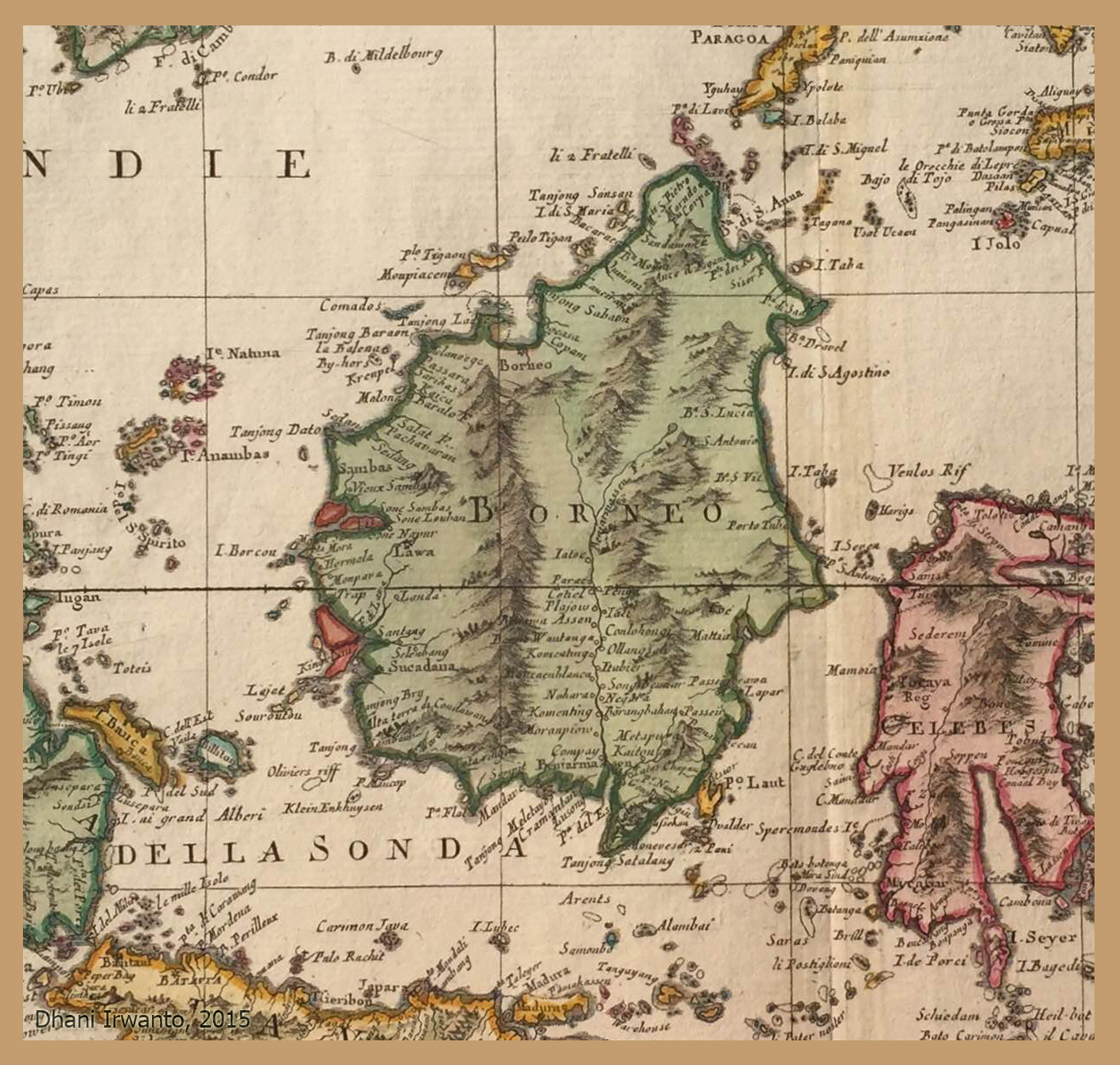
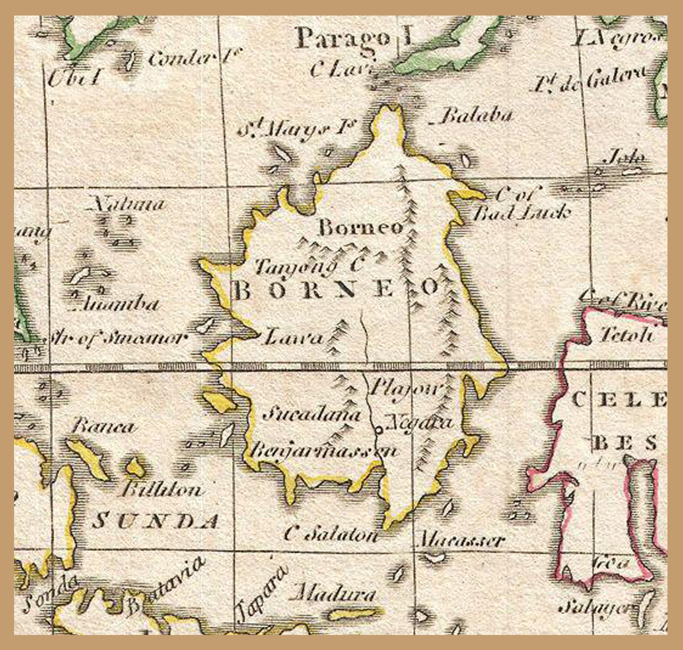
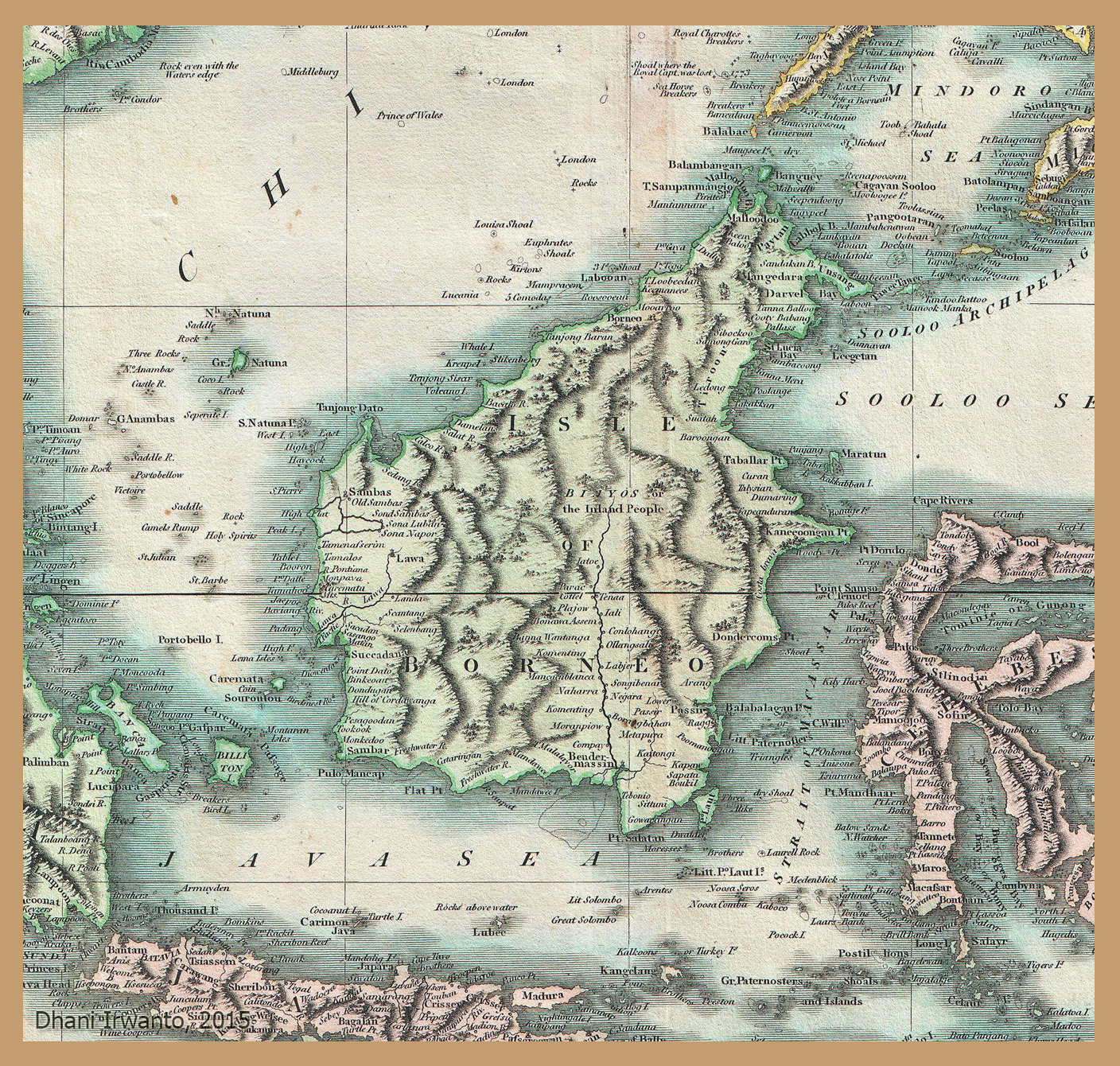
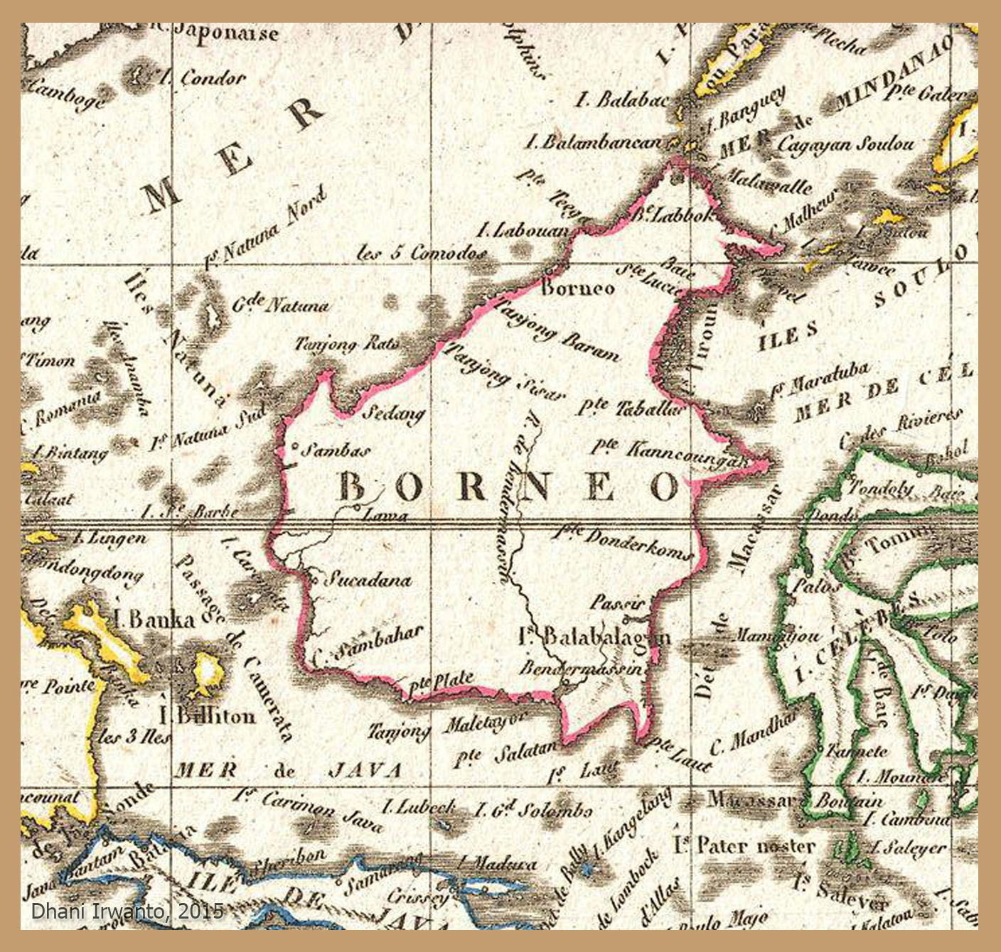
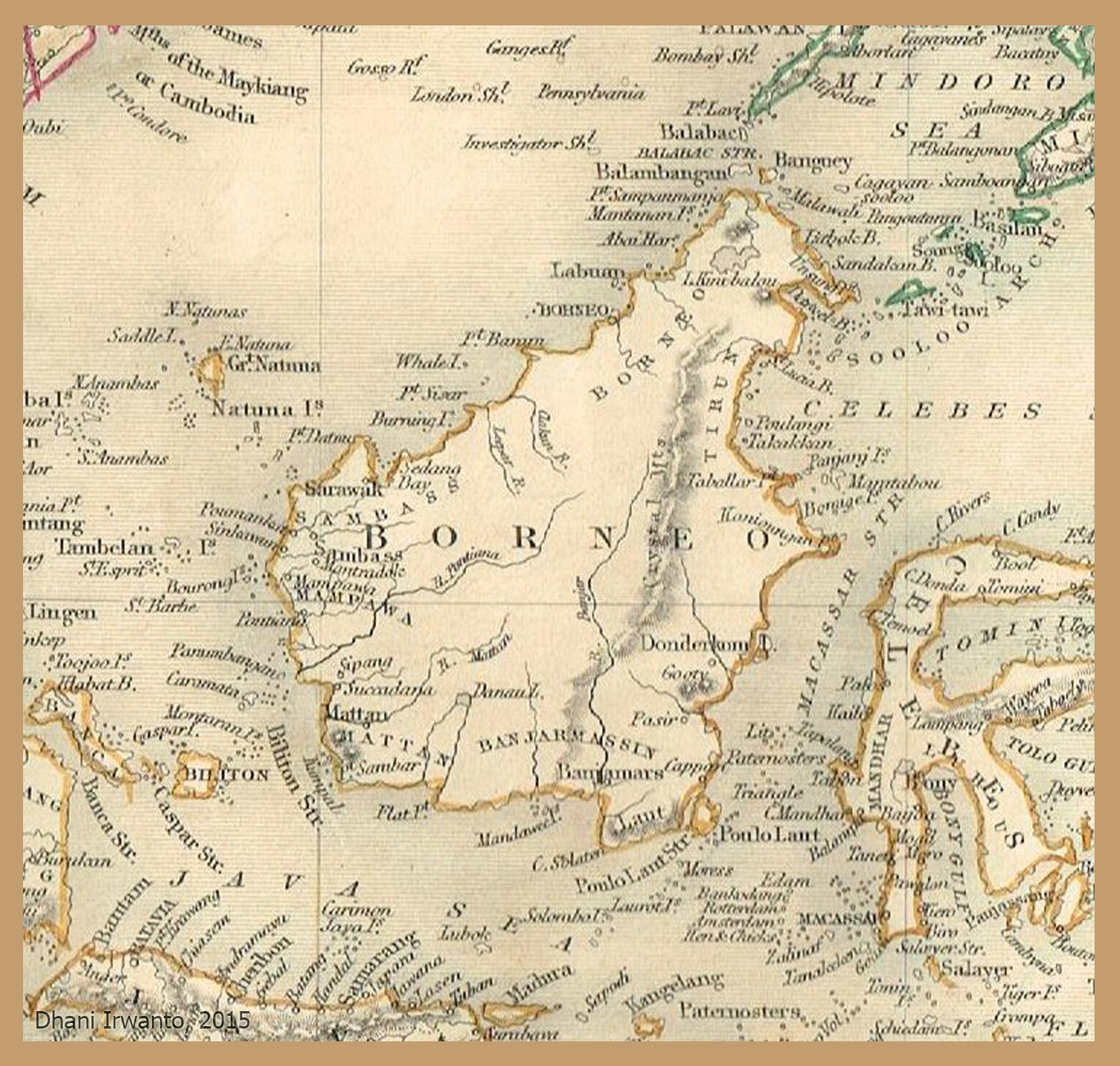
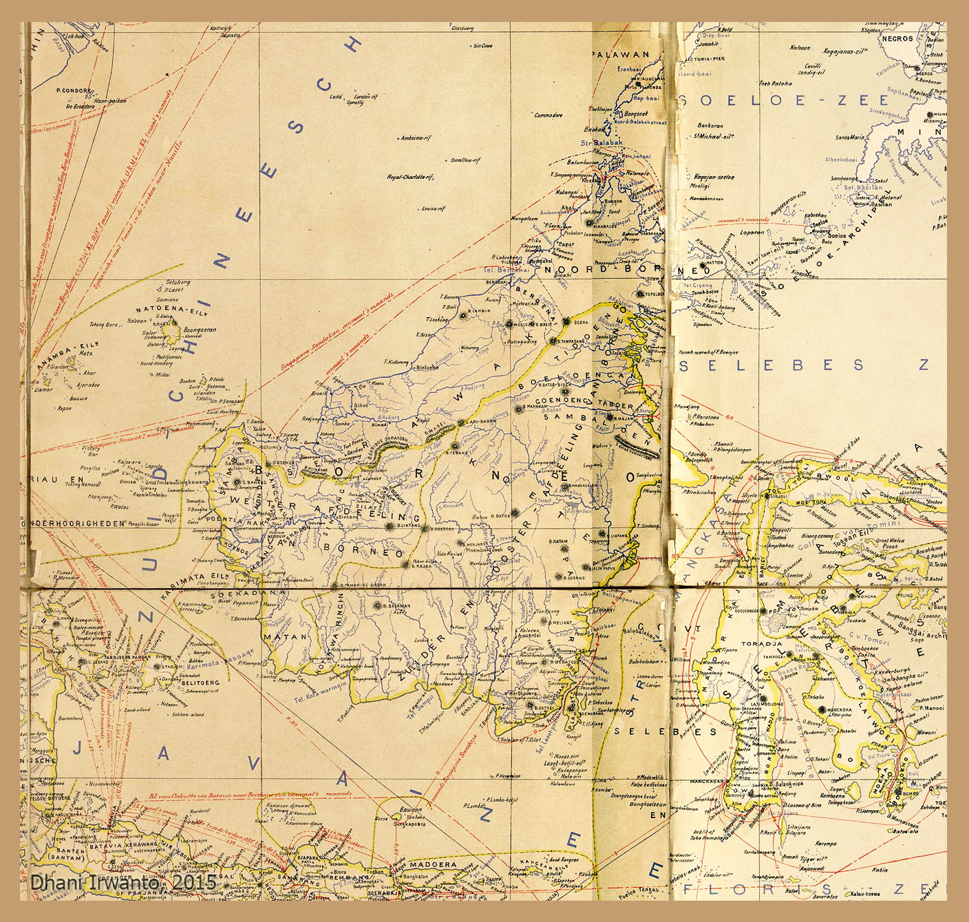
Finally, the Garden of Eden—a paradise watered by a river dividing into four: Tigris, Euphrates, Gihon, and Pishon. Genesis places Eden in the East, yet beyond ordinary geography. Some scholars argue Eden reflects older Mesopotamian “Dilmun” traditions—a far-off, pristine land. My 2015 article even suggested Kalimantan as Eden’s real-world counterpart.
Atlantis echo: Eden shares the archetype of a paradise lost—an ordered, fertile place destroyed or closed off after human transgression.
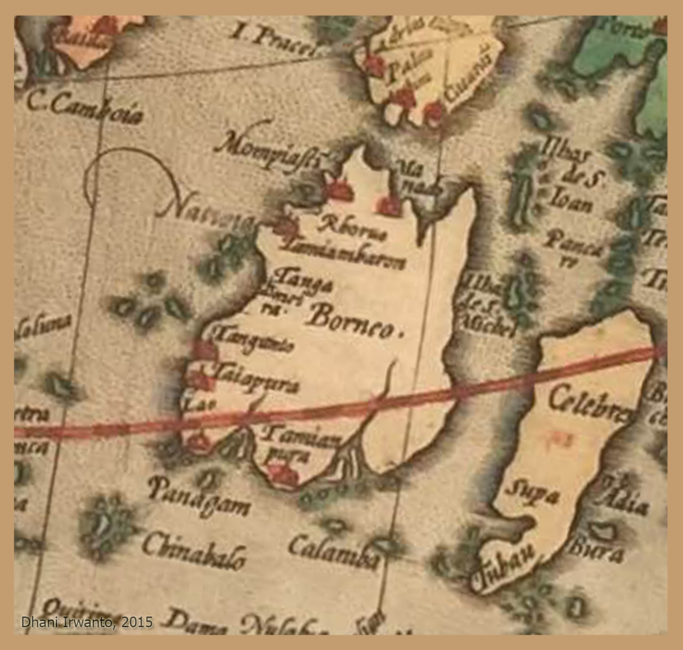
Gosong Gia and Nusantara Echoes
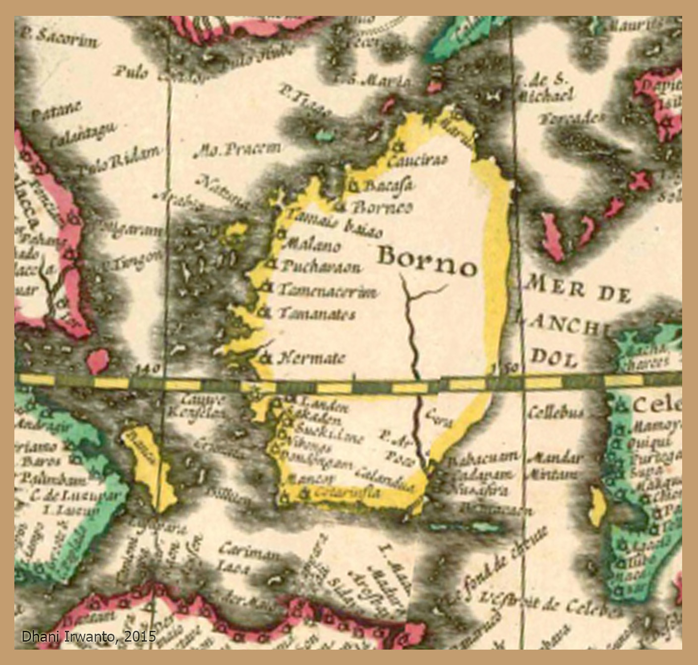
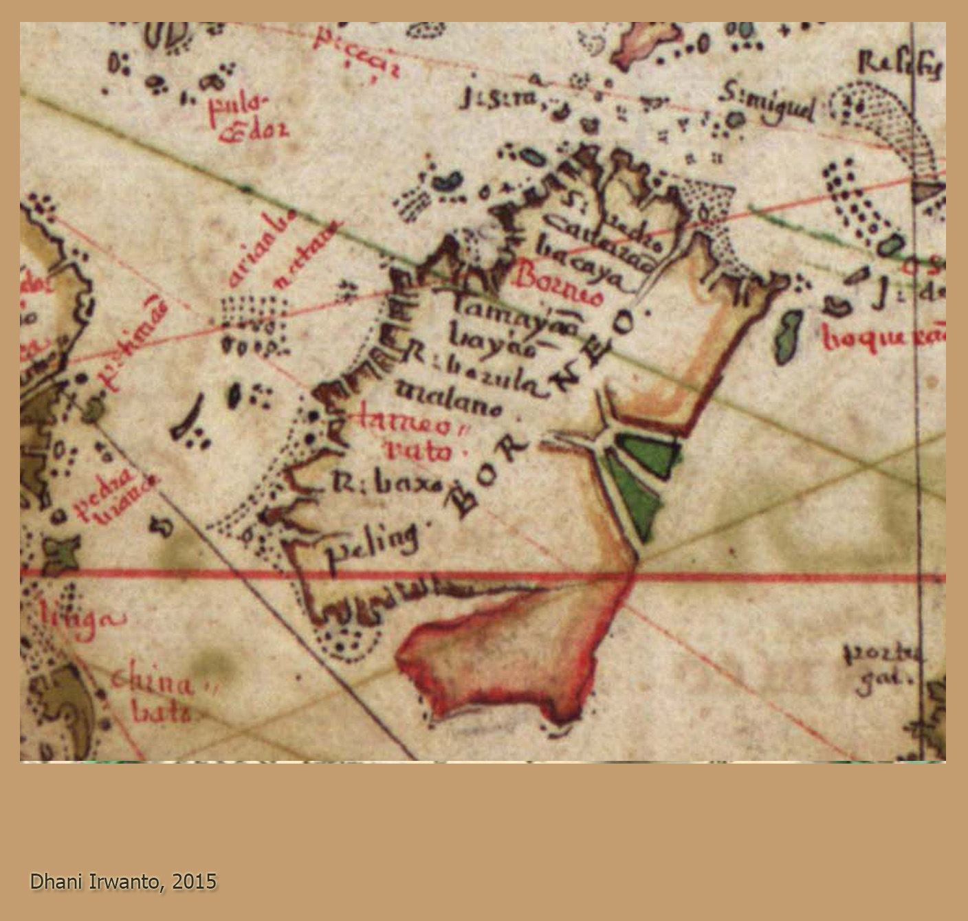
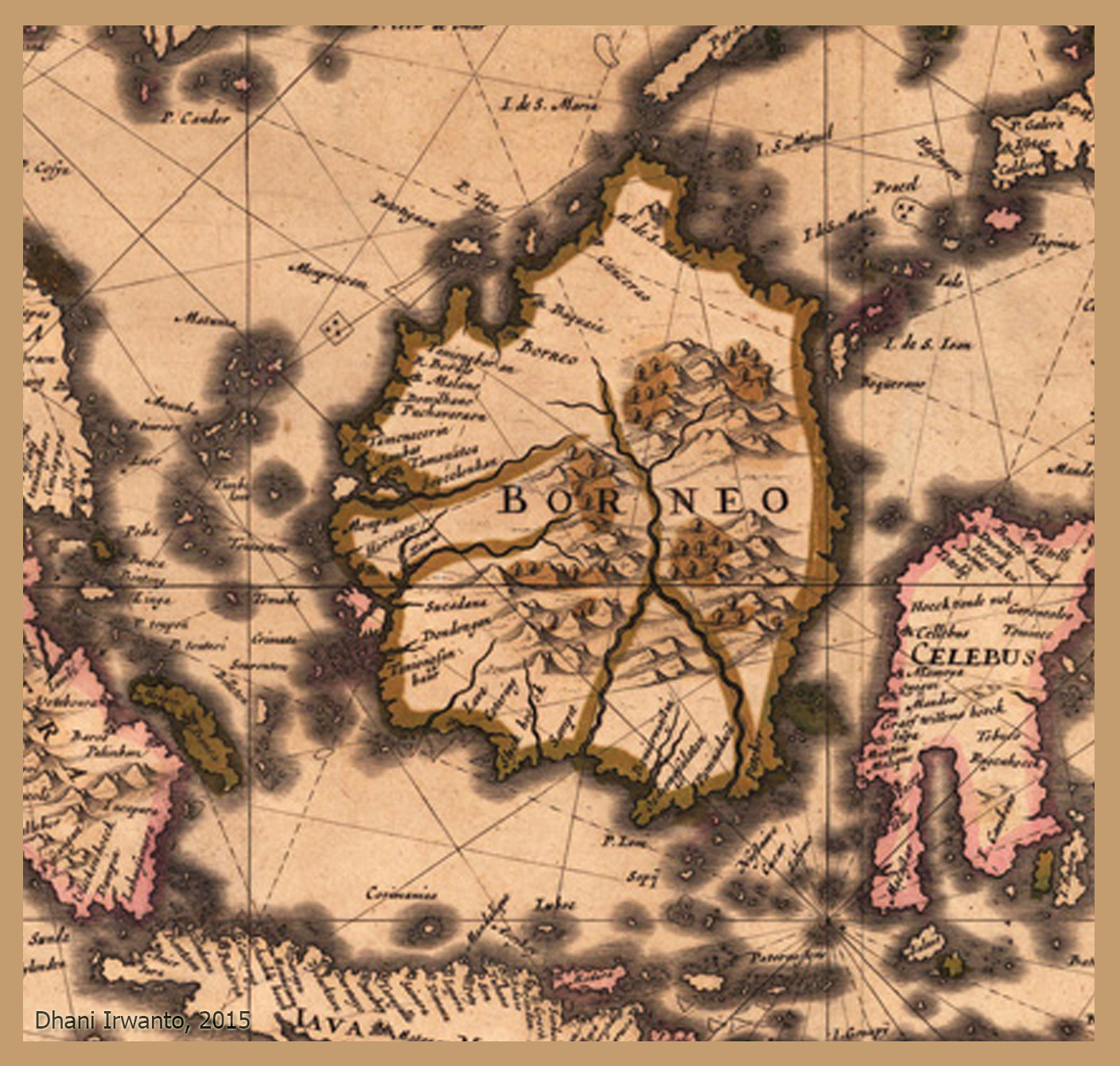
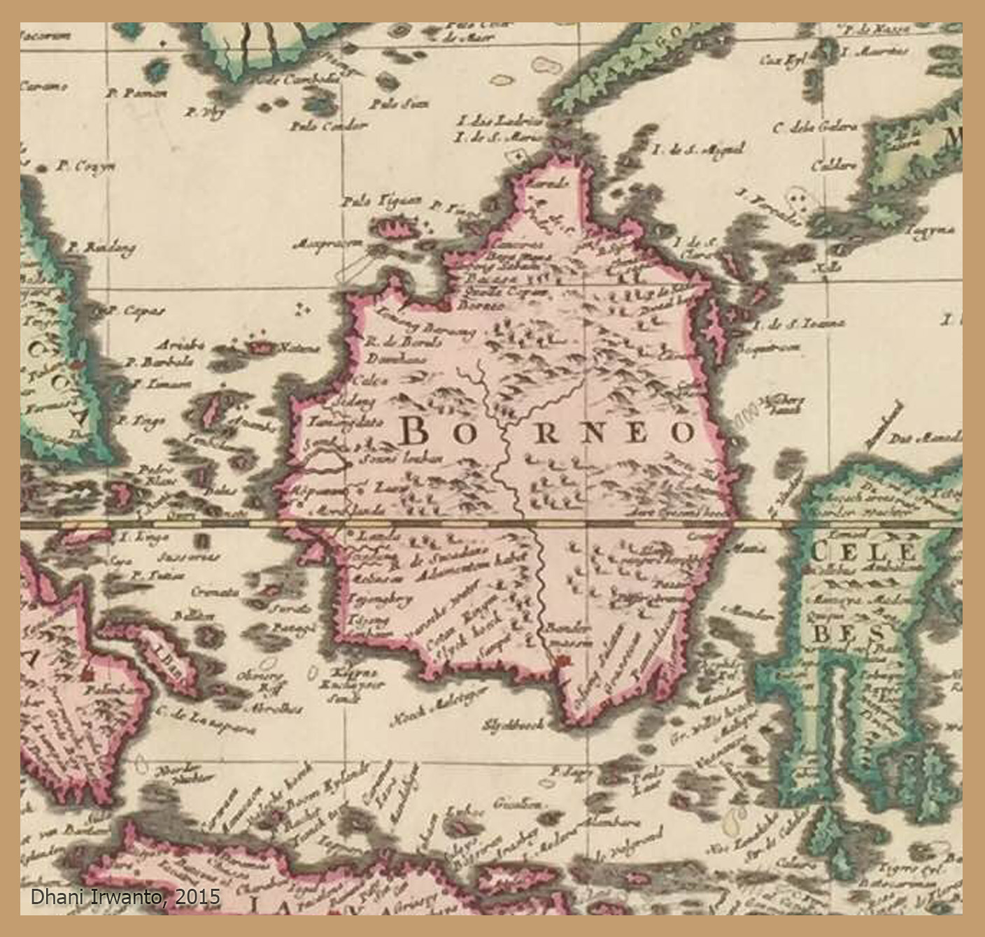
Slides mention Nusasura—possibly the “original name of Atlantis.” It combines nusa (island) and Asura. Old maps show names like Nusasira or Nisaira, perhaps distorted echoes. The Gosong Gia reef in the Java Sea is suggested as a drowned remnant. Even the people of Bawean Island hold myths of a sunken land.
Atlantis echo: If Atlantis lay in the Java Sea, Nusantara traditions like Nusasura may be its local survival in name.
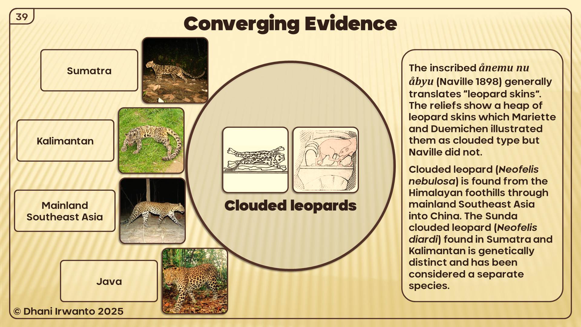
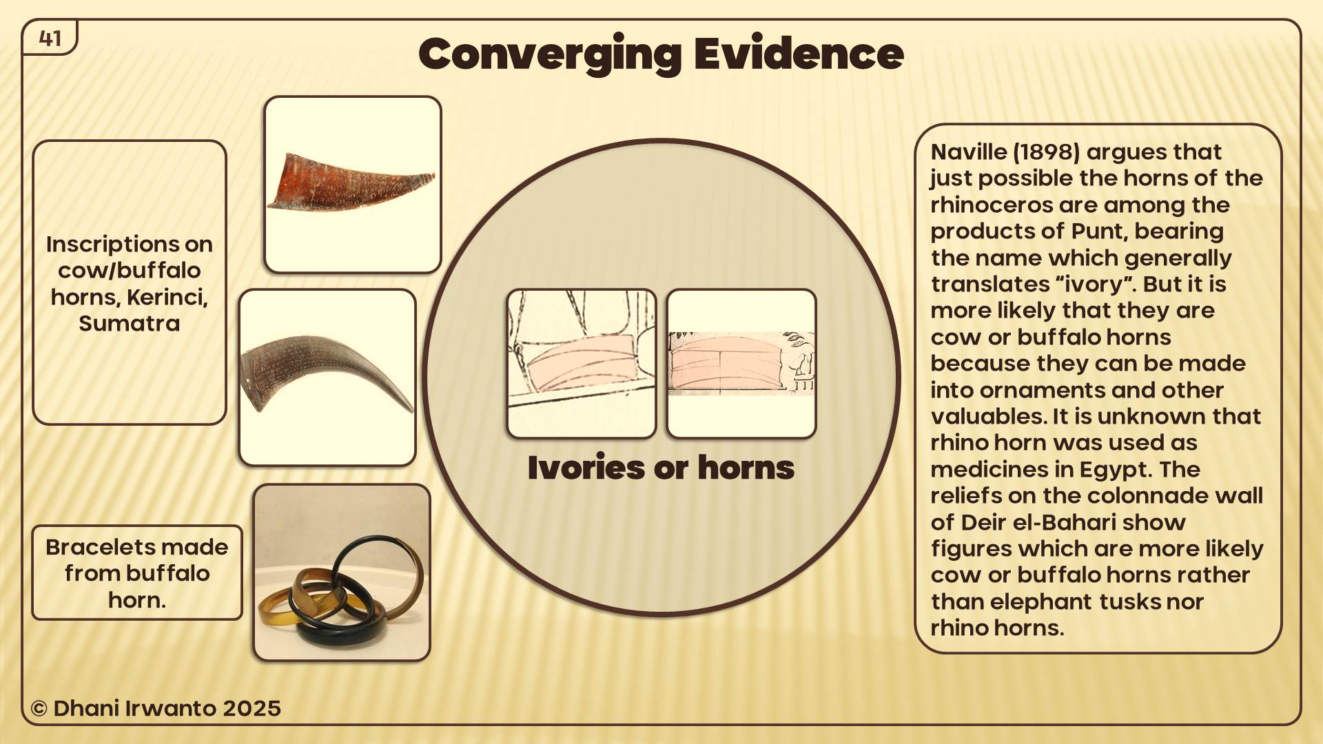
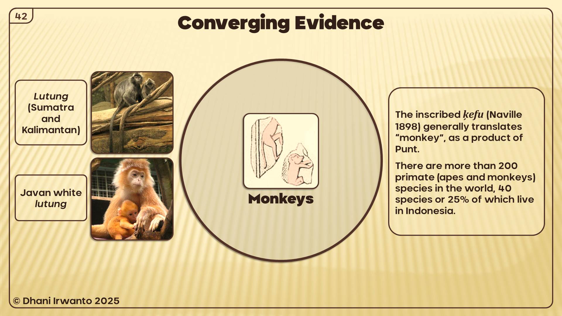
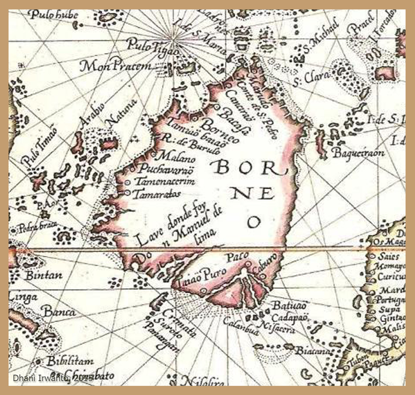
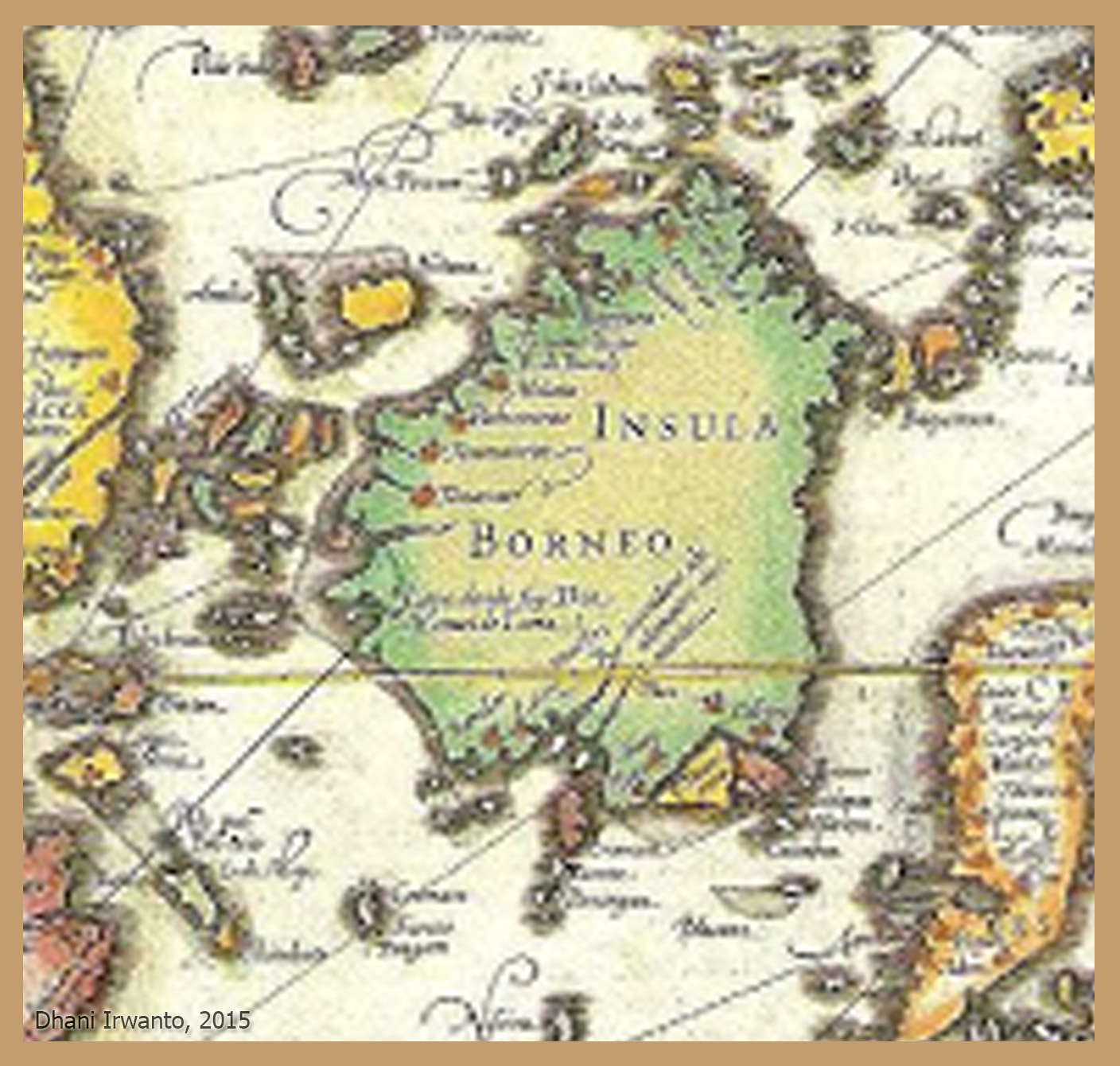
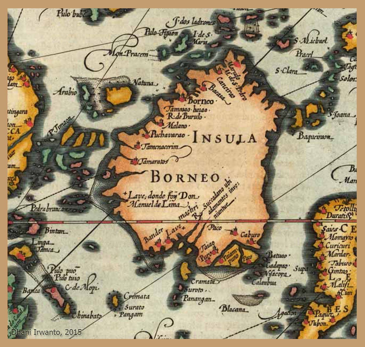
Neserser, Punt, and Southeast Asia: The Egyptian Connection
Plato insists that his Atlantis story came from Egyptian priests at Sais, who told Solon the tale. If so, then the Egyptian worldview—their maps of trade, geography, and sacred memory—shaped what Plato inherited.
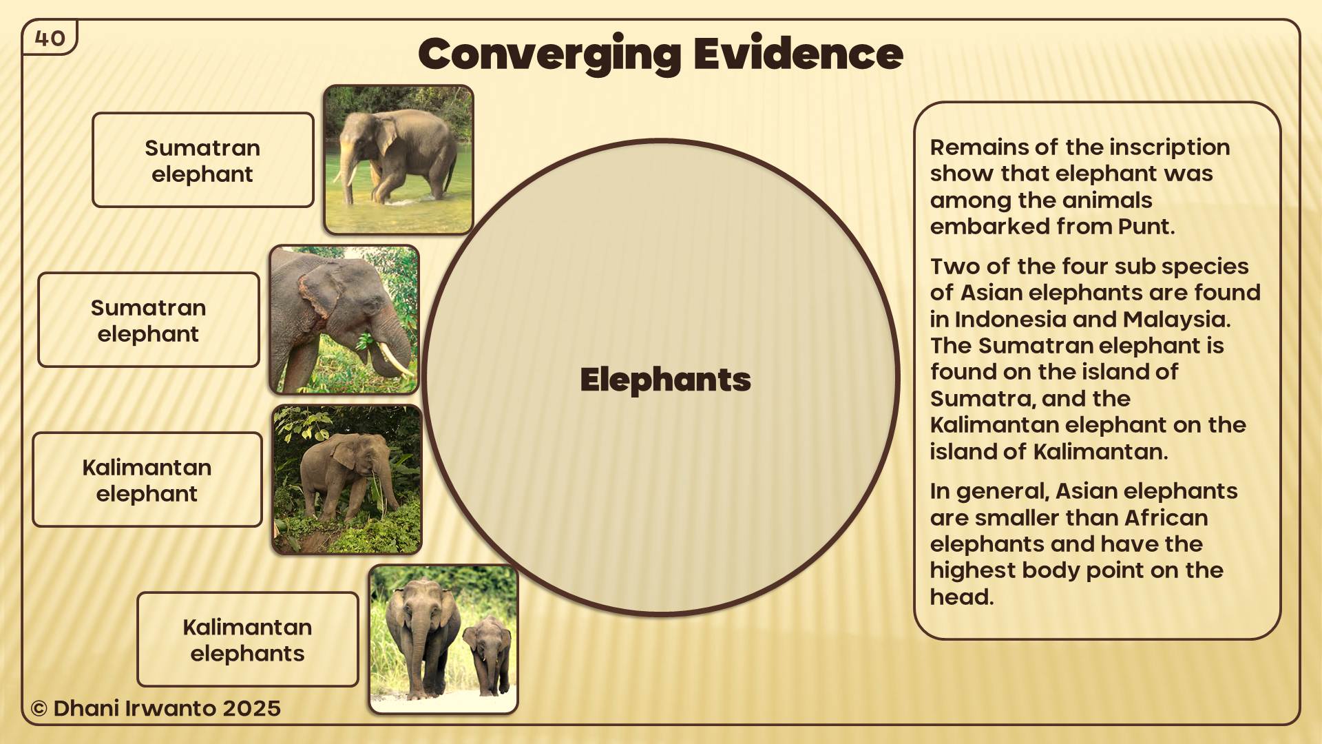
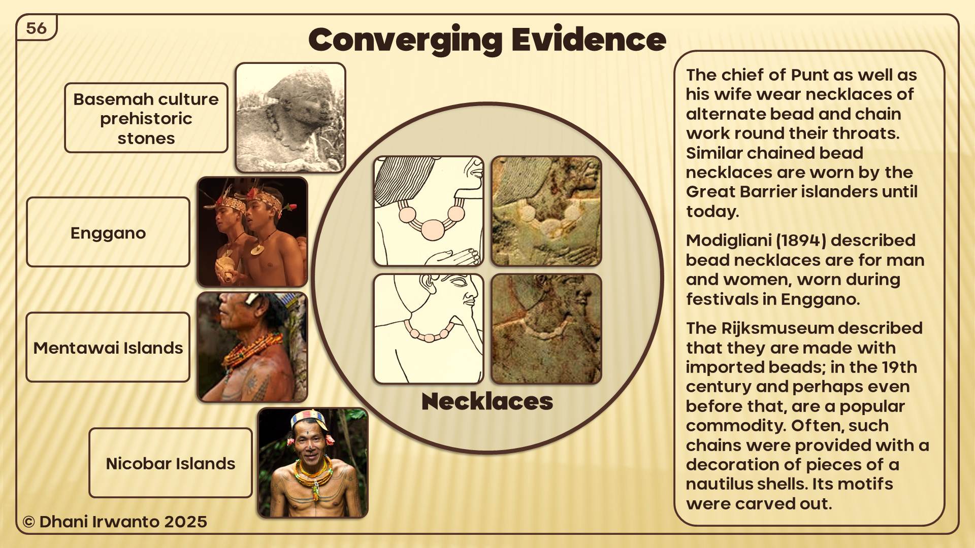
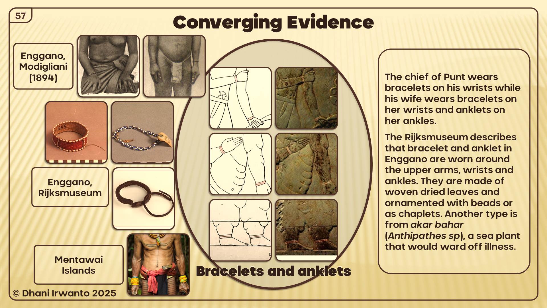
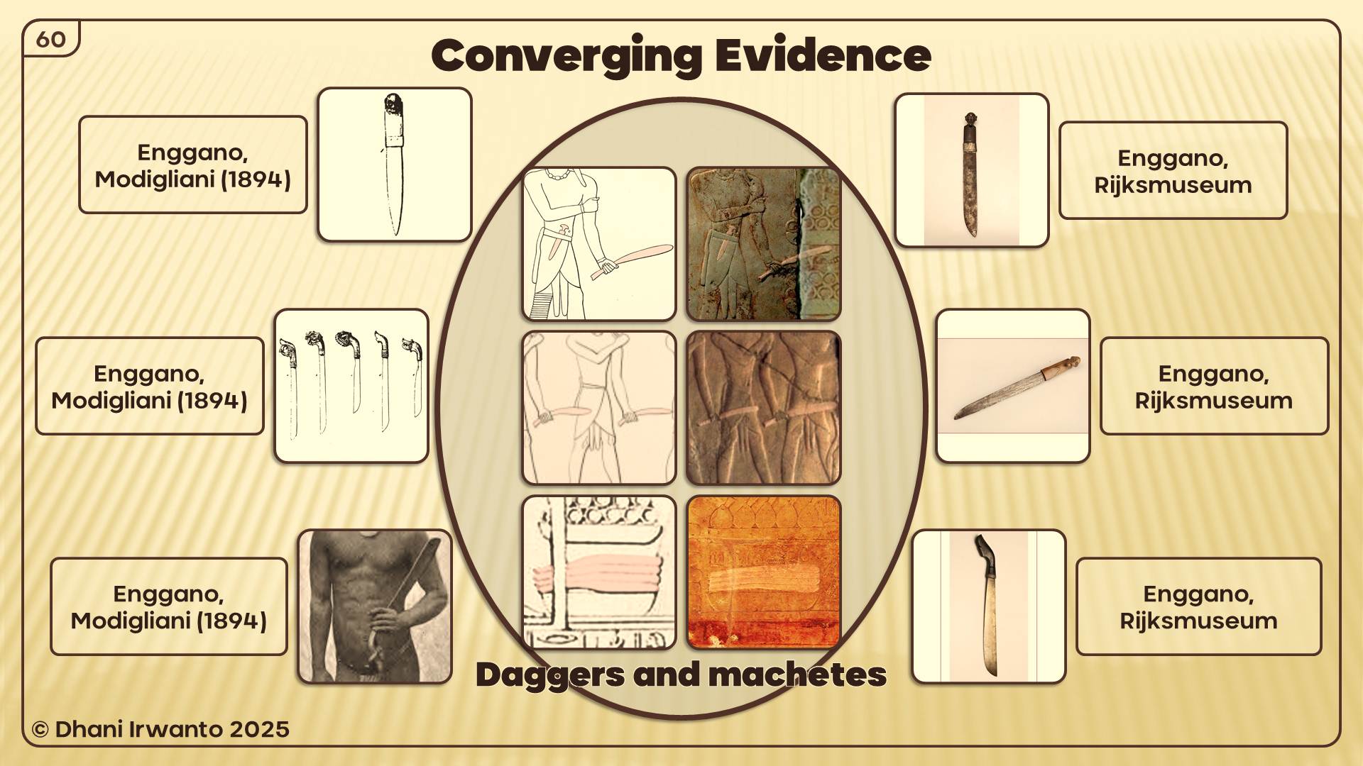
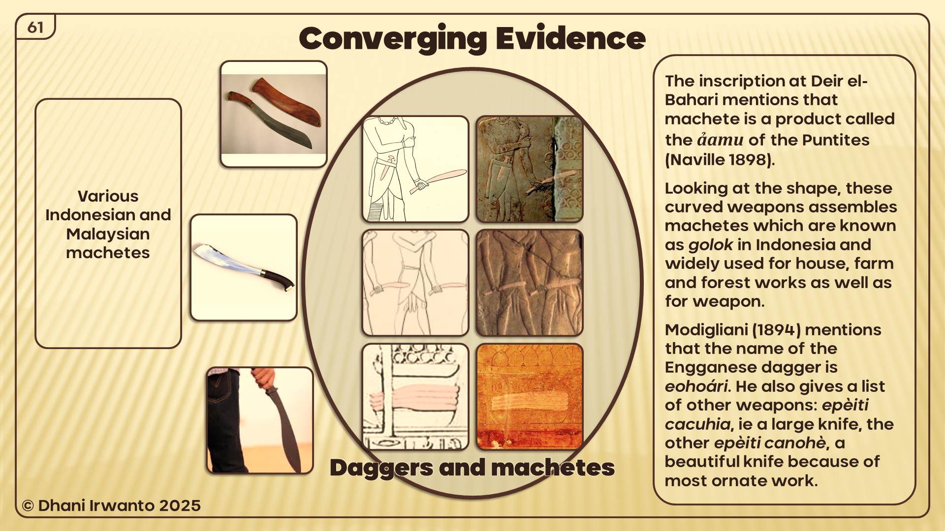
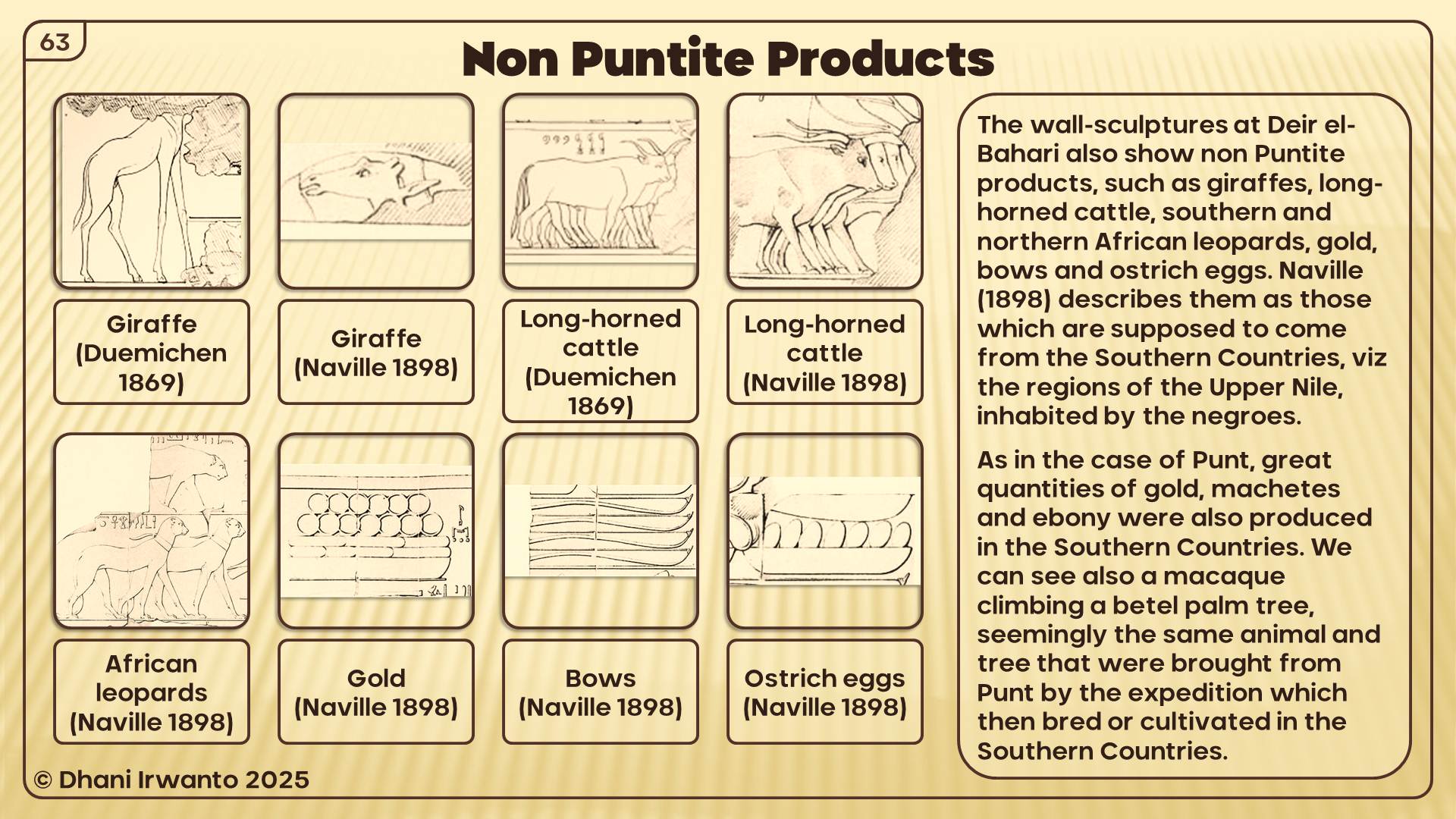
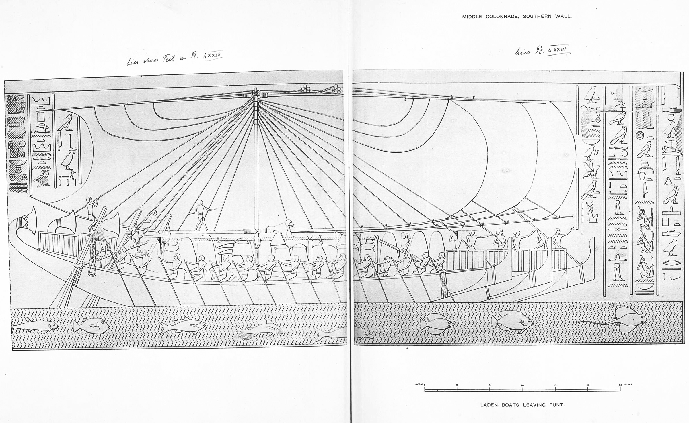
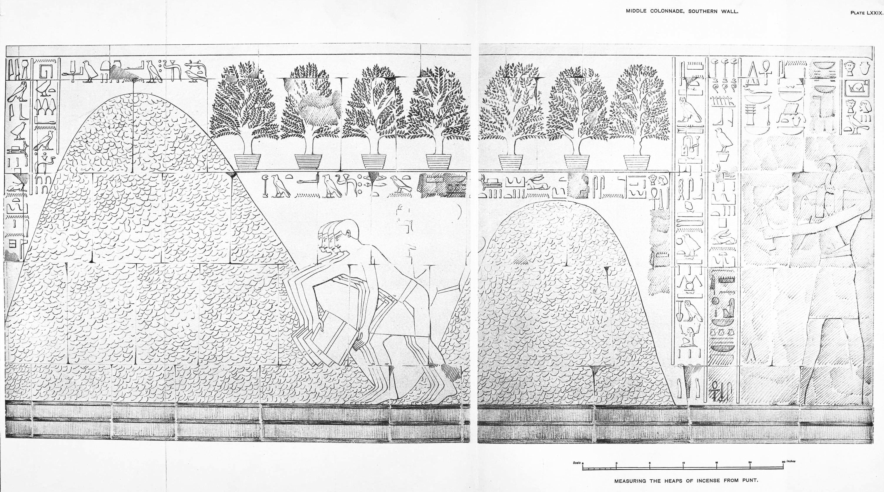
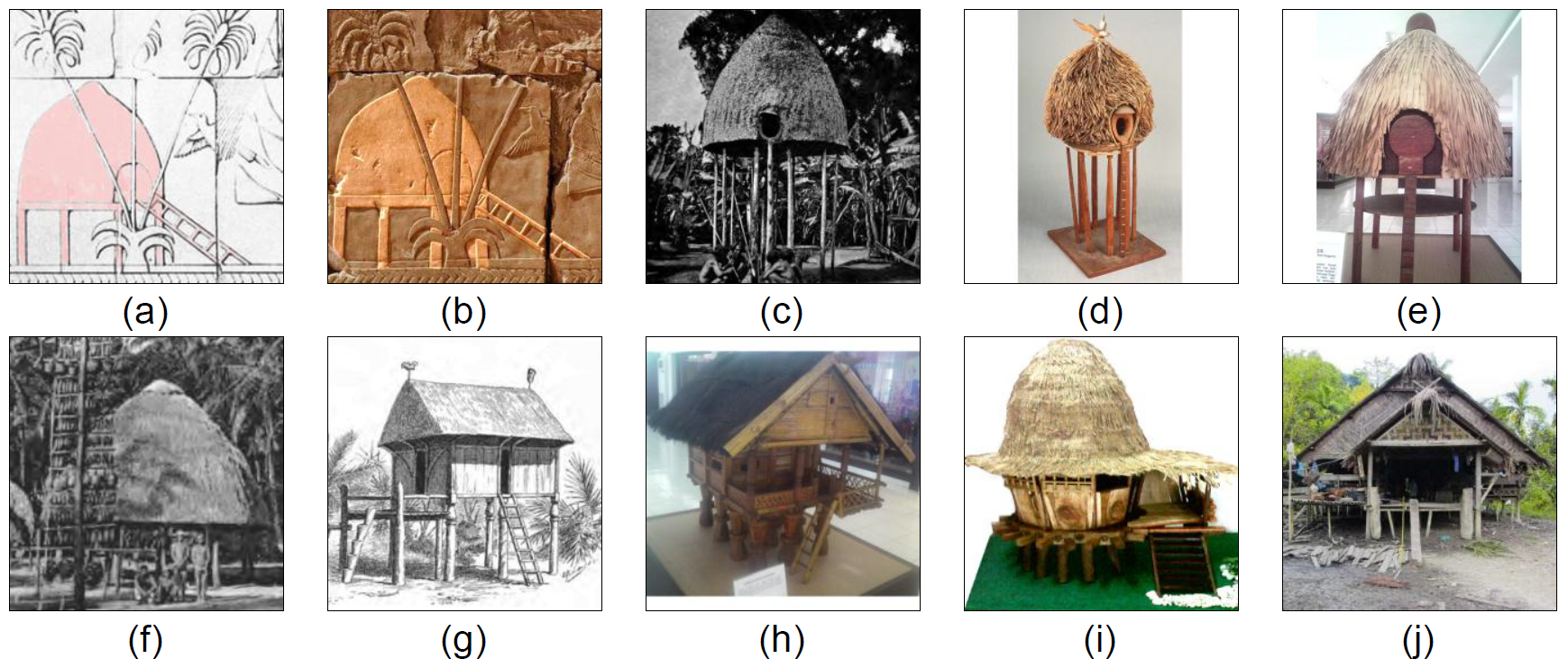
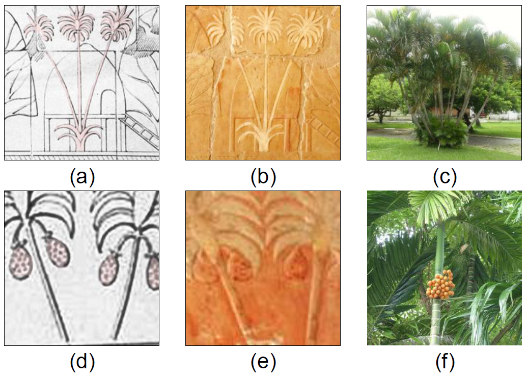
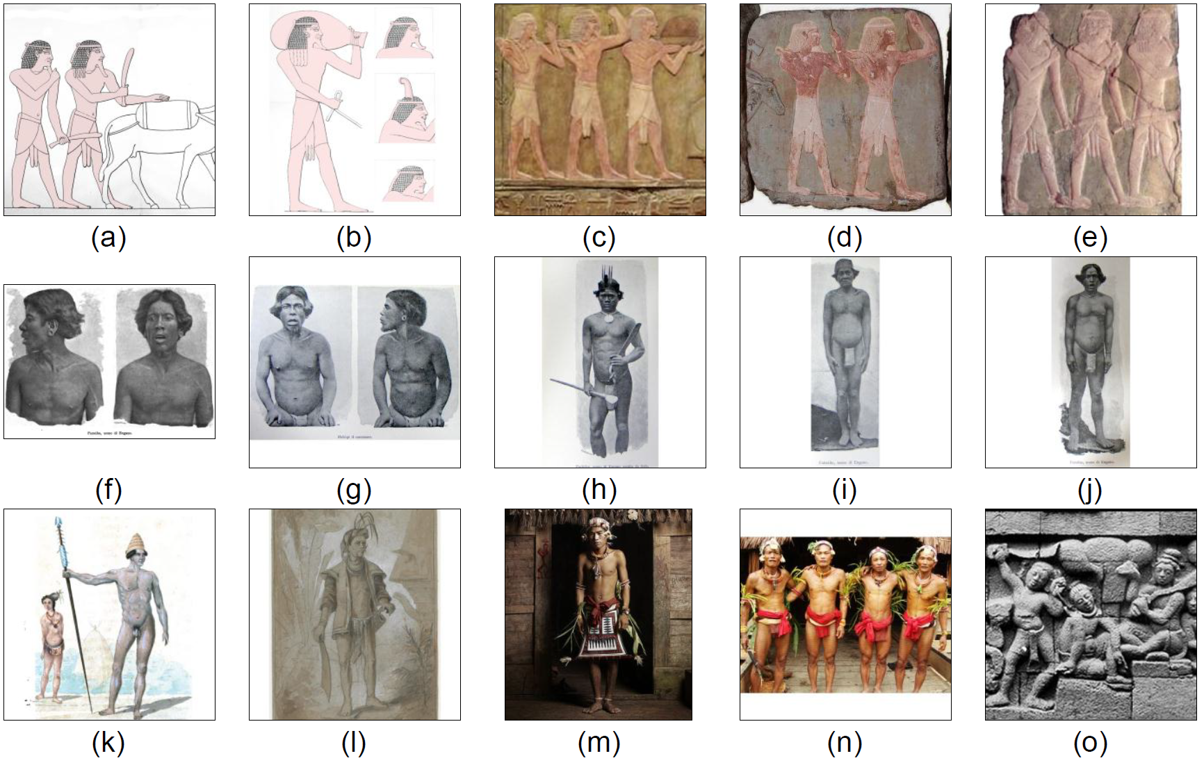
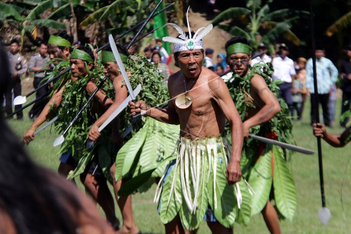
The Egyptians had firsthand knowledge of Southeast Asia, preserved in their accounts of the Land of Punt. Punt, described as the Ta Netjer or “land of the gods,” was not a vague myth but a real destination of repeated voyages, from Khufu to Rameses III. The great expedition of Hatshepsut (c. 1493 BCE) is famously carved on her temple walls, showing Egyptian ships sailing to Punt’s harbors.
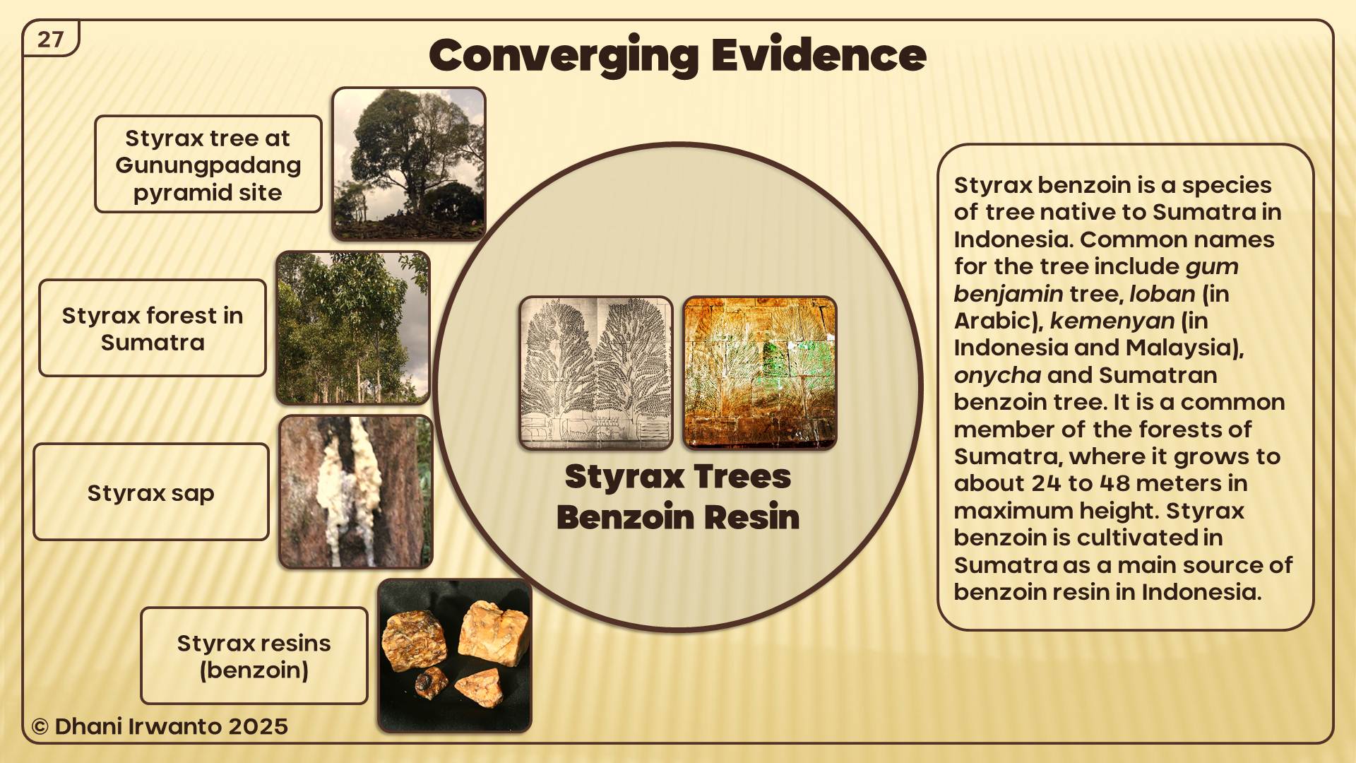
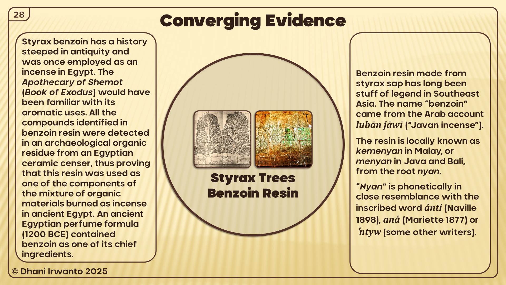
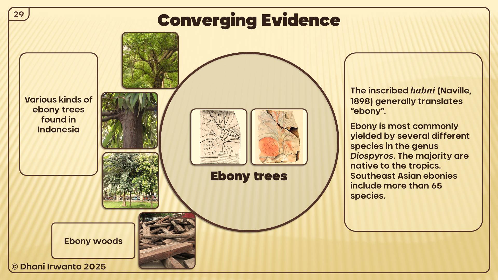
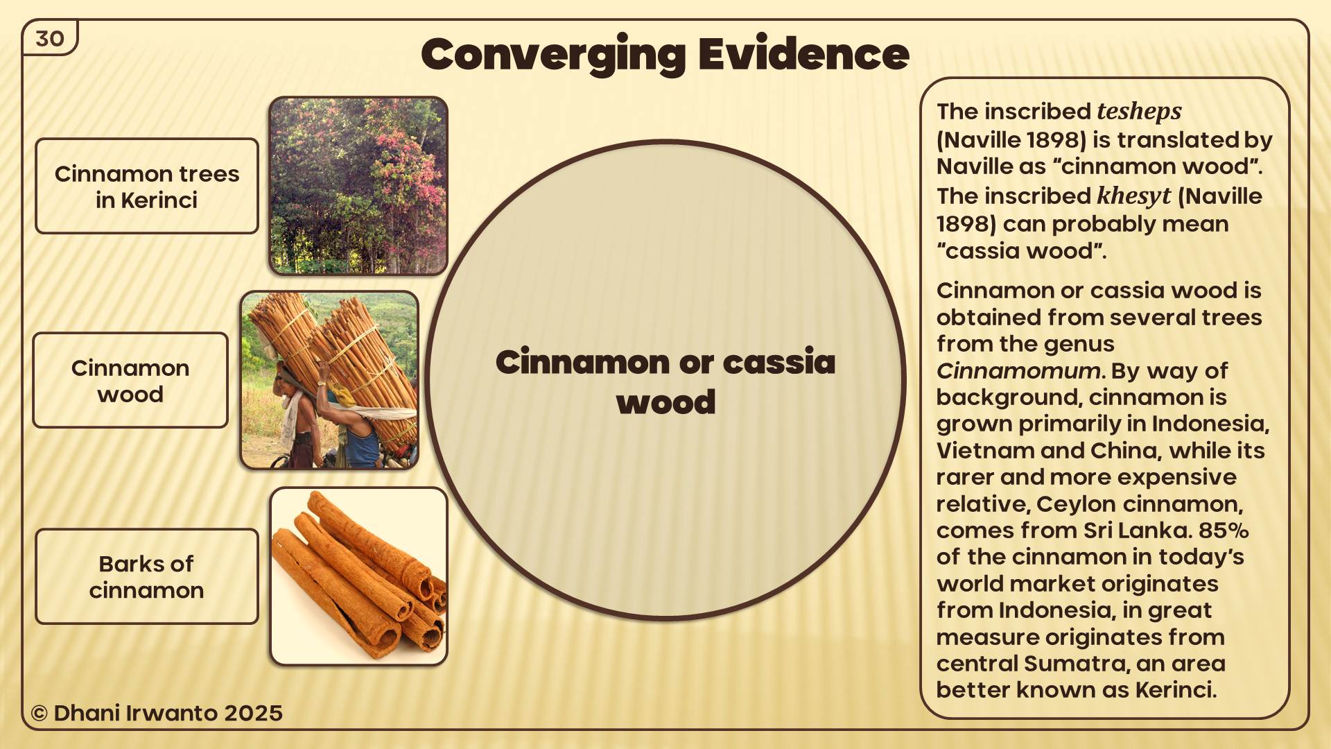
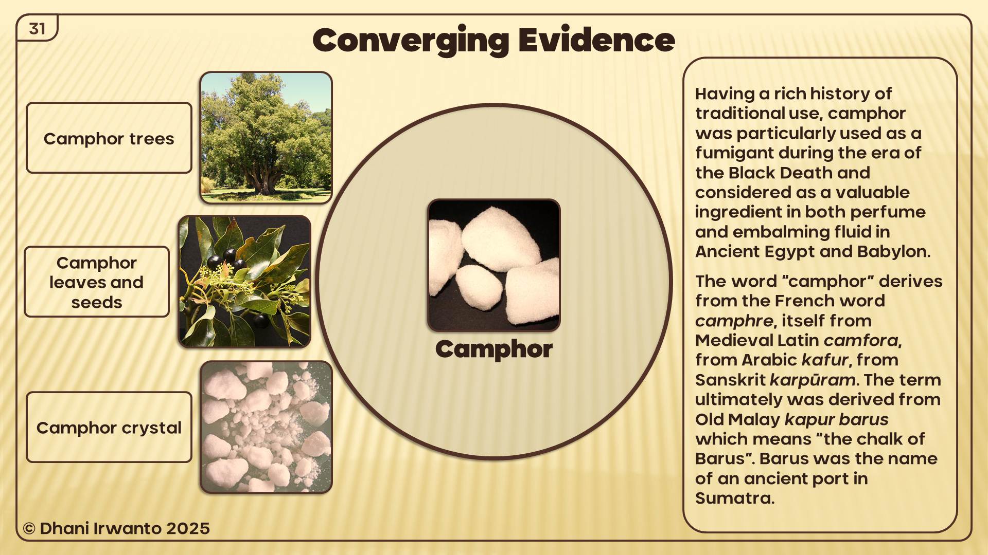
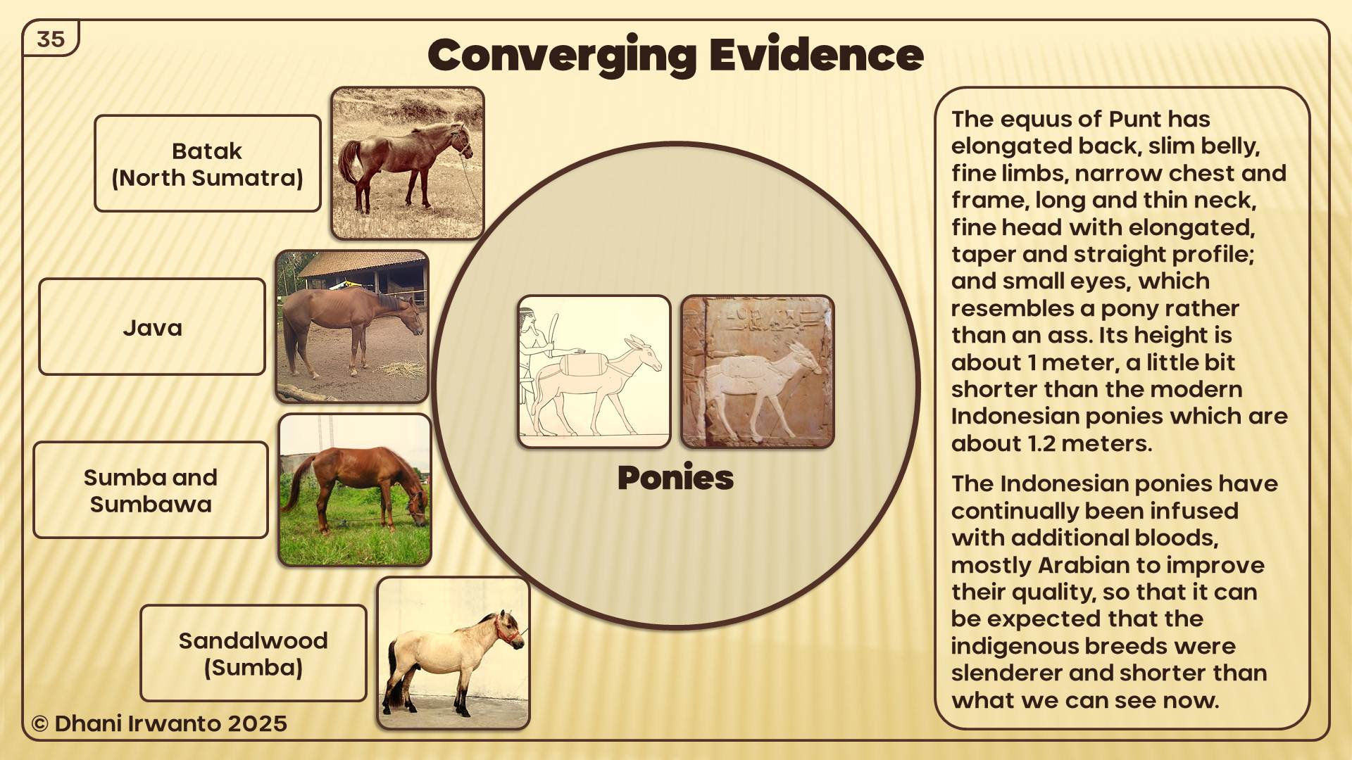
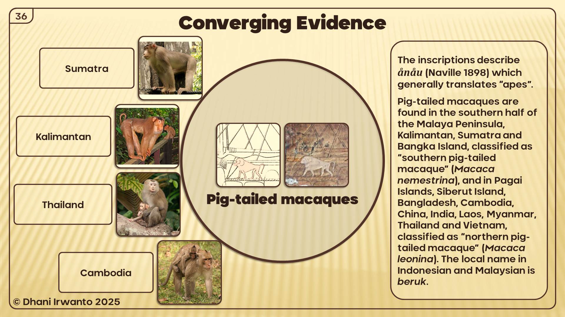
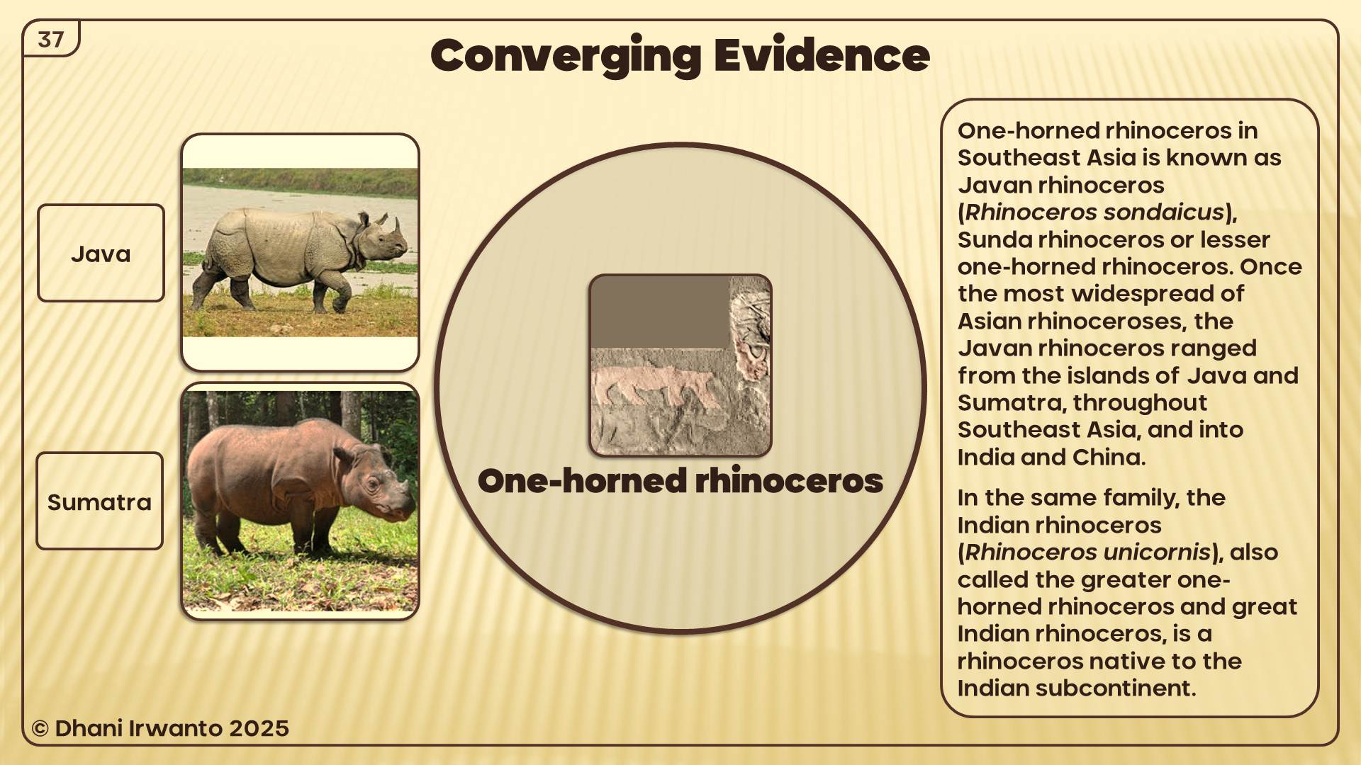
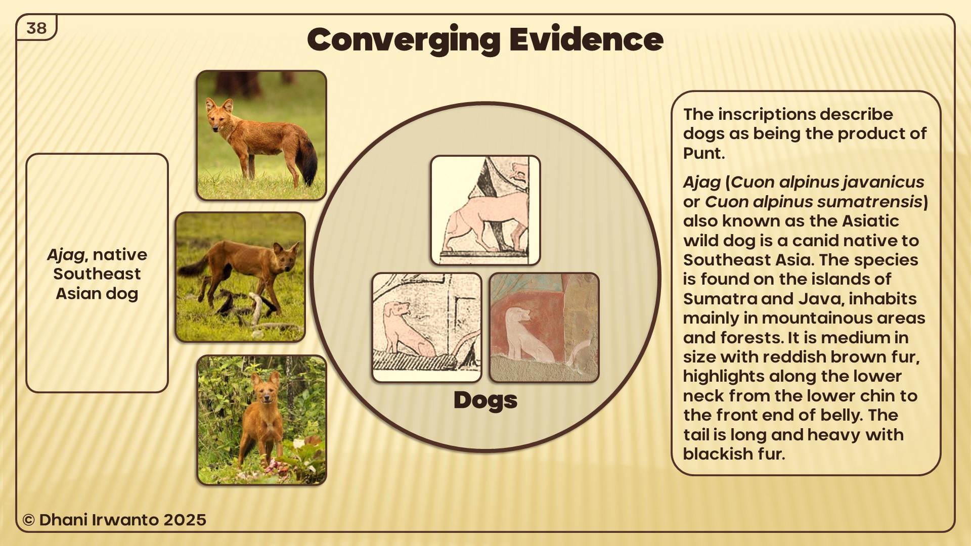
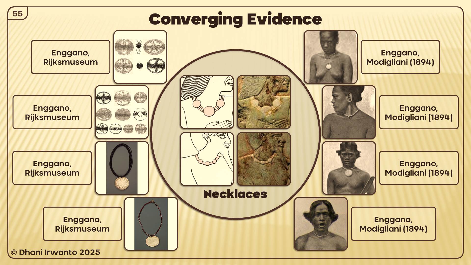
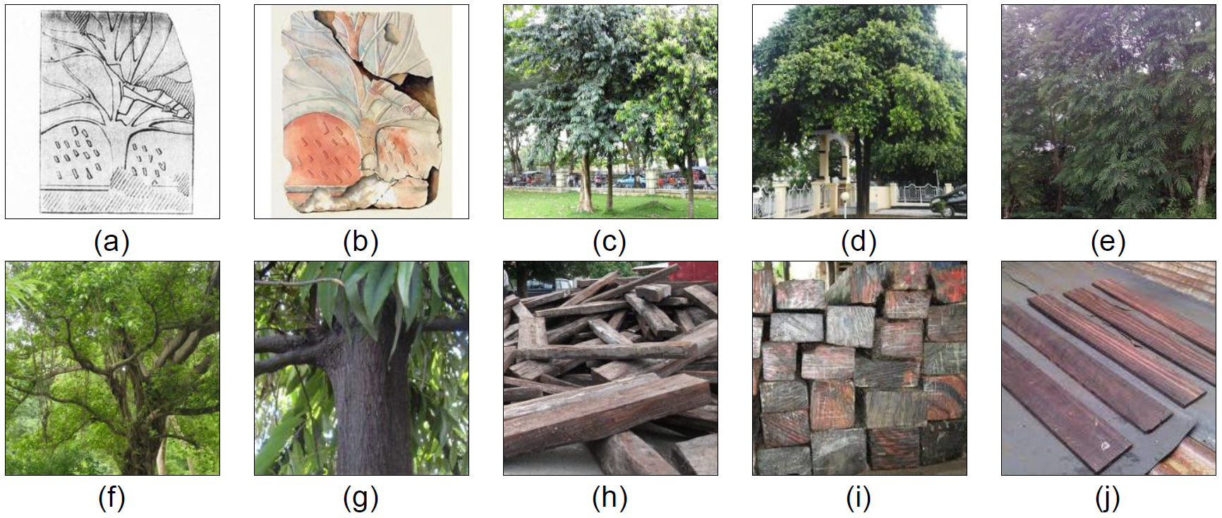
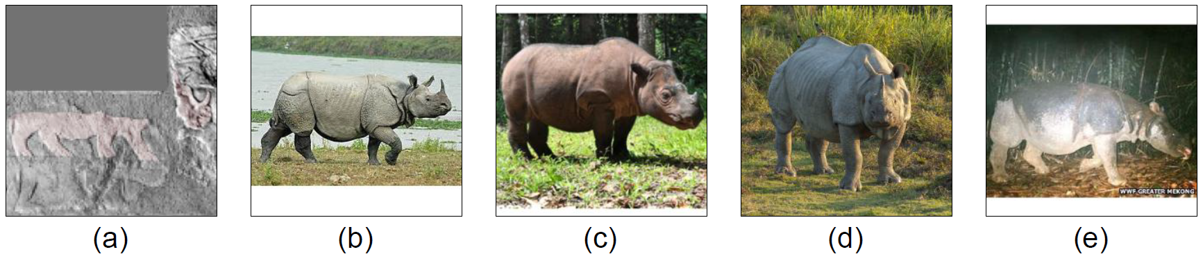
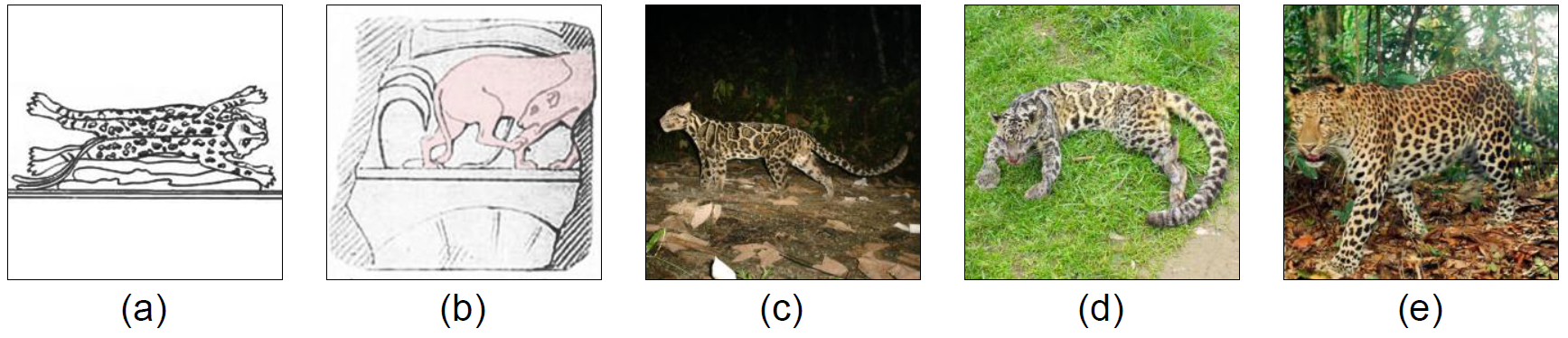
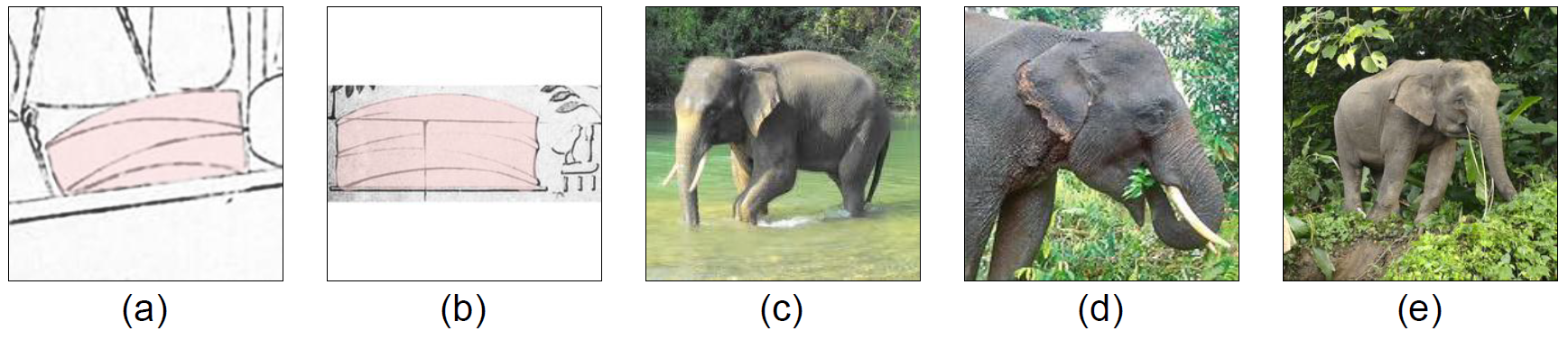
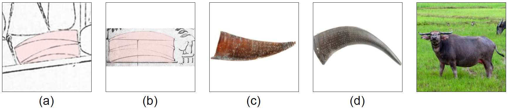
Products: Gold, camphor (kapur barus), benzoin (kemenyan), cinnamon, ebony, nutmeg, short-horned cows, elephants, and macaques—all endemic to Sumatra and neighboring islands.
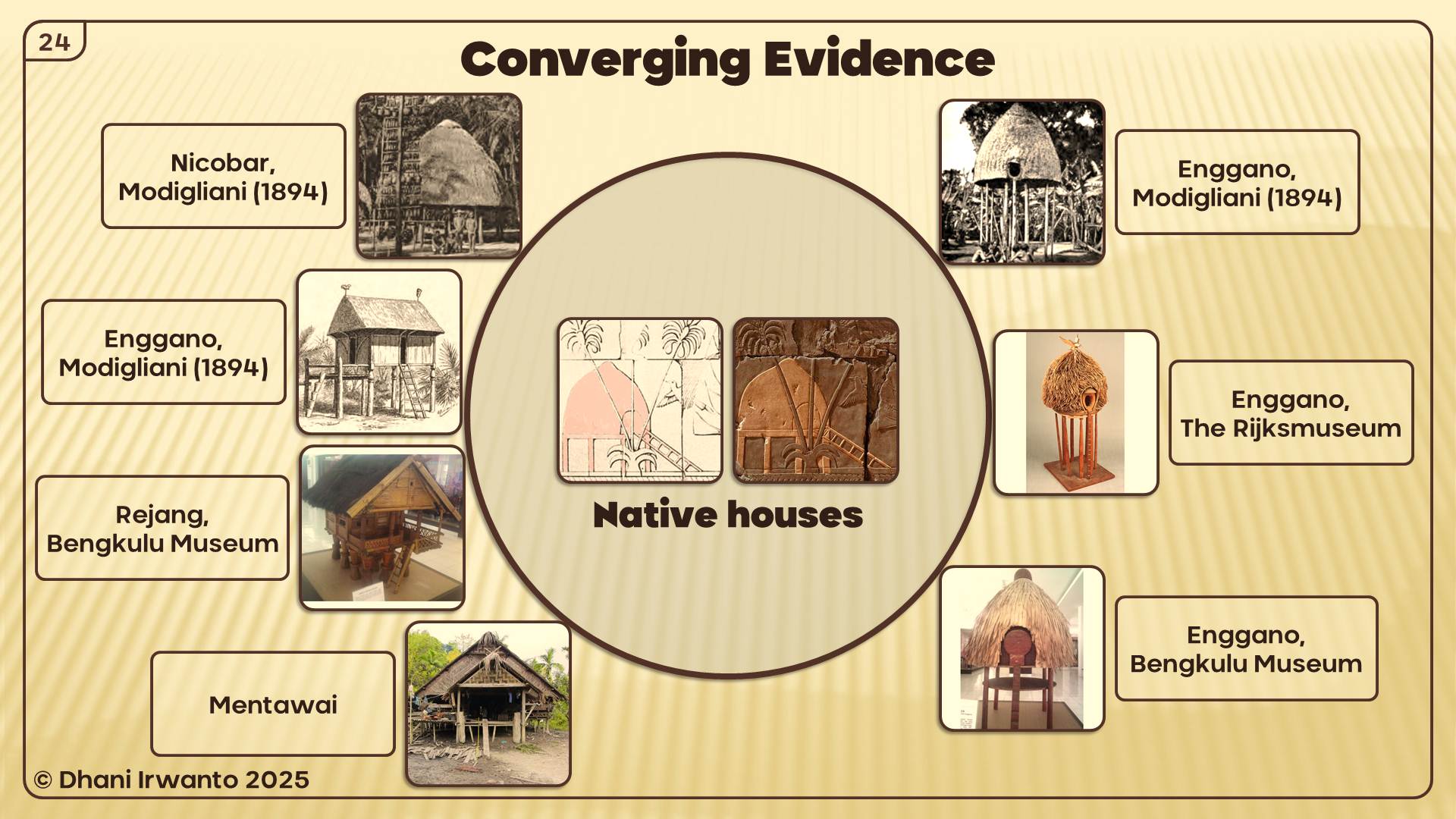
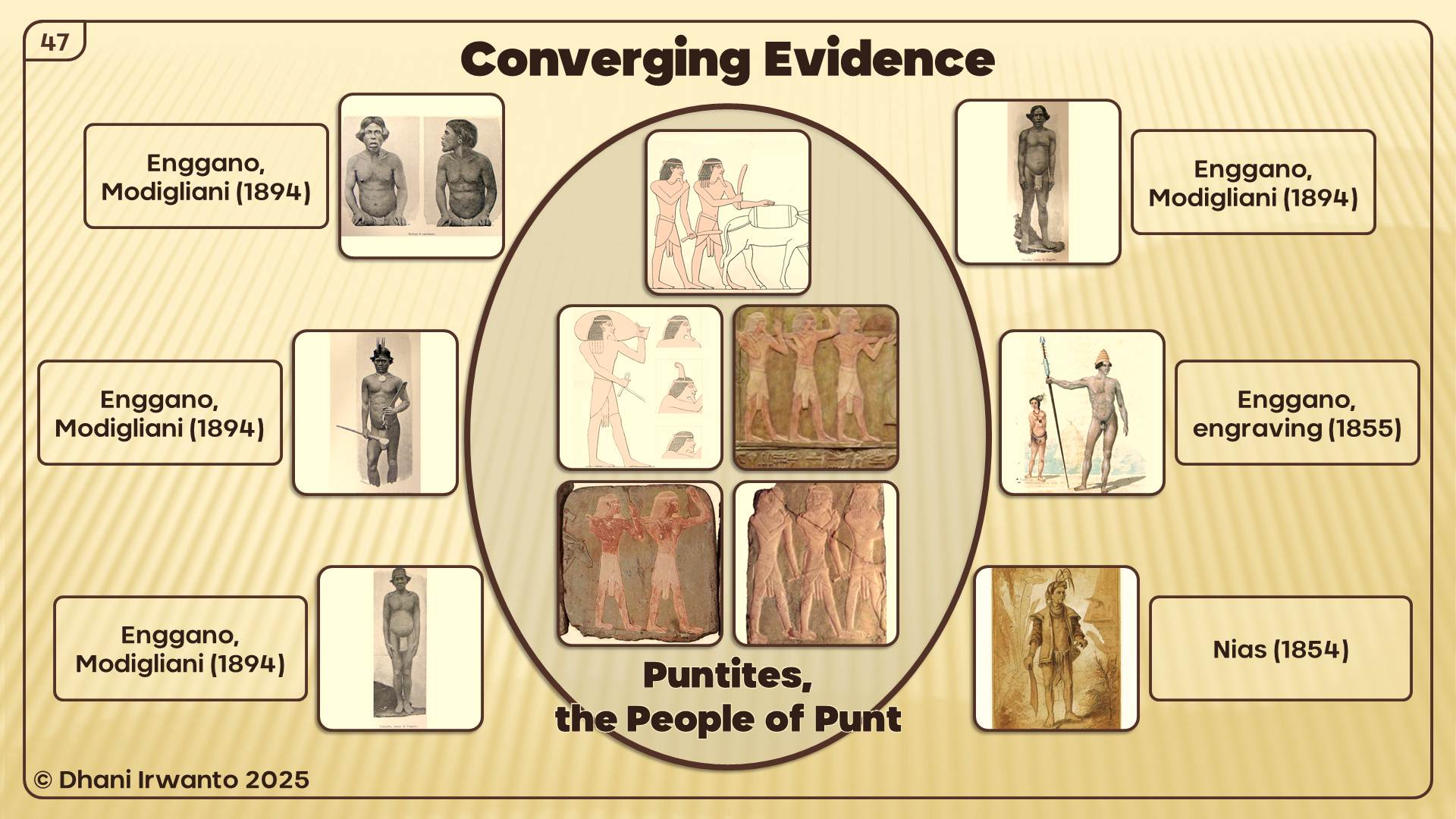
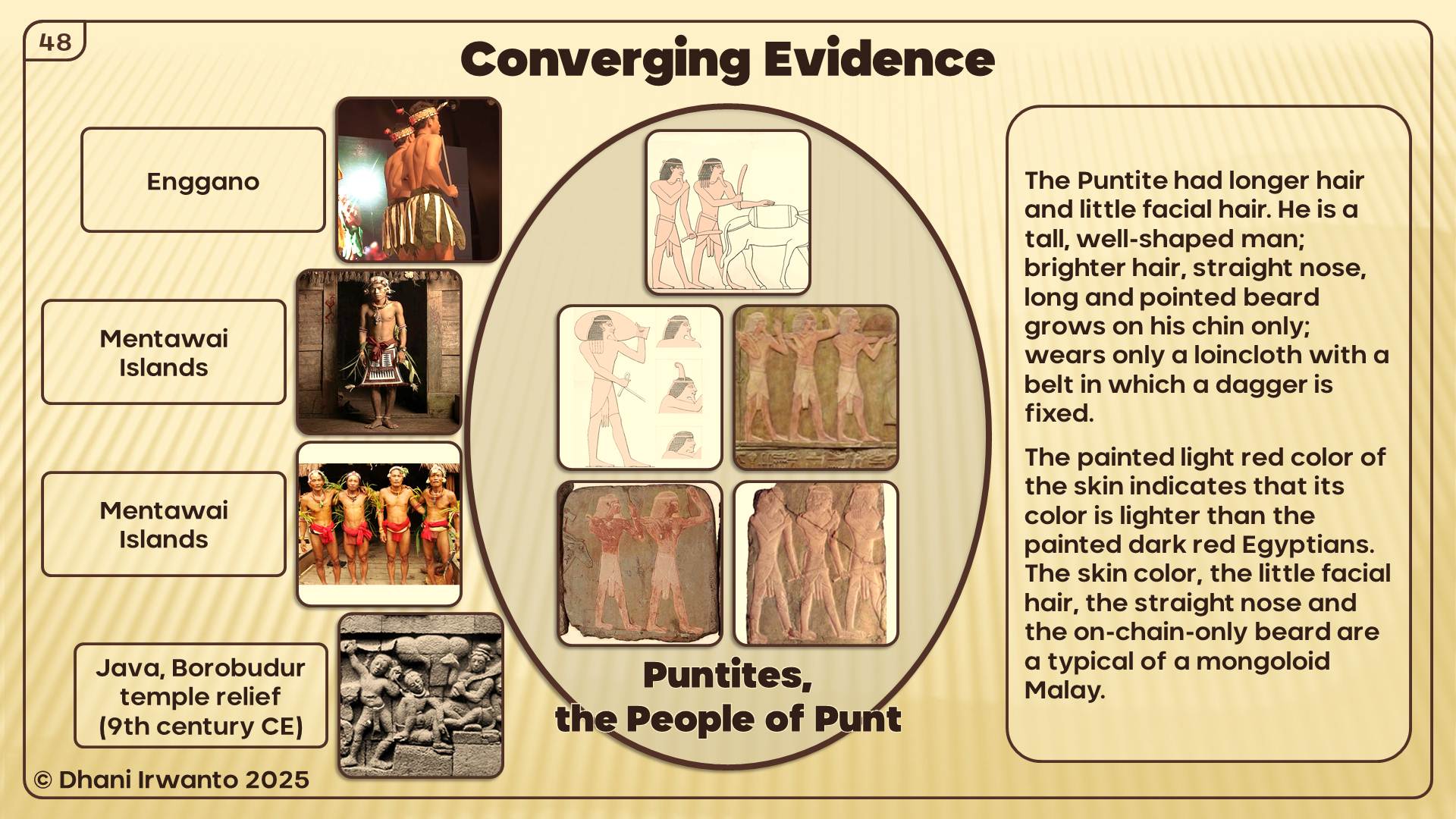
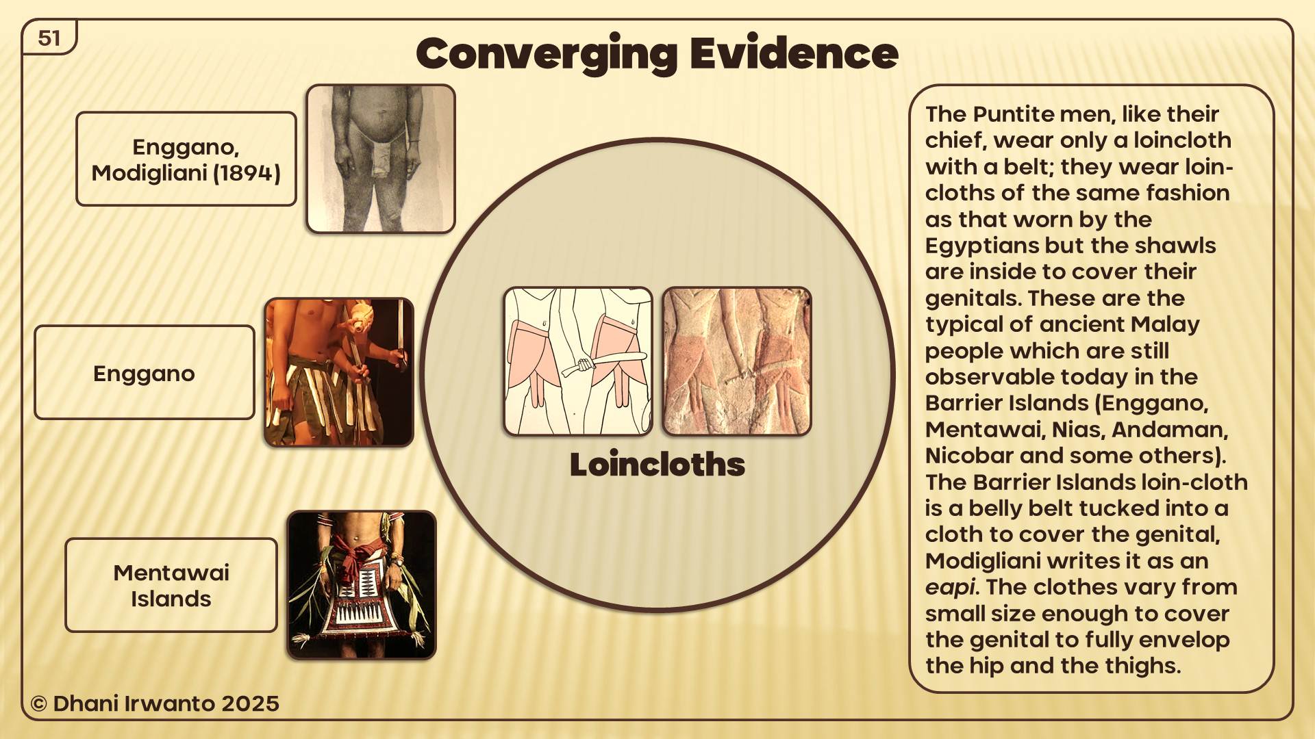
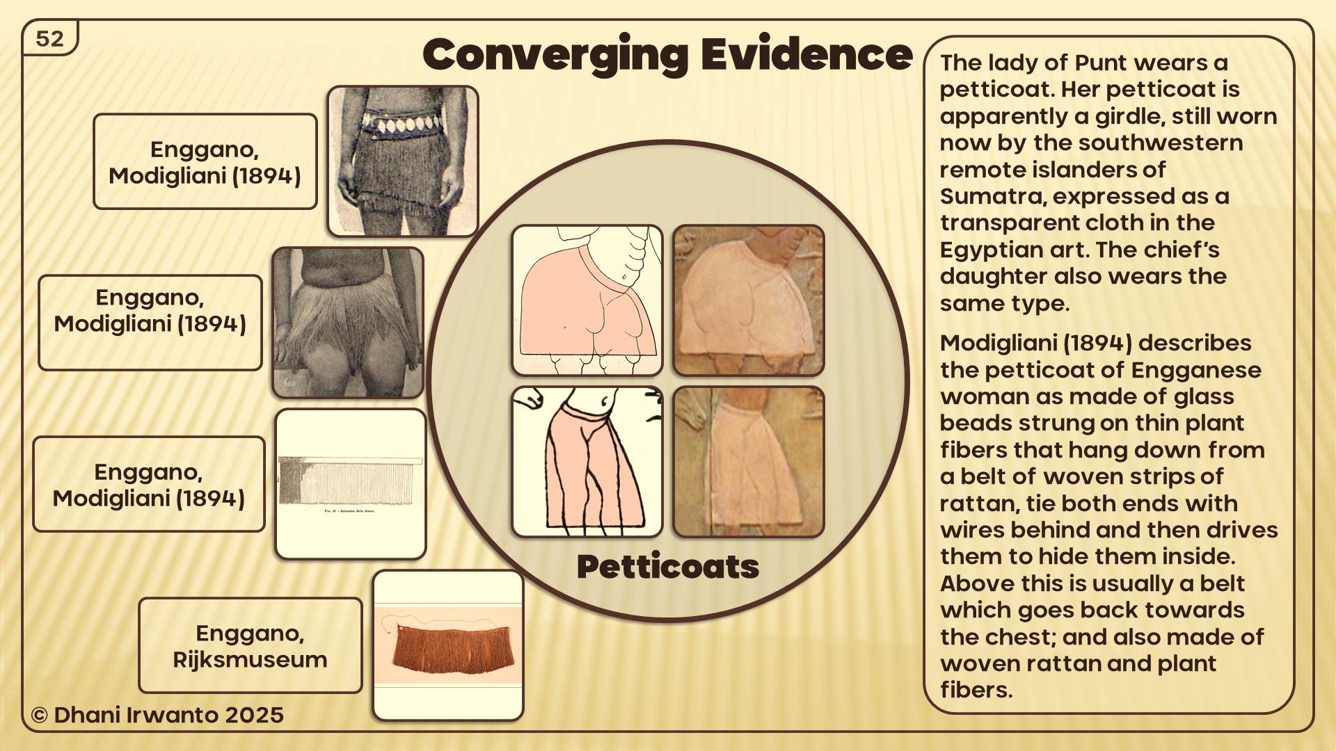
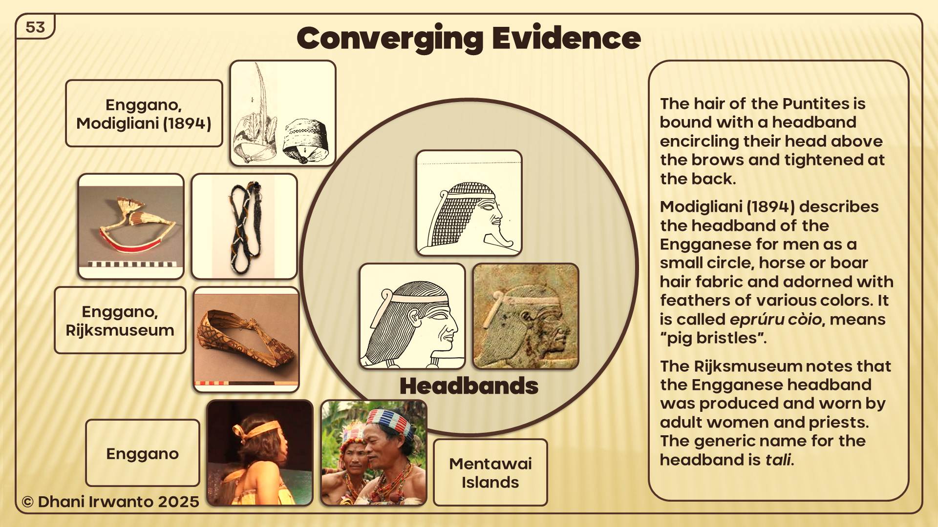
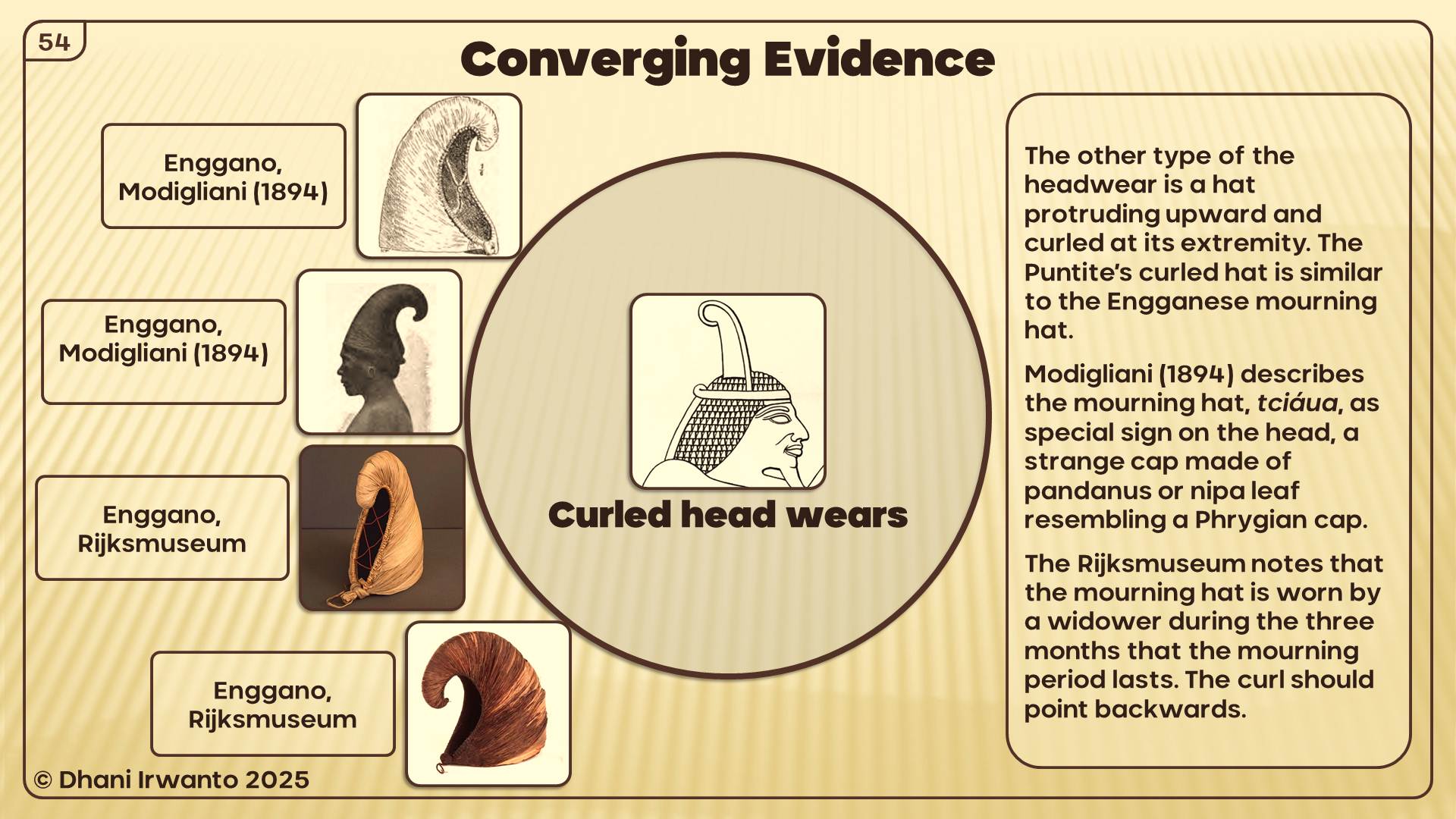
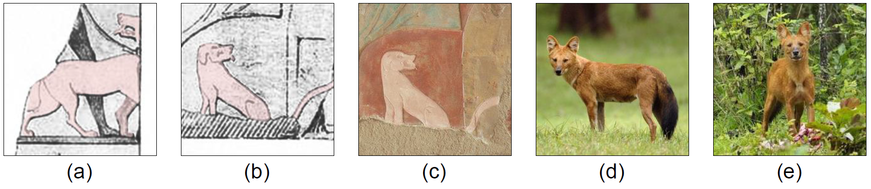
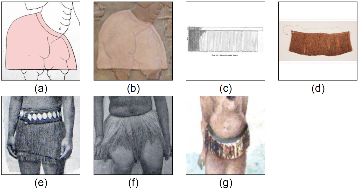
Architecture: Puntite houses on stilts match Sumatran and Enggano traditions.
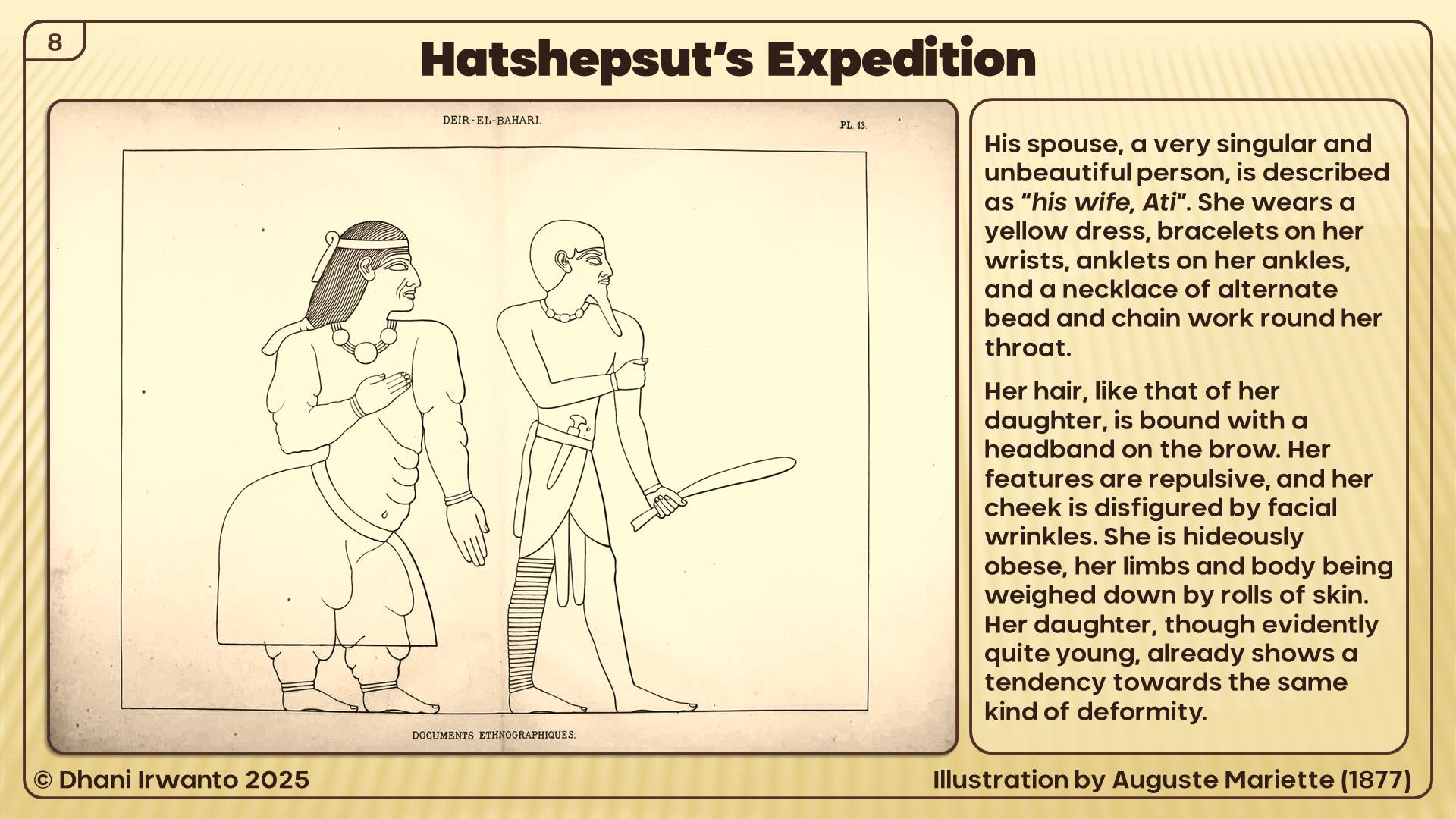
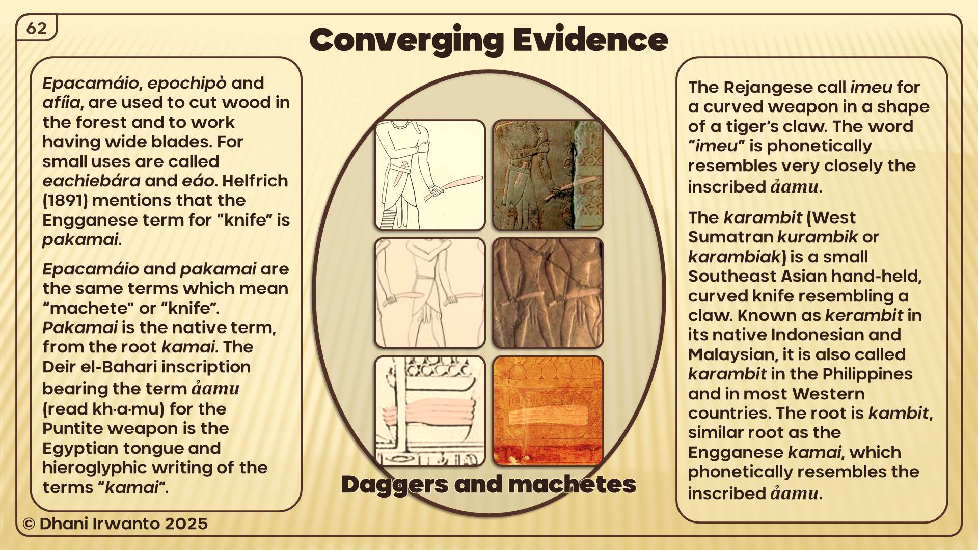
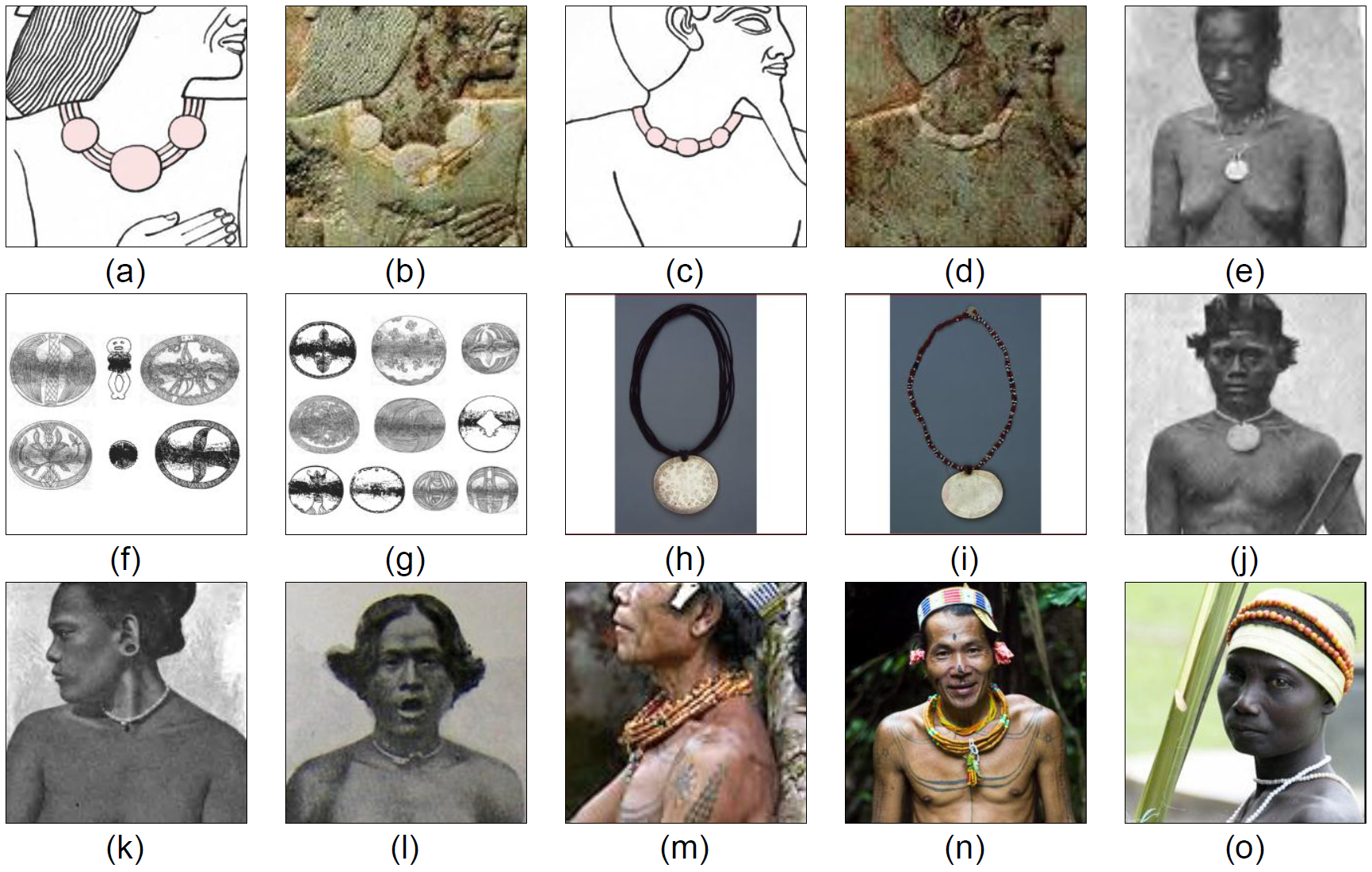
People: Puntites depicted with lighter skin, straight noses, and Malay-style dress, jewelry, and weapons.
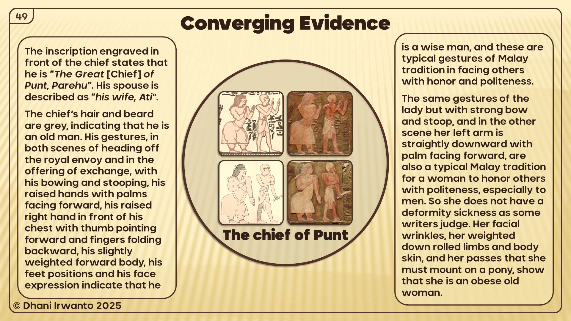
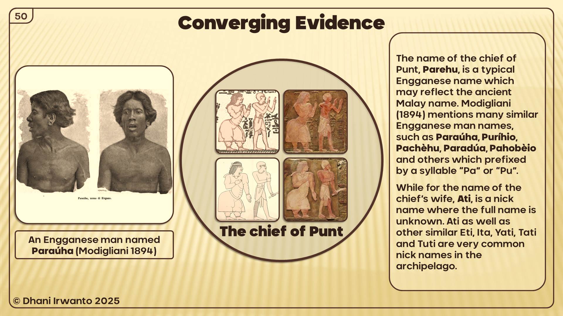
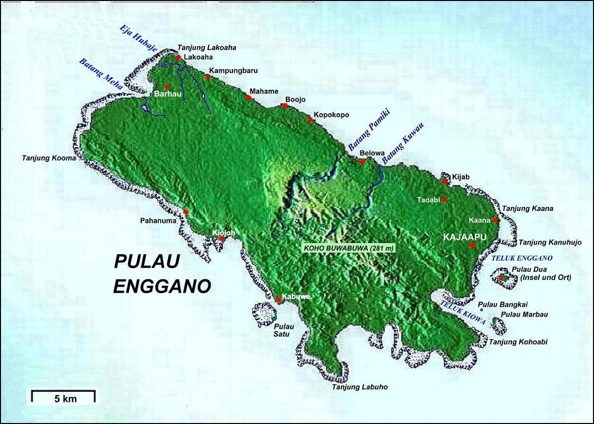
Names: Chief Parehu resembles Enggano names (Paraúha, Puríhio). His wife Ati recalls common Indonesian nicknames.
This is not coincidence—it is a cultural fingerprint.
Now let’s place this beside Neserser. The Book of the Dead speaks of Osiris enthroned at the center of six or seven concentric circles, on an island-lake in the far East. The imagery of circles, water, divine enthronement, and flood resonates directly with Plato’s Atlantis.
If the Egyptians already connected their cosmology to the far East—to Sumatra, the “land of origin”—then the parallels between Neserser and Atlantis may not be abstract at all. They may reflect Egypt’s sacred geography projected upon Southeast Asia.
The Thread of Transmission:
Egypt knew Sumatra as Punt—the source of incense, gold, and sacred products.
Neserser represented a circular, island-paradise of Osiris in the East.
Atlantis, as told by priests to Solon, may have drawn on this same Eastern sacred memory.
In this light, Atlantis is not a purely Mediterranean invention. It may encode Egypt’s knowledge of Southeast Asia, filtered through myth, memory, and Plato’s philosophy.
In the Book of the Dead (Papyrus of Nu), we encounter Neserser—“the Island of Fire” in the far East, where the sun rises. It is the dwelling place of Osiris (Ausares, Asar) and Thoth. The imagery is vivid: Osiris enthroned in the center of six or seven concentric circles on a sacred lake, a volcanic-like “island and lake of fire” dedicated to Ra, floods that reshape the landscape, and Thoth residing nearby, keeper of divine knowledge.
Later Egyptologists described these circles as “hidden after the flood.”
Atlantis echo: Here again are concentric circles, a sacred island, a great flood, and divine kingship.
Connecting the Dots: A Discussion
The parallels between Plato’s Atlantis and global myths—from Tamil Kumari Kandam to Mesopotamian Nisir, from Iranian Kangdez to Biblical Eden—show a striking pattern of shared motifs: floods, lost paradises, concentric sacred cities, and divine kingship.
Among these, the Egyptian contribution is the most critical. Plato himself acknowledged that the story came from Egyptian priests. Their sacred geography included Neserser, the concentric island of Osiris in the far East, and their historical voyages reached as far as Punt—identified with Sumatra, the ‘Land of Origin.’
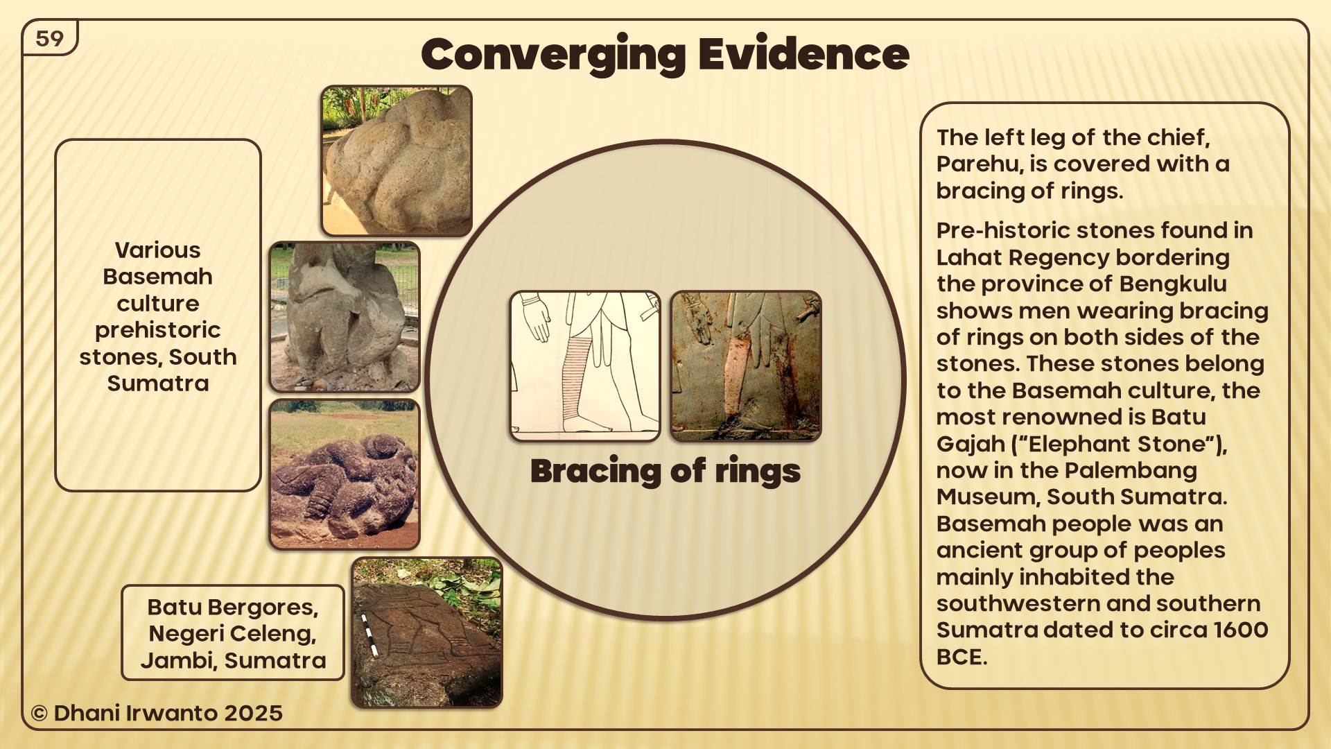
When we combine Neserser’s sacred concentric circles with Punt’s real-world geography and resources, a powerful connection emerges: Egypt not only imagined an eastern paradise, but had knowledge of one. Atlantis may be the philosophical echo of Egypt’s long memory of Southeast Asia.
Thus, the Atlantis story can be seen as a tapestry woven from many threads—myths of lost lands, religious cosmologies, and Egypt’s own encounters with Southeast Asia. Connecting these dots allows us to glimpse Atlantis not as an isolated legend, but as part of a wider human memory of catastrophe, paradise, and rebirth.
Conclusion: When Myths Rhyme Across Oceans
Kumari Kandam, Kangdez, Neserser, Nisir, Asuras, Atlas, Eden—each speaks in its own voice, yet the chorus is familiar. Lost lands, floods, circular cities, divine kings, and paradise destroyed.
Plato may have woven a Greek philosophical tale. But the motifs he used—perhaps borrowed, perhaps remembered—echo far older and wider. Atlantis may not be alone; it may be part of a global pattern of mythic memory of catastrophe and rebirth.
Comparative Snapshot: Parallels at a Glance
A concise table to visualize recurring motifs and where Southeast Asia fits in the Egyptian knowledge frame.
Tradition/Source
Core Setting
Key Motifs
Flood/Collapse
Concentric/Sacred Center
Sea-Lord/Lawgiver
SE Asia Link
Kumari Kandam (Tamil)
Southern drowned land
Golden age, irrigated plains, gem mining, lost coasts
Yes – land swallowed by sea
No explicit circles (ordered realms)
Implied righteous kingship
Indirect (Indian Ocean south)
Kangdez (Iranian)
Fortress in the Far East, near equator
Concentric walls, metals, springs, tidal plain, volcanoes
Implied peril at sea’s edge
Yes – concentric fortifications
Sovereign order (Iranian epic)
Points East; equatorial hints
Neserser (Egypt)
Island-lake in the Far East
Osiris enthroned; 6–7 circles; ‘lake of fire’
Yes – flood imagery; ‘hidden’ after
Yes – canonical concentric circles
Osiris/Ra as sacral law & kingship
Conceptual East (sunrise); bridge to Punt
Mount Nisir (Gilgamesh)
Mountain of grounding
Paradise-like East; forests, birds, monkeys; great flood
Yes – global flood narrative
No (mountain refuge)
Divine warning & survival order
Tropical imagery resonates with SE Asia
Asuras/Ahuras (Indo-Iranian)
Cosmic moral order
Waters, oaths, boundaries (Varuna/Ahura Mazda)
Not central
Symbolic circles (order)
Yes – sea-lord/lawgiver archetype
Cultural substrate across Indo-Iran
Atlas/Poseidon (Greek)
Atlantean kingship; sea-quake god
Names tied to sea power, metals, concentric city
Yes – sudden destruction
Yes – Atlantis capital rings
Poseidon (cf. Varuna/Baruna)
By proxy via Indo-Iran → Egypt
Garden of Eden (Genesis)
Eastern paradise, 4 rivers
Pristine garden, moral test, exile
Yes – loss/expulsion (not flood)
No circles; central river hub
Implied divine law
ANE roots; not specific to SE Asia
Nusasura/Gosong Gia (Java Sea)
Shoal/reef & island lore
Name echoes (nusa + asura); local sunken-land myths
Classical geographers—most prominently Claudius Ptolemy—refer to the Aurea Chersonesus (“Golden Peninsula”), long equated with the Malaya Peninsula. This study re-examines that consensus by triangulating Greco-Roman texts, Indic labels (Suvarṇabhūmi, Suvarṇadvīpa), resource geography, maritime routing, and toponymy. We argue that Ptolemy’s χερσόνησος functions as a scale-normalized, bi-littoral construct: a gold- and tin-forward corridor spanning both shores of the Strait of Malacca. Read geometrically, PtolemyBook 1, ch. 14 treats the first leg parallel to the equator and the second toward south-and-east, consistent with seasonally asymmetric monsoon routing. New contributions include: (i) a Sumatra-centered toponymic thread around Tanjung Emas (“Golden tanjung” —a projecting landform that may be marine or fluvial), accessible from the Bay of Berhala via the Batang Hari corridor and interpreted via metonymy (tanjung → regional chersonesos); and (ii) equator-ambiguous latitude tests combined with an alternative-inclusive crosswalk of Ptolemaic names. Results show that several Sumatra–Batang Hari alignments outperform canonical Malaya Peninsula placements on the latitude metric, and this advantage persists when multiple Malaya Peninsula alternatives are allowed. The framework preserves viable Malay identifications while motivating a Sumatra-focused component of the “Golden” label. It yields falsifiable predictions for archaeometallurgy (interior-to-estuary transects), toponymy audits (paired placements with winners), and sailing-time modeling (monsoon-aware residuals), providing a concrete agenda to confirm or revise the bi-littoral “Golden Corridor” model.
Keywords
Aurea Chersonesus; Golden Chersonese; Suvarnadvīpa; Sumatra; Malaya Peninsula; Ptolemy; Indian Ocean trade; Srivijaya; historical cartography; gold metallurgy; Batang Hari River; Tanjung Emas.
1. Introduction
In classical geography, the Aurea Chersonesus (“Golden Peninsula”) occupies a prominent position at the eastern edge of the Indian Ocean world. The most influential canonical description is found in Ptolemy’s Geography (2nd century CE), whose toponymic lists and coordinate grid—despite known distortions—shaped the medieval and early modern image of the Far East. For over a century of modern scholarship, the Golden Chersonese has been equated with the Malaya Peninsula, a view championed by Gerini, Wheatley, Linehan and others. This mapping is intuitive: Ptolemy’s Greek label chersonēsos refers to a peninsula, and the Malaya Peninsula is the most conspicuous salient in the region.
Yet parallel South and Southeast Asian traditions preserve complementary designations: Suvarṇabhūmi (“Land of Gold”) and Suvarṇadvīpa (“Island of Gold”). The latter is repeatedly linked to Sumatra (Indonesia)—a literal island long noted for its alluvial gold in the Minangkabau interior. Chinese and Arabic itineraries later anchor Srivijaya-era commerce along the Malacca–Andaman corridor, while archaeometallurgical and historical mining records underscore dense gold and tin provinces distributed across the Sunda Shelf. Together these strands suggest that ancient informants may have perceived a trans-Strait gold zone rather than a single, peninsular monocenter.
Classical writers already associated the Far East with Chryse/Aurea (“golden”) long before Ptolemy. The Periplus of the Erythraean Sea places an island called Chryse at the extreme eastern limit “under the rising sun,” a node for fine tortoise-shell and gold-related trade items. Pliny mentions both a promontory Chryse (Promunturium Chryse) and the islands Chryse and Argyre beyond the Indus, keeping “golden” toponymy in play as either cape or island. Pomponius Mela likewise lists Chryse and Argyre as islands, the former with “golden soil,” in his Far Eastern notices. Later poetic geographies such as Dionysius Periegetes (Periegesis) and Avienus (Ora Maritima) preserve the motif of a golden island at the sunrise margin. In South and Southeast Asian sources, Suvarṇabhūmi and Suvarṇadvīpa recur as Indic labels for a “golden land/island”; the Mahāvaṃsa records missions “to Suvarṇabhūmi,” while the Padang Roco (1286 CE) inscription explicitly names Swarnnabhūmi/ Suvarṇabhūmi in a Jambi–Dharmāśraya context, and the Nagarakretagama (1365) situates this golden geography within wider Javanese–Sumatran political space. For consolidated discussion, see the author’s earlier summary.
This paper reframes Aurea Chersonesus through a consilience framework that explicitly integrates: (i) textual–cartographic analysis of Ptolemy’s descriptive geometry and errors, (ii) resource geography (gold and tin provinces), (iii) monsoon-season maritime network modeling, and (iv) toponymy and ethnolinguistics, including a Sumatra-specific thread around Tanjung Emas (“Golden tanjung”) and the Batang Hari River system on Sumatra’s east-flowing watershed. We also incorporate authorial contributions from Sundaland research—specifically Irwanto’s works and website articles—as primary references and as a structured hypothesis to be tested alongside mainstream interpretations. We contend that a bi-littoral Golden Corridor model better explains the overlap between the Greco-Roman “peninsula” label and the Indic memory of an “island of gold,” while remaining open to strict falsification.
This study extends work within the Sundaland research program (2010–present).
Background and prior scholarship.
The standard view equating Aurea Chersonesus with the Malaya Peninsula rests on three pillars: (1) the literal meaning of chersonēsos as “peninsula,” (2) sequences of toponyms in Ptolemy and later writers that seem to fit the Malaya Peninsula littoral, and (3) a century of careful philological and cartographic work that codified these identifications. Against this, critics have flagged well-known features of Ptolemy’s geography: systematic longitude compression, variable latitude accuracy, and the compilation of sailing intelligence from merchants whose reports were stitched into schematic coastlines. The possibility of feature conflation is amplified at the eastern Indian Ocean rim, where two substantial coastlines—the Malaya Peninsula and Sumatra—straddle a narrow strait threaded by seasonal monsoon routes.
In parallel, Indian and Southeast Asian textual memories invoke Suvarṇabhūmi (Land of Gold) and Suvarṇadvīpa (Island of Gold), with the latter specifically resonant with Sumatra. Historians of metallurgy and early Southeast Asian trade have documented significant gold exploitation in Sumatra’s highlands and extensive tin belts on both shores. A consolidated review of Sumatra’s long history of gold production—artisanal, colonial, and modern—appears in van Leeuwen (2014), with a journal update in van Leeuwen (2022). The net result is an evidentiary landscape that supports either a Malaya Peninsula-only model or a broader, paired-shore model—leaving room for careful re-evaluation.
2. Materials and Methods
2.1 Sources and consilience design
Textual–cartographic analysis: reading Ptolemy’s coastal descriptors (promontories, gulfs, river mouths, sailing distances) against modern coastlines, while explicitly modeling the distortions of his coordinate grid.
Resource geography: mapping classical references to “gold” and “tin” onto known ore provinces (Sumatra interior, Malaya Peninsula belts, western Borneo) and comparing them with riverine access to export points.
Maritime network modeling: reconstructing monsoon-dependent sailing legs and currents across the Andaman–Malacca corridor to assess whether a Malaya Peninsula-only or a Malaya Peninsula–Sumatra model better explains reported distances and stopovers.
Toponymy and ethnolinguistics: re-auditing canonical identifications on the Malaya Peninsula side and testing Sumatra-side candidates, with special attention to hydronyms and ancient waypoints along the Batang Hari system; including a linguistic parallel between “Aurea Chersonesus” and “Tanjung Emas” (Golden tanjung).
2.2 Ptolemy’s coordinate system and latitude handling
Ptolemy lists a sequence of coastal features—capes, gulfs, islands—accompanied by latitudes and longitudes aligned to an Alexandrian prime meridian. The transmission of these coordinates is uneven: longitudes are systematically compressed; latitudes are more stable but still subject to copyist error and observational imprecision. For the Golden Chersonese, the relevant coordinates cluster near the equator—within a handful of degrees on either side—consistent with either the Malaya Peninsula’s southern sector or Sumatra’s east-coast theater. This equatorial clustering is not dispositive on its own, but it reduces the discriminating power of latitude while preserving an important constraint for any re-identification.
A key methodological move, therefore, is to treat Ptolemy’s coordinates as weak constraints to be combined with descriptive geometry (e.g., the order of features along a voyage) and sailing times. When this is done, several ambiguities arise that are better resolved by admitting Sumatra’s ports and promontories into the candidate set, rather than forcing a Malaya Peninsula-only mapping.
3. Results
3.1 Quantitative fit to Ptolemy’s latitudes
Latitude comparison with Ptolemy. Using our Sumatra (Batang Hari) coordinates and mainstream Malaya Peninsula placements, we computed residuals per toponym: |Δφ| (absolute signed difference). In the comparison (Table 3), the overall means favor the Sumatra placements as the modal ‘winner’.
3.2 Resource geography: gold, tin, and river access
An independent constraint from ores and rivers. The Sumatran interior (Minangkabau–Barisan) preserves a long record of alluvial and hard-rock gold, with major drainages trending east to the Batang Hari and the Bay of Berhala; historical syntheses outline a province-scale gold belt extending through the central highlands (van Leeuwen 2014; 2022). By contrast, the Malaya Peninsula is classically associated with prolific tin belts (with gold occurrences present but secondary). For distant compilers, such a bi-littoral metalscape could easily coalesce into a generalized “golden” reputation, irrespective of the precise ore mix on each shore.
A natural conveyor on the Sumatra side. The Batang Hari functions as a low-gradient corridor from interior sources to estuarine export nodes. In this configuration, Muara Sabak anchors access from the Bay of Berhala, while levee ridges, relict channels, and terrace margins along the lower–middle river offer plausible staging points for beneficiation and transshipment. Even allowing for seasonal constraints, interior-to-coast movement is mechanically feasible in antiquity and consistent with the corridor model proposed here (see Figure 2 for metallogenic context; Table 1 for gazetteer entries).
Implication for the “Golden” label. Read together, (i) a gold-forward Sumatran interior efficiently coupled to an east-draining river system, and (ii) a tin-forward Malay littoral participating in the same exchange circuits, provide a resource-hydrology mechanism by which a bi-littoral corridor could be perceived and named as Aurea. This pattern does not negate canonical Malaya Peninsula placements; it adds a Sumatra-side contribution that is independently motivated by ore belts and river access, and is testable against the toponymic cross-walk (Table 2) and latitude residuals (Table 3).
For historical overviews of Sumatra’s mining districts, see van Leeuwen 2014; 2022.
3.3 Toponymy and linguistic signals
Indic labels and scale. Sources preserve two overlapping labels—Suvarṇabhūmi (“land of gold”) and Suvarṇadvīpa (“island of gold”). While dvīpa literally means “island,” it is scale-flexible in Indic usage (cf. Jambudvīpa for the Indian subcontinent). In our context, the island reading maps neatly onto Sumatra, without excluding broader macro-regional senses that Greco-Roman compilers might have normalized into a single peninsular label.
Malayic tanjung and Greek chersonēsos. In Old Malay/Malayic usage, tanjung denotes a projecting landform in marine, lacustrine, or fluvial settings. The Tanjung Emas district (“Golden tanjung”) is best understood as a promontory-like high ground along the lower surrounding floodplain rather than a marine cape. This semantics resonates with Ptolemy’s chersonēsos—a macro-regional label—and allows a metonymic elevation whereby a renowned local tanjung contributes the name for a wider “golden” littoral. Geographically, the Tanjung Emas hinterland links directly to the Batang Hari corridor, enabling access from the Bay of Berhala inland to the Minangkabau gold belt.
Re-auditing Ptolemy’s names. Ptolemy’s lists of capes, gulfs, and river mouths include several non-consensus identifications. Our approach is a structured toponymy audit across both shores: we prioritize hydronyms, tanjung-promontories, emporia/market towns, and gold-semantic lexemes; we score each candidate on phonology/orthography, morphology/semantics, latitude residuals, and route coherence with neighboring entries. Ties within narrow thresholds (e.g., ≤0.2° latitude; ≤1 day sailing) are recorded as paired candidates, and a “winner” is declared only when one side clears both thresholds. Results are summarized in Table 2 (crosswalk) and Table 3 (latitude/residual tests), with notes on metonymy and potential conflations (a famed cape/emporion naming a wider reach).
Next evidentiary steps. These linguistic placements remain hypotheses to be tested against dated epigraphy, early Malay/Old Javanese/Sanskrit forms, and early Chinese notices around the rise of Śrīvijaya. Convergent support from these lines—together with the resource-hydrology fit and route modeling—would raise the probability of a Sumatra-linked component in the ancient “Golden” label without negating canonical Malaya Peninsula-littoral placements.
3.4 Maritime networks and monsoon timing
Findings from the latitude/residual tests. Across the full set and the near-equator subset, Sumatra–Batang Hari alignments outperform canonical Malaya Peninsula placements. Allowing multiple Malaya Peninsula alternatives per name does not erase this advantage. (See Table 3; cross-references in Table 2.)
Caveats and robustness. Ptolemy’s values carry observational/transcriptional noise, and several Malaya Peninsula identifications remain non-unique. Our residuals are comparative indicators, not absolute fits. Even so, the pattern holds across analysis slices and modeling choices (single-option vs. alternative-inclusive tallies), supporting a Batang Hari-centric reading of several toponyms.
Monsoon-structured routing. The Andaman–Malacca–Java Sea system is seasonally asymmetric. With NE/SE monsoon reversals, westbound and eastbound legs differ in coast selection, sailing times, and stopovers. Interpreted with the Ptolemy Book 1, ch. 14 geometry (first leg parallel to the equator; second south-and-east), the bi-littoral model frequently reduces sailing-time residuals (Figure 4): pilots could hug windward or leeward shores by season, cargo, and political control. On the Sumatra side, the Bay of Berhala → Batang Hari entrance provides a natural gateway; on the Malaya Peninsula side, routes favor tin-rich coastal settlements and established emporia.
Implication. Flexible, seasonally tuned routing is exactly what a “Golden Corridor” predicts: resource collection, transshipment, and long-distance export distributed across both coasts, with the Batang Hari corridor supplying a persistent Sumatran component without displacing viable Malaya Peninsula placements.
3.5 Case study: Batang Hari corridor and the Bay of Berhala
Physical setting and logistics. The Batang Hari drains a broad swath of the Minangkabau–Barisan highlands and debouches to the Bay of Berhala. Its east-trending, low-gradient lower course functions as a natural conveyor from interior gold districts to estuarine exchange nodes (see Figure 2 for metallogenic context). Muara Sabak anchors the mouth; levee ridges, relict channels, and terrace margins along the lower–middle river provide plausible staging points for beneficiation and transshipment, at least seasonally.
Toponymy anchor: Tanjung Emas. The district name Tanjung Emas (“Golden tanjung”) preserves a promontory-linked economic memory. In Malayic usage, tanjung denotes a projecting landform (marine or fluvial); here it fits a promontory-like high ground on the lower surrounding floodplain. Read alongside Greek χερσόνησος (chersonēsos, “peninsula”), this supports a metonymic elevation from a local landmark to a regional ‘golden’ littoral.
Ptolemaic cross-walk signals. Within this theater, several promontoria, sinus/gulfs, river mouths, and islets in Ptolemy’s lists admit tentative Sumatra-side correspondences when screened by (i) latitude residuals (Table 3), (ii) onomastic plausibility (Table 2 notes), and (iii) route coherence under the Ptolemy Book 1, ch. 14 geometry (first leg parallel to the equator, second south-and-east; see Figure 4). We do not sanctify any single identification; rather, we show that a Batang Hari-centric mapping is geographically and semantically coherent within Ptolemy’s equatorial constraints.
Near-term tests. Three checks can raise/lower the case:
(ii) Toponymy audit with scored paired placements (phonology/semantics + |Δφ| + route context);
(iii) Sailing-time residuals comparing Malaya Peninsula-only vs Malaya Peninsula–Sumatra models across monsoon windows (Figure 4). Convergent positives would strengthen a Sumatra-linked component in the ancient “Golden” label without displacing viable Malaya Peninsula identifications.
4. Discussion
4.1 Synthesis: the bi-littoral ‘Golden Corridor’ model
We triangulate the Ptolemaic dossier from three strands: (i) Greco-Roman “Chryse/Aurea” notices (promontory and island traditions), (ii) Indic labels Suvarṇadvīpa/Suvarṇabhūmi, and (iii) material proxies for gold production and exchange in Sumatra. Travel and scholastic itineraries (e.g., Samaraiccakaha; Atīśa, Dharmapāla, Vajrabodhi, Dharmakīrti in Suvarṇadvīpa) keep Sumatra in view; some readers also connect Josephus/Ophir to the Aurea Chersonesus stream. Archaeologically and historically (Lebong Donok/Lebong Tandai, Jambi paleo-alluvials, Salido, Kotacina), the record is consistent with a corridor of gold working rather than a single peninsular monocenter.
We synthesize these into a parsimonious bi-littoral model:
(1) Knowledge compression. Greco-Roman compilers normalized merchants’ reports into schematic forms. A bi-coastal gold/tin region framed by a narrow strait could be compressed into a single “Golden Peninsula” (χερσόνησος) even when source reports alternated between island and peninsula descriptions.
(2) Equatorial constraint. Ptolemy’s latitudes for the Golden Chersonese cluster near the equator. Both a southern Malay salient and an east-Sumatra promontory system satisfy this, so latitude alone does not decide; we therefore compare residuals (Table 3).
(3) Resource–hydrology fit. Sumatra’s gold-bearing highlands drain efficiently to the Batang Hari export gateway; the Malay Peninsula side contributes tin (and gold) via its own river access. The Malacca corridor integrates both shores into long-distance circuits.
(4) Consilience with metallogeny. Independent mining histories outline a Sumatran gold belt compatible with the corridor hypothesis and the Batang Hari axis (e.g., van Leeuwen 2014; 2022). This raises the prior that Ptolemaic “golden” toponyms can include Sumatra-side nodes.
(5) Linguistic echo and metonymy. The Malayic tanjung denotes a projecting landform (marine or fluvial). A famed local tanjung (e.g., Tanjung Emas) can be metonymically elevated to a regional chersonesos in Greek. In parallel, dvīpa in Suvarṇadvīpa is scale-flexible (from island to macro-region). Thus Greek “peninsula” and Indic “island of gold” reflect different scales/vantage points across the same Sumatran-centered corridor (see Table 2 notes).
(6) Itinerary realism. Read geometrically, Ptolemy Book 1, ch. 14 treats the first leg parallel to the equator and the second toward south-and-east (see Greek note). Monsoon-aware sailing reconstructions (Figure 4) naturally touch both shores across seasons; we therefore test Malaya Peninsula-only vs Malaya Peninsula–Sumatra routes by sailing-time residuals.
Implication. The Malay Peninsula mainstream placements remain compatible with a bi-littoral reading; selected toponyms show equal or better Sumatra fits in Table 2 and Tables 3. The corridor model yields testable predictions (archaeometallurgy, toponymy audits, route modeling) rather than a fixed point-location claim.
4.2 Counter-arguments and replies
Etymology (Peninsula vs. Island): Objection: the Greek χερσόνησος (chersonēsos) explicitly means “peninsula,” so an island identification is excluded. Reply: in Ptolemaic usage chersonēsos functions as a typological, macro-regional label—a compiler’s normalization of a coastal zone anchored by salient headlands—rather than a precise geomorphic diagnosis of every node within it. The elasticity is visible in the Greco-Roman dossier itself: “golden” toponyms appear as both promontory and island (e.g., Periplus Maris Erythraei chs. 63–64; Pliny, Natural History 6 [Promunturium Chryse and the Insulas Chrysen et Argyrēn]; Pomponius Mela, Chorographia 3.70; Dionysius Periegetes, Periegesis; Avienus, Ora Maritima). A locally famous tanjung (promontory-like high ground) can thus be metonymically elevated to a regional chersonēsos in Greek. On the Indic side, Suvarṇadvīpa (“island of gold”) is likewise scale-flexible: dvīpa ranges from literal islands to large cultural-geographic units (cf. Jambudvīpa for the Indian subcontinent), and labels such as Suvarṇabhūmi/Suvarṇadvīpa recur in texts and epigraphy (e.g., Mahāvaṃsa; Jātaka; Milinda Pañha; Padang Roco inscription; Nagarakretagama). Read together, the Greek “peninsula” and the Indic “island of gold” reflect different vantage points and scales across the same Sumatran-centered gold corridor, not a contradiction.
Canonical Malaya Peninsula Placements (Mainstream View). Objection: many Ptolemaic names have long-standing Malaya Peninsula identifications—e.g., Tacola → Takua Pa/Takuapa (Phang-nga); Perimulicus → Gulf of Thailand; Sabana → Singapore/Klang; Maleucolon → Malay Point—in classic treatments (Wheatley, The Golden Khersonese; Gerini, Researches on Ptolemy’s Geography of Eastern Asia; McCrindle’s Ptolemy; Stevenson’s trans.). Reply: our model does not displace these; it contextualizes them. We treat Ptolemy’s coastline list as a mixed-granularity gazetteer compiled from pilots’ reports, in which some labels are typological or metonymic. Accordingly, (i) we admit the Malaya Peninsula littoral assignments where they fit; (ii) we test paired candidates where direction/latitude residuals and onomastic/morphological cues are sharper on Sumatra (e.g., tanjung-based promontories, Batang Hari corridor nodes); and (iii) we allow for conflations (a famed cape/emporion naming a wider reach) and equatorial sign flips in transmission. In short, the Malaya Peninsula mainstream placements remain compatible with a bi-littoral model, while selected toponyms may find better or dual fits on Sumatra; the tables (2, 3) make these tests explicit.
Absence of excavated gold-processing sites on the proposed Sumatra promontory. Critics may note the thin archaeometallurgical record along the east-Sumatra estuaries. Reply: in tropical deltaic settings, surface features of gold working (sluice lines, small pits, earthen settling basins) are low-visibility and often erased by avulsion, mangrove accretion, and agriculture; the highest archaeological signal is expected up-basin on stable terraces rather than on the active estuary front. Independent geological/historical syntheses nevertheless document a long-lived Sumatran gold province, e.g., colonial records of at least 14 gold mines (1899–1940) with ~101 t Au produced—dominated by the Lebong Donok/Lebong Tandai district—situated within broader epithermal/orogenic belts that extend into the Batang Hari hinterland. These histories do not “prove” estuarine processing sites, but they raise prior probability that such sites existed and are masked by taphonomy and survey bias.
4.3 Limitations
Four limitations are salient.
(1) Textual–cartographic uncertainty. Ptolemy’s coordinates are copy-derived (via Marinus) with known distortions (prime-meridian choice, scale/shape compression) and scribal sign errors near the equator. Our use of residual table (Table 3) reduces but does not eliminate this noise; we therefore emphasize relative fits (comparative residuals, paired candidates) over absolute placements.
(2) Geomorphic and taphonomic loss. Tropical delta dynamics—rapid sedimentation, avulsion, mangrove accretion, later agriculture and extraction—erase or bury low-visibility gold-working signatures. This biases the surface record toward up-basin stability. We address this by prioritizing subsurface sampling (coring, geophysics), targeting terrace/levee contexts, and running negative-control transects outside the corridor to bound false positives.
(3) Linguistic palimpsest and onomastic drift. The Malay world layers Sanskritic, Malayic, Old Javanese, and local substrates; later Islamic/colonial spellings and folk etymologies confound straight etymologies. Our crosswalk treats names as probabilistic matches—scored on phonology, semantics, geography, and route coherence—and explicitly records dual candidates where ties persist. Definitive resolutions will require collaboration with historical linguists and dated toponym attestations.
(4) Model simplifications in route simulations. Sailing-time reconstructions approximate seasonal winds, currents, hull/sail performance, and unknown stopovers; the Greek narrative (Ptolemy Book 1, ch.) is interpreted geometrically (first leg parallel to the equator; second leg south-and-east), but alternative readings exist in translations. We mitigate by reporting per-leg residuals, running parameter sweeps/sensitivity analyses, and using results to compare Malaya Peninsula-only vs. Malaya Peninsula–Sumatra models rather than to assert exact day-to-mile conversions.
(A further limitation is evidence imbalance: Malaya Peninsula littoral archaeology is generally better published than Sumatra’s. We note this asymmetry and frame our claims as testable predictions to motivate targeted fieldwork.)
Objective. Test for placer-gold processing signatures along the Batang Hari corridor from upper–middle confluences (e.g., Tembesi, Sijunjung) to lower-delta levees/relict channels (Muara Sabak; adjacent tanjung promontories ~0–5 m above active floodplain).
Design & methods.
Remote sensing/terrain: SRTM/photogrammetry/LiDAR (if available) to map linear tailings/berms, abandoned race lines, terrace-edge benches.
Coring/transects: vibracoring or Russian-auger lines across levees, point bars, abandoned channels (interior→estuary gradient), plus negative-control transects outside the hypothesized corridor.
Artefact/microresidue survey: hammer-stones, anvils, crushing slabs; micro-quartz abraded flour, soot/ash films; note that smelting slag is uncommon in placer contexts.
Geochemistry: fines screening for Au–Ag; Hg spikes as amalgamation proxy (pXRF/ICP-MS); SEM–EDS/FTIR on concentrates.
Targeted geophysics: magnetometry/EM for hearth lenses or burned features.
Chronology: AMS ^14C (charcoal) and OSL (tailings/levee accretion) to bracket activity phases.
Decision rules (falsifiable).
Support for the estuary-linked processing prediction if ≥2 independent lines (e.g., Au–Ag fines + micro-abrasion + dated hearth lens) co-occur at lower Batang Hari nodes and yield dates broadly consistent with 1st–3rd c. CE (Ptolemaic horizon) or sustained pre-/protohistoric activity.
Revision trigger if signatures are absent at estuary nodes but present upstream only (interior-focused beneficiation), or if dating clusters far outside the hypothesized window.
Outputs. Georeferenced site inventory (interior→estuary), GIS layers for candidate features, analytical microresidue catalogue, and a brief QA/QC note on contamination controls; figure panel summarizing positive/negative transects.
(2) Toponymy audit (paired placements, scored).
Build a bilingual/trilingual gazetteer for Ptolemaic ↔ Malay/Old Javanese/Sanskrit forms on both shores (Batang Hari basin vs. Malaya Peninsula littoral).
Prioritize hydronyms, promontory names (tanjung), emporia/market towns, and gold-semantic lexemes.
For each Ptolemaic name, compute a composite score: (i) phonology/orthography match; (ii) morphology/semantics (e.g., “gold,” “cape,” “river”); (iii) |Δφ| (latitude residual, with equator-ambiguity rule near 0°); (iv) route coherence with adjacent names.
Treat ties ≤0.2° latitude and ≤1 day sailing as dual candidates; record a “winner” only when one candidate clears both thresholds.
Outputs: updated Table 2 (notes/etymology column expanded) and Table 3 (scores + winners), plus a short appendix on sound correspondences/loan patterns.
(3) Sailing-time modeling (seasonal residuals).
Run eastbound/westbound simulations under NE/SE monsoon windows using simple square-sail polars and coastal tacking constraints.
Compare two route families: Malaya Peninsula-only vs Malaya Peninsula–Sumatra (with Muara Sabak / Batang Hari stopover).
Convert reported “days” to distance via Ptolemaic reduction rules (Leg-1 parallel to equator; Leg-2 S+E bearing).
Report per-leg residuals (simulated vs. Ptolemaic) and a total misfit (median absolute % error).
Decision rule: Sumatra model is preferred if it reduces total misfit by ≥20% and improves at least two contiguous legs.
Outputs: revised Figure 4 panels with residual boxes, plus a one-page methods note.
Overlay gold-province belts (epithermal/orogenic districts) with river least-cost paths to export nodes; estimate interior-to-estuary tonnage friction.
Inputs: ore-belt polygons, SRTM-derived river networks/gradients, navigability classes, portage penalties, and historical mine districts.
Compute for each basin (e.g., Batang Hari vs. Pahang/Perak) a logistics index: (ore endowment × fluvial efficiency) → predicted export throughput.
Decision rule: Hypothesis gains support if Batang Hari ranks top-two under ≥2 parameterizations and aligns with high-score toponyms.
Outputs: a small metallogenic overlay figure (supporting Figure 2) and a table of basin indices to cite in Discussion.
6. Conclusion
Treating Aurea Chersonesus as a scale-normalized, bi-littoral construct reconciles Ptolemy’s χερσόνησος (“peninsula”) with Indic Suvarṇadvīpa (“island of gold”). Our reading of Ptolemy Book 1, ch. 14—first leg parallel to the equator, second leg toward south-and-east—and the Malayic semantics of tanjung (a projecting landform, not necessarily marine) allow a metonymic elevation from a local promontory (e.g., Tanjung Emas) to a regional chersonesos. Quantitatively, the latitude tests and the toponymy crosswalk (Tables 3, 2) show that several names admit equal or better fits on the Sumatra side, especially along the Batang Hari corridor, while leaving canonical Malaya Peninsula littoral placements intact where they remain competitive. Independent metallogenic histories of Sumatra’s gold province further raise the prior for a Sumatra-centered corridor rather than a single peninsular point.
The model is deliberately testable. Three levers can raise or lower its probability: (i) archaeometallurgical survey targeted at terrace/levee nodes from interior to estuary; (ii) toponymy audits that resolve paired/dual placements; and (iii) sailing-time residuals under seasonal winds (Figure 4). At a minimum, the Golden Chersonese should be read as a corridor, not a dot on the map—one in which Sumatra’s Suvarṇadvīpa plays a constitutive role while Malay Peninsula identifications remain part of a bi-littoral solution set.
Acknowledgments
I thank colleagues and readers for helpful comments on earlier drafts. This article draws on datasets developed in the Sundaland research program (2010–present); all interpretations and any errors are my own.
Funding
No external funding was received. The research was undertaken within the Sundaland research program.
Data availability
All tabular data are provided in Table 1, Table 2, and Table 3. Working spreadsheets and figure files are available from the author on reasonable request.
Competing interests
The author declares no competing interests.
Ethical approval
Not applicable.
References
Avienus, Rufus Festus. 1934. Ora Maritima. Ed. A. Berthelot. Paris: Les Belles Lettres.
Dionysius Periegetes. 2014. Dionysius Periegetes: Description of the Known World. Ed., trans., and comm. J. L. Lightfoot. Oxford: Oxford University Press.
Gerini, G. E. 1909. Researches on Ptolemy’s Geography of Eastern Asia (Further India and Indo-Malay Archipelago). London: Royal Asiatic Society & Royal Geographical Society.
Irwanto, Dhani. 2019 Sundaland: Tracing the Cradle of Civilizations. Bogor: Indonesia Hydro Media. ISBN: 9786027244924. (includes section on Aurea Chersonesus)
Josephus, Flavius. 1930–1965. Jewish Antiquities. Trans. H. St. J. Thackeray et al. Loeb Classical Library. Cambridge, MA: Harvard University Press. (See esp. Vol. I, 1930.)
Jātaka: Stories of the Buddha’s Former Births. 1895–1907. 6 vols. Trans. R. Chalmers, W. H. D. Rouse, H. T. Francis, and E. B. Cowell (ed.). Cambridge: Cambridge University Press (for the Pali Text Society; reprinted PTS, 1990).
Linehan, W. 1951. “The Identifications of Some of Ptolemy’s Place-Names in the Golden Khersonese.” Journal of the Malaya Peninsulan Branch of the Royal Asiatic Society 24 (3): 1–24.
Mahāvaṃsa. 1912. The Mahāvaṃsa or The Great Chronicle of Ceylon. Trans. Wilhelm Geiger. London: Published for the Pali Text Society by Oxford University Press.
Milinda Pañha (The Questions of King Milinda). 1890–1894. 2 vols. Trans. T. W. Rhys Davids. Sacred Books of the East 35–36. Oxford: Clarendon Press.
Padang Roco (Amoghapāśa) Inscription. 1286 CE. For text, discussion, and translations see: Krom 1916; Moens 1924; Slamet Muljana 1981; and later syntheses.
Periplus of the Erythraean Sea. 1989. The Periplus Maris Erythraei: Text with Introduction, Translation, and Commentary. Trans. Lionel Casson. Princeton, NJ: Princeton University Press.
Pliny the Elder. 1942. Natural History, Vol. II: Books 3–7. Trans. H. Rackham. Loeb Classical Library 352. Cambridge, MA: Harvard University Press.
Ptolemaeus, Claudius. 1843–1845. Claudii Ptolemaei Geographia. Ed. C. F. A. Nobbe. Leipzig: B. G. Teubner (repr. Hildesheim: Georg Olms, 1966).
Ptolemaeus, Claudius. 1932. The Geography of Claudius Ptolemy. Trans. and ed. Edward Luther Stevenson; intro. Joseph Fischer. New York: New York Public Library (repr. Dover, 1991).
Ptolemaios, Klaudios. 2006. Handbuch der Geographie. Griechisch–Deutsch. Eds. Alfred Stückelberger and Gerd Graßhoff. 2 vols. Basel: Schwabe.
van der Meulen, W. J. 1974. “Suvarṇadvīpa and the Chrysê Chersonêsos.” Indonesia 18 (October): 1–40.
van Leeuwen, T. M. 2014. “A Brief History of Mineral Exploration and Mining in Sumatra.” In Proceedings of Sundaland Resources 2014 – MGEI Annual Convention (Palembang, 17–18 Nov). https://doi.org/10.13140/2.1.2278.5607.
Wheatley, Paul. 1961. The Golden Khersonese: Studies in the Historical Geography of the Malaya Peninsula before A.D. 1500. Kuala Lumpur: University of Malaya Peninsula Press. Repr. 1973, Westport, CT: Greenwood Press.
Figure 1. Regional map of the Malaya Peninsula–Sumatra bi-littoral “Golden Corridor”.
Figure 2. Distribution of mineral occurrences, prospects and deposits in Sumatra (van Leeuwen and Pieters, 2014). Location of Tanjung Emas is added.
Figure 3A. Reconstruction of Ptolemy’s coordinates and identified toponymy for area of Golden Chersonese (Irwanto, 2017).
Inset is the plot of places given by Ptolemy with his coordinate system. Numbers are related to the explanations in the text.
Figure 3B. Reconstruction of Ptolemy’s coordinates and identified toponymy for area of eastern coast (Irwanto, 2017).
Inset is the plot of places given by Ptolemy with his coordinate system. Numbers are related to the explanations in the text.
Figure 3C. Reconstruction of Ptolemy’s coordinates and identified toponymy for area of piracy prone (Irwanto, 2017).
Inset is the plot of places given by Ptolemy with his coordinate system. Numbers are related to the explanations in the text.
Figure 4A. Monsoon routing schematic with sailing-time residuals (Malay Peninsula-only vs Malay Peninsula–Sumatra models)— residuals from observed rutters (Δt, days).
Figure 4B. Monsoon routing schematic with sailing-time residuals (Malay Peninsula-only vs Malay Peninsula–Sumatra models)— A/B/C segmentation (modeled at 4 kn; Δt for C only).
Table 1. Gazetteer and GIS coordinates (Batanghari corridor).
Ptolemaic Form
Feature Type
Modern Name
Longitude
Latitude
Aurea Chersonesus
promontory
Tanjung Emas (“Golden Promontory”)
100.762972
-0.438524
Balonca
place
Batu Sangkar
100.593900
-0.456900
Tacola
emporium (trading place)
Tikalak, Singkarak
100.597700
-0.676600
Cocconagara
place
Nagari Solok
100.653100
-0.791100
Palanda
fluvius (river)
Batang Lunto
100.800529
-0.706759
Palanda
place
Sawah Lunto
100.778400
-0.682000
Chrysoana/Chrysoanu
fluvius (river)
Sungai Mas (‘gold river’), Selo River and upper Ombilin River
100.634200
-0.492800
Tharra
place
Muara (Muara Sijunjung)
100.944600
-0.664700
Attibam
fluvius (river)
Upper Batang Hari River
101.597545
-0.963209
Promontorium
promontory
Several places named with “Tanjung” (“promontory”) at coast of Lake Singkarak
100.566780
-0.598574
Perimula
place
Berhala Island
104.040085
-0.516267
Perimulicus
sinus (bay)
Bay/Strait of Berhala
103.933170
-0.667159
Coli
civitas (social body of citizens)
Several places named with “Kuala” (“estuary” [of small rivers]) at eastern coast
103.594618
-0.932387
Coli
civitas (social body of citizens)
Kuala Tungkal
103.406822
-0.825672
Attaba
fluvius (river)
Batang Hari River (previously Batang Sabak River)
103.720431
-1.434334
Maleucolon
promontory
Sungai Lokan (village), Tanjung Jabung (promontory)
104.357700
-1.059200
Sabana
emporium (trading place)
Jambi city
103.611100
-1.607200
Zabæ
civitas (social body of citizens)
Muara Sabak (a village at estuary (‘muara’) of Sabak/Batang Hari River)
104.037921
-1.101304
Sarabes
estuary
Muara (estuary of) Sabak (river)
103.848494
-1.122666
Acadra
place
Koto Kandis
104.055669
-1.239440
Thipinobasti
emporium (trading place)
Suak Kandis
103.982107
-1.394223
Sobani
fluvius (river)
Lesser Jambi Stream, Muaro Jambi
103.626978
-1.481124
Pagrasa
place
Lubuk Rusa
103.359029
-1.561840
Samarade
place
Muara Tembesi
103.121965
-1.723715
Deltaic channel/ Settlement
Nipah Panjang
104.207044
-1.071452
Delta channel/River
Mendahara River
103.915658
-1.143107
Table 2. Toponymy crosswalk (Malaya Peninsula mainstream vs. Sumatra candidates).
Muara Sabak (a village at estuary (‘muara’) of Sabak/Batang Hari River)
Sarabes
estuary
Uncertain placement
Muara (estuary of) Sabak (river)
Acadra
place
Hà Tiên (Gulf of Thailand)
Koto Kandis
Thipinobasti
emporium (trading place)
Hà Tiên sector
Suak Kandis
Sobani
fluvius (river)
Uncertain/not attested
Lesser Jambi Stream, Muaro Jambi
Pagrasa
place
Uncertain/not attested
Lubuk Rusa
Samarade
place
Uncertain/not attested
Muara Tembesi
Deltaic channel/ Settlement
nan
Uncertain/not attested
Nipah Panjang
Delta channel/River
nan
Uncertain/not attested
Mendahara River
Note on McCrindle’s “coast facing south” (Ptolemy, Geog. 1.14)
A widely quoted English rendering by McCrindle reads: “since as the coast faces the south it must run parallel with the equator … ‘we must reduce … from Zabæ to Kattigara, since the course of the navigation is towards the south and the east.’”
The underlying Greek makes a geometric point about coastline orientation, not a southbound course on the first leg. Ptolemy says the Golden Chersonese → Zabæ stretch is “παράλληλον οὖσαν τῷ ἰσημερινῷ” (“parallel to the equator”), and explains that the intervening region runs opposite to the south—i.e., it trends east–west—so no angular reduction is needed. By contrast, the Zabæ → Cattigara leg is explicitly a sailing bearing: “τὸ τὸν πλοῦν εἶναι πρὸς νότον καὶ πρὸς ἀνατολάς” (“the voyage is toward the south and toward the east”), which is why that leg is reduced.
Implication. Translating the first clause as “the coast faces south” risks a syntagmatic slippage: it treats a statement about coastal aspect (used to justify an E–W treatment) as if it were the ship’s heading. Read with the Greek geometry in view, Ptolemy’s two-step logic is: (1) GC → Zabæ runs parallel to the equator (no reduction), then (2) Zabæ → Cattigara runs SE (reduce to the E–W component).
[1] Local usage of tanjung denotes a projecting landform in marine, lacustrine, or fluvial settings; here Tanjung Emas is a higher patch protruding into a lower floodplain along the Batanghari, not necessarily a marine tanjung. Metonymy: a prominent tanjung can label its surrounding littoral; Ptolemy’s chersonesos may reflect such upscaling.
[2] Greek text (PtolemyBook I): Τὴν μὲν οὖν ἀπὸ τῆς Χρυσῆς Χερσονήσου ἐπὶ Ζάβας οὐδέν τι δεῖ μειοῦν, παράλληλον οὖσαν τῷ ἰσημερινῷ, διὰ τὸ τὴν μεταξὺ χώραν ἀντίαν ἐκτετάσθαι τῇ μεσημβρίᾳ. [Lit.] “There is no need to reduce the [distance] from the Golden Chersonese to Zabæ, (it) being parallel to the equator, because the region between extends opposite to the south (i.e., trending east–west).” τὴν δ᾽ ἀπὸ Ζαβῶν ἐπὶ τὰ Καττίγαρα προσήκει συνελεῖν διὰ τὸ τὸν πλοῦν εἶναι πρὸς νότον καὶ πρὸς ἀνατολάς. [Lit.] “But the (distance) from Zabæ to Cattigara must be shortened, because the voyage is towards the south and towards the east.”
Table 3. Ptolemy vs Sumatra and Malaya Peninsula placements (|Δφ|)
Ptolemaic form
Ptolemy lat (reported) (deg)
Sumatra candidate (modern)
Sumatra lat (deg)
Sumatra |Δφ| (deg)
Malaya lat (deg)
Malaya |Δφ| (deg)
Acadra
-4.833
Koto Kandis
-1.239
3.594
10.380
15.213
Attaba
-1.000
Batang Hari River
-1.434
0.434
3.530
4.530
Attibam
-3.000
Upper Batang Hari River
-0.963
2.037
3.800
6.800
Balonca
4.667
Batu Sangkar
-0.457
5.124
Chrysoana/ Chrysoanu
1.000
Sungai Mas, Selo River and upper Ombilin River
-0.493
1.493
4.020
3.020
Chrysoana/ Chrysoanu
-1.333
Sungai Mas, Selo River and upper Ombilin River
-0.493
0.840
4.020
5.353
Cocconagara
2.000
Nagari Solok
-0.791
2.791
Coli
0.000
Several places named with “Kuala” at eastern coast
-0.932
0.932
6.150
6.150
Maleucolon
-2.000
Sungai Lokan Tanjung Jabung
-1.059
0.941
2.500
4.500
Pagrasa
-4.833
Lubuk Rusa
-1.562
3.271
Palanda
-1.500
Batang Lunto
-0.707
0.793
1.730
3.230
Palanda
-2.000
Sawah Lunto
-0.707
1.293
1.420
3.420
Perimula
2.667
Berhala Island
-0.516
3.183
8.430
5.763
Perimulicus
4.250
Bay/Strait of Berhala
-0.667
4.917
10.000
5.750
Promontori-um
2.667
Several places named with “Tanjung” at coast of Lake Singkarak
-0.599
3.265
2.500
0.167
Promontori-um
4.250
Several places named with “Tanjung” at coast of Lake Singkarak
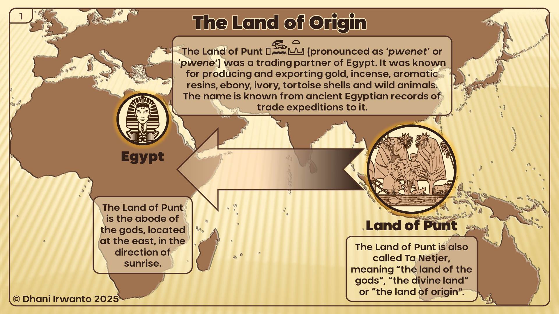
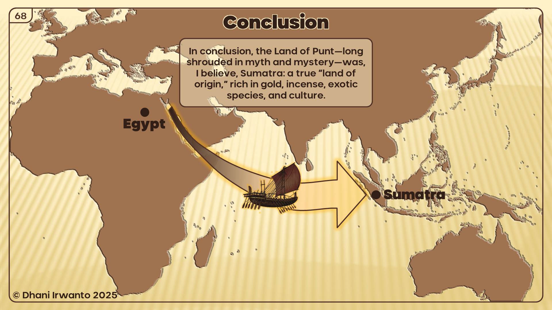
The Land of Punt has long stood as one of history’s enduring mysteries. Ancient Egyptian inscriptions speak of a distant, exotic land—rich in gold, incense, precious woods, and rare animals—referred to as “Ta Netjer,” the land of the gods, or the land of origin. For centuries, the true location of Punt has been debated by scholars, with hypotheses ranging from Africa to Arabia and beyond. Yet, none have fully accounted for the rich detail preserved in the records of Egypt’s trade expeditions.
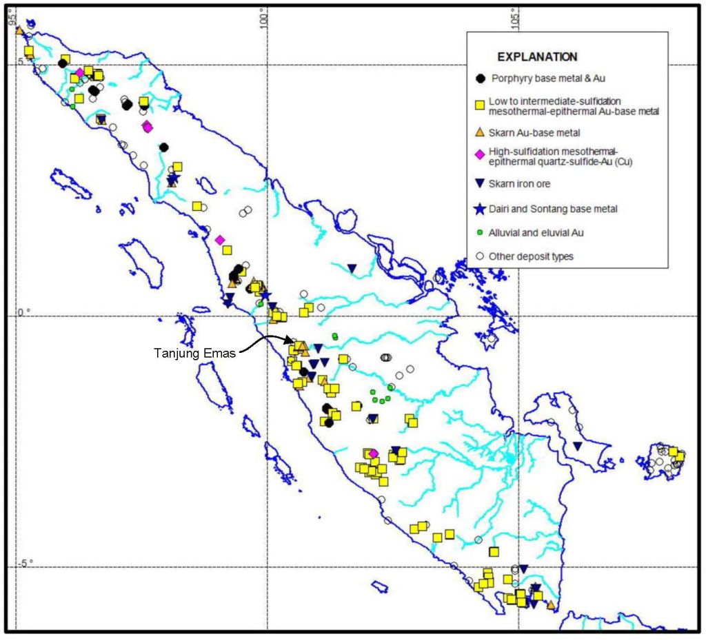
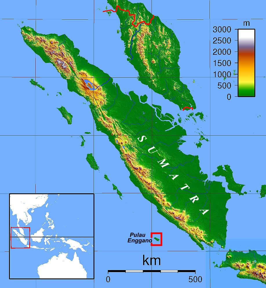
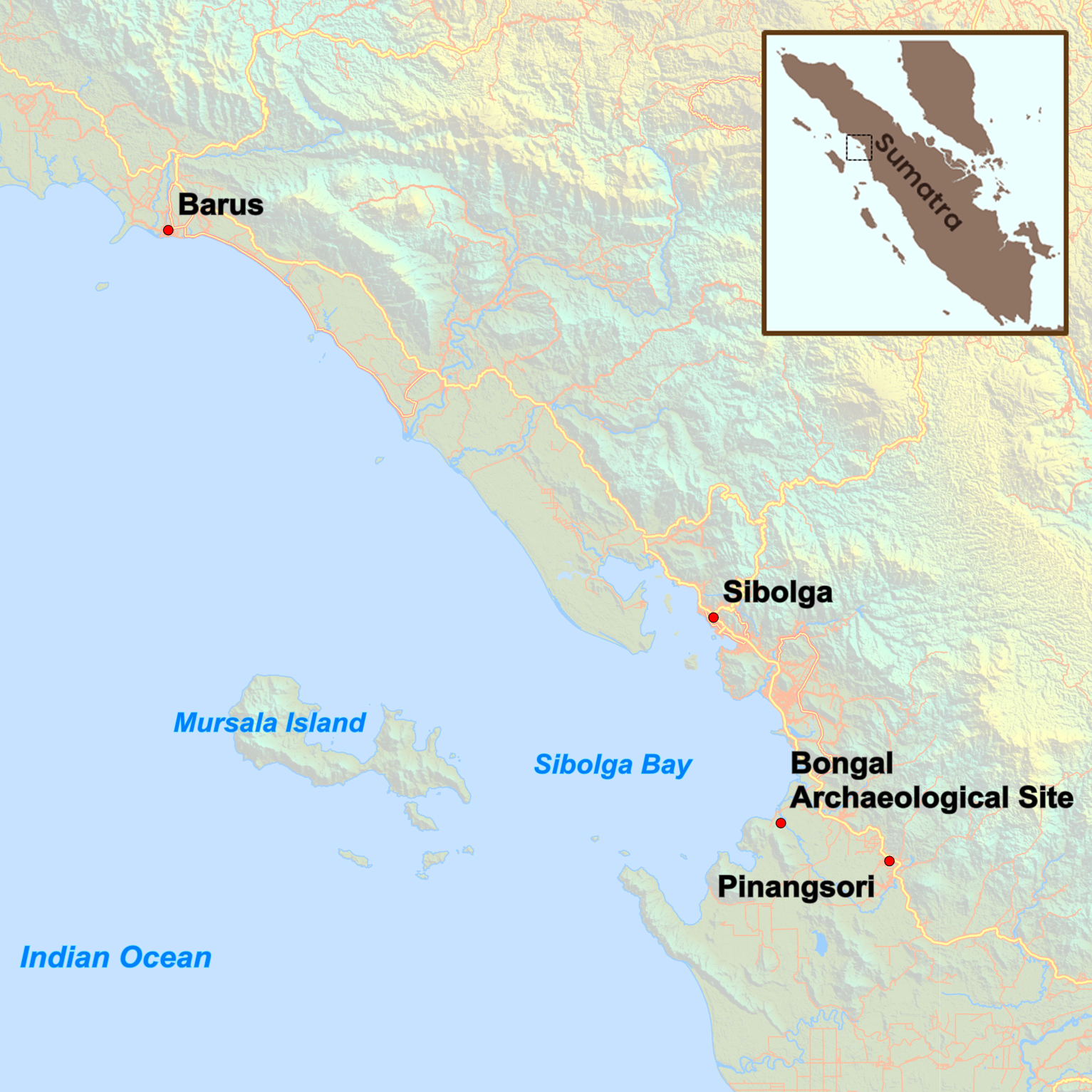
This presentation, the culmination of years of independent research, re-examines the evidence for Punt’s location through an interdisciplinary approach. By carefully analyzing historical texts, archaeological findings, botanical and zoological records, and living cultural traditions, I argue that the Land of Punt is best identified not in Africa, but on the island of Sumatra and its surrounding regions in Indonesia.
Key evidence—including the flora and fauna described by the Egyptians, the products traded, the architectural styles, and the physical features of Punt’s people—find their closest parallels in Sumatra’s unique environment and ancient cultures. Ancient Sumatran ports such as Bengkulu, Barus, and Pinangsori emerge as strong candidates for Punt’s legendary harbors.
By bringing together linguistic, historical, and ethnographic perspectives, this presentation invites you to reconsider the origins of the Land of Punt and, in doing so, explore new connections between the ancient civilizations of Egypt and Southeast Asia.
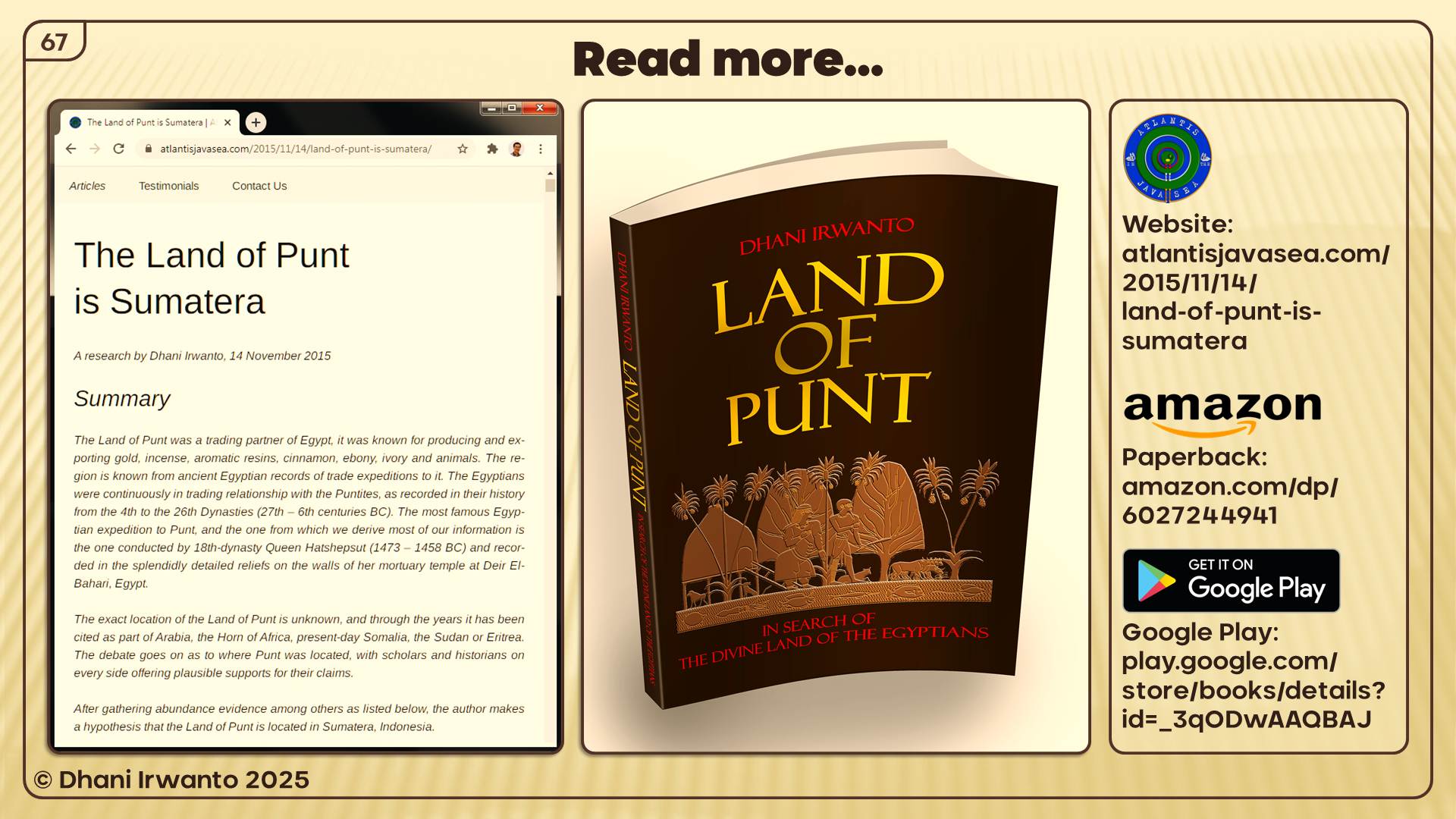
Land of Punt: In Search of the Divine Land of the Egyptians
This book presents the latest research about the Land of Punt – the Divine Land or the Land of Gods or the Land of Origin of the ancient Egyptians. After gathering abundance of converging evidence, the author argues that the Land of Punt is located in Sumatera, Indonesia.
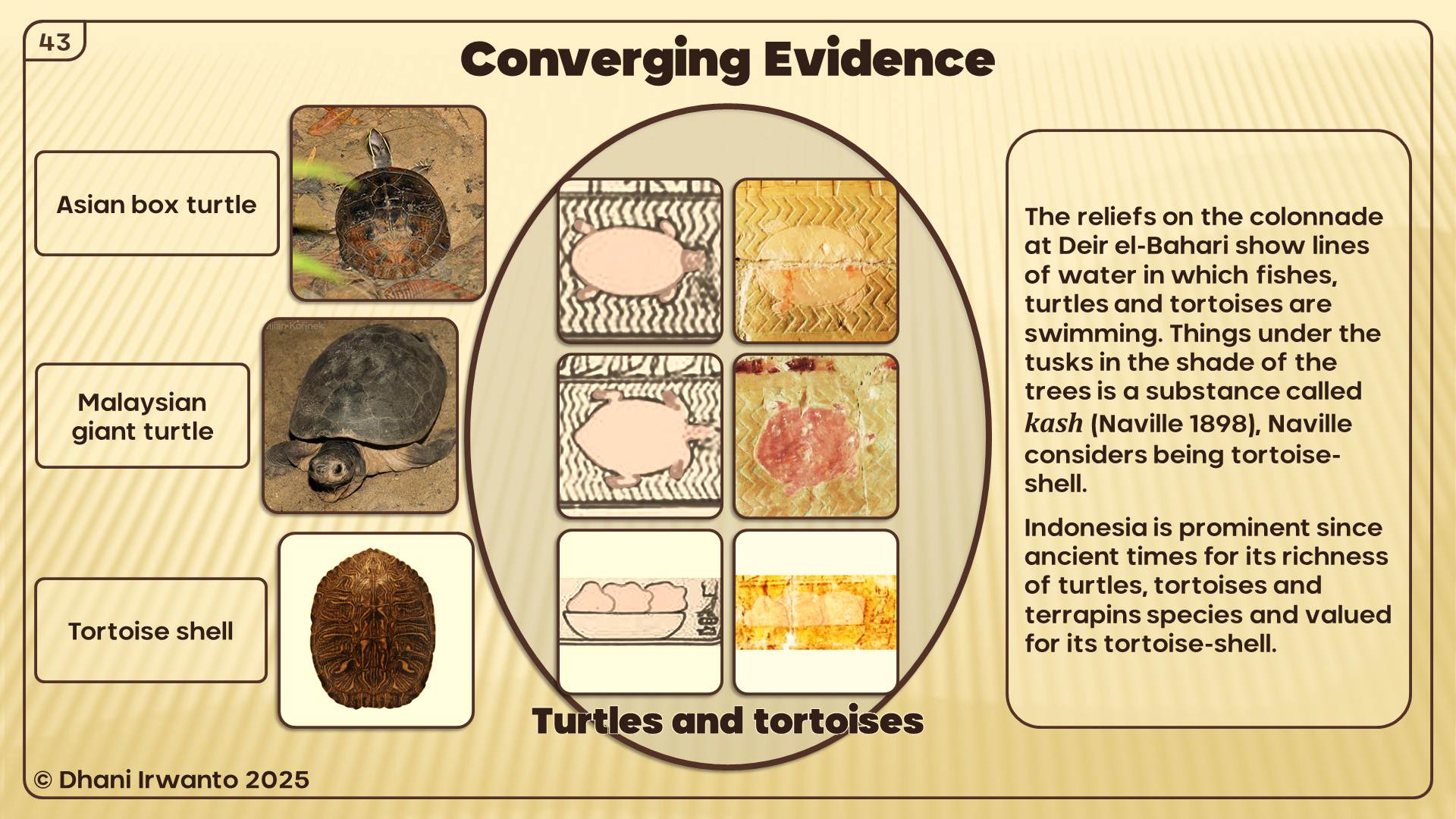
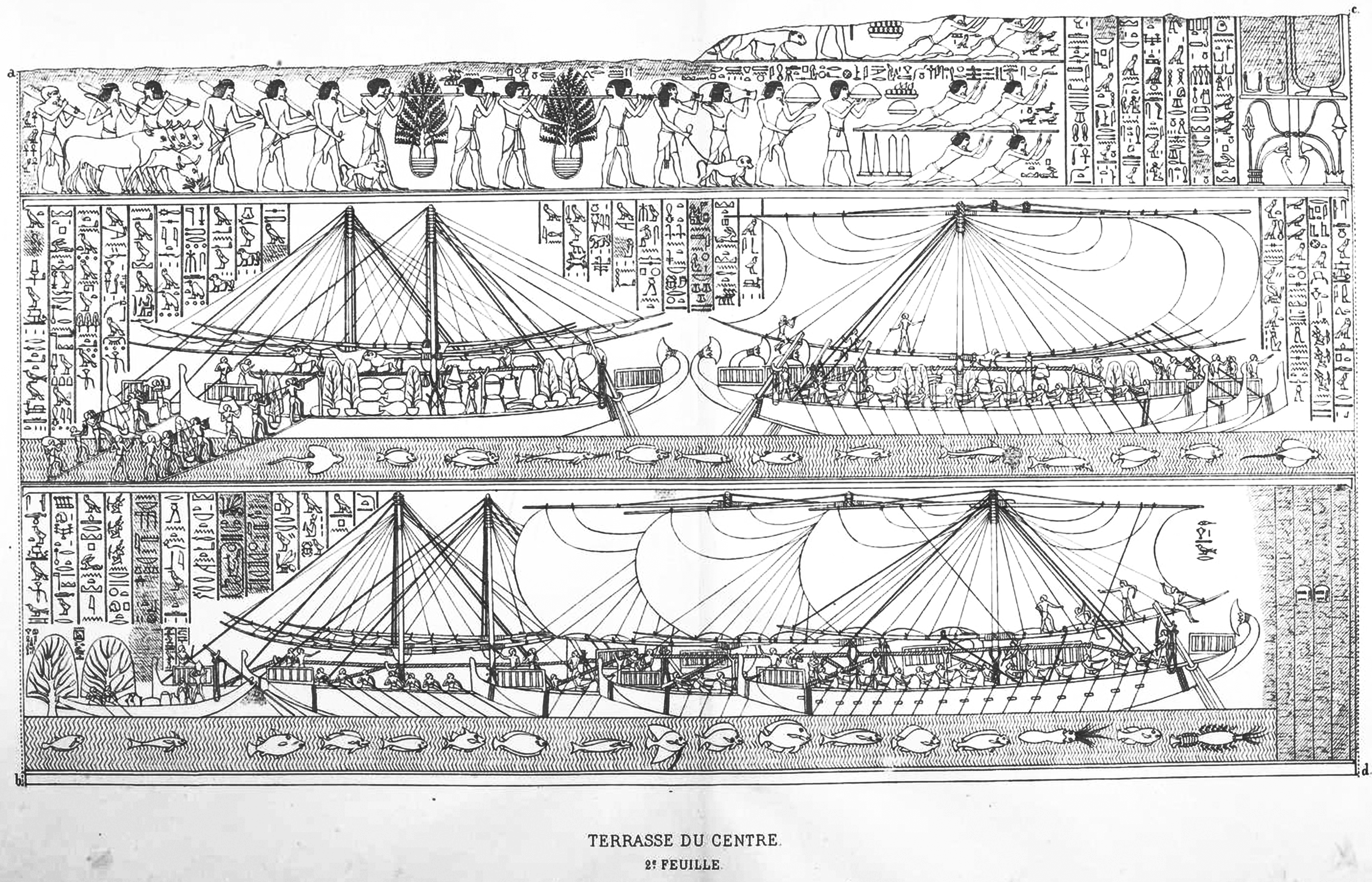
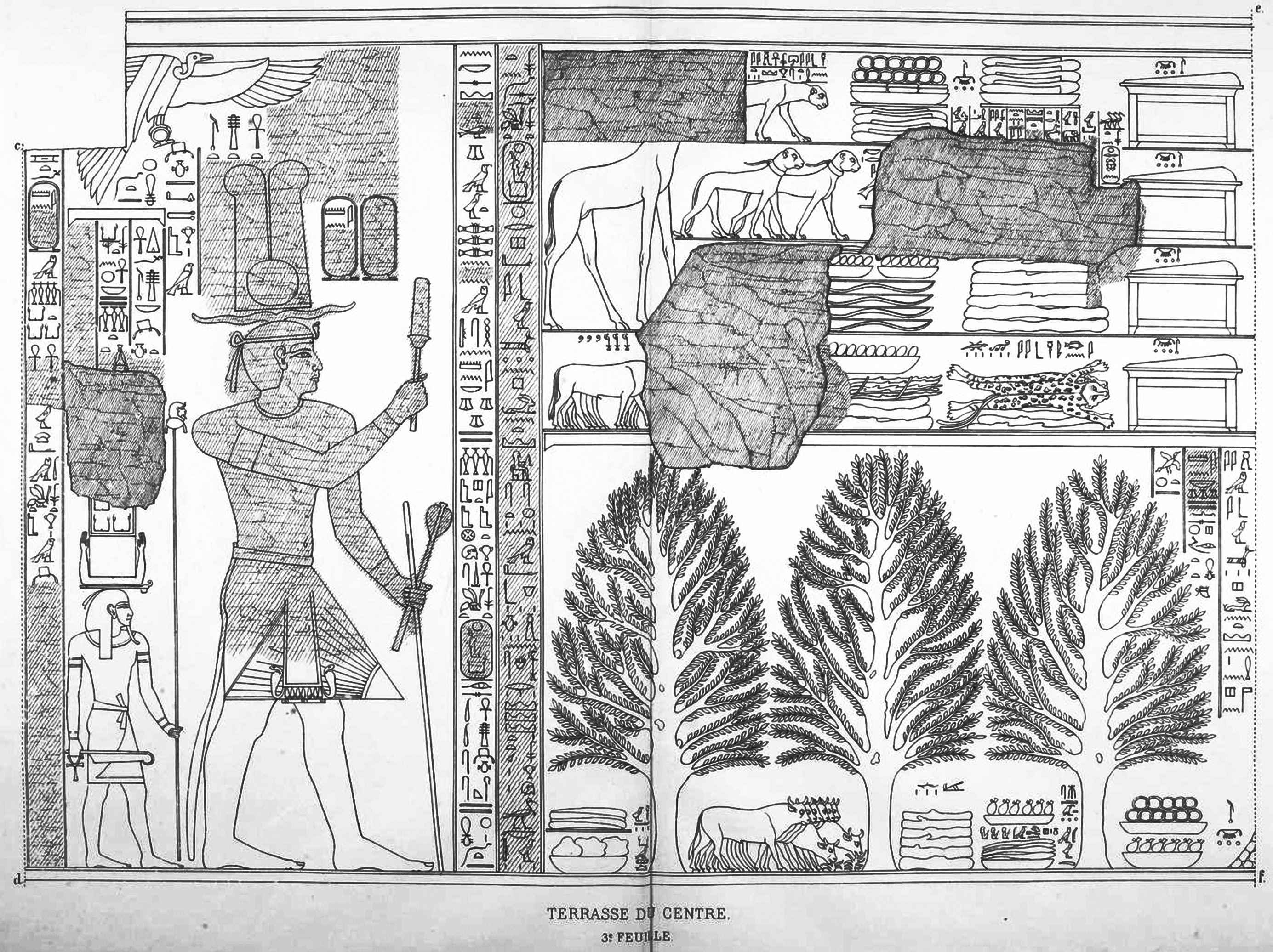
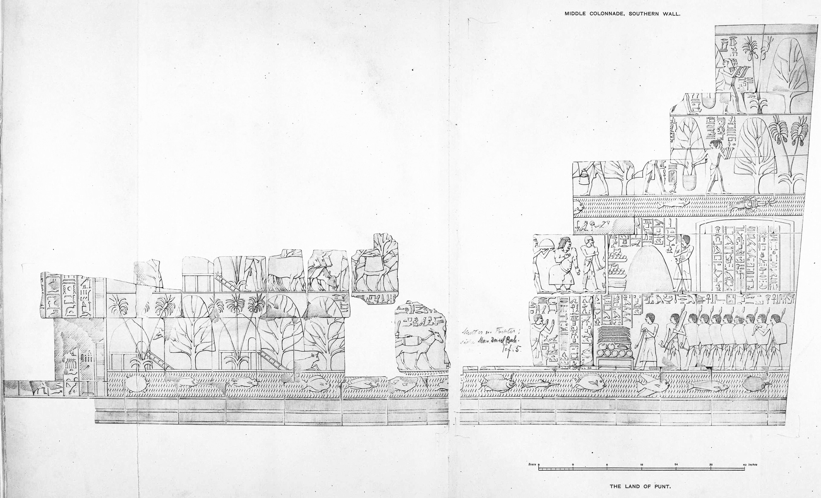
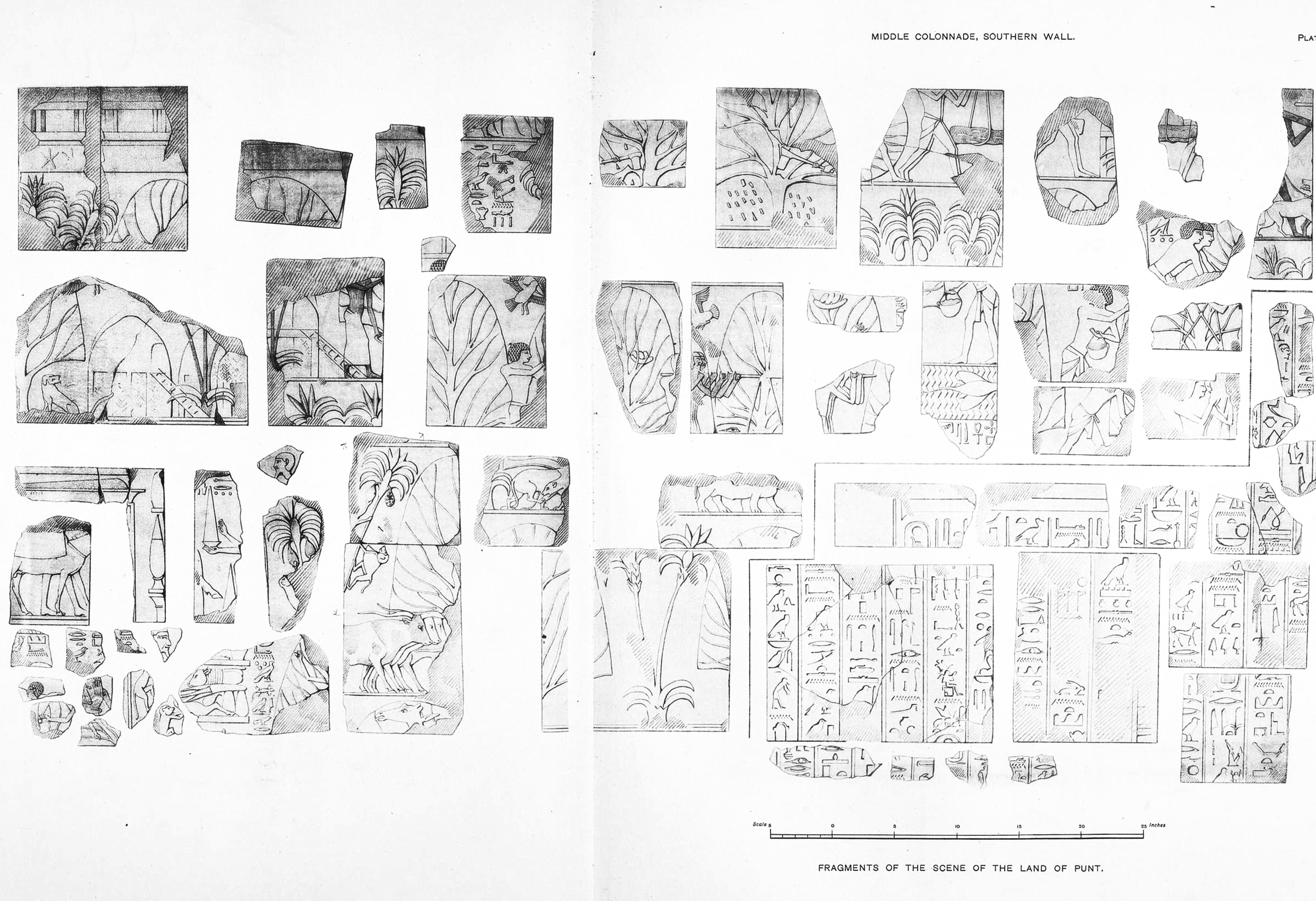
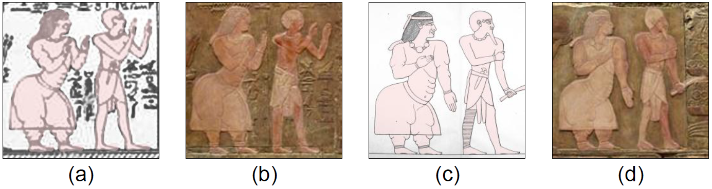
The Land of Punt was a trading partner of Egypt, it was known for producing and exporting gold, incense, aromatic resins, cinnamon, ebony, ivory and animals. The region is known from ancient Egyptian records of trade expeditions to it. The Egyptians were continuously in trading relationship with the Puntites, as recorded in their history from the 4th to the 26th Dynasties (27th – 6th centuries BC). The most famous Egyptian expedition to Punt, and the one from which we derive most of our information is the one conducted by 18th-dynasty Queen Hatshepsut (1473 – 1458 BC) and recorded in the splendidly detailed reliefs on the walls of her mortuary temple at Deir El-Bahari, Egypt.
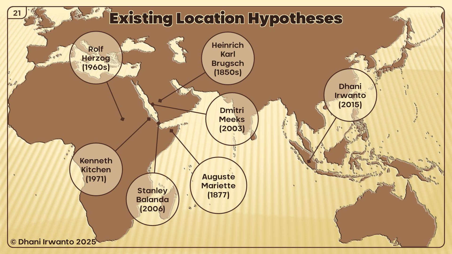
The exact location of the Land of Punt is unknown, and through the years it has been cited as part of Arabia, the Horn of Africa, present-day Somalia, the Sudan or Eritrea. The debate goes on as to where Punt was located, with scholars and historians on every side offering plausible supports for their claims.
After gathering abundance evidence among others as listed below, the author makes a hypothesis that the Land of Punt is located in Sumatera, Indonesia.
The Land of Punt, also called Pwenet or Pwene by the ancient Egyptians, was a trading partner of Egypt, it was known for producing and exporting gold, incense, aromatic resins, ebony, ivory, tortoise shells and wild animals. The region is known from ancient Egyptian records of trade expeditions to it. Some biblical scholars have identified it with the biblical land of Put.
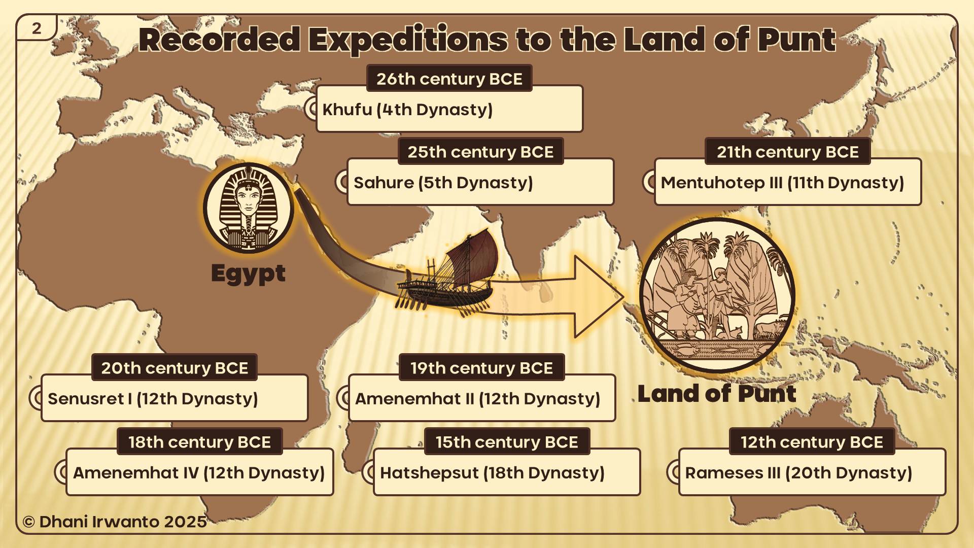
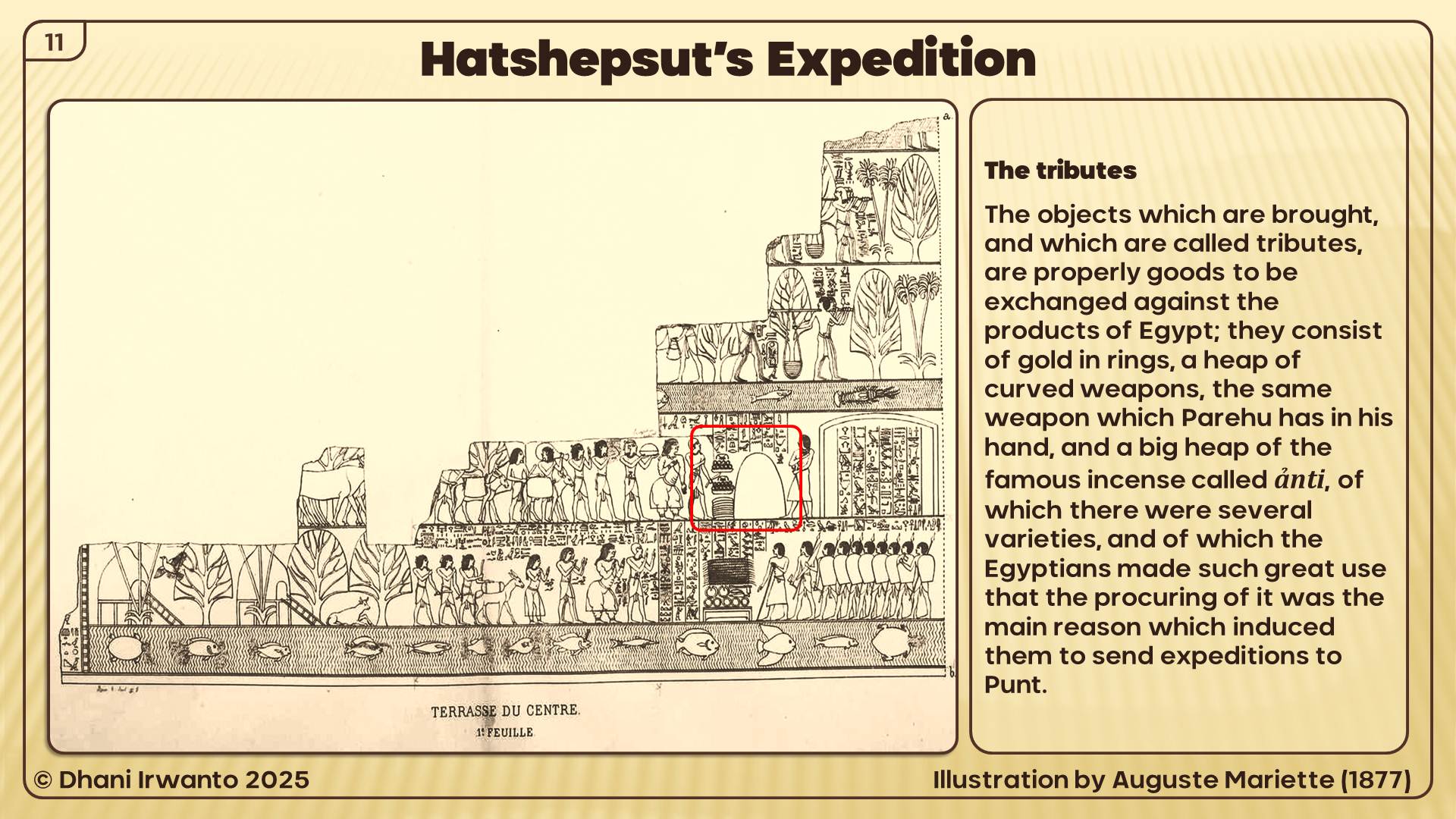
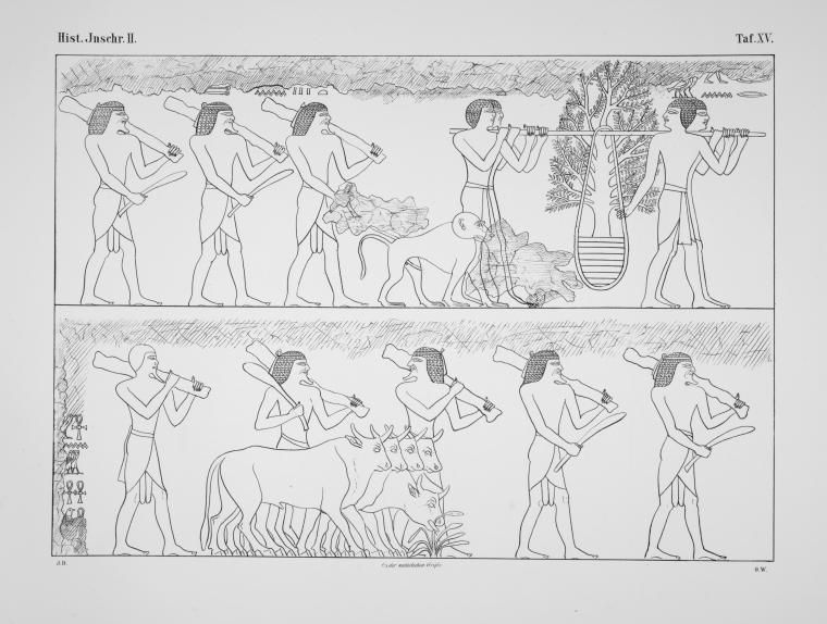
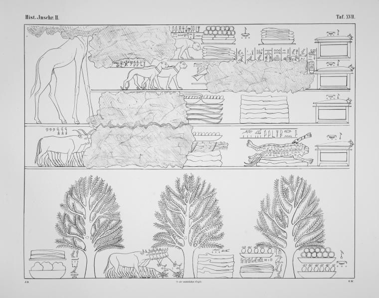
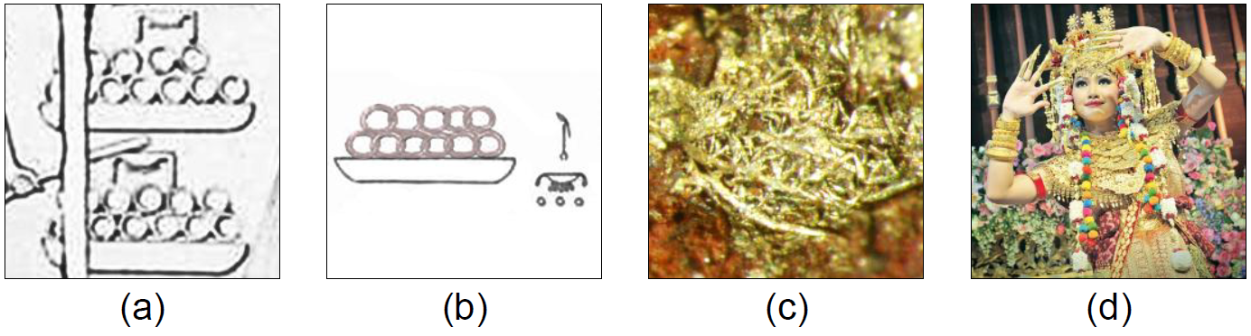
The first clear mention of Punt comes from the Old Kingdom. As the so-called Palermo Stone tells us, about 2500 BC during the reign of King Sahure, an expedition to Punt returned with 80,000 measures of ‘ntyw (ånti), which scholars believe to be frankincense. Derived from a tree of the same name, frankincense is a resin used to make incense, which the Egyptians coveted for temple rituals; frankincense was the most prized commodity from Punt. Sahure’s expedition also brought back 23,030 staves – wood being precious to a desert country like Egypt – and 6,000 measures of electrum, a natural alloy of gold and silver, among other items. Fragments from the decoration of this king’s mortuary temple at Abusir are interpreted as a representation of the inhabitants of Punt.
The Egyptians called the Land of Punt Ta Natjer. Literally translated, this means the Land of the Gods. Since Ra, the sun god, held a very important place in the Egyptian pantheon, historians believe that Punt was referred to as the Abode of the Gods because of its location to the east of Egypt, in the direction of the sunrise. The name could also refer to the superior wood imported from Punt, which went into the building of Egyptian temples and to the frankincense and other aromatic incense brought from Punt that were used extensively in religious rituals of the ancient Egyptians.
Older literature (and current non-mainstream literature) maintained that the label “Land of God”, when interpreted as “holy land” or “land of the gods/ancestors” or “divine land”, meant that the ancient Egyptians viewed the Land of Punt as their ancestral homeland. WM Flinders Petrie believed that the Dynastic Race came from or through Punt and EA Wallis Budge stated that the Egyptian tradition of the Dynastic Period held that the aboriginal home of the Egyptians was Punt.
The exact location of the Land of Punt is unknown, and through the years it has been cited as part of Arabia, the Horn of Africa, present-day Somalia, the Sudan or Eritrea. The debate goes on as to where Punt was located, with scholars and historians on every side offering plausible supports for their claims.
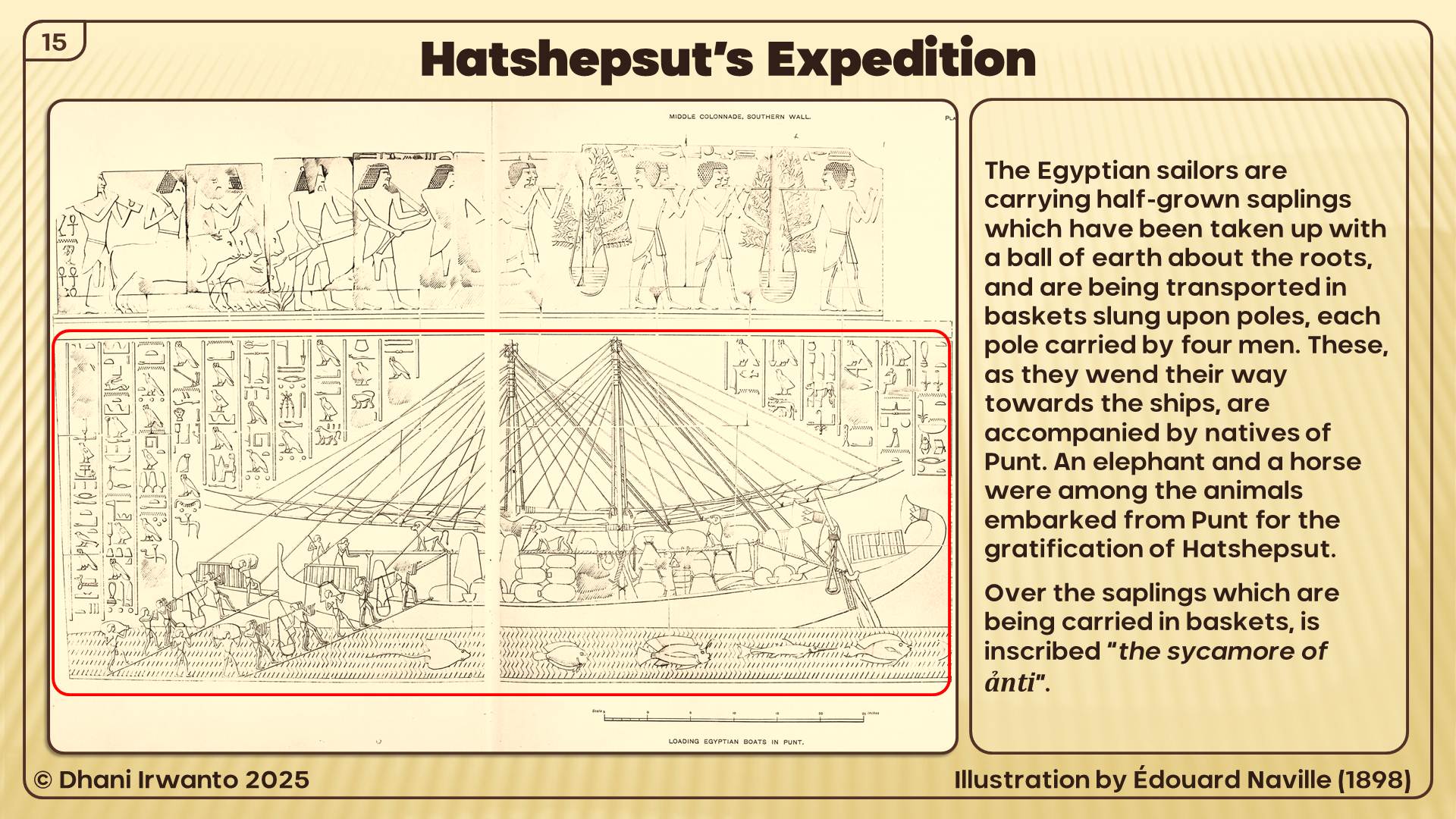
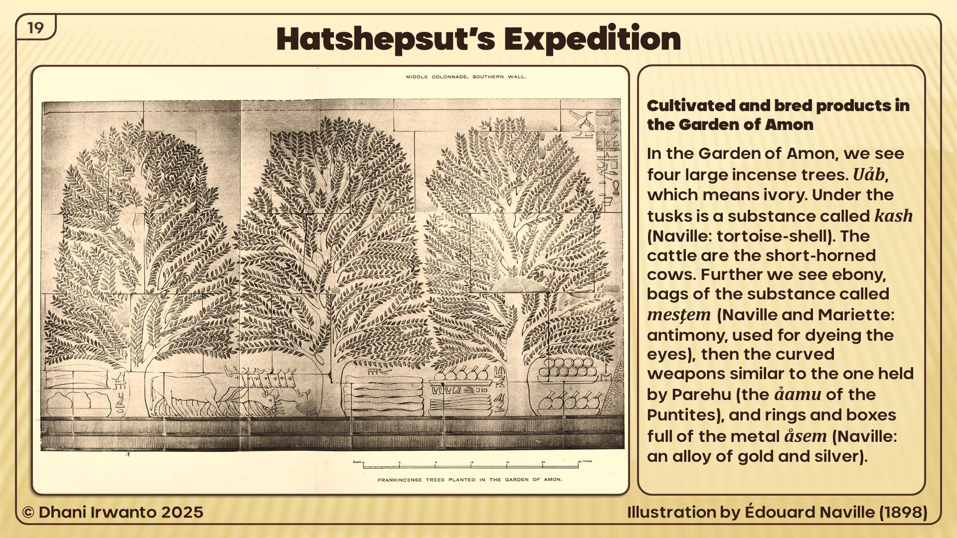
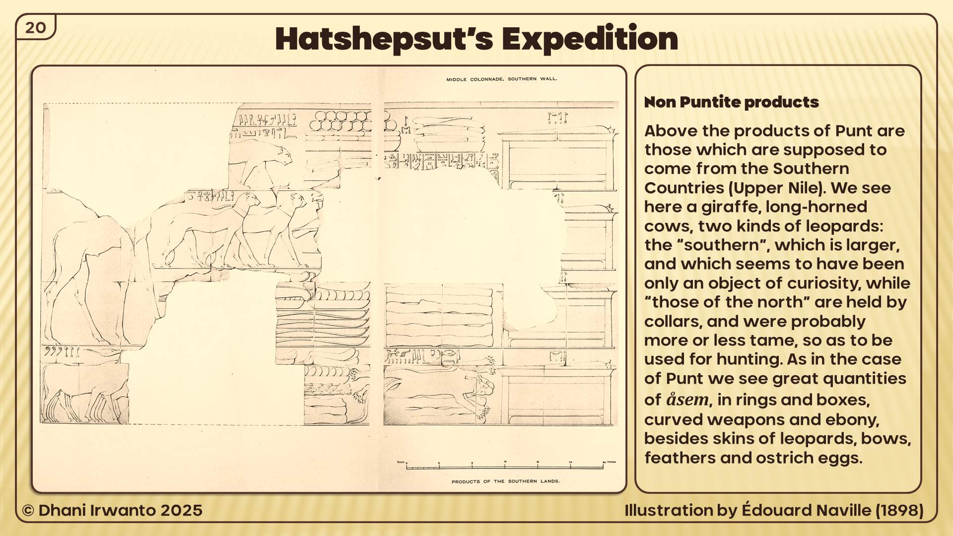
A 4th Dynasty relief shows a Puntite with one of Pharaoh Khufu’s sons, and in the 5th Dynasty documents show regular trade between the two countries. Among the many treasures brought to Egypt from Punt were gold, ebony, wild animals, animal skins, ivory, tortoise shells, spices, precious woods, cosmetics, frankincense and frankincense trees. The roots of the incense trees brought back from Punt by Hatshepsut’s expedition in 1493 BC can still be seen outside of her complex at Deir al-Bahari.
In the 12th Dynasty, Punt was immortalized in Egyptian literature in the very popular Tale of the Shipwrecked Sailor in which an Egyptian sailor converses with a great serpent who calls himself the “Lord of Punt” and sends the sailor back to Egypt laden with gold, spices and precious animals. Perhaps because of this tale Punt became more and more a semi-mythical land to the Egyptians and, after Hatshepsut’s voyages there, no more is written about it in any factual way. Punt came to hold a strange fascination for the Egyptian people as a “land of plenty” and was known as Te Netjer, the Land of the Gods from which all good things came to Egypt. Punt was also associated with Egyptian ancestry in that it came to be seen as their ancient homeland and, further, the land where the gods lived. Exactly why Punt was elevated from reality into mythology is not known but, after the 18th Dynasty, the land receded further and further in the minds of the Egyptians until it was lost in legend and folklore.
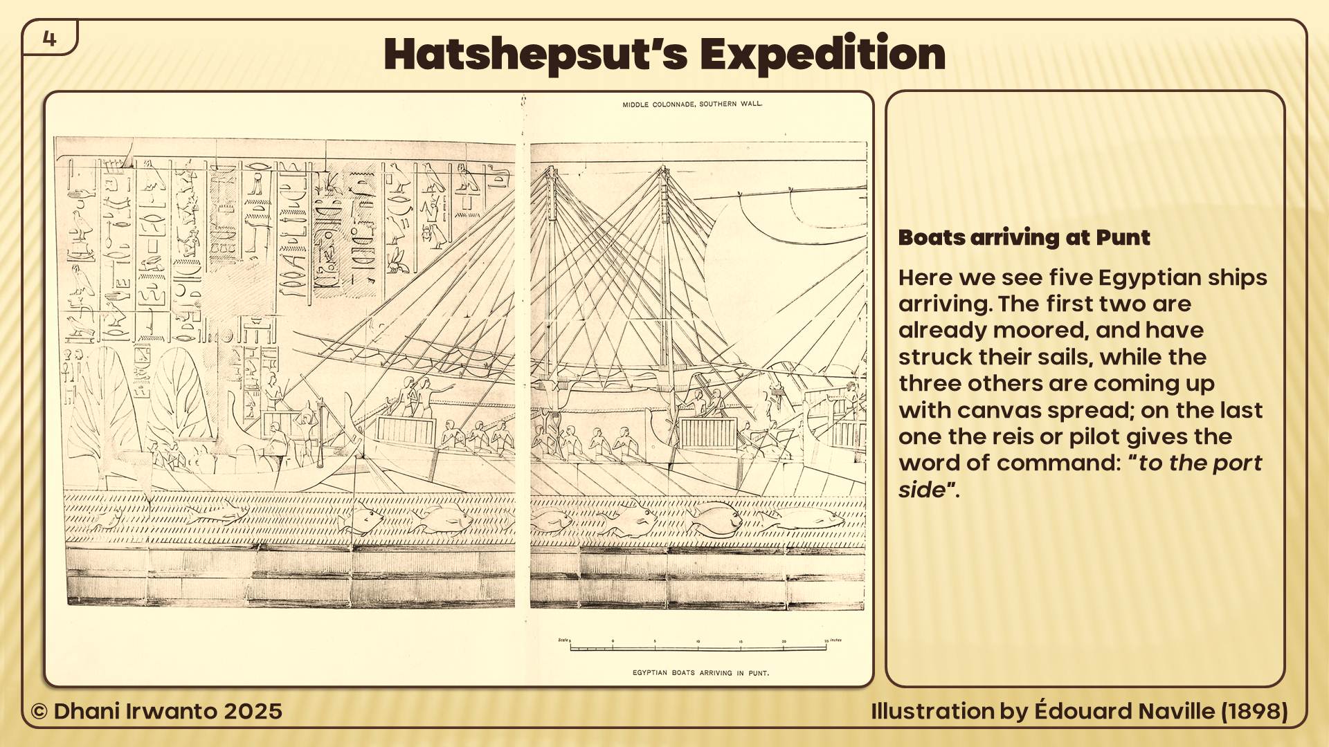
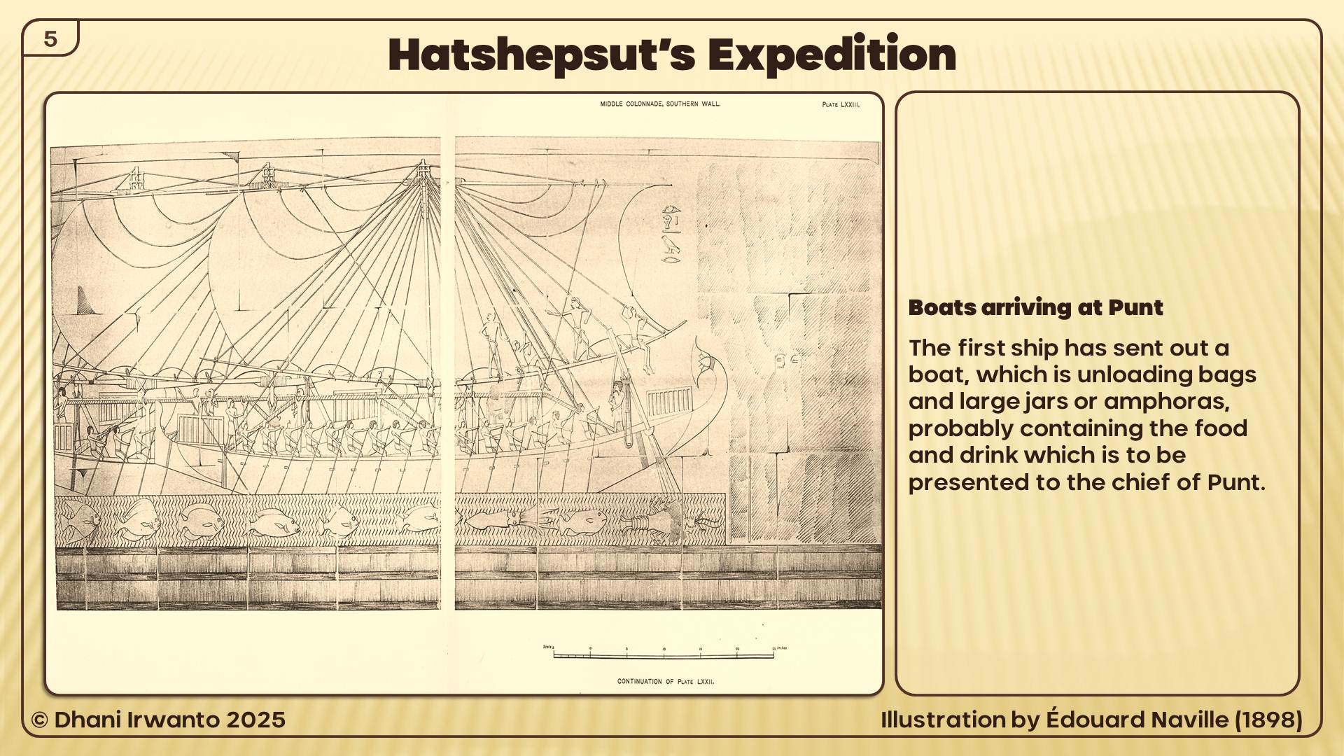
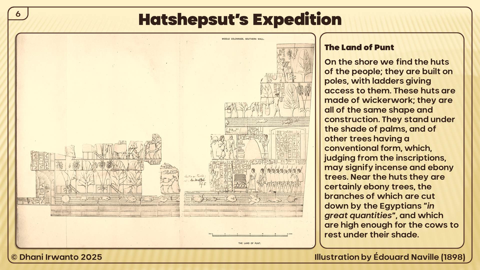
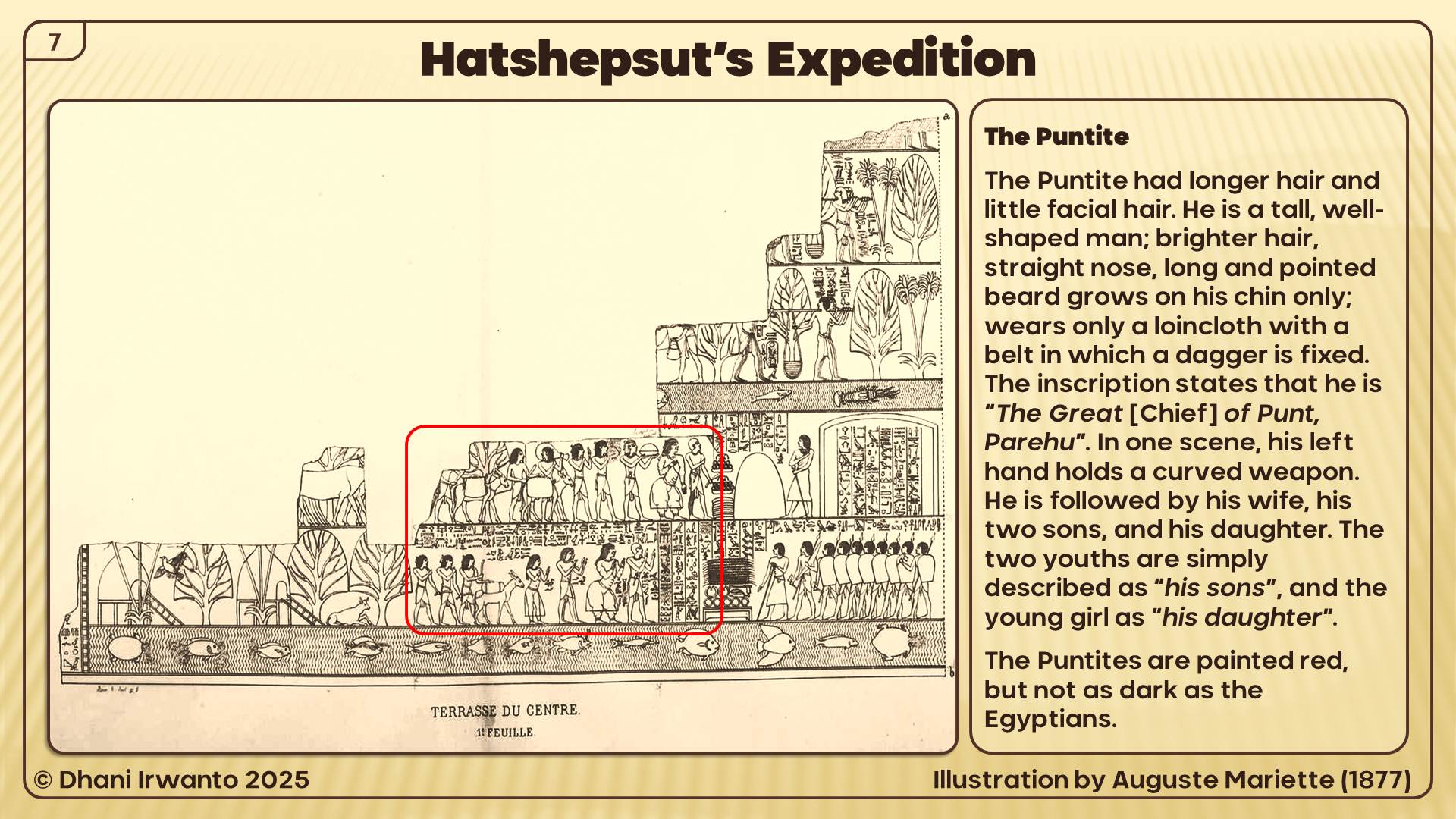
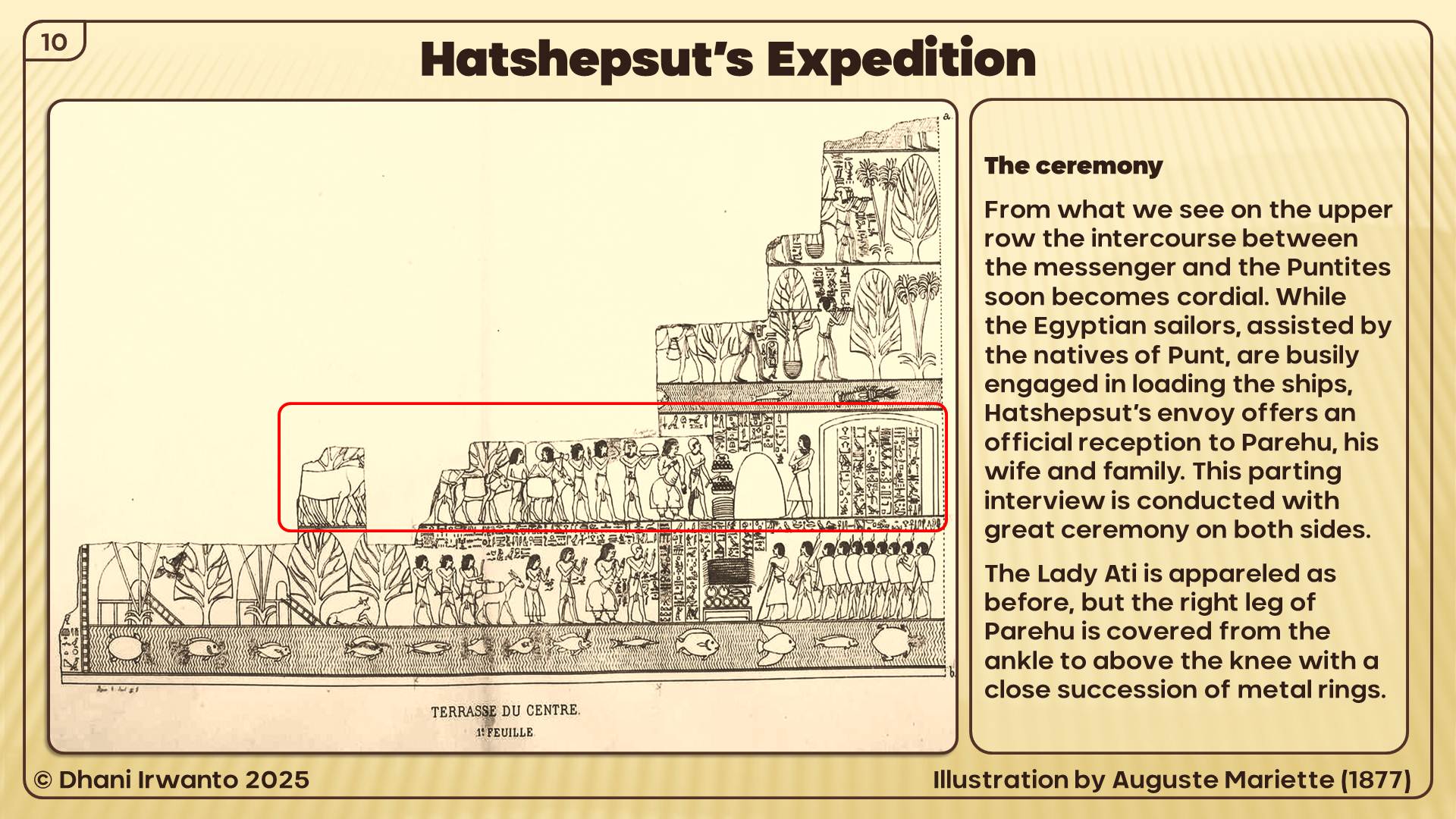
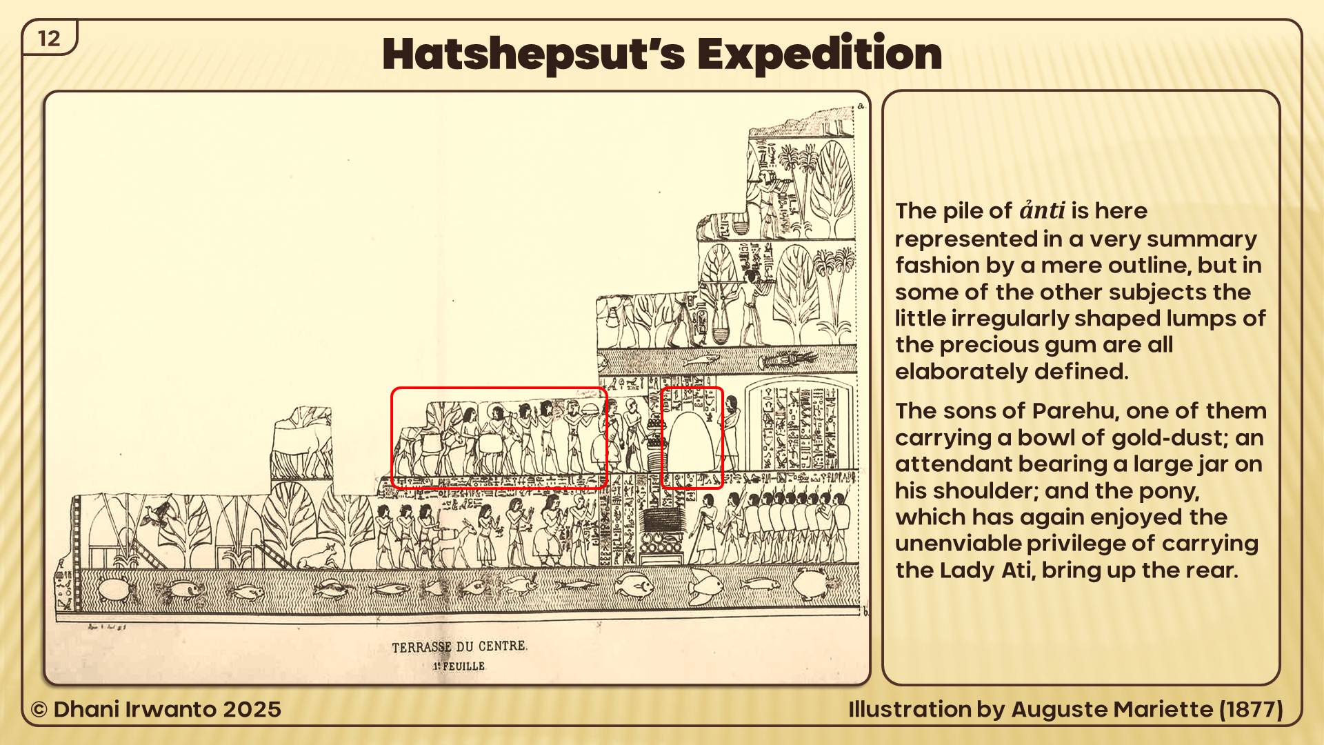
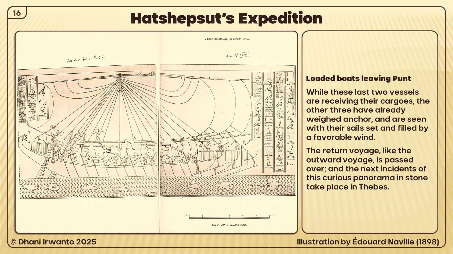
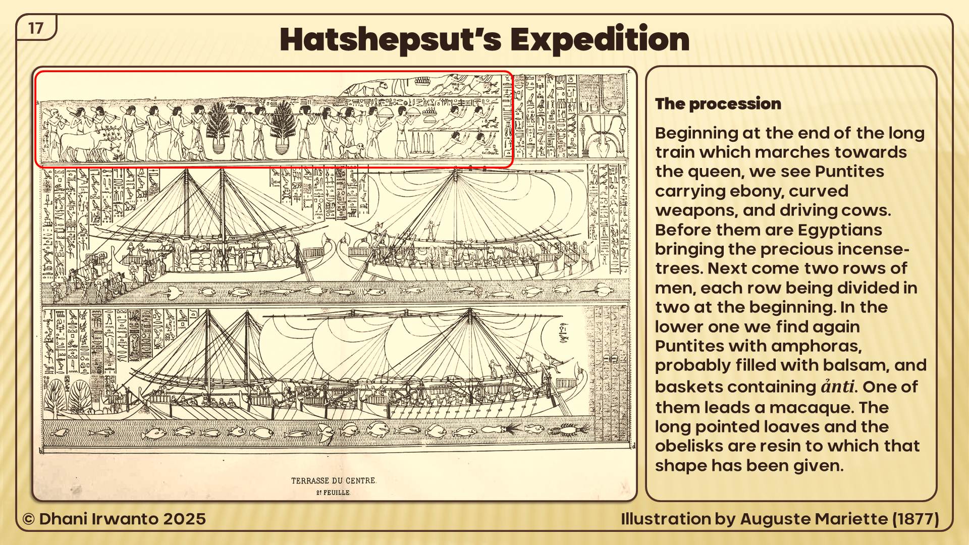
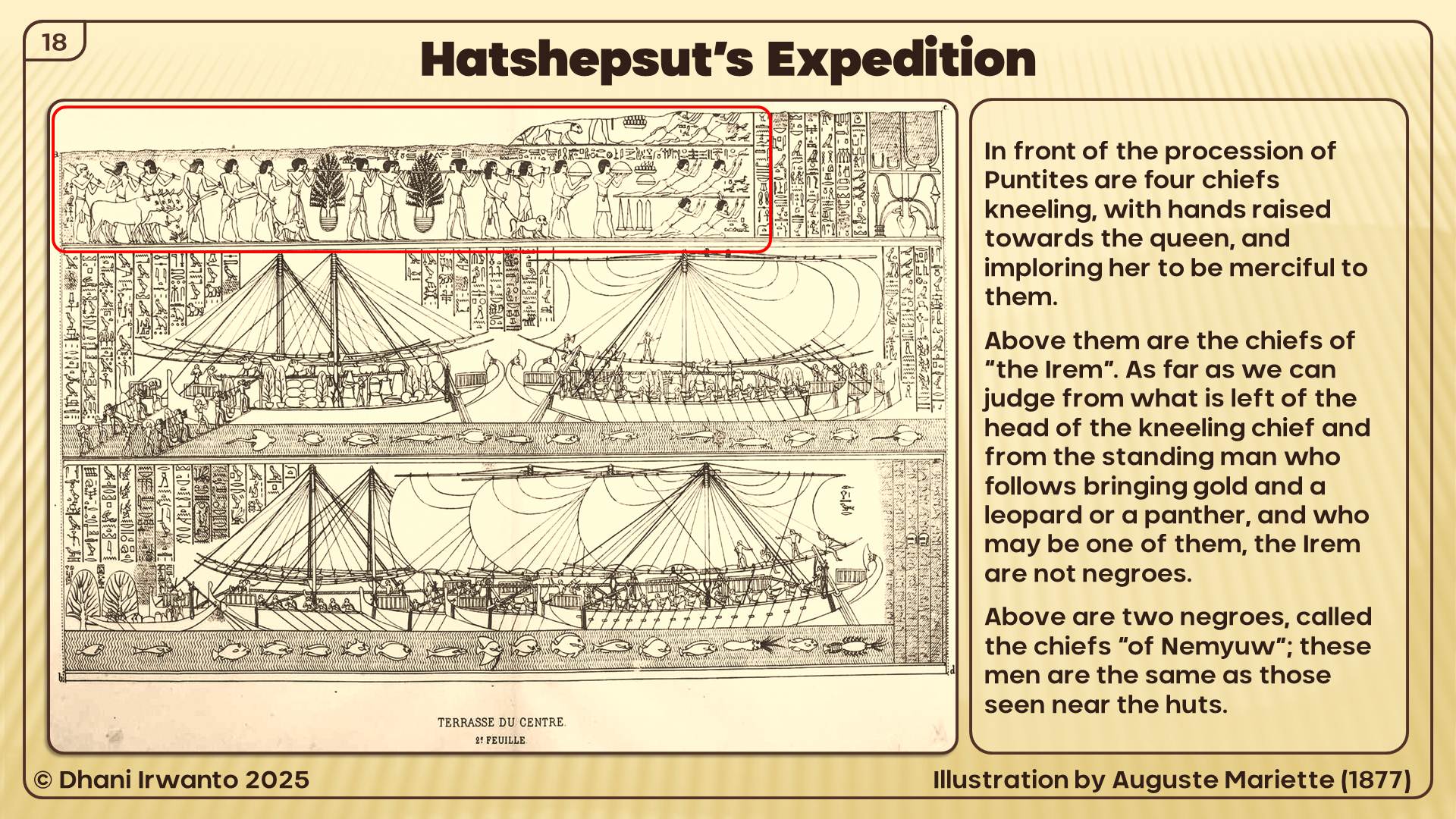
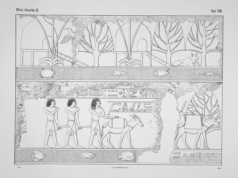
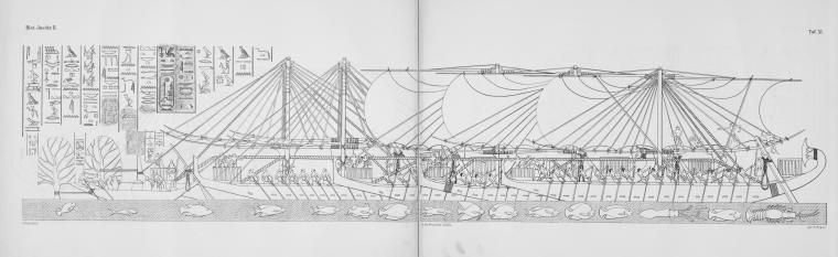
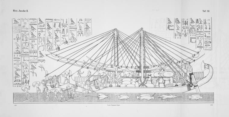
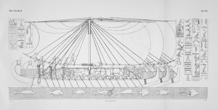
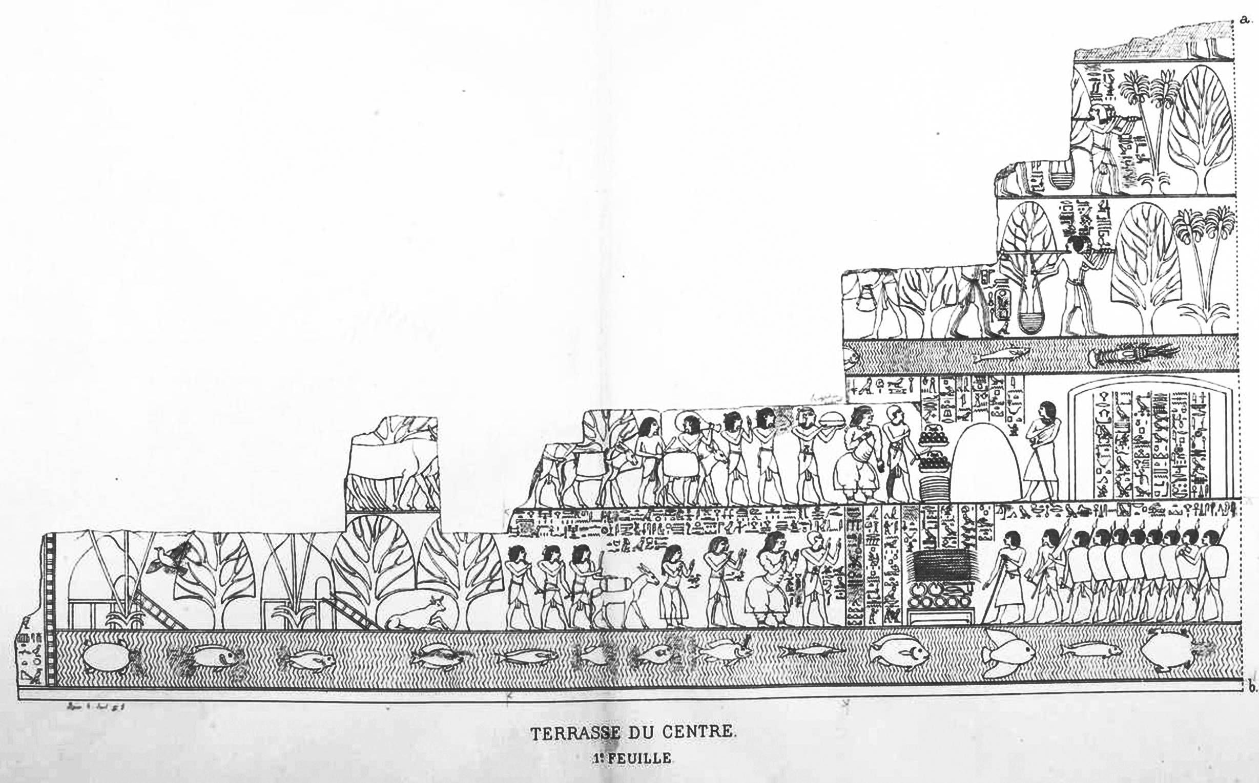
The most evidence about the land of Punt comes from a temple dedicated to the female pharaoh Hatshepsut, the 18th Dynasty of Egypt, who ruled for more than 20 years circa 1465 BC. A large relief of a trading mission to Punt is featured on the walls of the temple, known for Queen Hatshepsut’s famous expedition in 1493 BC, which brought back living trees to Egypt, marking the first known successful attempt at transplanting foreign fauna. We even know the names of the rulers of Punt during Hatshepsut’s reign: Parehu and his wife Ati. Reliefs on the walls of her temple there show the chief of the Puntites and his wife receiving the envoys from Egypt. From the descriptions that survived, the land of Punt was a peaceful and prosperous country that seemed to have a wide variety of highly valued goods to trade.
The earliest recorded Egyptian expedition to Punt was organized by Pharaoh Sahure of the Fifth Dynasty (25th century BC). However, gold from Punt is recorded as having been in Egypt as early as the time of Pharaoh Khufu of the Fourth Dynasty.
Subsequently, there were more expeditions to Punt in the Sixth, Eleventh, Twelfth and Eighteenth dynasties of Egypt. In the Twelfth Dynasty, trade with Punt was celebrated in popular literature in the Tale of the Shipwrecked Sailor.
In the reign of Mentuhotep III (11th dynasty, ca 2000 BC), an officer named Hannu organized one or more voyages to Punt, but it is uncertain whether he personally traveled on these expeditions. Trading missions of the 12th dynasty pharaohs Senusret I, Amenemhat II and Amenemhat IV had also successfully navigated their way to and from the mysterious land of Punt.
In the Eighteenth Dynasty of Egypt, Hatshepsut built a Red Sea fleet to facilitate trade between the head of the Gulf of Aqaba and points south as far as Punt to bring mortuary goods to Karnak in exchange for Nubian gold. Hatshepsut personally made the most famous ancient Egyptian expedition that sailed to Punt. During the reign of Queen Hatshepsut in the 15th century BC, ships regularly crossed the Red Sea in order to obtain bitumen, copper, carved amulets, naptha and other goods transported overland and down the Dead Sea to Elat at the head of the gulf of Aqaba where they were joined with frankincense and incense coming north both by sea and overland along trade routes through the mountains running north along the east coast of the Red Sea.
Hatshepsut’s 18th dynasty successors, such as Thutmose III and Amenhotep III also continued the Egyptian tradition of trading with Punt. The trade with Punt continued into the start of the 20th dynasty before terminating prior to the end of Egypt’s New Kingdom. From here on, trade contacts seem to have been non-existent and with but a single exception, references to Punt envisage it as a fabled and magical land. The exception is a reference to the Mountain of Punt which occurred as an inscription on a damaged stela found at Tel Defenneh dating back to the 26th Dynasty. It also declares a miracle and a blessing that there was rain upon the Mountain of Punt in late December/early January.
Queen Hatshepsut is a daughter of Thothmes I, third Pharaoh of the Eighteenth Dynasty, and of his wife, Queen Ahmes Nefertari. She inherited sovereign rights in virtue of her maternal descent from the old Twelfth Dynasty line.
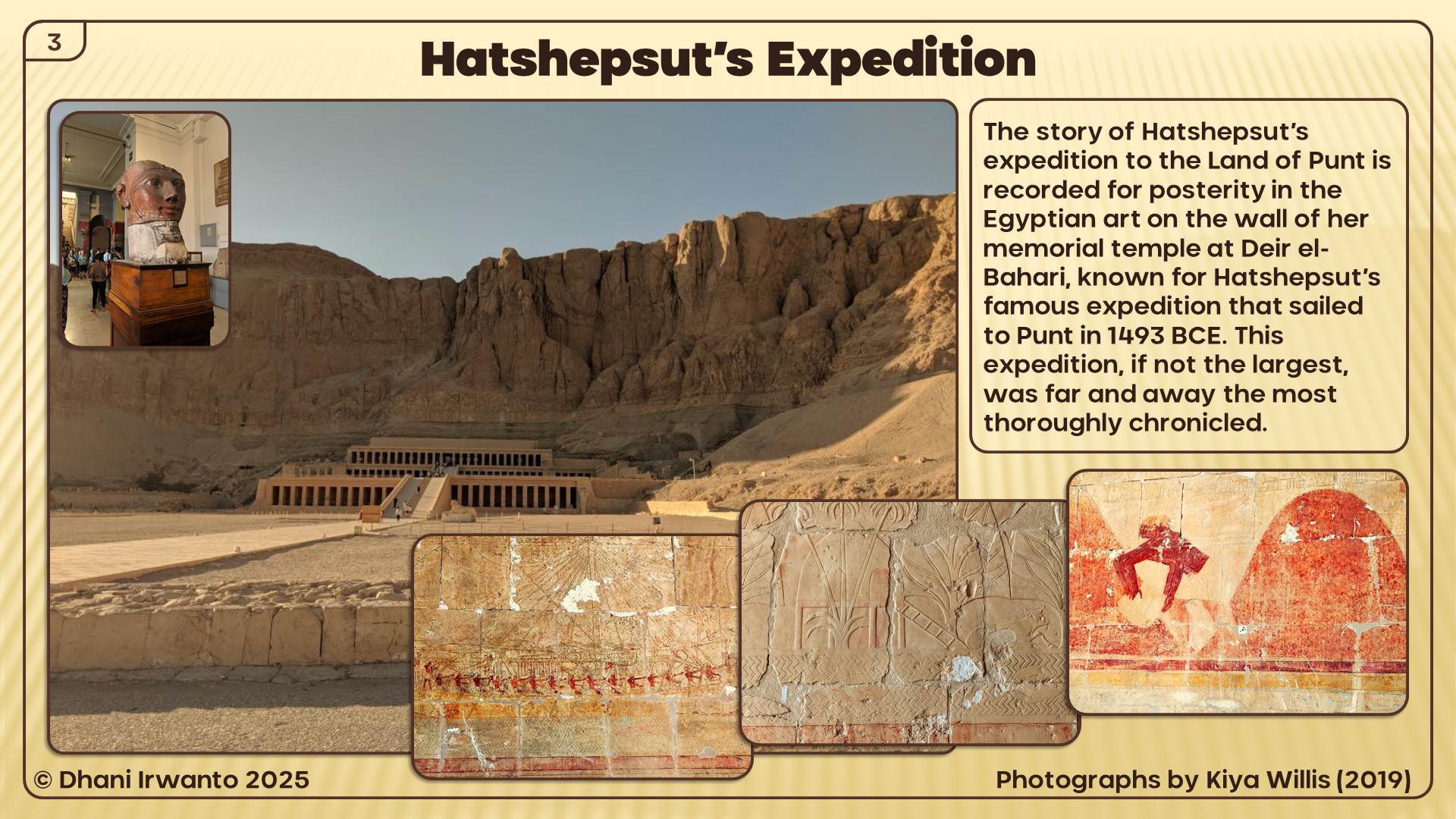
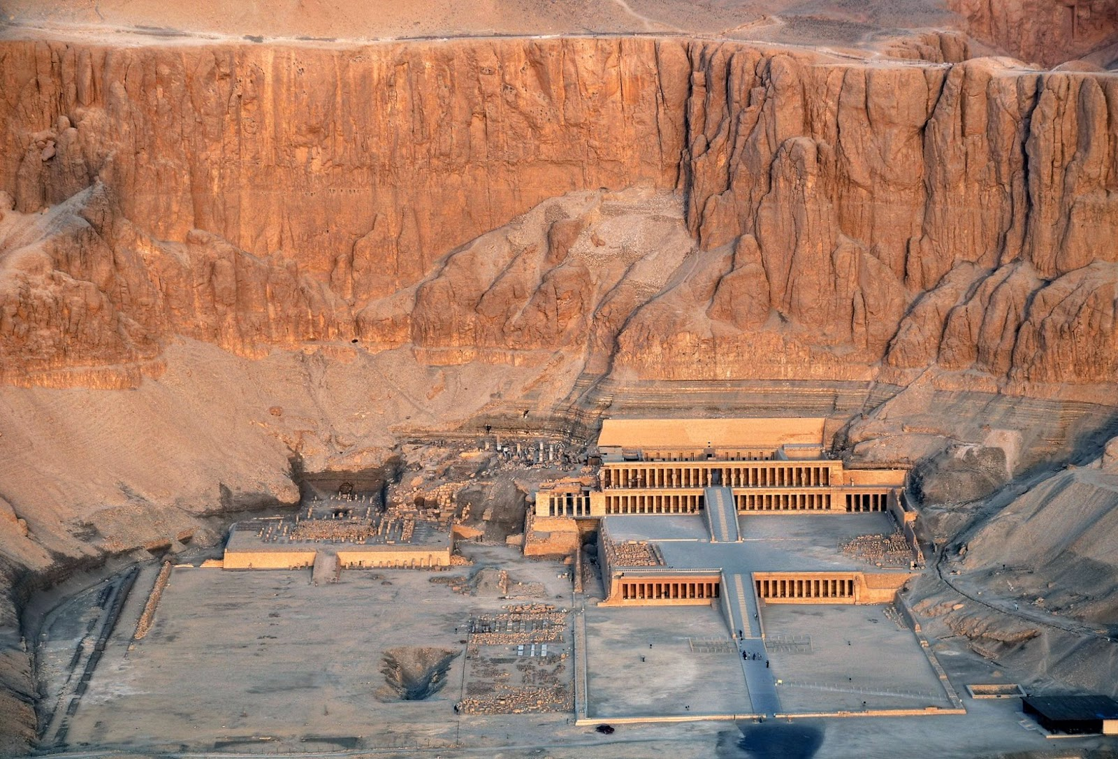
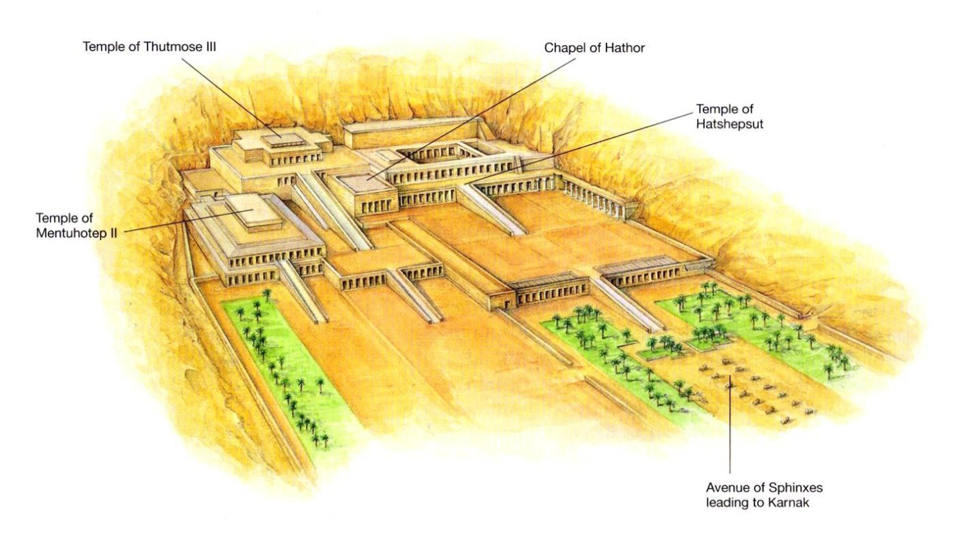
The story of Hatshepsut’s expedition to the Land of Punt is recorded for posterity in the Egyptian art on the wall of her memorial temple at Deir el-Bahari (Arabic for “The Northern Monastery”), a complex of mortuary temples and tombs located on the west bank of the Nile. It is separated from the Valley of the Kings by the peak of el-Qurn (Arabic for “The Horn” known to the Egyptians as “Dehent”) and lies directly across the water from the temple complexes at Karnak and Luxor in Thebes. The mountain formed a natural pyramid towering over the Valley of the Kings and Deir el-Bahari, and was sacred to Hathor and Meretseger.
The first to leave a description of the abandoned Coptic monastery that had once stood on top of the ruins of the temple of Hatshepsut was the famous English explorer Richard Pococke who stopped here in 1737. Jean-François Champollion copied the texts from the temple’s granite portals and the walls of the Main Sanctuary of Amon-Ra. John Gardner Wilkinson introduced the name Deir el-Bahari (“Northern Monastery”) in world literature in 1835. Richard Lepsius followed with the identification of the ruins as a temple of Hatshepsut.
Regular excavations were started by French archaeologist Auguste Mariette (1821 – 1881), the founder of the Egyptian Antiquities Service. Archaeological investigations of the Deir el-Bahari complex were begun in 1881, after objects belonging to the missing pharaohs began to turn up in the antiquities market. French archaeologist Gaston Maspero (1846 – 1916), director of the Egyptian Antiquities Service at the time, went to Luxor in 1881 and began to apply pressure to the Abdou El-Rasoul family, residents of Gurnah who had for generations been tomb robbers.
The first institution of great merit for Egyptological studies was a mission of the Egypt Exploration Fund (EEF) directed by French archaeologist Edouard Naville (1844 – 1926). Excavations at the temple began in the 1890s. Between 1893 and 1899 it managed to clear the Upper Terrace and most of the buried courtyards, chapels and colonnades. Roofs were installed over the Portico of the Obelisks and the porticoes of the Middle Terrace. The walls of the Main Sanctuary of Amon-Ra were reinforced and a provisional protection was carried out of the Sun Altar, Royal Cult complex, Hathor Chapel and Lower Northern Portico. In 1911, Naville turned over his concession on Deir el-Bahari (which allowed him sole excavator’s rights), and the legendary Herbert Winlock began what would be 25 years of excavation and restoration. Winlock arrived in Deir el-Bahari at the head of a mission of the Metropolitan Museum of Art which stayed there for the next twenty years (1911 – 1931), penetrating the terraces and the two ramps of the uncovered temple.
When Leszek Dąbrowski came with his group of specialists from Warsaw University’s Centre of Mediterranean Archaeology (PCMA), they found row upon row of decorated blocks arranged by their illustrious predecessors, waiting to be restored to their original positions in the walls, columns and architraves of the temple. The Poles had been invited to take over the project by the Egyptian Antiquities Organization. Kazimierz Michałowski remained at the head of this mission from its inception in the autumn of 1961 to his death in 1981.
The first pharaoh to build at Deir el Bahari was Nebhepetre Montuhotep II, of the Eleventh Dynasty who reunified the country after the First Intermediate Period. He chose to build his Mortuary Temple and tomb at Deir el-Bahari instead of with those of his predecessors at Dra Abu el Naga and also pioneered a new architectural style which despite its fresh look seems to have been inspired by the form of Old Kingdom pyramid complexes. He constructed a Valley Temple (now completely destroyed) connected by a long causeway to a Mortuary Temple which he named Akh Sut Nebhepetre (“Splendid are the places of Nebhepetre”). The Mortuary Temple consisted of a terrace perched against the cliff with a large stone edifice (described as a mastaba by some and a pyramid by others) above it and a deep shaft to his tomb below it.
The tombs of six princesses were found within the enclosure of the Mortuary Temple of Montuhotep. The tombs were excavated during the first phase of construction but their entrances were covered with masonry when the temple was enlarged. Each tomb contained a sarcophagus formed out of six large slabs joined together with metallic strips. Each sarcophagus was beautifully decorated with scenes of daily life and the presentation of offerings.
Many of Montuhotep’s officials were buried in tombs excavated from the cliffs around his Mortuary Temple including; the chancellor Akhtoy, viziers Dagi (TT103 Sheikh Abd el-Qurna) and Ipi (TT315 Deir el-Bahari), the treasurer Khety (TT311 Deir el-Bahari), royal guardsman Horhotep (TT314 Deir el-Bahari) and chief steward Henenu (TT313 Deir el-Bahari). There is also a mass grave in which sixty soldiers were interred. It is thought that they all died during active service in Nubia and were given the honor of being buried close to their pharaoh.
Amenhotep I built a temple at Deir el-Bahari and buried his Great Royal Wife (Ahmose-Meritamun) nearby in Theban Tomb. However, Amenhotep’s temple was in the prime spot chosen by Hatshepsut for her Mortuary Temple and so it was dismantled in order to allow her monument to be constructed. It seems that the original plan was to build her mortuary temple beside his, but the addition of the lower terrace meant that it had to be removed in its entirety. The only remaining evidence that the temple existed are a few bricks inscribed with Amenhotep’s name. The statues of the pharaoh were moved to Montuhotep’s Mortuary Temple.
Hatshepsut built the largest, best preserved and arguably the most impressive temple at the site, her Mortuary Temple named Djeser-Djeseru (“Holy of Holies”), best-preserved of the three complexes. Her Mortuary Temple is clearly inspired by that of Montuhotep and was built so that the colonnades at each side of the central ramp her temple correspond with the two levels of Montuhotep’s Mortuary Temple. After her death her temple was vandalized by Thuthmosis II and then by Akhenaten (because of his antipathy towards Amon).
Senenmut (who was Hatshepsut’s adviser, tutor to her daughter and possibly her lover) was given the honor of having a tomb (TT353 Deir el-Bahari) constructed within the precinct of her Mortuary Temple. He also had a tomb built in Sheikh Abd el-Qurna (TT71) and so the tomb at Deir el-Bahari is known as the “secret” tomb. It was badly damaged in antiquity, but some of the decoration is still visible. It is an unusually large tomb but it was not finished and Senenmut was buried in his other tomb. Unfortunately for him, his other tomb was also vandalized.
Thuthmosis III also built a temple complex here which he dedicated to Amon. It was intended to replace Hatshepsut’s Mortuary Temple as the focus of the “Beautiful Festival of the Valley” but was badly damaged during the Twentieth Dynasty. After that time it was used a source of building materials and in Christian times became the site of a Coptic cemetery.
During the 1870’s a number of items from ancient tombs appeared for sale in Egypt. Following investigations by Maspero and his assistant Brugsch it was confirmed that a family living in the village of Qurna had discovered a tomb and had been looting items over a period of years. Ironically, the tomb (listed as TT320 or DB320) turned out to house a number of pharaohs who had been moved there in order to protect them from tomb robbers. The cache held over fifty mummies including those of King Seqenenre Taa II, Ahmose I, Amenhotep I, Tutmosis I, II and III, Seti I and Ramesses II, III, and IX, Pinudgjem I and II and Siamun.
A cache of 163 reburied mummies of the Priests of Amon were also found in a tomb at Bab el Gasus. It is thought that these priests were the ones who organized the reburial of the pharaohs mummies in TT320.
During the Ptolemaic period, Hatshepsut’s Mortuary Temple was adapted to form a shrine to Amenhotep son of Hapu and Imhotep. In the Late Period the place was frequented by a group of ironworkers from Hermonthis.
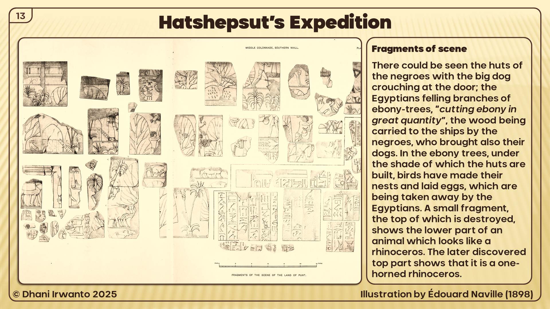
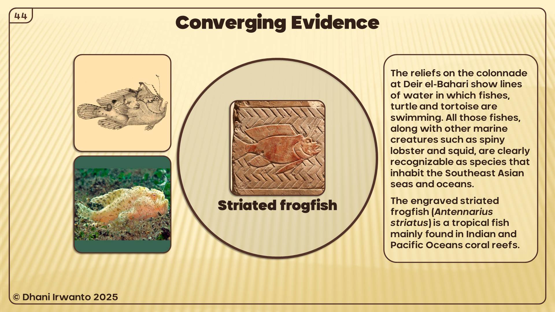
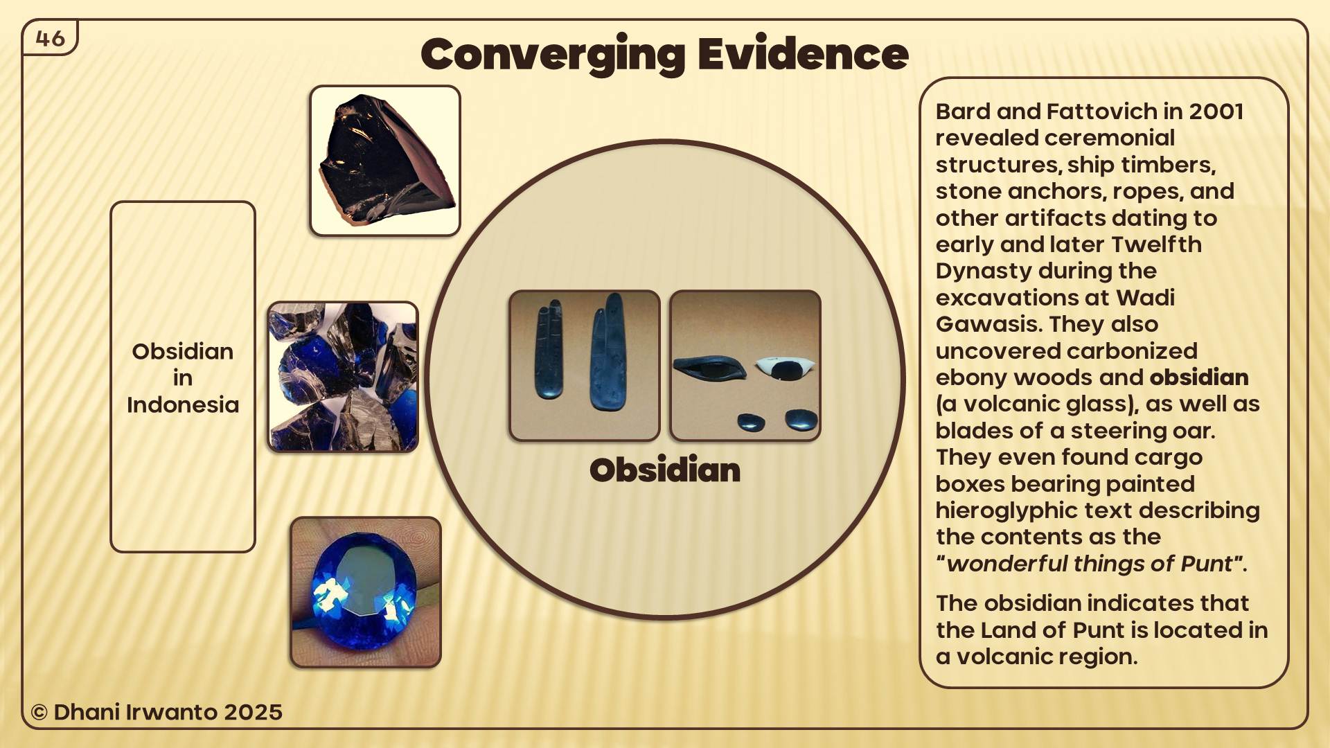
In the mid-1970s Abdel Monem Abdel Haleem Sayed of the University of Alexandria, Egypt, conducted test excavations at Wadi Gawasis, and found potsherds with painted (hieratic) inscriptions and inscribed stelae recording expeditions to Bia-Punt (the “mine” of Punt) from a locality called Sʒww, from the reigns of Senusret I, Amenenhat II, Senusret II and Senusret III. Sayed also uncovered some carved, round-topped anchors and a fragment of carved cedar timber with a mortise, most likely from a ship. Based on this evidence Sayed suggested that Mersa/Wadi Gawasis was the pharaonic port of Sʒww for seafaring expeditions to Punt in the Twelfth Dynasty. Another unearthing actual evidence of trade with Punt occurred during excavations beginning in 2001. Here, a team led by Kathryn Bard and Rodolfo Fattovich revealed ceremonial structures, ship timbers, stone anchors, ropes, and other artifacts dating to early and later Twelfth Dynasty. They also uncovered actual products presumably brought from Punt, including carbonized ebony woods and obsidian (a volcanic glass), as well as blades of a steering oar. They even found cargo boxes bearing painted hieroglyphic text describing the contents as the “wonderful things of Punt” (Bard, 2011).
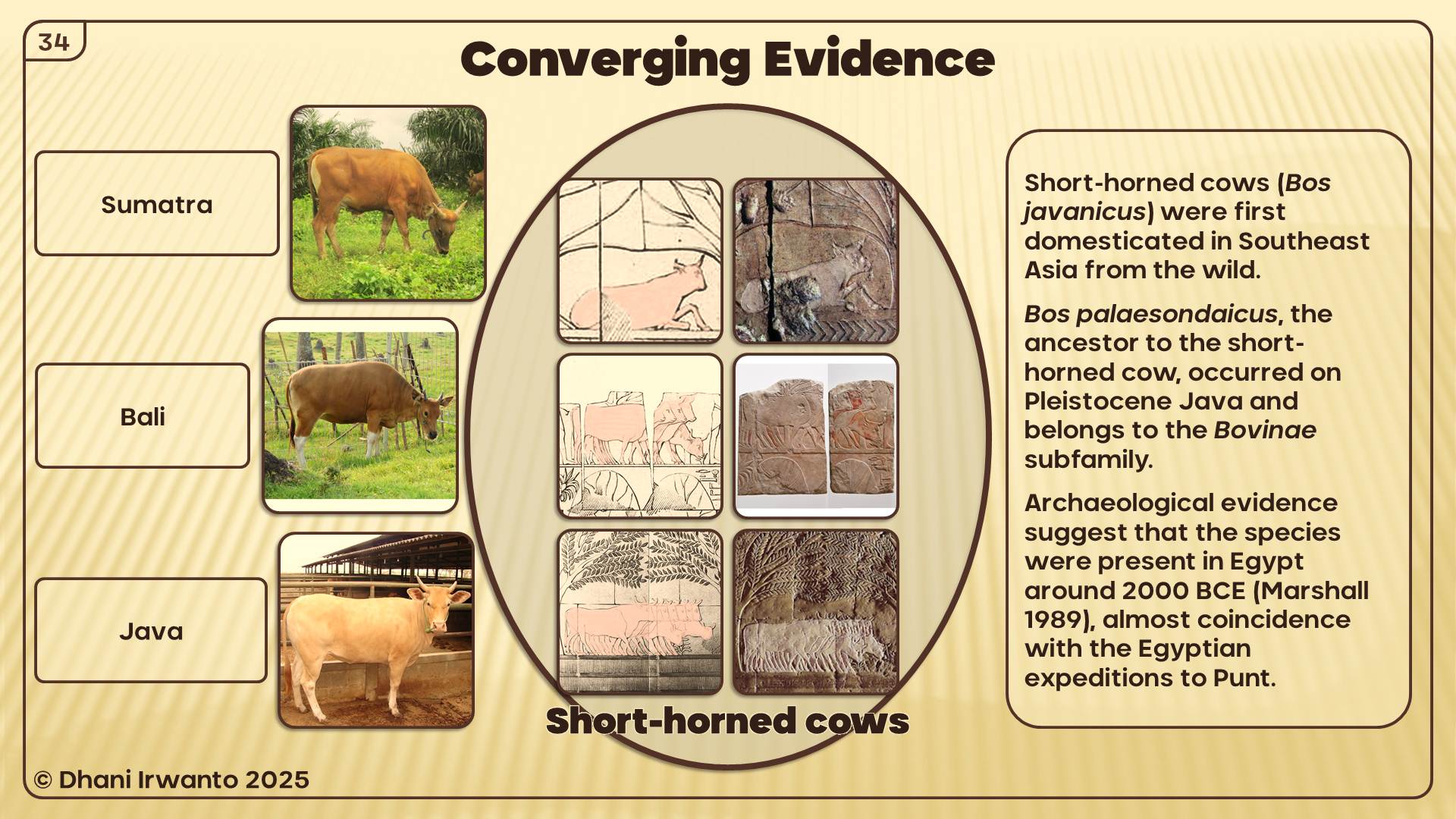
Archaeological evidence including pictures on pottery and rocks suggest that a species of cattle, zebu or brahman (Bos indicus) originating in South Asia, were present in Egypt around 2000 BC. Bos indicus are believed to have first appeared in Sub-Saharan Africa between 700 and 1500 AD, and were introduced to the Horn of African around 1000 AD (Marshall, 1989).
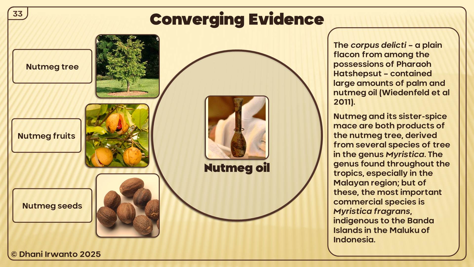
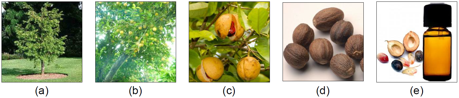
At the Radiology Clinic of the Bonn Universitätsklinikum, the corpus delicti – a plain flacon from among the possessions of Pharaoh Hatshepsut – was subjected to computerized axial tomography scan (CAT scan) in 2011. It became obvious very quickly that what they had found was not dried-up perfume. The mix contained large amounts of palm oil and nutmeg apple oil.
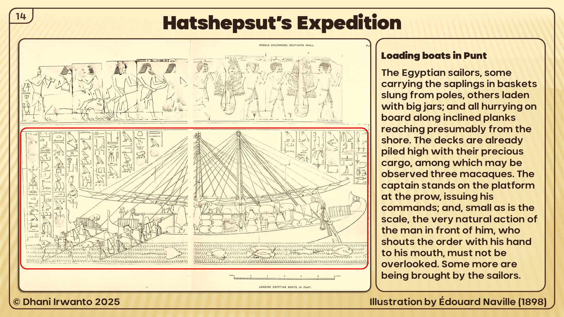
The walls of Djeser-Djeseru are illustrated with Hatshepsut’s autobiography, including stories of her fabled trip to the Land of Punt. Also discovered at Djeser-Djeseru were the intact roots of incense trees, which once decorated the front façade of the temple. These trees were collected by Hatshepsut in her expedition to Punt; according to the histories, she brought back five shiploads of goodies, including flora and fauna.
The author presents illustrations of wall-sculptures on middle colonnade of Deir el-Bahari (Djeser-Djeseru) made by Johannes Duemichen (1869), Auguste Mariette (1877) and Eduard Naville (1898) below. Most of the descriptions and hieroglyph transliterations are cited from Naville’s and Edwards’ reports, omitting their personal opinions and adding information by other authors.
Figure 2. Illustrations of wall-sculptures on middle colonnade of Deir el-Bahari (Johannes Duemichen, 1869)
Figure 3. Illustrations of wall-sculptures on middle colonnade of Deir el-Bahari (Auguste Mariette, 1877)
A report of that five-ship voyage survives on reliefs in Hatshepsut’s mortuary temple at Deir el-Bahari. Throughout the temple texts, Hatshepsut maintains the fiction that her envoy Chancellor Nehsi, who is mentioned as the head of the expedition, had travelled to Punt “in order to extract tribute from the natives” who admit their allegiance to the Egyptian pharaoh. In reality, Nehsi’s expedition was a simple trading mission to a land, Punt, which was by this time a well-established trading post. Moreover, Nehsi’s visit to Punt was not inordinately brave since he was accompanied by at least five shiploads of Egyptian marines and greeted warmly by the chief of Punt and his immediate family. The Puntites traded not only in their own produce of incense, ebony and short-horned cattle, but also gold, ivory and animal skins. According to the temple reliefs, the Land of Punt was ruled at that time by King Parehu and Queen Ati. This well illustrated expedition of Hatshepsut occurred in year 9 of the female pharaoh’s reign with the blessing of the god Amon:
“Said by Amon, the Lord of the Thrones of the Two Land: ‘Come, come in peace my daughter, the graceful, who art in my heart, King Maatkare [ie Hatshepsut] … I will give thee Punt, the whole of it … I will lead your soldiers by land and by water, on mysterious shores, which join the harbors of ảnti … They will take ảnti as much as they like. They will load their ships to the satisfaction of their hearts with trees of green [ie fresh] ảnti, and all the good things of the land.’”
Figure 4. Egyptian boats arriving at Punt (Eduard Naville, 1898)
Figure 5. Egyptian boats arriving at Punt (Eduard Naville, 1898) (continued)
The description of the expedition begins with these two figures. Here we see five Egyptian ships arriving. The first two are already moored, and have struck their sails, while the three others are coming up with canvas spread; on the last one the reis or pilot gives the word of command: “to the port side”. The first ship has sent out a boat, which is unloading bags and large jars or amphoras, probably containing the food and drink which is to be presented to the chief of Punt. The inscription in large characters above the ships is as follows:
“The navigation on the sea, the starting on the good journey to the Divine Land, the landing happily in the Land of Punt by the soldiers of the king, according to the prescription of the lord of the gods, Amon, lord of the thrones of the two lands, in order to bring the precious products of the whole land, because of his great love towards [here the name of Hatshepsut is erased with some signs which followed, and it has been replaced by the name of Rameses II] …… to the kings who were in this land eternally.”
Figure 6. The Land of Punt (Eduard Naville, 1898)
The picture of the Land of Punt was divided into four rows. In two of them the separation is made by a line of water in which fishes and tortoises are swimming. What is seen above the water may be considered as taking-place in the immediate vicinity of the shore, whereas where there is a simple line under the figures they are meant to be further inland.
On the shore we find the huts of the people; they are built on poles, with ladders giving access to them, evidently in order to protect the inmates against wild animals. These huts are made of wickerwork, probably of palm-stalks; they are all of the same shape and construction. They stand under the shade of palms, and of other trees having a conventional form, which, judging from the inscriptions, may signify incense and ebony trees. Near the huts they are certainly ebony trees, the branches of which are cut down by the Egyptians “in great quantities”, and which are high enough for the cattle to rest under their shade.
The Puntite, unlike ancient Egyptians, had longer hair and little facial hair. The Puntite is a tall, well-shaped man, his hair is brighter; his nose is straight, his beard long and pointed grows on his chain only; he wears only a loincloth with a belt in which a dagger is fixed. The inscription engraved in front of his body states that he is “The Great of Punt, Parehu”. The left leg of the chief, Parehu, is covered with a bracing of rings. In one scene, his left hand holds a curved weapon. The Puntites are painted red, but not as dark as the Egyptians. He is followed by his wife, his two sons, and his daughter, to each of whom is attached a short inscription. The two youths are simply described as “his sons”, and the young girl as “his daughter”. His spouse, a very singular and unbeautiful person, is described as “his wife, Ati”. She wears a yellow dress, bracelets on her wrists, anklets on her ankles, and a necklace of alternate bead and chain work round her throat. Her hair, like that of her daughter, is bound with a headband on the brow. Her features are repulsive, and her cheek is disfigured by facial wrinkles. She is hideously obese, her limbs and body being weighed down by rolls of skin. Her daughter, though evidently quite young, already shows a tendency towards the same kind of deformity. The complexions of the whole family are painted of a light red, and their hair black, thus showing that they are not of negro race. The superimposed hieroglyphic inscription, which extends to some length beyond that of the illustration, states that “Hither come the Great [ones] of Punt, their backs bent, their heads bowed, to receive the soldiers of His Majesty”.
An ass, saddled with a thick cushion, and three attendants carrying short staves, bring up the rear of the procession. Over the ears of this beast of heavy burden is engraved in hieroglyphic characters, “The great ass that carries his wife”. The men who guide and follow the ass wear the upcurved-beard everywhere characteristic of the natives of Punt in Egyptian art.
On the shore Hatshepsut’s royal envoy having landed, accompanied by his military escort, arranges on a table, or stand, the gifts which he has brought for presentation to the Prince of Punt. The envoy is in civil dress, and leans upon his staff of command. The soldiers are armed with spear and hatchet, and carry a large shield rounded at the top – the ordinary equipment of infantry of the line. Their captain carries no shield, but is armed with a bow, in addition to the spear and hatchet of his followers. We know from another inscription the name of this messenger: “he is called Nehsi”, the negro. His mission is quite peaceful. On a small table he has placed the presents offered by the queen, which are not of great value: necklaces, probably made of blue porcelain beads, an axe, a dagger and a few bracelets. The text above the table reads:
“The landing of the royal messenger in the Divine Land, with the soldiers who accompany him, in presence of the chiefs of Punt, to bring all good things from the sovereign (life, strength and health) to Hathor, the lady of Punt, in order that she may grant life strength and health to Her Majesty.”
This is a circuitous manner of stating that the said good things are intended, not for the goddess, but as a means of exchange for the coveted products of Punt.
Parehu seems afraid; he is raising his hands towards the Egyptians.
“The coming of the chiefs of Punt, bowing and stooping in order to receive these soldiers; they give praise to …… Amon (probably put there instead of the queen).”
Behind Parehu stood his wife, Ati, two sons and his daughter, as may be seen from Mariette’s publication. But this most valuable block has unfortunately disappeared, as well as the text it contained, which expressed the astonishment of the Puntites at the sight of the strangers. Naville gave a translation of their words as reproduced by Mariette: “They say in asking for peace: you arrived here on what way, to this land which the Egyptians did not know? Have you come through the ways of the sky, or have you travelled on water to the green land, the divine land to which Ra has transported you? For the king of Egypt there is no closed way, we live of the breath which he gives us.”
From what we see on the upper row the intercourse between the messenger and the Puntites soon becomes cordial. While the Egyptian sailors, assisted by the natives of Punt, are busily engaged in loading the ships, Hatshepsut’s envoy offers an official reception to Parehu, his wife and family. This parting interview is conducted with great ceremony on both sides. A tent has been pitched by order of the messenger, before which Parehu and his family, “the chiefs of Punt”, appear again.
“the coming of the chief of Punt, bringing his goods on the shore in presence of the royal messenger.”
The Lady Ati is appareled as before, but the right leg of Parehu is covered from the ankle to above the knee with a close succession of metal rings. The objects which are brought, and which are called tributes, are properly goods to be exchanged against the products of Egypt; they consist of gold in rings, a heap of curved weapons, the same weapon which Parehu has in his hand, and a big heap of the famous incense called ảnti, of which there were several varieties, and of which the Egyptians made such great use that the procuring of it was the main reason which induced them to send expeditions to Punt. The sons of Parehu, one of them carrying a bowl of gold-dust; an attendant bearing a large jar on his shoulder; and the ass, which has again enjoyed the unenviable privilege of carrying the Lady Ati, bring up the rear. The pile of ảnti is here represented in a very summary fashion by a mere outline, but in some of the other subjects the little irregularly shaped lumps of the precious gum are all elaborately defined. The envoy stands in front of his pavilion – omitted in the illustration – and is apparently in the act of inviting his guests to partake of the banquet which, by order of Hatshepsut, he has prepared for them.
The messenger is said to receive these things, but his queen has ordered him to be generous, and to show something of her royal hospitality. Nehsi will entertain the chiefs of Punt to a banquet in his tent.
Figure 7. Fragments of the scene of the Land of Punt (Eduard Naville, 1898)
The considerable part of this wall which is lost contained very interesting scenes, of which fragments only have been recovered. There could be seen the huts of the negroes with the big dog crouching at the door; the Egyptians felling branches of ebony-trees, “cutting ebony in great quantity”, the wood being carried to the ships by the negroes, who brought also their dogs, which may have been used in Egypt for the chase of the antelope and the wild bull. In the ebony trees, under the shade of which the huts are built, birds have made their nests and laid eggs, which are being taken away by the Egyptians. It is difficult to recognize what birds they are, owing to the incorrectness of the proportions. The Egyptians were seen also taking the eggs from the nests of the birds. The places where the fragments were found would make us think that this wall was ruined before the occupation of the temple by the Copts.
A small fragment, the top of which is destroyed, shows the lower part of an animal which looks like a rhinoceros.
Figure 8. Loading Egyptian boats in Punt (Eduard Naville, 1898)
The various scenes on this wall are not arranged with the same regularity as on the other side of the colonnade. They sometimes occupy the whole height of the wall, as for instance the description of the Land of Punt, or they are put one over the other, as is the case here. In the very interesting subject now before us, we see the Egyptian sailors, some carrying the saplings in baskets slung from poles, as before; others laden with big jars; and all hurrying on board along inclined planks reaching presumably from the shore, which, however, is not shown in the picture. The decks are already piled high with their precious cargo, among which may be observed three macaques, who make themselves perfectly at home. Slung to the main-mast of the nearest vessel, a harp is depicted, of a shape which may even now be seen in the hands of native musicians in Cairo and other large towns. The captain stands on the platform at the prow, issuing his commands; and, small as is the scale, the very natural action of the man in front of him, who shouts the order with his hand to his mouth, must not be overlooked. Some more are being brought by the sailors. The loading is described as follows:
“The loading of the cargo-boats with great quantities of marvels of the land of Punt, with all the good woods of the divine land, heaps of gum of ảnti, and trees of green ảnti, with ebony, with pure ivory, with green nub of ảamu, with cinnamon wood, khesit wood, balsam, soter-incense, mesṭemtu, with ảnảu, monkeys, dogs, and with skins of leopards of the south, with inhabitants of the country and their children. Never were brought such things to any king, since the world was.”
While these last two vessels are receiving their cargoes, the other three have already weighed anchor, and are seen with their sails set and filled by a favorable wind. A short inscription states that this is “the peaceful and prosperous voyage of the soldiers of his Majesty returning to Thebes, bringing with them the men of Punt. They bring such marvels of the Land of Punt as have never been brought by any King of Egypt, on account of the greatness of the King of the Gods, Amon, Lord of Thebes”.
From this point, the sculptured posterities form a continuous scene, those in the lower register being almost perfect, whereas those in the upper register are unfortunately so much broken away that in many places there remain only the feet of the figures and the water lines of the river. In several of the best preserved, we see the Egyptian sailors carrying half-grown saplings which have been taken up with a ball of earth about the roots, and are being transported in baskets slung upon poles, each pole carried by four men. These, as they wend their way towards the ships, are accompanied by natives of Punt. In one place where there is a great gap in the wall, the remains of the inscription show that an elephant and a horse were among the animals embarked from Punt for the gratification of Hatshepsut. A running commentary of short inscriptions is interspersed here and there between the figures. “Stand steady on your legs, Bohu!” says one of the bearers. “You throw too much weight upon my shoulders”, retorts Bohu.
Over the saplings which are being carried in baskets, is inscribed nehet ảnti; that is to say, the sycamore of ảnti. Elsewhere we see the full-grown trees. The trunk is massive; the leaf is a sharp-pointed oval; and at the junction of the trunk and the larger branches are seen little copper-colored lumps of irregular form, representing the resinous gum which has exuded through the bark.
Figure 9. Laden boats leaving Punt (Eduard Naville, 1898)
The next scene describes the voyage back to Egypt, and the happy arrival of the expedition at Thebes.
“The navigation, the arrival in peace, the landing at Thebes with joy by the soldiers of the king; with them are the chiefs of this land, they bring such things as never were brought to any king, in products of the land of Punt, through the great power of this venerable god Amon Ra, the lord of the thrones of the two lands.”
The return voyage, like the outward voyage, is passed over; and the next incidents of this curious panorama in stone take place in Thebes. We are shown nothing of the arrival of the squadron, nor of the unlading of the ships; the rest of the posterities consisting mainly of processions of priests, soldiers, and sailors. The order in which these processions meet and succeed each other is somewhat confusing. The hieroglyphic inscriptions in this part of the building are also greatly mutilated, so that the subjects in many instances have to be taken as their own interpreters. It seems possible that they do not all represent the return of the expedition from Punt, but that some may have reference to the ceremonies which accompanied the opening of the temple. The unity of the composition as an historic whole is moreover impaired by the introduction of other foreign tributaries besides those brought from Punt; whence it may be concluded that the artist, in order to produce a more brilliant effect, introduced the representatives of various nations who on other occasions, had laid their tribute at the feet of Hatshepsut.
Figure 10. Chiefs of Punt bowing before Egyptians (Eduard Naville, 1898)
Figure 8 and Figure 10, which is to be placed over Figure 9, shows us the landing from the ships at Thebes in the presence of the queen. This representation, of which nearly all the upper part has been lost, is particularly interesting, because we see Africans in great number who have come to Egypt with the ships.
Beginning at the end of the long train which marches towards the queen, we see Puntites carrying ebony, curved weapons, and driving cows. Before them are Egyptians bringing the precious incense-trees. Next come two rows of men, each row being divided in two at the beginning. In the lower one we find again Puntites with amphoras, probably filled with balsam, and baskets containing ảnti. One of them leads a macaque. The long pointed loaves and the obelisks are resin to which that shape has been given. In front of the procession of Puntites are four chiefs kneeling, with hands raised towards the queen, and imploring her to be merciful to them.
“they say, imploring her Majesty, hail to thee, King of Egypt, Lady Ra, shining like the solar disk ……”
The Puntites have the same type and dress as we saw in the description of their country. Above them are the chiefs of “the Irem”. As far as we can judge from what is left of the head of the kneeling chief and from the standing man who follows bringing gold and a leopard or a panther, and who may be one of them, the Irem are not negroes. Above are two negroes, called the chiefs “of Nemyuw”; these men are the same as those seen near the huts. The block on which they are represented was recovered in pulling down one of the upper walls.
According to Brugsch, the Irem are the Blemmyes. Like the Egyptians, they belong to the Hamitic branch; they bring gold and a leopard or a panther.
In the eighth year of Seti I (1283 BC), Irem revolted. However, the campaign against Irem was far less serious than any one of Seti’s Levantine campaigns. Seti I, setting off from the Nile, managed to take five wells and 400 people with the use of chariots. The importance of wells and the use of chariots (not boats, as might be expected for a place inside the Nile Valley) suggest that Irem was a pastoral area outside the Nile Valley. This location of Irem makes its identification with the Yam of the Old Kingdom all the more likely.
Since Nemyew’s chiefs are portrayed as negroes, it should be placed somewhere in the Nile valley above Kurgus.
All these men are supposed to be in presence of the queen, who, however, does not seem to have been herself represented. On a kind of stand adorned like a throne was her cartouche and her ka name. The text which was next to it is destroyed to nearly half of its height.
“…… the bowing down before Usertkau (Hatshepsu) by the chiefs of Punt
…… the Ảnti of Nubia of khenthunnefer, all lands………… of
…… stooping, bringing their goods in the place where is her Majesty.
…… roads which never had been trodden by others; it was reckoned
…… the lord of Thebes, as a tribute for each year.
…… as was ordered to her by her father, who put all lands under her feet living eternally.”
Nubia is a region along the Nile river located in what is today northern Sudan and southern Egypt. The name Nubia is derived from that of the Noba people, nomads who settled the area in the 4th century, with the collapse of the kingdom of Meroë. Before the 4th century, and throughout classical antiquity, Nubia was known as Kush, or Khent Hunnefer, or Khent-hen-nefer, or Khenthennofer, or, in Classical Greek usage, included under the name Ethiopia (Aithiopia). Nubia had a great influence on Egypt. Even the way the Nubians wore their hair was copied by the Egyptians.
Figure 11. The queen offering to Amon the products of the expedition (Eduard Naville, 1898)
In order to express her thankfulness to Amon, who had shown the way to her ships and brought them back safely, Hatshepsu must consecrate the best things of Punt to the god. This we see her doing in a scene which occupies the whole height of the wall. Hatshepsu standing, wearing the atef crown, holding the insignia of royal power, and followed by her ka, dedicates to Amon the choice products of the foreign countries.
“The king himself, king of Upper and Lower Egypt, Ramaka takes the good things of Punt, and the valuables of the Divine Land, presenting the gifts of the southern countries, the tributes of the vile Kusch, the boxes (of gold and precious stones) of the land of the negroes to Amon Ra, the lord of the throne of the two lands. The king Ramaka, she is living, she lasts, she is full of joy, she rules over the land like Ra eternally.”
Figure 12. Incense trees planted in the Garden of Amon (Eduard Naville, 1898)
The valuable cargo which the queen feels bound to offer to Amon is represented in the four following figures. The wall is here divided into two rows. Beginning at the bottom, we see first the products which are properly those of the Land of Punt, four large trees, incense-trees planted in the garden of Amon, where they have prospered and reached such a height that cattle may easily walk under their branches. Various things have been collected in the shade of the trees: ảbu, which means ivory. Under the tusks is a substance called kash, the meaning of which is doubtful, but Naville considers being tortoise-shell judging from the determinative.
The cattle are the short-horned cows, further we see ebony, bags of the substance called mesṭem (Naville and Mariette allege as antimony, used for dyeing the eyes), then the curved weapons similar to the one held by Parehu (the ảamu of the Puntites), and rings and boxes full of the metal åsem (Naville assumes as an alloy of gold and silver).
Figure 13. Measuring the heaps of incense from Punt (Eduard Naville, 1898)
The incense ảnti, of which there were as many as fourteen different sorts, was the most important product of Punt. We see here that the numerous bags of that substance which were the chief part of the cargo of the ships, have been emptied, and the incense, after having been measured by means of bushels, is gathered in large heaps. The text explains that “these are heaps of green [fresh] ảnti in great number; the measuring of green ảnti in great quantity to Amon, the lord of the thrones of the two lands, from the marvels of the Land of Punt, and the good things of the Divine Land”. Above the heaps are incense-trees in pots. “Trees of green ảnti thirty-one, brought among the marvels of Punt to the Majesty of this god, Amon Ra, the lord of the throne of the two lands; never was such thing seen since the world was.”
Behind the four men emptying their bushels stood a man whose figure has been rubbed off. He is called “the writer, the steward Thoth[mes?]”. We do not know why his figure has been erased; he may have been one of the friends and supporters of Hatshepsu, and therefore his name and figure were destroyed. We shall see other instances of names of officials being erased.
The god Thoth himself acts as writer, and keeps a record of all that has been brought from Punt and offered to the god:
“to record in writing, to make up the accounts; altogether millions, hundreds of thousands, tens of thousands, thousands, hundreds [an infinite number] of good things of the Land of Punt, given to Amon Ra.”
Thoth, who is said to reside in a temple, the name of which is doubtful, and who is called the chief of the rekhytu, has been erased. This destruction is certainly not the work of any of the Thothmes, and must be assigned to a later date.
Figure 14. Products of the southern lands (Eduard Naville, 1898)
Above the products of Punt are those which are supposed to come from the southern countries (Upper Nile), viz the regions of the Upper Nile, inhabited by the negroes whom we saw represented before, and by the Anti of Nubia. These goods must have been brought by caravans, showing that there was already a regular trade established between the valley of the Nile and the coast. We see here a giraffe, long-horned cattle, two kinds of leopards: the larger which seems to have been only an object of curiosity, while the others are held by collars, and were probably more or less tame, so as to be used for hunting. As in the case of Punt we see great quantities of åsem, in rings and boxes, curved weapons and ebony, besides skins of leopards, bows, feathers, and ostrich eggs.
Above the large gap in the middle of the figure we see the tops of several columns of text and fragments of a cartouche which seems to be that of Thothmes I. It probably refers to his campaign in Asia, towards the Euphrates, as far as a place called Niy, where Thothmes III, his grandson, as we know from the biography of one of his officials, hunted elephants, killing a great number of them. The few signs • left point to an inscription of the same kind as that which relates the deeds of the younger king.
Figure 15. Weighing precious metals from the southern countries (Eduard Naville, 1898)
All the good things from the southern countries are brought to Amon by the god Tetun, the god of Nubia, who is present at the weighing of the precious metals. This weighing is superintended by Horus:
“The balance, the right one of Thoth, for weighing silver, gold, lapis lazuli, malachite.”
On the sculpture there is only the weighing of åsem in rings; below are the weights ṭebennu, some of which have the form of bulls. As Thoth did in the case of Punt, Safekhabui here records an unlimited number of good things from the lands of the south.
The debate over Punt’s place on the map began in the 1850s, when the newly formed Antiquities Service of Egypt began clearing the great temples in and around Thebes. Based on newly revealed hieroglyphic texts that described Punt as a source of aromatic substances situated to the east of Egypt, Heinrich Karl Brugsch first suggested, in the late 1850s, that Punt lay on the Arabian Peninsula. It seemed straightforward enough. After all, the Greeks had glorified the “perfumes of Arabia”, a land that lies due east of Egypt.
Auguste Mariette changed this thinking with two discoveries. One was a hieroglyphic list that the Pharaoh Tuthmosis III left at Karnak Temple in Thebes that included Punt in those lands south of Egypt. The other was Hatshepsut’s bas-relief, which, among other evidence it bears that points to Africa, shows distinctly African animals as products or natives of Punt, including the giraffe and rhinoceros, neither of which is found in Arabia. For the location of Punt, Mariette settled on the Somali coast, which also is known for its aromatics, including the fabled incense.
Mariette’s hypothesis held well into the next century. Then, in the 1960s, based on a detailed study of the flora and fauna and other elements of Punt represented in Hatshepsut’s bas-relief, Rolf Herzog placed Punt along the Upper Nile south of Egypt, specifically between the Atbara River and the confluence of the White and Blue Niles. Punt, Herzog felt, was reached overland and by river, but not by sea.
Yet Hatshepsut’s relief appears to contradict that stance, as Kenneth Kitchen pointed out in a 1971 review of Herzog’s work. Most indisputably, Kitchen notes, the fish that Hatshepsut’s carvers depicted beneath the Punt ships, along with other marine creatures such as spiny lobster and squid, are clearly recognizable as species that swim to this day in the Red Sea.
Kitchen, in nearly four decades of writing on the subject of Punt, has succeeded in establishing what today is the most widely accepted position on the location of Punt. It was situated, he proposes, in what is today eastern Sudan and northern Ethiopia, extending from the Red Sea to the Nile. Arabia was out of the question, Kitchen says. Perhaps the most contrary evidence is linguistic, he writes: “As for Parehu, the only named chief of Punt, the consonant p in his name and that of Punt itself also firmly excludes Arabia”. Old South Arabian languages possess an f but no p. Thus, Kitchen writes, “Arabia would have had a Farehu, chief of Funt”! Egyptian has both consonants, so the transcription is reliable, he adds.
Other experts, while acknowledging the p problem, are not so quick to dismiss Arabia as the Land of Punt. In a 2003 paper – one that Kitchen himself called “a brilliant, most impressive tour de force” even as he challenged its premise – Dmitri Meeks advanced the notion that Punt lay along the entire western coast of the Arabian Peninsula, from the Gulf of Aqaba to Yemen. Meeks says that when one takes all ancient references to Punt into account, the picture becomes clear. “Punt, we are told by the Egyptians, is situated – in relation to the Nile Valley – both to the north, in contact with the countries of the Near East of the Mediterranean area, and also to the east or southeast, while its furthest borders are far away to the south”, he writes. “Only the Arabian Peninsula satisfies all these indications.”
In one of the most recently proposed hypotheses, Stanley Balanda, in a 2005 – 2006 paper, offers a sort of compromise between the Kitchen and Meeks theories. Balanda argues that a key expression within Hatshepsut’s text has been misinterpreted as saying “by the sea” or “along the sea front” when it really means “on both sides of the sea”. If Hatshepsut’s expeditionaries had indeed, as Balanda translates one bit of hieroglyphs, “pitched tents for the king’s representative and his expedition to the incense terraces on both sides of the sea in order to receive the chiefs of this land”, then one place on the Red Sea presents itself above all others. This is the straits of Bab el Mandeb at the sea’s southern end, where today Djibouti and Yemen face each other across narrows no wider than the English Channel. Punt, Balanda proposes, was a region of indeterminate size stretching out on both sides of the strait, which lay at the heart of Puntite commercial activities.
The most famous Egyptian expedition to Punt, and the one from which we derive most of our information is the one conducted by 18th-dynasty Queen Hatshepsut (1473 – 1458 BC) and recorded in the splendidly detailed reliefs on the walls of her mortuary temple at Deir El-Bahari. This expedition was led by the Nubian officer, Nehsi. The route “by land and sea” most probably went from Koptos overland via Wadi Hammamat to the Red Sea port of Queisir, the dismantled five ships being transported by donkey to be re-assembled on arrival at the port (Kitchen 1993). The text accompanying the Deir el-Bahari reliefs specifically repeats three times that the expedition went “by land and sea” and this same method of travel was used on the expedition led by Henu in the reign of king Mentuhotep III and on the expedition mounted by king Ramesses III. The expedition of Senusret I provides some of the clearest evidence of a major Egyptian expedition to Punt using the Red Sea route.
Papyrus Harris I, a contemporary Egyptian document which detailed events that occurred in the reign of the early 20th dynasty king Ramesses III, includes an explicit description of an Egyptian expedition’s return from Punt:
“I hewed great galleys with barges before them. They were sent forth into the great sea of the inverted water, they arrived at the countries of Punt. They were laden with the products of God’s Land.They arrived safely at the desert-country of Coptos: they moored in peace, carrying the goods they had brought. They [the goods] were loaded, in travelling overland, upon asses and upon men, being reloaded into vessels at the harbor of Coptos. They [the goods and the Puntites] were sent forward downstream, arriving in festivity, bringing tribute into the royal presence.”
Sayed in the mid-1970s found potsherds with painted (hieratic) inscriptions and inscribed stelae recording expeditions to Bia-Punt (the “mine” of Punt), some carved, round-topped anchors and a fragment of carved cedar timber with a mortise, most likely from a ship. He suggested that Mersa/Wadi Gawasis was the pharaonic port of Sʒww for seafaring expeditions to Punt in the Twelfth Dynasty. Bard and Fattovich in 2001 revealed ceremonial structures, ship timbers, stone anchors, ropes, and other artifacts dating to early and later Twelfth Dynasty. They also uncovered carbonized ebony woods and obsidian (a volcanic glass), as well as blades of a steering oar. They even found cargo boxes bearing painted hieroglyphic text describing the contents as the “wonderful things of Punt”.
Such clear evidence for a sea route to Punt is practically irrefutable, and it is now generally accepted by most scholars that some if not most expeditions used the Red Sea to travel to Punt. The attribution of Punt as “Land of the Gods”, “Land of the Ancestors”, “Holy Land” or “Divine Land” referred to as the Abode of the Gods where its location is to the east of Egypt in the direction of the sunrise, means that Punt definitely located east of Egypt. The expeditions to travel to Punt used the sea route began at the Red Sea.
The Egyptians were not particularly well versed in the hazards of sea travel, and the long voyage to Punt is a situation involving exposure to danger. The rewards of obtaining incense, ebony and other valuable goods clearly outweighed the risks.
The expedition to Punt by Hatshepsut is recorded in the splendidly detailed reliefs on the walls of her glorious mortuary temple at Deir El-Bahari. Her reputation and magnified accomplishment achieved by the successful return upon the dangers of the sea, ritual and celebration after the achievement and the indicator of her leadership and skill in motivating and governing the Egyptian society to high achievement, exhibit how difficult the voyages leading to and returning from Punt was. Such things were also accomplished by the former and following pharaohs, though not well documented. These complications and achievements would indicate that the voyages did not take place solely in the Red Sea, but in the open sea, the Indian Ocean. The very long distance would explain why so few voyages were made there, unlikely in the Red Sea alone. The inscription on the wall of Deir El-Bahari “traversing the Great Sea on the Good Way to the Land of the Gods” and from Papyrus Harris I “They were sent forth into the great sea of the inverted water…” depict the route was an ocean (“Great Sea”).
The colonnade reliefs at Deir El-Bahari are clearly of crucial importance since they show in great detail its flora and fauna and its inhabitants. The scenes illustrate not only the trade products which the Puntites traded with the Egyptians but also some of the fauna and flora of Punt. The former may be classed as luxury goods of which the most important is incense (ảnti), used widely in Egyptian religious ritual worship. Other goods include ebony, ivory, gold/electrum, cinnamon wood, khesit wood, balsam, resin, tortoise shells and weapons. The fauna depicted include such diverse species as short-horned cows, pig-tailed macaques, one-horned rhinoceros, monkeys, dogs, skins of clouded leopards and a wide variety of fishes are also displayed. The floras have been identified as the betel palm, the ebony tree and the styrax tree. The huts of the people are built on poles, with ladders giving access to them, made of wickerwork of the same shape and construction.
Archaeological evidence is so far somewhat sparse and unless additional evidence turns up, it is unlikely that anyone will ever be able to pinpoint the location of Punt with total certainty. All that one can do is make a hypothesis for its whereabouts with a fair degree of probability, by gathering evidence shaping a compound of observable characteristics (term similar to “phenotypes” in biology). The evidence shall be of genuine proofs strongly or most probably representing the phenotypes. The richer the compound of the phenotypes, the stronger the likelihood of the hypothesis. Relying on this method and after gathering evidence, the author makes a hypothesis that the Land of Punt is located in Sumatera, Indonesia.
Sumatera is an island in western Indonesia, the largest island that is entirely in Indonesia (two larger islands, Kalimantan and Papua, are shared between Indonesia and other countries) and the sixth largest island in the world. The Indian Ocean borders the west, northwest, and southwest sides of it with the island chain “Barrier Islands” of Simeulue, Nias, Mentawai, Pagai and Enggano bordering the southwestern coast. On the northeast side the narrow Strait of Malaka separates the island from the Malay Peninsula, an extension of the Eurasian continent. On the southeast the narrow Sunda Strait separates it from Java. The northern tip borders the Andaman Islands, while on the eastern side are the islands of Bangka and Belitung, Karimata Strait and the Java Sea.
Sumatera was known in ancient times by the Sanskrit names of Swarnadwīpa (“Island of Gold”) and Swarnabhūmi (“Land of Gold”), because of the gold deposits of the island’s highland. Arab geographers referred to the island as Lamri (Lamuri, Lambri or Ramni) in the 10th to 13th centuries, in reference to a kingdom near modern-day Banda Aceh which was the first landfall for traders. Late in the 14th century the name Sumatera became popular in reference to the kingdom of Samudra Pasai, which was a rising power until it was replaced by Sultanate of Aceh. Sultan Alauddin Shah of Aceh, on letters written in 1602 addressed to Queen Elizabeth I of England, referred to himself as “king of Aceh and Samudra”. The word itself is from Sanskrit samudra, meaning “gathering together of waters, sea or ocean”.
Odoric of Pardenone in the story of his voyage in 1318 mentioned that he sailed to the east of the Coromandel, India, for 20 days, and came to the kingdom Sumoltra. Ibn Bathutah told in the book of Rihlah ila l-Masyriq (“Wandering to the East”) that in 1345 he was stopped in the kingdom of Samatrah. In the following century, the name of Samudra, a kingdom in Aceh, was taken by travelers to mention the whole island. European writers in the 19th century found that the indigenous inhabitants did not have a name for the island.
Many travelers including Ibn Majid, Roteiro, Amerigo Vespucci, Masser, Ruy d’Araujo, Alfonso Albuquerque and Antonio Pigafetta recorded the names: Samatrah, Camatarra, Samatara, Samatra, Camatra, Camatora, Somatra, Samoterra, Samotra, Sumotra, Zamatra and Zamatora. Records of the Dutch and English colonials, since Jan Huygen van Linschoten and Sir Francis Drake in the 16th century, have always been consistent in the writing of Sumatra (Indonesian Sumatera).
Sumatera is the cradle of Malay civilization. A name Bhumi Malayu, written in the Padang Roco Inscription dated 1286 and 1347 CE found in Dharmasraya (central Sumatera), Adityawarman declared himself as the ruler of Malayupura. The Majapahit record, Nagarakretagama dated 1365 CE, mentioned that the land of Melayu was dominated by Majapahit Empire. From these records, the name Malayu seems to be identified with the area around the Batanghari valley from estuarine to hinterland in present-day central-eastern of Sumatera. The people inhabiting the eastern coast of Sumatera and parts of the Malay peninsula identified themselves as Malay with a common language called the Malay language. After the arrival in the 16th century, the Europeans identified the native people living on both coasts of the Malaka strait as Malay people. This term extended to neighboring peoples with similar traits.
While searching the ancient culture of Sumatera is very vogue today, the author focuses on the remote islands off the southwestern coast of Sumatera to trace back its culture. The island chain of Andaman, Nicobar, Simeulue, Nias, Mentawai, Pagai and Enggano are isolated island facing the Indian Ocean. These islands have similar nature conditions and cultures but Enggano is the most isolated and undeveloped. There is a considerable early traveler literature on Enggano from as early as 1596.
Enggano Island is a small island about 100 km southwest of Sumatera. There are six villages on the island, which are all located on the island’s only main road, which traverses the island’s northeast coast: Kahayapu, Kaana, Malakoni, Apoho, Meok and Banjarsari. Malakoni, Apoho, and Meok have more Enggano natives, and the other villages have larger immigrant populations. There are ferries to Bengkulu from Kahayapu and Malakoni.
Figure 17. Enggano Island
The name of the island suggests some early contact with Portuguese traders (engano in Portuguese means “mistake”). The earliest published account is that of Cornelis de Houtman. On the 5th of June 1596 four ships under the command of Cornelis de Houtman approached land. It appeared to be an island. Although some crew members tried to go ashore to get fresh supplies, they returned to their ships after seeing some natives who appeared to be very aggressive. In 1602, 1614, 1622, and 1629 other Dutch ships came to Enggano and sometimes succeeded in trading some goods. However, in general the population was not inclined to seek much contact with the visitors.
In 1645 the Dutch colonial administration in Batavia (present-day Jakarta) sent two ships to get slaves from Enggano. In the fierce fighting two Dutch soldiers were killed, but the other soldiers succeeded in capturing 82 people. On the way back to Batavia six of the Engganese died. The fate of the other captives is not known. It is likely that they never returned to Enggano, and died as slaves in Batavia. The expedition was not considered a success, so for a long time the Dutch lost their interest in Enggano.
In 1771, the Englishman Charles Miller visited Enggano. His experiences were published in 1778, and translated into Dutch in 1779. Miller succeeded in landing and meeting the indigenous population. He described as follows:
“With great difficulty and danger we beat up the whole South-west side of it, without finding any place where we could attempt to land; and we lost two anchors and had very near suffered shipwreck before we found a secure place into which we might run the vessel. At last, however we discovered a spacious harbor at the southeast end of the island and I immediately went into it in the boat, and ordered the vessel to follow me as soon as possible, for it was then a dead calm. We rowed directly into this bay; and as soon as we had got round the point of an island which lay off the harbor, we discovered all the beach covered with naked savages who were all armed with lances and clubs; and twelve canoes all full of them who, till we had passed them, had lain concealed, immediately rushed out upon me, making a horrid noise: this, you may suppose, alarmed us greatly; and as I had only one European and four black soldiers, besides the four lascars that rowed the boat. I thought it best to turn, if possible under the guns of the vessel before I ventured to speak with them.”
Eventually, he met these “noble savages” and learned something of their natural, feminist, atheist and property-sharing culture.
“They are a tall, well-made people; the men in general are about five feet eight or ten inches high; the women are shorter and more clumsily built. They are of a red color, and have straight, black hair, which the men cut short, but the women let grow long, and roll up in a circle on the top of their heads very neatly. The men go entirely naked, and the women wear nothing more than a very narrow slip of plantain leaf. They seemed to look at every thing about the vessel very attentively; but more from the motive of pilfering than from curiosity, for they watched an opportunity and unshipped the rudder of the boat, and paddled away with it.”
R Francis, trader in coconut oil, stayed on Enggano during the periods 1865 – 1866 and 1868 – 1870. He must have made a deep impression on the Engganese people, for they were still talking about this Francis in the 1930s when the German linguist Hans Kähler visited the island. Italian explorer Elio Modigliani visited Enggano Island between April 25 and July 13, 1891. He detailed the apparently dominant role of women in Enggano culture in L’Isola delle Donne (“The Island of Women”), first published in 1894, and still an important source of information, not only because of the text, but also because of the illustrations. In 1994 those illustrations were greeted with great surprise on Enggano. When Modigliani was on Enggano some villages were still located in the hills. Soon after this, all the Engganese moved to the coastal areas. In fact, in the nineteenth-century the Buginese traders from Sulawesi seemed to have been attracted to Enggano by the large quantities of coconuts. The Dutch Rijksmuseum has an important collection of Enggano artifacts and their publication by Pieter J ter Keurs reproduces Modigliani’s drawings.
The population went into severe decline in the 1870s, possibly from disease. The population figure dropped from 6.420 in 1866 to only 870 in 1884 and after this dramatic decline the population decreased even further (Suzuki, 1958; Winkler, 1903; Keurs, 2011). The Dutch sent medical officers to investigate. Since the island’s highest point is only 281 m above sea level, it would have been severely affected by the tsunami associated with the Krakatoa eruption in 1883, as well as by the massive volcanic debris. The indigenous population never recovered and numbered only about 400 souls in the early 1960s. Therefore, the Indonesian government uses the island for rehabilitation of juvenile offenders from Java, who perform forced labor, clearing bush and constructing rice fields. As noted above, the population has recovered somewhat since that time.
There are five Engganese sub-clans: Kauno, Kaitora, Kaarubi, Kaohoa and Kaaruba. The subdivision of the clans seems to vary (Keurs, 2011). Many of these sub-clans, however, no longer exist. This is because people migrated to other islands and married non-Engganese, thus creating an inactive situation for the sub-clans concerned. Especially when Engganese, matrilineal, women married non-Engganese men, usually patrilineal, the sub-clan lost an opportunity for survival; for the children were normally incorporated in the family of the man.
The island of Enggano represents a major linguistic and historical puzzle. Its inhabitants are said to be Austronesian speakers, yet their language shows few cognates with mainstream Austronesian vocabulary (Blench, 2014). They had no cloth, grew no cereals, but only vegetative crops and lived in beehive-shaped houses on stilts, and quite unlike any peoples in neighboring regions. There is a considerable early traveler literature in Dutch cited in the bibliography, but little in the way of ethnographic accounts except Modigliani (1893, 1894).
Around the turn of the twentieth century, when missionaries were gearing up to convert the population, the former systems of housing and social organization were in breakdown and it is hard now to reconstruct their exact nature. In recent years Keurs (2006, 2008, 2011) has been the main ethnographer to take an interest in this topic and his internet publication (Keurs, nd) includes a summary of what can be extracted from the literature, photographs of remaining items of material culture in European museums and a valuable bibliography.
Comparing the features depicted in the Deir El-Bahari reliefs with those of the present-day and ancient Enggano produces close matches. Ancient Engganese features are cited from Modigliani’s book and artefact collections in the Dutch Rijksmuseum and Bengkulu Museum.
1) Trading of Valuable Goods
In the early centuries AD, Indians and Westerners called Southeast Asia the “Golden Khersonese”, the “Land of Gold”, and it was not long thereafter that the region became known for its pepper and the products of its rainforests, first aromatic woods and resins, and then the finest and rarest of spices. Terms of “Silk Route”, “Gold Route”, “Incense Route”, “Ivory Route”, “Cinnamon Route” and “Spice Route” among others were created referring to routes to East and Southeast Asia. From the seventh to the tenth centuries Arabs and Chinese thought of Southeast Asia’s gold, as well as the spices that created it; by the fifteenth century sailors from ports on the Atlantic, at the opposite side of the hemisphere, would sail into unknown oceans in order to find these Spice Islands. They all knew that Southeast Asia was the spice capital of the world. From roughly 1000 AD until the nineteenth-century ‘industrial age’, all world trade was more or less governed by the ebb and flow of spices in and out of Southeast Asia.
During three millennia of pharaonic history Egyptians traded goods with other countries, while the Egyptian government tried to control this trade and profit from it. These included cedar wood from Lebanon; ebony and ivory from Africa; incense, myrrh and oils from Punt; lapis lazuli from Afghanistan; gold from Nubia, and even the important metals copper and iron from their best allies. Occasionally, they bought mud pottery or horses from other civilizations.
During the Late Period much of Egyptian trade was in the hands of Phoenicians and Greeks, who had settled in the Delta. Naukratis on the western most arm of the Nile was for some time the only international port. The Persians under Darius I did much to further trade throughout their empire. The canal connecting the Nile and thus the Mediterranean with the Red Sea was re-excavated and remained in use until late Roman Times.
Shipbuilding was known to the Ancient Egyptians as early as 3000 BC, and perhaps earlier. Ancient Egyptians knew how to assemble planks of wood into a ship hull, with woven straps used to lash the planks together, and reeds or grass stuffed between the planks helped to seal the seams. The Archaeological Institute of America reports that the earliest dated ship – 75 feet long, dating to 3000 BC – may have possibly belonged to Pharaoh Aha.
Austronesian traders had brought spices to African markets via a southern maritime route. Cultural items that came from Southeast Asia, or at least tropical Asia, were diffused first to the southeastern coast of Africa before moving northward. An important factor in ascertaining the old spice routes from Southeast Asia is the trail of cloves from Maluku and the southern Philippines north to South China and Indochina and then south again along the coast to the Strait of Malacca. From there the cloves went to India spice markets and points further west (Miller, 1969). UNESCO recognize the north-south direction of commerce through the Philippines as part of the ancient maritime spice route. The Philippine-Maluku hub persisted into Muslim times and is chronicled in Arabic historical and geographic writings.
The cinnamon route started in the cinnamon and cassia-producing regions of northern Indochina and southern China and then likely proceeded from South China spice ports southward during the winter monsoon down the Philippine corridor. The route likely turned southeast at that point to Sumatra and/or Java to pick up different varieties of cinnamon and cassia along with ebony and benzoin. From southwestern Indonesia the voyage then took the Austronesian merchants across the great expanse of the Indian Ocean to Africa.
2) In Tropical Region in the East
The colonnade reliefs at Deir el-Bahari are clearly show in great detail flora and fauna, culture and social life of its inhabitants in the Land of Punt. The scenes include betel palm trees, ebony trees, incense trees, ivory, gold/electrum, cinnamon wood, khesit wood, balsam, resin, tortoise shells, cows, macaques, monkeys, dogs, leopards and a wide variety of fishes are clearly specific of a green tropical region with high intensity of rainfall. The inscription on a damaged stela found at Tel Defenneh declaring a miracle and a blessing that there was rain upon the Mountain of Punt in late December/early January also indicate a tropical region in the range of southern hemisphere.
Obsidian uncovered during the excavations at Wadi Gawasis along with cargo boxes bearing painted hieroglyphic text describing the contents as the “wonderful things of Punt” indicate that the Land of Punt is located in a volcanic region.
The Egyptians called the Land of Punt Ta Natjer or the Land of the Gods. Since Ra, the sun god, held a very important place in the Egyptian pantheon, historians believe that Punt was referred to as the Abode of the Gods and its location is in the east, in the direction of the sunrise.
Archaeological evidence suggest that short-horned cows were present in Egypt around 2000 BC, believed to have first appeared in Sub-Saharan Africa between 700 and 1500 AD, and were introduced to the Horn of African around 1000 AD. It becomes an indications that the Punt expeditions, in which cow is one kind of the trading animals, were towards the East.
Naville (1898) describes the huts of the Puntite; they are built on poles, with ladders giving access to them, evidently in order to protect the inmates against wild animals. These huts are made of wickerwork, probably of palm-stalks; they are all of the same shape and construction.
Modigliani (1894) describes the native Engganese houses are called cacario and differ much from those in Malaysia and other intermediate. The floor is usually made with two or four large pieces of wood, and round cut; the houses of ordinary size ranges from 3 to 4 meters in diameter.
The Rijksmuseum describes the Engganese houses are very typical. They now no longer exist, the last was demolished in around 1903. This model shows a wooden bird figure attached on the roof. In addition, the narrow doorway clearly visible. The door is not shown. This house model has no central pole. Beehive houses on Enggano were for man and woman, and sometimes used for the youngest child of a family. It was too small and uncomfortable, with no opening for fresh air to be used by an extended family. Various beehive houses stood in a circle and thus formed a settlement. The main house was standing in the middle and was slightly larger than the remainder of the houses. House models in Florence and Jakarta also show this picture.
The figures on the lower row, (f) to (j), are developed houses similar to Engganese architecture around the region.
Figure 19. Engganese house door and frame:
(a) Modigliani (1894); (b) The Rijksmuseum
As described by Naville (1898), the native houses of Punt stand under the shade of palms. There are many of these trees grown in Punt as shown on the reliefs of colonnade at Deir el-Bahari. On a fragment illustrated by Naville, shown a macaque climbing a palm tree, seemingly the same tree in Punt that was planted in southern countries, from nuts that were brought from Punt.
The author identifies the palm tress as betel or areca palm trees, among the popular trees in Sumatera and generally the regions in Southeast Asia. Betel or areca palm (Areca catechu) is a species of palm which grows in much of the tropical Pacific, Asia and parts of east Africa. The palm is believed to have originated in the Philippines, but is widespread in cultivation and is considered naturalized in southern China (Guangxi, Hainan, Yunnan), Taiwan, India, Bangladesh, the Maldives, Sri Lanka, Cambodia, Laos, Thailand, Vietnam, Malaysia, Indonesia, New Guinea, many of the islands in the Pacific Ocean, and also in the West Indies. The species is known as pinang or penang in Indonesian and Malaysian, jambi or jambe in Javanese, Sundanese, Balinese and Old Malay.
Betel or areca palm is grown for its commercially important seed crop, the betel or areca nut. The color of the young nuts is green and the matures are varieties of yellow, light brown to red. Tanjungpinang and Pangkalpinang cities in Indonesia, Indonesian province of Jambi and Penang Island off the west coast of Peninsular Malaysia are some of the places named after a local name for betel nut. Actually, there are numerous city and areal names in Indonesia and Malaysia using the words pinang or jambe. This shows how important betel nut in the Austronesian civilization, especially in the modern day Indonesia and Malaysia.
The betel nut is also popular for chewing throughout some Asian countries, such as Indonesia, Malaysia, China (mainly Hunan), Taiwan, Vietnam, the Philippines, Myanmar, India and the Pacific, notably Papua New Guinea, where it is very popular. Chewing betel nut is quite popular among working classes in Taiwan.
The betel palm is also used as a landscaping species. Betel log climbing contest (lomba panjat pinang) is the most popular attraction to celebrate the Independence Day of the Republic of Indonesia.
The habitat of the Rejang people was named Pinang Belapis, now the name of a sub-district, literally means “layered betel trees”. Rejang people allegedly have similar culture with the Egyptians as will be discussed here afterwards.
5) Styrax Trees
Figure 21. Styrax trees: (a) Punt, Naville (1898); (b) Punt, Deir el-Bahari; (c) at Gunungpadang pyramid site; (d) and (e) forests in Sumatera; (f) Styrax benzoin; (g) sap; (h) and (i) resins; (j) resin burnt by a shaman
The inscriptions on the colonnade reliefs at Deir el-Bahari mention (Edwards, 1891):
“… They will take ảnti as much as they like. They will load their ships to the satisfaction of their hearts with trees of green [ie fresh] ảnti, and all the good things of the land.”
“The loading of the cargo-boats with great quantities of marvels of the land of Punt, with all the good woods of the divine land, heaps of gum of ảnti, and trees of green ảnti …”
“…in the harbors of ảnti of Punt …”
“these are heaps of green (fresh) ảnti in great number; the measuring of green ảnti in great quantity to Amon, the lord of the thrones of the two lands, from the marvels of the Land of Punt, and the good things of the Divine Land”
“Trees of green ảnti thirty-one, brought among the marvels of Punt to the Majesty of this god, Amon Ra, the lord of the throne of the two lands; never was such thing seen since the world was.”
Ảnti (Naville, 1898), anå (Mariette, 1877) or ‘ntyw (some other writers) including the trees with the same name is believed by the author to be styrax trees and benzoin resin.
Naville (1898) and Edwards (1891) describes with so many words of ảnti or benzoin found on the colonnade reliefs at Deir el-Bahari. Ảnti (benzoin) is classed as luxury goods used widely in Egyptian religious ritual worship. The main purpose of the Hatshepsut’s expedition to the Land of Punt is the exploration of ảnti. The ảnti (styrax), of which there were as many as fourteen different sorts, was the most important product of Punt. These trees were collected by Hatshepsut’s expedition to Punt; she brought back five shiploads of goodies, including flora and fauna, and then cultivated in the Garden of Amon. Ảnti resin from the recultivation in the southern countries then became the main product of the area. Intact roots of ảnti trees were discovered at Djeser-Djeseru, which once decorated the front façade of the temple.
Styrax benzoin was used by the ancient Egyptians in the art of perfumery and incense. The apothecary of Shemot (book of Exodus) would have been familiar with its aromatic uses. Styrax benzoin has a history steeped in antiquity and was once employed as an incense in Egypt. All the compounds identified in benzoin resin were detected in an archaeological organic residue from an Egyptian ceramic censer, thus proving that this resin was used as one of the components of the mixture of organic materials burned as incense in ancient Egypt (Modugnoa et al, 2006). An ancient Egyptian perfume formula (1200 BCE) contained benzoin as one of its chief ingredients (Keville et al, nd).
Ảnti or anå is probably the same incense as onycha (Greek: ονυξ), one of the components of the consecrated Ketoret (incense) which appears in the Torah book of Exodus (Ex 30:34-36) and was used in the Jerusalem’s Solomon’s Temple. The internationally renowned Bible scholar Bochart stated, at one point in his research, that onycha was actually benzoin, a gum-resin from the Styrax species (Abrahams, 1979). Abrahams states that the use of benzoin in the Biblical incense is not inconceivable since Syro-Arabian tribes maintained extensive trade routes prior to Hellenism. Styrax Benzoin was available via import to the biblical lands during the Old Testament era. Herodotus of Halicarnassus in the 5th century BC indicates that different kinds of styrax resins were traded.
The name “benzoin” is probably derived from Arabic lubān jāwī (لبان جاوي, “Javan frankincense”); compare the mid-eastern terms gum benjamin and benjoin. The Hindustanis refer to benzoin as lobanee or luban. The word “storax” is an alteration of the Late Latin styrax. In the Orphic hymns it is στόρακας or στόρακα. The original word shecheleth was replaced with onycha by the Septuagint translation. Onycha in turn is derived from the onyx stone meaning “fingernail”. Another writer says that the Hebrew shecheleth identifies with the Syriac shehelta which is translated as “a tear or distillation” and that the context and the etymology seem to require the gum of some aromatic plant. The book of Ecclesiasticus lists storax as one of the ingredients when alluding to the sacred incense of the biblical tabernacle. The Hindustanis use benzoin to burn in their temples – a circumstance strongly in favor of the hypothesis that benzoin is part of the incense formula of Exodus.
Benzoin has long been stuff of legend in Southeast Asia. Benzoin resin is locally known as kemenyan in Malay from Ancient Malay root kamanyang, or menyan in Java and Bali. The Arab account refers to Java, lubān jāwī (“Javan frankincense”), where menyan is the original word. If we remove the prefixes ke and me then the root is nyan. Also, the word is sometimes abbreviated to nyan. A place named Trunyan in Bali is from the words taru nyan mean “styrax tree” that a lot grow there. The word nyan is in close resemblance with the inscribed word ảnti (Naville, 1898), anå (Mariette, 1877) or ‘ntyw (some other writers) in Egypt.
Benzoin resin is produced by several species of styrax trees. It is used as a component in incenses, perfumes, and medicines. In Southeast Asia, two types of this resin are produced: Siam benzoin, extracted from Styrax tonkinensis in Laos, Vietnam and southern China; and Sumateran benzoin, extracted from Styrax paralleloneurum and Styrax benzoin in Sumatera. Sumateran benzoin is a resin produced by styrax trees, widely managed in forest gardens in the highlands of North Sumatera and scattered in the whole island.
The styrax leaves are rounded to elongated oval-shaped, measuring 4 – 15 cm long and 5 – 7.5 cm wide, in close resemblance to those on the colonnade reliefs at Deir el-Bahari.
Styrax benzoin is a species of tree native to Sumatera in Indonesia. Common names for the tree include gum benjamin tree, loban (in Arabic), kemenyan (in Indonesia and Malaysia), onycha and Sumateran benzoin tree. It is a common member of the forests of Sumatera, where it grows to about 24 to 48 meters in maximum height. Styrax benzoin is cultivated in Sumatera as a main source of benzoin resin in Indonesia.
Styrax benzoin in Indonesia is usually referred to as kemenyan durame (Styrax benzoine), kemenyan bulu (Styrax benzoine var hiliferum), kemenyan toba (Styrax paralleloneurum), and kemenyan siam (Styrax tokinensis). Styrax benzoin has several synonyms like Benzoin officinale (Hayne); Benzoina vera (Rafin); Cyrta dealbata (Miers); Lithocarpus benzoin (Royle); Plagiospermum benzoin (Pierre); Styrax benjuifer (Stokes); and Styrax dealbata (Gurke).
Benzoin is misleadingly called frankincense, a term usually applied to the resinous exudate from Boswellia spp of Arabia and Africa. It is possible that this use of the term frankincense derives from benzoin of Indonesian origin that was traded by the Arabs, who regarded it as a form of frankincense, at least 700 years ago.
In the 9th century, both types of benzoin resin were already being traded in China and used as components of traditional medicine (Sumateran benzoin) and perfumes (Siam benzoin). Arab traders were instrumental in the expansion of its trade, as it was fast becoming one of the most expensive trade products from the East.
Arab geographical texts from the 9th century onwards refer to Fansur and Bâlûs as the sources of high quality grades of camphor and benzoin. There is evidence to suggest that, in the tenth century, Arab merchants visited Fansur and Bâlûs via Ceylon, in trading expeditions which were specifically aimed at purchasing the region’s famous camphor and benzoin. Fansur is identified as Pancur and Bâlûs is Barus, two regions in the southwest coast of Sumatera. Some authors write that Pancur was allegedly Punt.
Sumateran benzoin has the bigger modern market share of around 4,000 tones per year compared to 70 tones for Siam benzoin (Katz et al, 2002), though it is less valued on the international market.
Benzoin resin has been extracted for centuries from wild trees that occur naturally on Sumatera, and as the market expanded local people started to plant benzoin trees in their gardens. It is not clear when cultivation began but it has existed for at least 200 years. The management system was described in Dutch reports in the late 19th century, and today’s practice does not differ much from the one reported then.
Bukit Kemenyan in Bengkulu, from its name meaning “the hill of benzoin” was a styrax forest. This place is in the area of Rejang people which allegedly has similar culture with the Egyptians as will be discussed here afterwards.
6) Ebony Trees
Figure 22. Ebony trees: (a) Punt, Naville (1898); (b) Punt, Deir el-Bahari; (c) to (g) various kinds of ebony trees found in Indonesia; (h) to (j) ebony woods
As described by Naville (1898) and Edwards (1891), the Egyptians were trading ebony wood from Punt. The colonnade reliefs at Deir el-Bahari show the Egyptians felling branches of ebony-trees (as in the above figure), with inscription “cutting ebony in great quantity” (Edwards, 1891), the wood being carried to the ships by the negroes. The inscribed habni (Naville, 1898) generally translates “ebony”. The ships were loaded with ebony. Beginning at the end of the long train which marches towards the queen, the Puntites were carrying ebony. Piles of ebony wood in the Garden of Amon were among the trading goods.
Ebony is a dense black wood, most commonly yielded by several different species in the genus Diospyros. Ebony is dense enough to sink in water. It is finely-textured and has a very smooth finish when polished, making it valuable as an ornamental wood.
Ebony has a long history of use, with carved pieces having been found in Ancient Egyptian tombs. By the end of the 16th century, fine cabinets for the luxury trade were made of ebony in Antwerp. The wood’s dense hardness lent itself to refined moldings framing finely detailed pictorial panels with carving in very low relief (bas-relief), usually of allegorical subjects, or with scenes taken from classical or Christian history. Within a short time, such cabinets were also being made in Paris, where their makers became known as ébénistes, which remains the French term for a cabinetmaker.
Species of ebony include Diospyros ebenum (Ceylon ebony), native to southern India and Sri Lanka; Diospyros crassiflora (Gabon ebony), native to western Africa; and Diospyros celebica (Makassar ebony), native to Indonesia and prized for its luxuriant, multi-colored wood grain. Mauritius ebony, Diospyros tesselaria, was largely exploited by the Dutch in the 17th century. Some species in the genus Diospyros yield an ebony with similar physical properties, but striped rather than evenly black (Diospyros ebenum).
Southeast Asian ebonies include Diospyrosareolata in Malay Peninsula (Thailand and Malaysia); Diospyrosbantamensis in Sumatera, Java and Kalimantan; Diospyrosblancoi, often referred to by other name Diospyrosdiscolor, Diospyros blancoi or mabolo, origin of the Philippines; Diospyrosborneensis in China, Thailand, Malay Peninsula, Sumatera and Kalimantan; Diospyrosbuxifolia, ki merak, rangkemi or meribu in India, Indochina, Thailand, and the whole of archipelago as far as New Guinea; Diospyroscanaliculata (synonym: Diospyroscauliflora, Diospyrosxanthochlamys) in India, Myanmar, Indochina, Thailand and the archipelago, the fruit is used as ubar (dye) for nets and clothing; Diospyroscelebica, Makassar ebony, endemic to Sulawesi, and in danger of extinction; Diospyrosclavigera (synonym: Diospyrosmalaccensis); kayu arang, in Malay Peninsula, Singapore, Lingga Islands, up to Bangka; Diospyrosconfertiflora, nyangit toan, in Thailand, Malay Peninsula, Sumatera, Kalimantan and Bangka, in peat forest, heath forest and lower montane forest up to an altitude of 1250 m above sea level; Diospyroscurranii, spreads in Southeast Asia (Myanmar, Laos, Cambodia, Thailand), Sumatera, Kalimantan as far as the Philippines; Diospyrosdigyna (synonym: Diospyrosnigra, Diospyrosebenaster), sawo hitam, black persimmon, black sapote, zapote negro, believed to originate from Mexico and Guatemala, and in medieval Spanish conquistadors brought to the Philippines, which later spread to Sulawesi and Maluku, the fruit has a green skin, which become black when ripe, brown and sweet flesh, eaten fresh or made into drinks and pastries; Diospyrosdiscocalyx, endemic to Borneo (Sabah); Diospyrosdurionoides, kayu arang durian, endemic to Kalimantan; Diospyrosevena, kayu malam, limited in the Pacific Islands and Kalimantan; DiospyrosFerrea, bibisan, spread from West Africa, India, Indochina, the archipelago as far as north to Ryukyu and east to Australia, Melanesia and Polynesia; and some other more than 50 species.
7) Cinnamon Wood
Figure 23. Cinnamon: (a) trees in Kerinci, Sumatera; (b) wood transported by people; (c) drying barks; (d) barks
The inscription on the colonnade at Deir el-Bahari describe that cinnamon wood is the product of Punt. The inscribed tesheps (Naville, 1898) is translated by Naville as cinnamon wood. The inscribed khesyt (Naville, 1898) can probably mean cassia tree.
Cinnamon or cassia wood is obtained from several trees from the genus Cinnamomum that the bark is used in both sweet and savory foods. While Cinnamomum verum is sometimes considered to be “true cinnamon”, most cinnamon in international commerce is derived from related species, which are also referred to as “cassia” to distinguish them from “true cinnamon”. Cinnamon is the name for perhaps a dozen species of trees and the commercial spice products that some of them produce. All are members of the genus Cinnamomum in the family Lauraceae.
Cinnamon was so highly prized among ancient nations that it was regarded as a gift fit for monarchs and even for a god: a fine inscription records the gift of cinnamon and cassia to the temple of Apollo at Miletus. The Greeks used kásia or malabathron to flavor wine, together with absinth wormwood (Artemisia absinthium). While Theophrastus gives a good account of the plants, he describes a curious method for harvesting: worms eat away the wood and leave the bark behind. Egyptian recipes for kyphi, an aromatic used for burning, included cinnamon and cassia from Hellenistic times onward. The gifts of Hellenistic rulers to temples sometimes included cassia and cinnamon as well as incense, myrrh, and Indian incense (kostos), so one might conclude that the Greeks used it for similar purposes.
Through the Middle Ages, the source of cinnamon was a mystery to the Western world. From reading Latin writers who quoted Herodotus, Europeans had learned that cinnamon came up the Red Sea to the trading ports of Egypt, but where it came from was less than clear. When the Sieur de Joinville accompanied his king to Egypt on crusade in 1248, he reported – and believed – what he had been told: that cinnamon was fished up in nets at the source of the Nile out at the edge of the world (ie the Land of Punt).
By way of background, cinnamon is grown primarily in China, Vietnam and Indonesia, while its rarer and more expensive relative, Ceylon cinnamon, comes from Sri Lanka. 85% of the cinnamon in today’s world market originates from Indonesia, in great measure originates from central Sumatera, an area also better known as Kerinci. The fertile soils of the slopes of the Kerinci high valley with abundant rainfall are widely grows cinnamon trees producing high quality cinnamon.
Camphor laurel tree (Cinnamomum camphora) is a tree that produces camphor. Cinnamomum camphora is a large evergreen tree found in Asia (particularly in Sumatera and Kalimantan). Camphor is also found in the kapur tree (Dryobalanops sp), a tall timber tree from the same region.
The fragrant camphor tree and its products, such as camphor oil, have been coveted since ancient times. Having a rich history of traditional use, it was particularly used as a fumigant during the era of the Black Death and considered as a valuable ingredient in both perfume and embalming fluid in Ancient Egypt and Babylon.
The word camphor derives from the French word camphre, itself from Medieval Latin camfora, from Arabic kafur, from Sanskrit, कर्पूरम् (karpūram). The term ultimately was derived from Old Malay kapur barus which means “the chalk of Barus”. Barus was the name of an ancient port located near modern Sibolga city on the western coast of Sumatera island (today North Sumatera Province, Indonesia). This port was initially built prior to the Indian-Batak trade in camphor, benzoin and spices. Traders from India, East Asia and the Middle East would use the term kapur barus to buy the dried extracted ooze of camphor laurel trees (Cinnamonum camphora) from local Batak tribesmen; the camphor tree itself is endemic to that region. In the proto-Malay-Austronesian language, it is also known as kapur Barus. Even now, the local tribespeople and Indonesians in general refer to aromatic naphthalene balls and moth balls as kapur Barus.
9) Balsam
The inscription on the colonnade at Deir el-Bahari describe that balsam is the product of Punt. The inscribed åhemtu (Naville, 1898) is translated by Naville as balsam. Åhemtu probably also means camphor, as camphor is one of the ingredients to concoct balsam.
Balsam is a solution of plant-specific resins in plant-specific solvents (essential oils). Such resins can include resin acids, esters or alcohols. The exudate is a mobile to highly viscous liquid and often contains crystallized resin particles. Over time and as a result of other influences the exudate loses its liquidizing components or gets chemically converted into a solid material (ie by autoxidation).
Camphor is considered as a valuable ingredient in the embalming fluid in Ancient Egypt and Babylon. Some authors require balsams to contain benzoic or cinnamic acid or their esters. As mention above, this material are numerous in Sumatera.
The corpus delicti – a plain flacon from among the possessions of Pharaoh Hatshepsut – contained large amounts of palm and nutmeg oil (Wiedenfeld et al, 2011).
Nutmeg and its sister-spice mace are both products of the nutmeg tree, derived from several species of tree in the genus Myristica. The genus comprises about 100 species found throughout the tropics, especially in the Malayan region; but of these, the most important commercial species is Myristica fragrans, an evergreen tree indigenous to the Banda Islands in the Maluku of Indonesia which contains enough of an aromatic essential oil to make it valuable for cultivation. Nutmeg is the dried seed of the plant; mace is the dried aril surrounding the shell enclosing the seed. Nutmeg is usually used in powdered form. This is the only tropical fruit that is the source of two different spices, obtained from different parts of the plant. Several other commercial products are also produced from the trees, including essential oils, extracted oleoresins, and nutmeg butter.
Nutmeg is also cultivated on Penang Island in Malaysia, in the Caribbean, especially in Grenada, and in Kerala, a state formerly known as Malabar in ancient writings as the hub of spice trading, in southern India. Other species used to adulterate the spice include Papuan nutmeg Myristica argentea from New Guinea, and Myristica malabarica from India. In the 17th-century work Hortus Botanicus Malabaricus, Hendrik van Rheede records that Indians learned the usage of nutmeg from the Indonesians through ancient trade routes.
As described by Naville (1898) and Edwards (1891), the Egyptians were also trading short-horned cattle from Punt. From Naville’s illustration and the reliefs at at Deir el-Bahari, the cattle are identified as cows. These are much different with the long-horned cattle, also on the reliefs, from the southern countries, viz the regions of the Upper Nile which are more like sanga cattle.
Southeast Asian name for cow is banteng or tembadau (wild), sapi or lembu (domesticated). Banteng (Bos javanicus) is a species of wild cattle found in Southeast Asia. Banteng have been domesticated in several places in Southeast Asia, and there are around 1.5 million domestic banteng, which are called Bali cow (Bos javanicus domesticus), sapi or lembu. These animals have high economic value in the region and are used as working animals and for their meat. Banteng have also been introduced to Northern Australia, where they have established stable feral populations.
In their myth, cow is regarded as a divine animal in the archipelago. Batara Guru having the highest status of god in the upper world is symbolized as always rides a divine cow, Lembu Andini.
The following subspecies are recognized: Java banteng (Bos javanicusjavanicus), found in Java and Bali, the males are black and females are buff. Kalimantan banteng (Bos javanicuslowi), from Kalimantan, they are smaller than Java banteng and the horns are steeper; bulls are chocolate-brown. Burma banteng (Bos javanicusbirmanicus), in Myanmar, Thailand, Cambodia, Laos and Vietnam, these males and females are usually buff, but in Cambodia, 20% of the bulls are blackish, and on the Malayan Peninsula in Thailand, most of the bulls are black.
Bos palaesondaicus occurred on Pleistocene Java and belongs to the Bovinae subfamily. It has been described by the Dutch paleoanthropologist Eugène Dubois in 1908. The holotype of Bos palaesondaicus is a skull from Trinil. This species is the likely ancestor to the banteng (Bos javanicus).
Zebu (Bos primigenius indicus or Bos indicus or Bos taurus indicus), sometimes known as indicine cattle, humped cattle or brahman, is a species or sub-species of domestic cattle originating in South Asia. Zebus are characterized by a fatty hump on their shoulders, a large dewlap and sometimes drooping ears. Zebu cattle are thought to be derived from Asian aurochs, sometimes regarded as a subspecies, Bos primigenius namadicus. Wild Asian aurochs disappeared during the time of the Indus Valley Civilization from its range in the Indus basin and other parts of the South Asia possibly due to inter-breeding with domestic zebu and resultant fragmentation of wild populations due to loss of habitat (Rangarajan, 2001).
Java cow and Sumatera cow are believed to be derived from zebu (the words sapi, lembu and zebu are believed from the same origin). Archaeological evidence suggest that the species were present in Egypt around 2000 BC, believed to have first appeared in Sub-Saharan Africa between 700 and 1500 AD, and were introduced to the Horn of African around 1000 AD (Marshall, 1989). It becomes an indication that the Punt expeditions, in which cow is one kind of the trading animals, were towards the East.
The inscriptions on the colonnade reliefs at Deir el-Bahari mention “The great ass that carries his wife” referring to the equus. Remains of the inscription show that an elephant and a horse were among the animals embarked from Punt for the gratification of Hatshepsut.
The equus of Punt, one was for carrying the obese lady Ati and the other for transporting goods, has elongated back, slim belly, fine limbs, narrow chest and frame, long and thin neck, fine head with elongated, taper and straight profile; and small eyes which resembles a pony rather than an ass, except its ears are large and long. Its height is about 1 meter, a little bit shorter than the Indonesian ponies which are around 1.2 meters.
The different breeds of native Indonesian horses are slender, but still strong and sturdy, so they deserve to be called ponies than horses. The ponies are thought to have descended from Mongolian Horse and Arabian blood or ancient Chinese stock. In general, they are well-conformed, and most of their faults are partly to blame on the poor forage to which they have access. The only other breed of the country which is of better quality is the Sandalwood Pony.
The ponies have a fine head or rather heavy with a straight or slightly convex profile. The neck is long for some breeds but short for the others, muscular and thin, the withers are low to prominent. The chest and frame are narrow, the back is usually long, and the quarters sloping. The legs are fine but tough with good hooves. They usually average about 1.2 meters but may stand up to 1.3 meters, and are generally brown, but can be any color.
The ponies have continually been infused with additional bloods, mostly Arabian to improve their quality, so that it can be expected that the indigenous breeds were slenderer and shorter than what we can see now. So were the ears just possible larger and longer.
Pony is the mascot of Bengkulu City, shown as a statue named Patung Kuda Kerdil (means the statue of pigmy horse, or pony) located at the city center.
13) Pig-tailed Macaques
Figure 28. Pig-tailed macaques: (a) Punt, Naville (1898); (b) Punt, Deir el-Bahari; (c) Siberut; (d) Sumatera; (e) Kalimantan; (f) Sabah; (g) Thailand; (h) Pagai; (i) Cambodia; (j) used for picking coconuts in Sumatera
The reliefs on the colonnade at Deir el-Bahari show macaques, first on the decks of the laden ships and the others in the long train which marches towards the queen. On a fragment illustrated by Naville, shown a macaque climbing a palm tree, seemingly in the southern countries where they were breeded there. The other fragment of the upper register of the reliefs shows a macaque holding her baby. The inscriptions describe them as ảnảu (Naville, 1898) which generally translates “apes”.
Pig-tailed macaques are found in the southern half of the Malay Peninsula (only just extending into southernmost Thailand), Kalimantan, Sumatera and Bangka Island, classified as “southern pig-tailed macaque” (Macaca nemestrina), and in Pagai Islands, Siberut Island, Bangladesh, Cambodia, China, India, Laos, Myanmar, Thailand, and Vietnam, classified as “northern pig-tailed macaque” (Macaca leonina). The local name in Indonesian and Malaysian is beruk.
Pig-tailed macaques live in elevations starting at sea level and ranging to above 2000 m. They live in forests, mostly rainforests and swamps. They prefer dense, humid rainforest.
Within a group or colony, macaques like to go down to the ground to look for fell fruits. Sometimes they go to the river or lake to drink and play. The new master childbirth, sometimes seen carrying her baby. While the young macaques sometimes look up and down the tree and playing chase. Macaques are usually dare to approach human and can be friends of men. In the area of Pariaman, West Sumatera, macaques are taught to help people picking coconuts.
In 2010, a genetic study was conducted on the mummified remains of baboons that were supposedly brought back from Punt by the ancient Egyptians. Led by a research team from the Egyptian Museum and the University of California, the scientists used oxygen isotope analysis to examine hairs from two baboon mummies that had been preserved in the British Museum. One of the baboons had distorted isotopic data, so the other’s oxygen isotope values were compared to those of modern-day baboon specimens from regions of interest. The researchers found that the mummies most closely matched modern specimens seen in Eritrea and Ethiopia as opposed to those in neighboring Somalia. However, this study has not proved anything for the following reasons. The researchers were only able to identify the origin of the baboon from the Valley of the Kings. The other baboon, from Thebes, appears to have spent some time living in Egypt as an exotic pet. While it was living in Egypt, and consuming the local diet, its oxygen isotope value changed. That change means that researchers could not tell where it was from. Therefore, isotopic signature could be identified only from one baboon and the localization is still very vague.
There is a famous legend among the Rejangese which tells a story of a white pig-tailed macaque (beruk putih). Rejang people allegedly have similar culture with the Egyptian as will be discussed here afterwards.
Two fragments of the upper register of the reliefs on the colonnade at Deir el-Bahari show a one-horned rhinoceros in Punt.
Naville (1898) argues that just possible the horns of the rhinoceros are among the products of Punt, bearing the name which generally translates “ivory”. On the relief, the objects called “ivory”, have a shape much more like rhinoceros horns than elephant tusks. However, the author argues that the objects in question are buffalo or cow horns, as will be described hereinafter.
One-horned rhinoceros in Southeast Asia is known as Javan rhinoceros (Rhinoceros sondaicus), Sunda rhinoceros or lesser one-horned rhinoceros. Once the most widespread of Asian rhinoceroses, the Javan rhinoceros ranged from the islands of Java and Sumatera, throughout Southeast Asia, and into India and China. The species is critically endangered, with only one known population in the wild, and no individuals in captivity. It is possibly the rarest large mammal on earth, with a population of as few as 58 to 61 in Ujung Kulon National Park at the western tip of Java in Indonesia. A second population in Cat Tien National Park in Vietnam was confirmed as extinct in 2011. The decline of the Javan rhinoceros is attributed to poaching, primarily for their horns, which are highly valued in traditional Chinese medicine.
In the same family, the Indian rhinoceros (Rhinoceros unicornis), also called the greater one-horned rhinoceros and great Indian rhinoceros, is a rhinoceros native to the Indian subcontinent. It once ranged throughout the entire stretch of the Indo-Gangetic Plain, but excessive hunting and agricultural development reduced their range drastically to 11 sites in northern India and southern Nepal.
There is a legend among the Rejangese which tells a story about a man named Si Pahit Lidah (literally means “bitter tongue) meeting with a group of rhinoceros, that one of them became a stone now called Batu Badak (rhinoceros stone) because of his magic. Rejang people allegedly have similar culture with the Egyptians as will be discussed here afterwards.
15) Dogs
Figure 30. Dogs: (a) and (b) Punt, Naville (1898); (c) Punt, Deir el-Bahari; (d) and (e) ajag, native Southeast Asian dog
The reliefs on the colonnade at Deir el-Bahari and a fragment illustrated by Naville show native dogs roaming around the houses and garden or guided. The inscriptions describe dogs as being the product of Punt.
Ajag (Cuon alpinus javanicus or Cuon alpinus sumatrensis) also known as the Asiatic wild dog is a canid native to Southeast Asia. The species is found on the islands of Sumatera and Java, inhabits mainly in mountainous areas and forests. It is medium in size with reddish brown fur, highlights along the lower neck from the lower chin to the front end of belly. The tail is long and heavy with blackish fur.
Peter Savolainen of the KTH Royal Institute of Technology in Sweden (2015) and Ya-Ping Zhang of the Kunming Institute of Zoology in China (2015) suggest that humans first domesticated dogs in Southeast Asia 33,000 years ago, and that about 15,000 years ago a subset of dog ancestors began to migrate toward the Middle East and Africa. Their movement was likely inspired by that of their human companions, but it’s also possible that they began their journey independently. One possible motivating factor could have been melting glaciers, which started retreating approximately 19,000 years back. It wasn’t until 5000 years after they first began spreading out from Southeast Asia that dogs are thought to have reached Europe. Before finally making their way to the Americas, one of these groups doubled-back to Asia where they interbred with dogs that had migrated to northern China. If only more of today’s pets were that active.
The inscription on the colonnade at Deir el-Bahari describes that leopard skins are the product of Punt. The inscribed ånemu nu åbyu (Naville, 1898) generally translates leopard skins. The reliefs show a heap of leopard skins which Mariette and Duemichen illustrated them as clouded type but Naville not. A fragment illustrated by Naville shows a roaring leopard in Punt.
Clouded leopard (Neofelis nebulosa) is found from the Himalayan foothills through mainland Southeast Asia into China. The Sunda clouded leopard (Neofelis diardi) found in Sumatera and Kalimantan is genetically distinct and has been considered a separate species since 2006.
The Sunda clouded leopard is the largest cat in Kalimantan, and has a stocky build. Its tail can grow to be as long as its body, aiding balance. Its coat is marked with irregularly-shaped, dark-edged ovals which are said to be shaped like clouds, hence its common name.
The Javan leopard (Panthera pardus melas) is a leopard subspecies confined to the Indonesian island of Java, craniometrically distinct from leopards from the rest of Asia, and are a distinct taxon that split off from other Asian leopards hundreds of thousands of years ago.
17) Ivory
Figure 32. Elephants: (a) and (b) Puntite ivory, Naville (1898); (c) and (d) Sumatera; (e) Kalimantan
The inscriptions on the colonnade at Deir el-Bahari describe that ivory is the product of Punt. The inscribed uảb (Naville, 1898) or abw generally translates ivory. The reliefs show stacks of ivory loaded on the ship and in the Garden of Amon. Remains of the inscription show that an elephant and a horse were among the animals embarked from Punt for the gratification of Hatshepsut.
The Sumateran elephant (Elephas maximus Sumateranus) is one of three recognized subspecies of the Asian elephant, and native to the Indonesia island of Sumatera. In general, Asian elephants are smaller than African elephants and have the highest body point on the head. The tip of their trunk has one finger-like process. Their back is convex or level. Females are usually smaller than males, and have short or no tusks.
The Borneo elephant (Elephas maximus borneensis), also called the Borneo pygmy elephant, inhabits northeastern Borneo. It has become commonplace to refer to Borneo elephants as a ‘pygmy’ subspecies. But adult elephants of Sabah of both genders are similar in height to their counterparts in Peninsular Malaysia. There was no significant difference in any of the characters between the two captive populations.
The now extinct Java elephant (Elephas maximus sondaicus) once inhabited Java is identical to the Kalimantan elephant.
The Sumateran forests abounding with elephants, ivory is consequently found in abundance, and is carried both to the China and Europe markets. The animals themselves were formerly the objects of a considerable traffic from Achin, Afghanistan to the coast of Coromandel, and vessels were built expressly for their transport.
One of the habitats of Sumateran elephant is in Seblat, southeast Sumatera, within the area of Kerinci-Seblat National Park. This place is in the area of Rejang people which allegedly has similar culture with the Egyptians as will be discussed here afterwards.
Figure 33. “Ivories”: (a) and (b) Puntite ivory, Naville (1898); (c) and (d) inscriptions on cow/buffalo horns, Kerinci, Sumatera; (e) buffalo
Naville (1898) argues that just possible the horns of the rhinoceros are among the products of Punt, bearing the name which generally translates “ivory”. But the author argues that they are cow or buffalo horns because cow/buffalo horns can be made into ornaments and other valuables. It is unknown that rhino horn was used as medicines in Egypt. The reliefs on the colonnade wall of Deir el-Bahari show figures which are more like cow or buffalo horns rather than elephant tusks. The cows are already discussed above. Water buffalo (Indonesian and Malaysian kerbau), also called Asian buffalo and Asiatic buffalo, is a large bovine native to Southeast Asia and the Indian Subcontinent. The water buffalo is one of the animals of greatest economic and religious value used as a sacrificial victim in the Southeast Asia, Indian sub-continent and southern China. Water buffalos are also commonly used to plough the rice fields, to prepare the soil for planting with handmade wooden plows, since the ancient time in Southeast Asia.
A characteristic of Southeast Asian houses is the forked horn on the roof, which is considered to be a symbol of the buffalo, regarded throughout the region as a link between heaven and this world. The most famous stilt houses of Indonesia are those of the Dayak in Kalimantan, the Minangkabau and Batak in Sumatera, and the Toraja in Sulawesi.
The inscription on the colonnade at Deir el-Bahari describe that monkeys are the product of Punt. The inscribed ḳefu (Naville, 1898) generally translates monkey. Fragments illustrated by Naville shows figures of monkeys.
There are more than 200 primate (apes and monkeys) species in the world, 40 species or 25% of which live in Indonesia. Unfortunately, 70% of Indonesian primates are threatened by extinction due to habitat loss and degradation and also the poaching for trade. One of the major factors threatening Indonesian primates is the illegal trade because most of the traded primates are wild caught. Every year, thousands primate from various species are caught from the wild to be traded as pets or for meat consumption. The primates poached for their meat include Javan langur (Trachypithecus auratus), long-tailed macaque (Macaca fascicularis), Sumateran langur (Presbytis thomasi, Presbytis melalophos), and the pig-tailed macaque (Macaca nemestrina, Macaca leonina). The meats of these primates are falsely believed to have healing properties, for example to cure asthma. Most primates in Indonesia have been protected by law meaning that the trade and ownership is illegal.
19) Turtles and Tortoises
Figure 35. Turtles and tortoises: (a) to (c) and (f) to (h) Puntite turtle, tortoise and shells, Mariette (1877) and Deir el-Bahari; (d) Asian box turtle; (e) Asian forest tortoise; (i) Malaysian giant turtle; (j) tortoise shell
The reliefs on the colonnade at Deir el-Bahari show lines of water in which fishes, turtle and tortoise are swimming. Things under the tusks in the shade of the trees is a substance called kash (Naville, 1898), the meaning of which is doubtful, but Naville considers being tortoise-shell judging from the determinative.
Indonesia is a country which rich of freshwater turtles, tortoises and terrapins species. Most of them are facing extinction due to habitat loss, hunting and human consumption. Among the endangered are Southeast Asian narrow-headed softshell turtle (Chitra chitra), southern river terrapin (Batagur affinis), painted terrapin (Batagur borneoensis), Roti island snake-necked turtle (Chelodina mccordi), Sulawesi forest turtle (Leucocephalon yuwonoi), Cantor’s giant softshell turtle (Pelochelys cantorii), Asian forest tortoises (Manouria emys emys), and spiny turtle (Heosemys spinosa).
Asian box turtles are turtles of the genus Cuora in the family Geoemydidae. There are about 12 species. The keeled box turtle (Pyxidea mouhotii syn Cuora mouhotii) is often included in this genus, or separated in the monotypic genus Pyxidea. Genus Cuora is distributed from China to Indonesia and the Philippines. Asian forest tortoise (Manouria emys), also known as Asian brown tortoise, is a species of tortoise found in India (Assam), Bangladesh, Burma (or Myanmar), Thailand, Malaysia and Indonesia (Sumatera, Kalimantan). Malaysian giant turtle or Bornean river turtle (Orlitia borneensis) is a species of turtles in the Bataguridae family found in Indonesia and Malaysia. It is monotypic within the genus Orlitia.
The Southeast Asian archipelago with its medicines, spices and aromatic substances, with precious timbers and tortoise shell was an important link in the ancient far-reaching trade network, interconnecting continents. An ancient Roman account, Taprobana, the present-day Kalimantan Island, produces pearls, transparent stones, muslins and tortoise shell.
20) Fishes
Figure 36. Fishes of the Punt (Mariette, 1877)
Figure 37. Salt and fresh water fishes in Southeast Asia
The reliefs on the colonnade at Djeser-Djeseru show lines of water in which fishes, turtle and tortoise are swimming. All those fishes, along with other marine creatures such as spiny lobster and squid, are clearly recognizable as species that inhabit the Southeast Asian seas and oceans. The engraved striated frogfish (Figure 38) is a tropical fish mainly found in Indian and Pacific Oceans coral reefs.
Figure 38. Striated frogfish engraved at Djeser-Djeseru. This fish species is tropics mainly found in Indian and Pacific Oceans coral reefs
Fisheries are integral to the way of life of many Southeast Asians. Twelve countries bordering on the region are all traditionally fishing nations though the magnitude of fishing effort varies from one to the other. They are Myanmar, Burma, China, including the mainland and Taiwan Province, Hongkong, Indonesia, Cambodia, Macau, Malaysia, The Philippines, Singapore, Thailand and Vietnam. The surface sea current in the region changes its direction completely in accordance with the two monsoon seasons, with the exception of the Malaka Strait where waters flow always in a northerly direction, although the intensity varies according to the season. These are the distinctions in the environmental characteristics of the region that determine the species and ecological features of the resources. The region-specific features of the resources, which have been derived from the above-mentioned environment in the region, are the multispecies nature of fish community; the fast growing and early maturing of the individual fish with relatively short life span; end the multiple or almost all year-round prolonged spawning.
The region is also characterized by the abundant distribution of coral reefs, especially in the western-most and eastern parts, while mangroves are numerous where there is substantial discharge of fresh water. The Coral Triangle is in the six Indo-Pacific countries of Indonesia, Malaysia, Philippines, Solomon Islands, Papua New Guinea and Timor-Leste.
Southeast Asia has a coastline of 173,000 kilometers and a sea area of over 4.4 million square kilometers (UNESCAP 2006). Southeast Asia has an estimated 2,500 fish species (ASEAN 2002). The coastal countries in the region are significant producers of fish. The Coral Triangle harbors 600 species of coral and more than 1,300 reef-associated fish species (ASEAN 2013).
21) Precious metal
Figure 39. Gold: (a) and (b) Punt, Naville (1898); (c) Lebongdonok ancient mine (Sumatera); (d) Sriwijaya costume (Sumatera)
Gold from Punt is recorded as having been in Egypt as early as the time of Pharaoh Khufu of the Fourth Dynasty. The Fifth Dynasty Pharaoh Sahure’s expedition also brought back electrum, a natural alloy of gold and silver, among other items.
The inscriptions on the colonnade at Deir el-Bahari mention precious metals including gold are the product of Punt. Several gold rings are shown on the reliefs. Naville describes the inscription as rings and boxes full of the metal åsem, ie the Greek electrum, also called in Egyptian papyri åsemos, an alloy of gold and silver. The reliefs show tributes brought by the people of Punt consist of gold in rings, among other items. The sons of Parehu, one of them carries a bowl of gold-dust.
Ancient Chinese and Indian manuscripts speak of unbelievable gold treasures to be found in various parts of Southeast Asia. One of these areas was known by its Sanskrit name of Suvarnadvipa (“Island of Gold”), which according to some scholars refers to Sumatera, although others think that this name may correspond to a larger region in Southeast Asia. While textual evidence may be ambiguous, there is plenty of physical evidence to indicate that Sumatera was the site of a flourishing gold mining industry in pre-historic times. When early European explorers and traders came to the island, they found widespread abandoned alluvial and underground gold workings. The extensiveness of some of these workings suggests the presence of a very large, organized workforce, and it seems probable that Indian immigrants taught the native population the difficult art of building shafts and tunnels. Some of the larger sites include Lebongdonok in Bengkulu, where large grinding stones and classical gold coins have been found, underground excavations in palaeo-alluvials covered by volcanic deposits in Jambi, and Salido in West Sumatera. Waste material found in the vicinity of Lebongdonok assayed 180 – 200 g/t Au and 300 – 1200 g/t Ag, suggesting that only very high bonanza grades were mined. There is archeological evidence that indicates that gold was melted and worked at Kotacina, which was a major trading center between the 12th and 14th centuries, located 6 km southwest of Belawan in northeast Sumatera, and that mercury was used for amalgamation. Local alluvial deposits were probably the main source of gold. The nearest hard rock workings are located 50 km southwest of Kotacina.
In addition to this physical evidence there are stories, legends, and written reports that suggest that gold played an important role in the early history of Sumatera. Here are a few examples. In the 14th century, the Sumateran ruler Adityawarman, who had an honorific title of Kanakamedinindra (“Gold Land Lord”), is thought to have moved his capital to the malaria-infested coast of West Sumatera, because of rich gold deposits present in the hinterland. Many stories have been told over the ages in the Lebong district about Sultan Daula Mahkuta Alamsyah, a “descendant of Alexander the Great”, who once ruled the mighty empire of Pagarruyung and sent his explorers out over the mountains to search for precious metals. Captain William Dampier (1651 – 1715), an English navigator and accomplished naturalist and writer, who made three voyages around the world, reported in 1689 that significant amounts of gold were mined in Aceh.
The first documented gold mining activity in Sumatera is the re-opening of the ancient silver-rich Salido gold mine in West Sumatera in 1669 by the VOC, a Dutch trading company that for two centuries monopolized trade between Europe and Asia. The government of the Netherlands East Indies initiated geological investigations combined with mineral exploration in 1850 and private industry followed 30 years later. Between 1899 and 1940, 14 gold mines were developed, including two alluvial dredging operations, most of which were short-lived and uneconomic.
Today Indonesia is a leading mining country in Asia for its tin, nickel, copper, gold and coalmines. This has been done with the help of foreign companies and foreign investment.
As described by Naville, the gold of Punt is not pure gold but an alloy of gold and silver, inscribed as åsem. Same case is in the Pharaoh Sahure’s expedition. Waste material found in the vicinity of Lebongdonok ancient mine, southwest Sumatera, contains mixture of gold and silver, could be the gold mine site of Punt. Åsem phonetically resembles emas, means “gold” in Malay. Lebongdonok is in the area of Rejang people which allegedly has similar culture with the Egyptian as will be discussed here afterwards.
22) Chief of Punt
Figure 40. Puntite chief and his wife: (a) and (c) Mariette (1877); (b) and (d) Deir el-Bahari
The Puntite, unlike ancient Egyptians, had longer hair and little facial hair. They are painted red, but not as dark as the Egyptians. The Puntite is a tall, well-shaped man, his hair is brighter, neatly cut; his nose is straight, his beard long and pointed grows on his chain only; he wears only a loincloth with a belt in which a dagger is fixed. The inscription engraved in front of his body states that he is “The Great of Punt, Parehu”. The left leg of the chief, Parehu, is covered with a bracing of rings. In one scene, his left hand holds a curved weapon. His spouse, a very singular and unbeautiful person, is described as “his wife, Ati”. She wears a yellow dress, without shirt at the first appearance, bracelets on her wrists, anklets on her ankles, and a necklace of alternate bead and chain work round her throat. Her hair, like that of her daughter, is bound with a headband on the brow. Her features are repulsive, and her cheek is disfigured by facial wrinkles. She is hideously obese, her limbs and body being weighed down by rolls of skin.
The light red color of the skin indicates its lighter color than the Egyptians which are dark red. The skin color, little facial hair, straight nose and beard on the chain only is typical of mongoloid. The chief’s hair and beard are grey, indicating that he is an old man, as in the Malay tradition that the elder is wiser, called tetua (“elder”). Derived from the term, today’s Indonesian and Malaysian ketua (also “elder”) is a call to a chief though he is young. His gestures, in both scenes of heading off the royal envoy and in the offering of exchange, with his bowing and stooping, rising his hands with palms facing forward, rising right hand in front of his chest with thumb pointing forward and fingers folding backward, a little bit body weight forward, feet positions and face expression indicate him a wise man, and these are typical gestures of Malay tradition in facing others honorably and politely. The lady gestures the same but with strong bow and stoop, and in the scene of exchange offering her left arm straight downward with palm facing forward, also a typical Malay tradition for a woman to be polite and to honor others, especially men, so she does not have a deformity sickness as some writers judge. The facial wrinkles and weighted down of her rolled limbs and body skin, and her passes that must mount a horse, show that she is an obese old woman.
A note by Charles Miller (1771) – which describe the Engganese are a tall, well-made people; the men in general are about 5 feet 8 or 10 inches high while the women are shorter and more clumsily built – confirms the above characteristics.
The name of the Punt chief, Parehu is a typical Engganese name. Modigliani (1894) mentions many similar man names like Paraúha, Puríhio, Pachèhu, Paradúa, Pahobèio and others begin with Pa. While the name of the chief’s wife, Ati, the author has an opinion that it is a nick name and the full name is unknown. Ati as well as other similar Eti, Ita, Yati, Tati, and Tuti are very common nick names in the archipelago.
Figure 41. Paraúha, an Engganese man (Modigliani, 1894)
The lady wears shirt during the exchange offering but not in the heading off. The shirt is allegedly a present from the envoy. Her petticoat is apparently a girdle, now still worn by the southwestern islanders of Sumatera, expressed as a transparent cloth in Egyptian art. The chief’s daughter also wears the same type of petticoat. Modigliani (1894) describes the petticoat of Engganese woman as made of glass beads strung on thin plant fibers that hang down from a belt of woven strips of rattan, tie both ends with wires behind and then drives them to hide them inside. Above this is usually a belt which goes back towards the chest; and also made of woven rattan and plant fibers.
Figure 42. Petticoats: (a) Punt, Naville (1898); (b) Punt, Deir el-Bahari; (c) Enggano, Modigliani (1894); (d) Enggano, Rijksmuseum; (e) and (f) Engganese women wearing feast and mourn petticoats, respectively (Modigliani, 1894); (g) on a 1855 engraving
The headband, necklaces, bracelets and anklets are identified below.
In Enggano, the headband was produced and worn by adult women and priests. The generic name for headband tali (Rijksmuseum). Priests in daily life were recognizable by, among other wearing a tali (Kruyt, 1938). Until the early twentieth century clothes and accessories from tree bark as everyday (undecorated) and ceremonial (decorated) worn clothing. Partly due to the introduction of woven fabrics became bark clothing into disuse. Decorated tree bark clothing and accessories were in the early twentieth century still worn during ceremonies (Rijksmuseum).
Figure 44. Necklaces: (a) and (c) Punt, Mariette (1877); (b) and (d) Punt, Deir el-Bahari; (e), (j), (k) and (l) Enggano, Modigliani (1894); (f) and (g) Enggano, shell beads, Modigliani (1894); (h) and (i) Enggano, Rijksmuseum; (m) Enggano; (n) Mentawai; (o) Nicobar
Bead necklaces are described as necklaces for women, worn during festivals in Enggano. However, it is also possible that they were worn by men (Modigliani 1894). They are made with imported beads; in the 19th century and perhaps even before that, are a popular commodity. Often, such chains were provided with a decoration of pieces of a nautilus shells. It motifs were carved out (Rijksmuseum).
Figure 45. Bracelets and anklets: (a), (c) and (e) Punt, Mariette (1877); (b), (d) and (f) Punt, Deir el-Bahari; (g) and (h) Enggano, Modigliani (1894); (i) to (k) Enggano, Rijksmuseum; (l) Mentawai
Bracelet and anklet in Enggano are worn around the upper arms, wrists and ankles. They are made of woven dried leaves and ornamented with beads or as chaplets. Another type is from akar bahar (Anthipathes sp), a sea plant that would ward off illness.
Figure 46. Bracing of rings: (a) Punt, Mariette (1877); (b) Punt, Deir el-Bahari; (c) and (d) “Batu Gajah” stone, Palembang Museum; (e) “Basemah Warrior” stone, South Sumatera
The left leg of the chief, Parehu, is covered with a bracing of rings. A pre-historic stone found in Lahat Regency bordering the province of Bengkulu shows men wearing bracing of rings on both sides of the stones. This stone belongs to the Basemah culture, called “batu gajah” (“elephant stone”), is now in Palembang Museum, south Sumatera. Basemah people was an ancient group of peoples mainly inhabited the southwest and south Sumatera. They had great influence to other peoples inhabited west, central and north Sumatera.
Ring bracing is still used today by the people of Padaung and Kayan tribes in Myanmar and several Dayak peoples in Kalimantan.
Figure 47. Daggers and machetes: (a), (c) and (e) Punt, Naville (1898); (b), (d) and (f) Punt, Deir el-Bahari; (g) to (i) Enggano, Modigliani (1894); (j) to (l) Enggano, (m) to (o) Indonesia and Malaysia; (p) Betawi (Jakarta) machete dance
The chief of Punt wears only a loincloth with a belt in which a dagger is fixed. In one scene, his left hand holds a curved weapon probably with sheath. Most of the Puntites hold this kind of weapon in every scene. The inscription on the colonnade of Deir el-Bahari also mentions that this weapon is a product called the ảamu of the Puntites (Naville, 1898). Looking at the shape, these curved weapons assembles machetes which are known as golok in Indonesia and widely used for house, farm and forest works as well as for weapon.
Modigliani (1894) mentions that the name of the Engganese dagger is eohoári. He also gives a list of other weapons: epèiti cacuhia, ie a large knife, the other epèiti canohè, a beautiful knife because of most ornate work. Epacamáio, epochipò and afíia, are used to cut wood in the forest and to work having wide blades which cacuhia would not resist. Other smaller knives that are used for culinary uses and for small jobs are called eachiebára and eáo. Helfrich (1891) mentions that the Engganese term for “knife” is pakamai.
Epacamáio (Modigliani) and pakamai (Helfrich) are the same terms which mean “machete” or “knife”, or generally working tool or weapon composed of a sharp blade attached on a hilt. Epacamáio is the Italian style of the word pakamai, so pakamai is the native term. If we remove the prefix pa then the root is kamai. The Deir el-Bahari inscription bearing the term ảamu (read kh·a·mu) for the Puntite weapon is the Egyptian tongue and hieroglyphic writing of the terms kamai. Engganese language is in particular having been isolated from language expansion in the western Indonesia. Nothofer (1986, 1994) refers to this language as “Palaeo-Hesperonesian”.
The karambit (West Sumatran kurambik or karambiak) is a small Southeast Asian hand-held, curved knife resembling a claw. Known as kerambit in its native Indonesian and Malay, it is also called karambit in the Philippines and in most Western countries. If we remove the infix ar then the root is kambit, the same root as the Engganese kamai, which resemble the inscribed ảamu.
Typical vegetation in Southeast Asia is woodier and the machete is therefore optimized for a stronger chopping action with a heavier blade and a “sweet spot” further forward of the handle; the blade is also beveled more obtusely to prevent it from binding in the cut. Parang is a collective term for swords, big knives and machetes hailing from all over the archipelago. A golok is a cutting tool, similar to a machete that comes in many variations and is found throughout the archipelago. It is used as an agricultural tool as well as a weapon. The word golok (sometimes misspelled in English as “gollock”) is of Indonesian origin but is also used in Malaysia and is known as gulok and bolo in the Philippines. In Malaysia the term is usually interchangeable with the longer and broader parang. In the Sundanese region of West Java it is known as bedog. The badik or badek is a knife or dagger developed by the Bugis and Makassar people of southern Sulawesi.
23) People of Punt
Figure 48. The people of Punt: (a) and (b) Punt, Mariette (1877); (c) to (e) Punt, Deir el-Bahari; (f)to (j) Enggano, Modigliani (1894); (k) Enggano, engraving (1855) (l) Nias (1854); (m) and (n) Mentawai; (o) Java, Borobudur temple relief (9th century)
The Puntites, unlike ancient Egyptians, had longer hair and little facial hair, painted red, but not as dark as the Egyptians. They are a tall, well-shaped, have straight nose, long beard and pointed grows on his chain only; they wear only a loincloth with a belt, their hair are bound with headbands, a necklace on their necks; they wear loin-cloths of the same fashion as that worn by the Egyptians but shawls are inside to cover the genitals. These are the typical of ancient Malay people observable in the Barrier Islands (Enggano, Mentawai, Nias, Andaman, Nicobar and some others).
The Barrier Islands loin-cloth is a belly belt tucked into a cloth to cover the genital, Modigliani writes as an eapi. The clothes vary from small size enough to cover the genital to fully envelop the hip and thighs.
Figure 49. Head wears: (a) and (b) Punt, Mariette (1877); (c) to (e) Enggano, Modigliani (1894); (f) to (j) Enggano, Rijksmuseum
The headband of the Puntites encircles the head above the brow and tightened at the back. The other type of the headband is with a hat protruding upward and curled at its extremity.
Modigliani (1894) describes the headband of the Engganese for men as a small circle, horse or boar hair fabric and adorned with feathers of various colors. It’s called eprúru còio, means pig bristles. Rijksmuseum notes that the headbands were worn in daily activities. Because of the long hair that Engganese men had earlier, these bands were very suitable to keep the hair bent off the face.
The Puntite’s hat protruding upward and curled at the extremity is similar to the Engganese mourning hat. Modigliani (1894) describes the mourning hat, tciáua, as special sign on the head, a strange cap made of pandanus or nipa leaf resembling a Phrygian cap. Rijksmuseum notes that mourning hat is worn by a widower during the three months that the mourning period lasts. The curl should point backwards.
24) Naga People
In the 12th Dynasty, Punt was immortalized in Egyptian literature in The Tale of the Shipwrecked Sailor in which an Egyptian sailor converses with a “great serpent” who calls himself the “Lord of Punt” and sends the sailor back to Egypt laden with gold, spices, incense, elephants’ tusks, and precious animals. “Serpent” in the Austronesian as well as Sanskrit languages is naga. The author interprets the serpent met by the Egyptians as the Naga people, possibly the serpent-worshipers, who historically inhabited the Southeast Asian islands. The “great serpent” means the chief of the Nagas who called himself as the Lord of Punt, since the term “great” translated from the Egyptian hieroglyphics means “chief” as well as “the great Punt” is meant “the chief of Punt”.
The Tale of the Shipwrecked Sailor caused a change in the Egyptians’ understanding about the Land of Punt to become a myth because of the emergence of a mythological serpent who conversed with humans. However, the story is derived from a papyrus that the writter may embelished it with the things from the myths.
The Tamil epic Manimekhalai states an island betwen Srilanka and Java – pressumably Sumatera – inhabited by the cannibalistic Nagas. The capital of Java was mentioned as Nagapuram, suggests that Java was also inhabited by the Nagas, in which their kings were Bhumichandra and Punyaraja who claimed descent from Indra.
One more place associated with the Nagas by the epic is Puhar, the capital of the Cholas, which was once the capital of the Nagas who were driven out by the first Chola king Muchukunta with the aid of the Indra’s demon. The sister epic Silappadikaram compares Puhar with the Naga capital, and Puhar has been known as Nagaram or Pattinam. The Naga people appear until the third century BC as a distinct group in the early Sri Lankan chronicles as well as early Tamil literary works. In the third century BC they started to assimilate to Tamil language and culture, and lost their separate identity.
There are modern people with the same name inhabiting the northeastern part of India and northwestern Myanmar. The Nagas being left undisturbed for such a long time, have retained the culture of the most ancient times till today. Some authorities traced their origin to the head-hunters of Malay and the races of Southern Seas. The folktale, folk songs and legends of Nagas pointed their origin to the southeast. Nagas custom and culture are similar to those tribes in the Southern Seas in many aspects. The embroidery on the Naga clothes resembles the kind done on the Indonesian clothes. The Nagas uses the cowries-shells and conch-shells in decorating their kilts, must have used marine shells during their sojourned and acquired the knowledge from the Southern seas. Shakespeare, who wrote the history of Assam, also wrote that the Nagas are resembled to those tribes of Dayaks and they loved the marine-shells, which is not found in Naga villages. Headhunting practice was common up to the 20th century and may still be practised in isolated Naga tribes of Myanmar. Their many customs and way of life like headhunting, dormitory system, tattooing, platform burial, looms, terraces rice field etc very similar to that of those living in the remote parts of Southeast Asia indicates that their ancient abode was near the sea, if not in some islands.
Naga is a deity or a class of mythological beings found in Hinduism and Buddhism. They dwell in underground premises of our Earth. There are legends about Nagas in the folklore of present tribal Hindus of Southern India (Adivasis) and the aboriginals of Australia. In these legends, the Nagas inhabited a big continent that existed somewhere in the Pacific Ocean. It sank and the remnants of it formed the Indonesian archipelago and Australia. These Nagas are said to have developed a subterranean civilization technologically much more advanced than ours and they are thought to possess superhuman powers.
In a Cambodian legend, the Nagas were a reptilian race of beings who possessed a large empire or kingdom in the Pacific Ocean region. The seven-headed Naga serpents depicted as statues on Cambodian temples such as Angkor Wat possibly represent the seven races within the Naga society.
Almost every temple in Indonesia is decorated with serpent heads called Makara, as well as houses, musical instruments and other ornamental arts. The Javan Naga is usually described as a protector or guardian, so commonly found in the carved gates, entrances, stairs or steps with a belief to protect the buildings he occupies.
In Chinese art, dragons are usually depicted as a snake-like creature that is long, scaly, quadruped and horned. The Chinese dragon symbolizes strength and good luck, especially escorting water, rain and flooding. In the terminology of ‘yin and yang’, dragon is a ‘yang’ (male) that complements ‘fenghuang’ (the Chinese phoenix) that is a ‘yin’ (female). The Chinese dragon emblems the authoritative and magical culture.
25) Maritime Trade
Maritime Southeast Asia consists of more sea than land. There is the Malay peninsula, several large islands and tens of thousands of small islands. It is not surprising therefore that from early times, power in Southeast Asia was associated with maritime market system.
The creation of a market system took place as early as the Pleistocene, with the advent of specialization and the start of the Neolithic Age. The earliest signs of the market system at work can be seen with the advent of bartering within tribes. Open-air or tented marketplaces were developed where merchants had their shops and where craftsmen made and sold their wares. The marketplaces are not only places for the purchase of goods, they are also places for the people to gather for many other purposes. The marketplaces were developed near river-mouths or other strategic waterways. Rice and other agricultural products were shipped down to them on the rivers from the more fertile and productive uplands. In exchange for their rice and other agricultural products, they received salt and dried fish from the downstream centers, and a variety of imported goods – precious metalware, ceramics, and cloth in particular, often produced as far away as India and China.
The demands of growing business and trade caused a money system to be developed. Earliest forms of money would usually be specie, or commodity money, examples range from seashells, to tobacco leaves, to large round rocks, to beads.
Small islands were, along with alluvial valleys, a favored area for early settlement because of their abundance of fish and coastal palms, and the defensive advantages which local knowledge of reefs and passages provided. Many of the major river estuaries, on the other hand, were dangerously malarial until tamed for permanent rice fields. This left a role in some of the crucial sea-lanes to the boat- or island-dwelling orang laut (sea people).
In line with population growth, those marketplaces also grew bigger, and generally transformed into seaports. The first dominant seaport to arise in the archipelago was Sriwijaya in Sumatera. From the 5th century, the capital, Palembang, became a major seaport and functioned as an entrepot on the Spice Route between India and China. Sriwijaya’s wealth and influence faded when changes in nautical technology in the 10th century enabled Chinese and Indian merchants to ship cargo directly between their countries and also enabled the Chola state in southern India to carry out a series of destructive attacks on Sriwijaya’s possessions, ending Palembang’s entrepot function.
The great trading port of Malaka was founded at the beginning of the 15th century. Malaka grew to become the major trading port in Southeast Asia. The Chinese under the Ming dynasty had decided that they would establish direct trading links in the region. China extended its protection to Malaka and this helped to deter other regional challenges to its power. Islam arrived with traders from India in the late 13th and 14th centuries and its influence had spread to the extent that by the mid-15th century, Malaka, the pre-eminent trading port in Southeast Asia, was a Muslim sultanate.
In an effort to break the Arab monopoly on trade between Europe and Asia, the Portuguese decided to establish direct trading links in Asia. Portugal was the first European power to establish a bridgehead on the lucrative maritime Southeast Asia trade route, with the conquest of the Sultanate of Malaka in 1511. The Netherlands and Spain followed and soon superseded Portugal as the main European powers in the region. In 1599, Spain began to colonize the Philippines. In 1619, acting through the Dutch East India Company, the Dutch took the city of Sunda Kelapa, renamed it Batavia (now Jakarta) as a base for trading and expansion into the other parts of Java and the surrounding territory. In 1641, the Dutch took Malaka from the Portuguese. Economic opportunities attracted Overseas Chinese to the region in great numbers. In 1775, the Lanfang Republic, possibly the first republic in the region, was established in West Kalimantan, Indonesia, as a tributary state of the Qing Empire; the republic lasted until 1884, when it fell under Dutch occupation as Qing influence waned.
Malay language, first developed around the estuary of Batanghari River in Sumatera, dominated the regions of Southeast Asia. Malay language shows the closest relationship to most of the other languages of Minangkabau, Kerinci, Rejang, and is clearly, but not so closely, related to the other Austronesian languages of Kalimantan, Java and to the Cham languages of Vietnam. Malay language spread through interethnic contact and trade across the archipelago as far as the Philippines. This contact resulted in a lingua franca that was called Bazaar Malay (melayu pasar, “market Malay”). It is generally believed that Bazaar Malay was a pidgin, a grammatically simplified means of communication that develops between two or more groups that do not have a language in common. Bazaar Malay is still used to a limited extent in Singapore and Malaysia.
The Malay word for “market” is pekan, derived from Old Malay pakan. Expression of “hari pekan” is known in some regions means “the day when the market is held”, which is usually held in the interval of 7 days (a week), then pekan is the common term for “week”. Pekan is also the term for the larger residential areas, mainly because these areas were developed from marketplaces. In the more advanced development, pekan becomes a term for a trading town. Pekanbaru, Pekan Labuhan, Pekan Nagori Dolog and Pekan Perigi in Sumatera; Pekan in Pahang, Malaysia; and Pekan Tutong in Brunei, are some of the places named after the trading town.
The Land of Punt in Egyptian hieroglyphs, , transliteration p-wn-nt, Gardiner Code {Q3 E34 N35 X1 N25} are spelled pwenet. The last sign is the determinative for country, land. The feminine “t” ending was not pronounced during the New Kingdom, then the pronunciation is pwene or puene. Pwene is likely the pakan or pa’an in Old Malay. The Egyptians were continuously in trading relationship with the Puntites, as recorded in their history from the 4th to the 26th Dynasties (27th – 6th centuries BC). They recognized the marketplace in Punt as what the people called pakan or pa’an, “the market”, or the trading place.
The probable place for the trading between them was in southwest Sumatera, the present province of Bengkulu, where it was easily reached from the Indian Ocean. The Enggano Island is located off that coast of which the ancient culture of Bengkulu is still can be portrayed from the isolated Engganese. The ancient Bengkulu people was the cradle of Neo-Malayan, spreads almost the whole archipelago.
Based on the evidence above, the author hypothesizes the Land of Punt is located around Bengkulu coast, in southwest Sumatera. This region is easily accessed from the Indian Ocean.
Bengkulu has been inhabited from prehistoric times. Most go into the interior, while others inhabit coastal areas. They were the cradle of Neo-Malayan, composed of Rejang, Serawai/Pasemah, Kaur, Lembak and Ketahun.
The Rejangese are an ethnic group living mainly on the southwest coast of the island of Sumatera, on the cool mountain slopes of the Barisan mountain range, in the province of Bengkulu, Indonesia. The Rejangese are prevalent in Rejang Lebong Regency (districts of Lebong Utara, Lebong Selatan, Curup and Kepahiang), in North Bengkulu Regency (districts of Taba Penanjung, Pondok Kelapa, Kerkap, Arga Makmur and Lais), in Kepahiang Regency, in Lebong Regency and in Central Bengkulu Regency. Majority of them lived in along the slopes of Bukit Barisan mountain range.
1) Rejang People
The Rejangese speak the Rejang language, in the regions of Argamakmur, Muaraaman, Curup, Kepahiang and Rawas. There are five major dialects: Lebong, Musi, Kebanagung, Pesisir and Rawas. Rejangese is not obviously close to other Malayo-Polynesian languages. McGinn (2009) classified it among the Bidayuh and Melanau languages of Kalimantan. Rejang is not to be confused with the Rejang-Baram group of languages spoken in Sarawak and Kalimantan, which are quite different.
The Rejang alphabet belongs to a group of scripts known as surat ulu (“upstream script”), which includes Bengkulu, Lembak, Lintang, Lebong and Serawai script variants. It is also sometimes known as Kaganga, after the first three letters, and is related to the Batak and Buginese alphabets. Rejang alphabet is one of the more commonly used indigenous terms to refer to the three main groups of the southern Sumatran scripts: surat incung thus refers to the script of the people of Kerinci, surat ulu to the script of Lebong, Lembak, Lintang, Pasemah, Rejang and Serawai, and surat Lampung to the script of Lampung, Abung and Komering.
Rejang is the original Sumaterans, least tainted by later-introduced Malay and Javanese customs (Marsden, 1784). The Rejang have been isolated from the outside world for centuries. They hold a deep appreciation for their history and a keen dissatisfaction for anyone else’s culture. These factors alone make them highly mistrustful and somewhat closed-minded to outsiders.
Rejang is derived from the words ra and hyang, meaning the noble god (“Hyang”). “Ra” is a title or designation for a respectable person in the ancient history of the archipelago. Rahyang can also be interpreted as the “God Ra”. Ra, the sun god, held a very important place in the Egyptian pantheon. The label “Land of God”, when interpreted as “holy land” or “land of the gods/ancestors” or “divine land”, refers to Ta Natjer, ie The Land of Punt. Historians believe that Punt was referred to as the Abode of the Gods because of its location to the east of Egypt, in the direction of the sunrise, the sun god Ra. The inscriptions on the colonnade walls of Deir el-Bahari refer Punt as the “Divine Land”.
When early European explorers and traders came to the island, they found widespread abandoned alluvial and underground gold workings. An extensive alluvial and underground gold workings found at large site Lebongdonok, in the region of Rejang people, suggest the presence of a very large, organized workforce, where large grinding stones and classical gold coins have been found. Waste material found in the vicinity of Lebongdonok suggests that only very high bonanza grades were mined.
Styrax trees producing benzoin resin are found a lot in the Bukit Duabelas National Park, Part of the Kerinci-Seblat National Park. The Rejang people inhabit this region. Place names like Bukit Kemenyan (“benzoin hill”) and Tanjung Kemenyan (“benzoin peninsula”) around this region indicate that styrax trees were cultivated in the region.
Kerinci high valley north of Bengkulu, where the Kerinci people inhabit, is the origin of cinnamon trees.
Legends among the Bengkulu and Lampung tribes tell stories related to contacts with foreign traders.
2) The Phoenicians
The Phoenicians were perhaps the most prolific seafarers and traders of the ancient world. Theirs was an enterpresing maritime trade culture that spread across the Mediterranean from 1550 to 300 BC. The first recorded appearance of the Phoenicians in the Indian Ocean is connected with the establishment of the port of Ezion-Geber in 950 BC. For more than a thousand years, the Phoenicians sailed under different flags in the Mediterranean, the Atlantic, the Red Sea and the Indian Ocean. It is also possible for them to sail by their own trading expeditions since they knew about the benefits of sailing to the Far East. There is no doubt they were capable of crossing vast oceans using currents and winds.
Linguistic and alphabet studies of the Rejang culture conducted by among others Sir Thomas Stamford Raffles (1817), J Park Harrison (1896), EEEG Schroder (1927) and MA Jaspen (1983) show some correlations to the ancient Phoenician and Egyptian. The author makes comparisons among the three main groups of the southern Sumatran scripts: Rencong (or Ancung) in Kerinci, Rejang in Bengkulu and Lampung in southern Sumatera, and the Egyptian prototype and the Proto-Sinaitic (Old Phoenicia) as shown below. Also shown the Brahmin-influenced scripts, Ugarit and the modern Latin.
Figure 50. Ancient Phoenician-Nusantara-Indian alphabet correspondences
As we can see from the above comparisons, the Lampung, Rejang and Rencong closely resemble the Phoenician’s Proto-Sinaitic rather than the Indian’s Brahmi. These three regions of Sumatera were very little influenced by Indian culture in the history. The Phoenician alphabet is derived from Egyptian hieroglyphics and became one of the most widely used writing systems, spread by Phoenician merchants across the Mediterranean world, where it evolved and was assimilated by many other cultures.
The Phoenicians were famed in Classical Greece and Rome as “traders in purple”, referring to their monopoly on the precious purple dye of the murex snail, used, among other things, for royal clothing, and for the spread of their alphabets. The trade of precious commodity also involved precious gems, where rubies and diamonds were first cut and polished in India (Greater India). The most credible scholars knew that the Phoenicians were very secretive with the sources of their trading empire. The source of the materials and the recipe for the preparation of the dye solution are still in mystery.
The Phoenicians used the cedar of Lebanon for building commercial and military ships, as well as houses, palaces and temples. There is no evidence of ancient cedar forests in Lebanon, the current cedar trees could very well have been transplanted from elsewhere during ancient times. The stories of tin credibly involve the Phoenician. The mystery still remains as to where the Phoenicians truly arose from, certainly not from the Mediterranean region because there is no story about it. There is no history of Indian sailors trading on the open seas; for they were better known as brokers or middlemen for the sake of logistics. The secretive of the Phoenicians makes unanswered question from where the Phoenicians arose.
The oldest attested form of the name Phoenicia is the Mycenaean po-ni-ki-jo, po-ni-ki, ultimately borrowed from Ancient Egyptian fnḫw (fenkhu) “Asiatics, Semites”. Herodotus’ account (written ca 440 BC) refers to the myths of Io and Europa (History, I:1): “According to the Persians best informed in history, the Phoenicians began the quarrel. These people, who had formerly dwelt on the shores of the Erythraean Sea, having migrated to the Mediterranean and settled in the parts which they now inhabit, began at once, they say, to adventure on long voyages, freighting their vessels with the wares of Egypt and Assyria …” Implicit in these accounts that the Phoenicians, as well as the Egyptian, were originated from the “East” or “Asian” at the shore of Erythraean Sea. The Indian Ocean was formerly named the Erythraean Sea (Herodotus, Dicaearchus, Eratosthenes, Posidonius and Strabo), where the Phoenicians formerly dwelt and need long voyages to migrate to the Mediterranean.
Velikovsky (2006) relates the name Phoenicia to pontifex, which means “high priest”. The word “pontiff” is not of Latin origin. It is not derived from “pons”, but probably from “Punt”. When it is said that Queen Hatshepsut, after visiting Punt, built a “punt” for the god Amon, this means a sacred place of worship. By erecting a “punt” in Egypt, Queen Hatshepsut also introduced the institution of the high priest, copying the service of the temple in Jerusalem, built on a Phoenician model.
Solomon’s alliance with Hiram, the king of the Phoenicians, explains the strong Phoenician influence in the life of the kingdom of Judah and Israel. This influence is stressed in the scriptures in the story of the erection of the temple, built with the help of Hiram, who provided Solomon with building material and with the chief craftsman, a man of Hebrew-Phoenician origin (I Kings 7:13-14). Also the common expedition to Ophir and the peaceful transfer of territory from the domain of one king to that of the other (I Kings 9:11) might have brought it about that the whole of Palestine at that time was called Phoenicia. It is very likely that the Egyptian expeditions to the Land of Punt at the later period were also by the help of the Phoenicians.
The origins of the Egyptians as well as the Phoenicians are the Land of Punt, ie Bengkulu. We could speculate that the Egyptians were the earlier Puntites and the Phoenicians the later. During the Late Period much of Egyptian trade was in the hands of Phoenicians and Greeks. A long history of contacts with the Egyptians made the Puntites (or Bengkulu) learned from the Egyptians how to voyage and to trade luxurious goods of their products. It is natural that the producers always keen to sell their products directly to the costumers to gain their own profit. They allegedly had a cooperation with the Buginese in Sulawesi to build the ship. Buginese traders were frequently visited Bengkulu and Enggano Island in the ancient times for the trading of supreme quality coconuts (Helfrich, 1891). The Rejang alphabet is also related to the Bugis. The Buginese has “Phinisi” ship, a close resemblance with the name “Phoenicia”, which has been proven tough to sail the vast oceans.
The abundance of wood with high quality in Sumatera could probably facilitate them to build more sophisticated ships than those of the Egyptians. The source of goods to trade, ie murex snail, incense and precious gems among others are of the Southeast Asian origins. These Puntites who had managed to do this trade are called the Phoenicians, from the roots “Punt”, “Pwene” or “Phinisi”. To have the monopoly of the Asian traded goods in the Mediterranean, the Phoenicians kept the secrecy of the sources until in the 18th century the Dutch and the British managed to explore the resources in great amount. The Indian Ocean coastal people of Sumatera as well as the Buginese are renowned for their proficiency in trade. Their legends and songs also tell stories about oversea trading (merantau, “to wander about”). The Buginese along with the Barito Dayak in Kalimantan are traced to have relationships to the Malagasy in the antiquity.
Also, a long history of contacts with the Egyptians made the Puntites learn hieroglyphics writing, but then developed it further to become alphabetic script. The Lampung, Rejang, Rencong and Bugis alphabets are the legacies of this script as has been discussed above.
3) Land of Ophir
The renowned maritime skills of the Phoenicians amazed King Solomon (973 – 33 BC) that he asked the King of Tyre to send him Phoenician carpenters and veteran sailors to join his fleet to the land of Ophir in 945 BC (Kings 1: 9-26). There is no exact certainty though about the location of the land of Ophir. The geographical location of Ophir is described in exactly the same way as the Land of Punt. Both countries lie “far away, to the south-east”; the ships set sail from a port on the Red Sea and the round voyage lasts three years in both cases. The goods brought from Ophir are more or less the same as those the Egyptians brought from Punt and their other ports. King Solomon received a cargo of gold, silver, “algum wood”, precious stones, ivory, apes and peacocks every three years.
The existence of the Biblical Eldorado of the Land of Ophir (I Kings 10:11, II Chronicles 9:21) is believed to be the final destination of the Lost Tribes of Israel. In Genesis 10 (the Table of Nations) is said to be the name of one of the sons of Joktan. Joktan or Yoktan was the second of the two sons of Eber, the great grandson of Shem – the son of Noah. In pre-Islamic literature, Ophir is mentioned in the three pre-islamic Arabic and Ethiopic sources: The Kitab-al-Magall, The Cave of Treasure, and the Conflict of Adam and Eve with Satan. The Kitab al-Magall states that in the days of Reu, a king of Saba (Sheba) named “Pharoah” annexed Ophir and Havilah to his kingdom, and “built Ophir with stones of gold, for the stones of its mountains are pure gold”.
A passage may be cited from Josephus in his Antiquity of the Jews (93/94 CE) in speaking of the pilots furnished to Solomon by Hiram of Tyre. Solomon gave his command that they should go along with his stewards to the land that previously called Ophir, but then the Aurea Chersonesus, to fetch gold. From this he makes a definite statement, that Ophir and the Aurea Chersonesus are one. The 16th to 17th century maps mention Mount Ophir, which is the present-day Mount Talamau, located about 100 kilometers (62 miles) northwest of Tanjungemas renowned in the ancient times for its gold mines. These are other evidence that the Ophir is located in Sumatera, most likely a region named Tanjungemas.
4) Languages
Jones-Gregorio in 1994 made a study for his thesis about Egyptian and West Semitic words in the Rejang culture base on Jaspen’s Rejang dictionary. He concludes that many of the Rejang words seem to be unquestionably ancient Egypt and Phoenicia.
Table 1. Egyptian-Rejang-Indonesian-Malay words correspondence (Jones-Gregorio, 1994)
Table 2. Hebrew-Rejang-Indonesian-Malay words correspondence (Jones-Gregorio, 1994)
5) Location of Punt
Figure 51. Possible locations of the port of Punt in the Hatsepshut expedition
The possible locations of the port of Punt in the Hatsepshut expedition are Ipuh, Bengkulu, Mana and Bintuhan but the most probable is Bengkulu.
Bengkulu as the most probable location is for the reasons that the coast conditions support the ships to harbor and the closest distance to the main Rejang culture, the styrax habitat, the cinnamon habitat and the ancient gold mine of Lebong Donok. A new port was build at the area of Pulau Baai in 1984. The bay existed at the site and the gentle slope of the coast facilitate a good place for harboring.
The English East India Company (EIC) established a pepper-trading center and garrison at Bengkulu (Bencoolen) in 1685. In 1714 the British built Fort Marlborough, which still stands. The trading post was never profitable for the British, being hampered by a location which Europeans found unpleasant, and by an inability to find sufficient pepper to buy. It became an occasional port of call for the EIC’s East Indiamen sailing ships. Despite these difficulties, the British persisted, maintaining their presence for roughly 140 years before ceding it to the Dutch as part of the Anglo-Dutch Treaty of 1824 in exchange for Malacca. Bengkulu remained part of the Dutch East Indies until the Japanese occupation in World War 2.
The other probable locations are Ipuh, Manna and Bintuhan. At Ipuh, there is no bay that could protect the ships to harbor but the coast slope is gentle. It is said that there was an ancient marketplace at Ipuh. Manna is an old town and marketplace that has been registered in the European maps from as early as the 16th century. Serawai, the second largest tribe in Bengkulu after Rejang, inhabit the area around Manna, among others in the districts of Talbot, Seluma, Talo, Pino, Kelutum, Manna and Seginim.
Figure 52. Pinangsori as possible origin of the name of Punt
Arab geographical texts refer to Fansur or Fansuri and Bâlûs as the sources of high quality grades of camphor, benzoin and gold. Fansuri is identified as Pinangsori and Bâlûs as Barus, two ancient settlement areas in North Sumatra Province, Indonesia.
At Bongal, an archaeo-logical port site in the Pinangsori area, Umayyad and Abbasid dynasties coins, Tang Dynasty ceramics, Islamic pottery, and jewelry were found.
The name Punt (pronounced as ‘pwenet’ or ‘pwene’) could be the Egyptian version of Fansuri or Pinangsori. The coast is ideal for anchoring due to the bay and islands as protection against large waves from the Indian Ocean, as well as the gently sloping beaches and land.
After the fall of the Egyptian dinasties, the trade route to Sumatra was probably passed down to Arab, and perhaps the Phoenicians traders.
The Land of Punt designation as Ta Netjer by the Egyptian people which literally can be translated as the Land of the Gods, is the abode of the gods, and its location is toward the sunrise, where sun god Ra. The Land of Gods can be interpreted as “the land of the ancestors”, which means that the ancient Egyptians viewed the Land of Punt as their ancestral land.
From the discussion above and the abundance amount of the evidence, it is clearly allegable to conclude that the Land of Punt in Sumatera. In connection with the Land of Punt as the ancestral land of the ancient Egyptians, it can be concluded that the ancestral land of the Egyptians is in Sumatra, with the most probable location is in Bengkulu.
The story of Atlantis came from Egypt, which is said to be contained in the inscription on a temple in Egypt. In general, Egypt has records of the most complete and accurate account of the events of the past, even the most ancient. It is also said that the origin of the Egyptians were in Atlantis, as a region that has been conquered. We could speculate that the ancient Egypt told by the priest is actually a primordial ethnic group and believed to be their ancestors prior the deluges and other catastrophes. The Egyptians were among the refugees and survivors of the catastrophes; then resettled on the land which is now called the Egypt. In the rescue, they brought records and registers, and hereinafter preserved them in their temples, or their memories were written back after being in a new place.
Linkage between the Land of Punt and Atlantis is both an ancestral land of the Egyptians. This clearly reinforces the hypothesis by the author that the state of Atlantis is Sundaland, considering Sumatera was once located within the territory of Sundaland. The primordial Egyptians, that is, a region conquered by Atlantis, is in Sumatera, while the capital city of Atlantis is in what is now called the Java Sea.
Johannes Duemichen, Historiche Inschriften Altägyptischer Denkmäler, Leipzig, 1869
Auguste Mariette-Bey, Deir-El-Bahari, Documents Topographiques, Historiques et Ethnographiques, Recueillis dans Ce Temple, Leipzig JC Hinrichs, 1877
Amelia Ann Blanford Edwards, Pharaohs Fellahs and Explorers, Chapter 8: Queen Hatasu, and Her Expedition to the Land of Punt, Harper & Brothers, New York, 1891 (First edition), pp 261-300
WM Flinders Petrie, AS Murray and FLL Griffith, Tanis, Part 11, Nebesheh (Am) and Defenneh (Tahpanhes), Trubner & Co, London, 1888
Eduardo Naville, The Temple of Deir El Bahari, The Offices of The Egypt Exploration Fund, London, 1898
Shih-Wei Hsu, The Palermo Stone: the Earliest Royal Inscription from Ancient Egypt, Altoriental. Forsch., Akademie Verlag, 37 (2010) 1, 68–89
Kathryn A Bard and Rodolfo Fattovich, The Middle Kingdom Red Sea Harbor at Mersa/Wadi Gawasis, Boston University and University of Naples “l’Orientale”, 2011
Fiona Marshall, Rethinking the Role of Bos indicus in Sub-Sahara Africa, Current Anthropology Vol 30, No 2, 1989.
Elio Modigliani, L’Isola Delle Donne, Viaggio ad Engano, Ulrico Hoepli Editore – Libraio Della Real Casa, Milano, 1894
Pieter J ter Keurs, Enggano, Digital publications of the National Museum of Ethnology, nd
Masakazu Kashio, Dennis V Johnson, Monograph on Benzoin (Balsamic Resin from Styrax Species), RAP Publication: 2001/21, Food and Agriculture Organization of the United Nations Regional Office for Asia and the Pacific, Bangkok, Thailand, 2001
HJ Abrahams, Onycha, Ingredient of the ancient Jewish incense: An attempt at identification in Econ, 1979
Francesca Modugnoa, Erika Ribechinia and Maria Perla Colombini, Aromatic resin characterisation by gas chromatography–mass spectrometry: Raw and archaeological materials, Journal of Chromatography A Volume 1134, Issues 1-2, 17 November 2006, Pages 298-304.
Kathi Keville, Mindy Green, Aromatherapy: A Complete Guide to the Healing Art, nd
Theo van Leeuwen, A Brief History of Mineral Exploration and Mining in Sumatra, Proceedings of Sundaland Resources 2014 MGEI Annual Convention, 2014
OL Helfrich & JAJC Pieters, Proeve van Eene Maleisch-Nederlandsch-Enganeesch Woordenlijst, Batavia Albrecht Rusche, ‘s Hage M Nijhoff, 1891
Immanuel Velikovsky, From the Exodus to King Akhnaton, Paradigma Ltd, 2009
Charles Robert Jones-Gregorio, Egyptian And West Semitic Words In Sumatra’s Rejang Culture, Dominican School of Theology and Philosophy St Albert the Great College, 1994
Paul Dickson, Dictionary of Middle Egyptian in Gardiner Classification Order, Creative Commons, 2006
Taprobana: Classical Knowledge of an Island in theOpposite-Earth
This book presents the latest research about the Taprobana – a historical name for an island of the Antichthones (“opposite-world”), in the Eastern Sea, described by some Roman classic writers. After gathering abundance evidence, the author finally proofs that Taprobana is actually the Kalimantan Island (English: Borneo).
Taprobana (Ancient Greek: Ταπροβανᾶ) or Taprobane (Ταπροβανῆ) was the historical name for an island in the Indian Ocean. Onesicritus (ca 360 BC – ca 290 BC) was the first author that mentioned the island of Taprobana. The name was also reported to Europeans by the Greek geographer Megasthenes around 290 BC, and was later adopted by Ptolemy in his own geographical treatise to identify a relatively large island south of continental Asia. Though the exact place to which the name referred remains uncertain, some scholars consider it to be a wild misinterpretation of any one of several islands, including Sumatera and Sri Lanka.
The island entered European consciousness during the conquests of Alexander the Great. Alexander’s admirals Nearchus and Onesicritus described Taprobana in their reports to their king. Nearchus sailed around the southern tip of India, describing the smells of cinnamon that wafted from the fabulous island he passed along the way. Megasthenes, Seleucus’s ambassador to the court of Chandragupta Maurya, fleshed the place out a bit more. Several Roman cartographers and historians wrestled with the size, shape, and position of Taprobana before Claudius Ptolemy described an immense “Taprobana” in his Geographia, written about AD 150, six times the size of the Indian subcontinent and straddling the equator.
After the fall of Rome, European geography entered a Dark Age more profound than that of most other disciplines. Like many ancient books and scholarly works, especially those housed at the Library at Alexandria, the work of Ptolemy was lost for over a thousand years in Western scholarship. At the end of the 1400s, after Renaissance scholars studying the writings of the Muslim scholars who had preserved much of the classical knowledge that had been lost to the West, his work was rediscovered and translated into Latin, a more commonly used language of Western scholars at the time. Geographia became popular once again and more than 40 editions were printed.
In his work Geographia, Ptolemy described and compiled all knowledge about the world’s geography in the Roman Empire of the 2nd century. A substantial undertaking in scholarship of the day, Geographia was written in eight volumes. The first part discusses the problems of projections, that is, representing spherical item such as the earth on a flat sheet of paper. The second part included seven volumes and was composed entirely of atlas.
One problem modern historians have encountered when researching Ptolemy’s work is that his works were all copied by hand and redistributed. Many of his maps were not redrawn when copies were made and most copies known to exist today do not include his drawings; rather, the books include maps made many centuries later based on his descriptions or are missing maps altogether. One such source that points out this problem is an Arabian scholar by the name of al-Mas’udi who wrote around AD 956 that Ptolemy’s Geographia mentioned a colored map with more than 4,530 cities plotted and over 200 mountains. In Ptolemy’s world map he identifies many modern geographic areas including Taprobana and Aurea Chersoneus.
This has been the primary subject of debate over Taprobana. Each succeeding generation has read vague descriptions of the island left by their predecessors, and wrangled over what their predecessors really meant. 18th and 19th century scholars began to think that Ptolemy confused Sri Lanka with Sumatera, or even the lower peninsula of India. In the end, it is impossible to assign a single place with all of the qualities that have been labeled with the name “Taprobana” over the ages.
The name Taprobana had been applied to Sumatera from the fifteenth century onwards, after a misunderstanding by the Italian traveller Nicolo di Conti. Conti was the first European traveler who distinguished Sri Lanka from Taprobana and identified the latter as Sumatera, which it will be noted, athwart the equator. Subsequent geographers, historians, cosmographers and thinkers alike became engaged in a controversy over its proper identification. Considerable confusion began to exist as to whether Sri Lanka or Sumatera was the island of Taprobana and depicted in the Hereford, Ebstrof, Catalan Atlas’ Mappae Mundi and on Fra Mauro’s Planisphere and Martin Behaim’s Globe. The maps such as “Cantino”, “Caverio” and “Contarini” have misled the contemporary viewers who in their turn transmitted this confusion either through implicitly casual discussions or even deliberately explicit instructions to mapmakers who in their turn propagated it just as naively and with the same degree of intelligence as their informants through the documents they were producing for their immediate users.
The peculiar geographical vicissitudes of Taprobana drew the attention of leading figures from western history, Ramusio, Gossellin, Kant, and Cassini who concerned with the dilemma, attempted to resolve the question of Taprobana’s identification with countries ranging from Sumatera to Madagascar. Venetian geographer, historian and humanist Ramusio relying on an account of an anonymous Portuguese and based on geographical and astronomical data sought to reconcile the location and dimensions of Sumatera with the position and size of the island that Iambulus the Greek merchant claimed to have discovered. The aim of his argument thereby was to determine that this island was precisely the Taprobana of the classical authors.
Sebastian Munster’s map of Taprobana drawn in 1580 carries the German title, Sumatera Ein Grosser Insel (“Sumatera, a large island”). The old debate was settled earlier in favor of Sri Lanka, but the more recent display of Munster’s map with its title has reignited the debate. Munster’s map was “a fine example” of the difficulties Renaissance map makers had in placing the continents of the world. It showed the cartographic confusion that Europeans had trying to understand the geography of Asia.
What still baffles everyone is the exaggerated size of Taprobana if Ptolemy really meant the isle to represent present day Sri Lanka. In contrast, the sub-continent of India which is shown in the map is far smaller in dimensions. It was true that Sri Lanka by Ptolemy’s time was a well-known island as it was centrally situated in the Indian Ocean but India and her products were equally known from the pre-Christian era, starting with the Persian occupation of territory up to the river Sind and Alexander’s conquests following that as well as through sea-borne trade.
On the contrary, Taprobana, despite its sheer size, was assigned by Ptolemy with trade in elephants and golden spices. Both Sri Lanka and Sumatera were known for these two commodities, and the latter more so for spices but it is Sri Lanka which had better historical record for elephants. The intelligence displayed by Sri Lankan elephants and easier transport across the Indian continent perhaps, accounted for preference for them. Sri Lankan elephants began to be exploited in a big way only after the East African resources dwindled.
Under the Mongol Empire’s hegemony over Asia (the Pax Mongolica, or Mongol peace), Europeans had long enjoyed a safe land passage, the Silk Road to India (the Indies, a far larger region than modern India) and China, which were sources of valuable goods such as spices and silk.
In the early centuries AD, Indians and Westerners called Southeast Asia the “Golden Peninsula”, the “Land of Gold”, and it was not long thereafter that the region became known for its pepper and the products of its rainforests, first aromatic woods and resins, and then the finest and rarest of spices. From the seventh to the tenth centuries Arabs and Chinese thought of Southeast Asia’s gold, as well as the spices that created it; by the fifteenth century sailors from ports on the Atlantic, at the opposite side of the hemisphere, would sail into unknown oceans in order to find these Spice Islands. They all knew that Southeast Asia was the spice capital of the world. From roughly 1000 AD until the nineteenth-century ‘industrial age’, all world trade was more or less governed by the ebb and flow of spices in and out of Southeast Asia.
Throughout these centuries the region and its products never lost their siren quality. Palm trees, gentle surf, wide beaches, steep mountain slopes covered with lush vegetation, birds and flowers of brilliant colors, as well as orange and golden tropical sunsets have enchanted its visitors as well as its own people through the ages. Indeed, it is said that when in the last years of the sixteenth century the first Dutch ship arrived at one of the islands of the Indonesian archipelago, the entire crew jumped ship, and it took their captain two years to gather them for the return trip to Holland.
In the international trading by land and water several major empires were involved. At the western end of the caravan and sea routes (the famous Silk Roads) was the Roman Empire, which at the time included the countries around the Mediterranean, Egypt, the Levant and Arabia. From there the trade routes ran east through the kingdoms of the Parthians and the Kushans in Central Asia and northern India, through the land of the Shaka (Indo-Scythians) and Shatavahana in northern and central India, to the South Indian kingdoms of the Cheras, Pandyas and Cholas and, continuing via Sri Lanka and the Bay of Bengal, to Funan in present-day South Vietnam and to China, at the eastern end of the Silk Roads. The Chinese Han dynasty traded indirectly with Rome, be it on the caravan routes that led through Central Asia to India, the Persian Gulf and finally to the eastern Mediterranean, be it across the oceans, from the South China Sea, across the Indian Ocean, the Persian Gulf, the Arabian Sea and the Red Sea as far as Alexandria and Rome. The Southeast Asian archipelago with its medicines, spices and aromatic substances, with precious timbers and tortoise shell was an important link in this far-reaching trade network, interconnecting continents.
With the fall of Constantinople to the Ottoman Turks in 1453, the land route to Asia became much more difficult and dangerous. Portuguese navigators tried to find a sea way to Asia. In 1470 the Florentine astronomer Paolo dal Pozzo Toscanelli suggested to King Afonso V of Portugal that sailing west would be a quicker way to reach the Spice Islands, Cathay (China) and Cipangu (Japan) than the route round Africa. Afonso rejected his proposal. Portuguese explorers, under the leadership of King John II, then developed a passage to Asia by sailing around Africa. Major progress in this quest was achieved in 1488, when Bartolomeu Dias reached the Cape of Good Hope, in what is now South Africa. Meanwhile, in the 1480s, the Columbus brothers had picked up Toscanelli’s suggestion and proposed a plan to reach the Indies (then construed roughly as all of south and east Asia) by sailing west across the “Ocean Sea”, ie the Atlantic. During his first voyage in 1492, instead of arriving at Japan as he had intended, Columbus reached the New World, landing on an island in the Bahamas archipelago that he named “San Salvador”. Over the course of three more voyages, Columbus visited the Greater and Lesser Antilles, as well as the Caribbean coast of Venezuela and Central America, claiming all of it for the Crown of Castile.
Portugal was the first European power to establish a bridgehead on the lucrative maritime Southeast Asia trade route, with the conquest of the Sultanate of Malaka in 1511. The Netherlands and Spain followed and soon superseded Portugal as the main European powers in the region. In 1599, Spain began to colonize the Philippines. In 1619, acting through the Dutch East India Company, the Dutch took the city of Sunda Kelapa, renamed it Batavia (now Jakarta) as a base for trading and expansion into the other parts of Java and the surrounding territory. In 1641, the Dutch took Malaka from the Portuguese. Economic opportunities attracted Overseas Chinese to the region in great numbers. In 1775, the Lanfang Republic, possibly the first republic in the region, was established in West Kalimantan, Indonesia, as a tributary state of the Qing Empire; the republic lasted until 1884, when it fell under Dutch occupation as Qing influence waned.
Englishmen of the United Kingdom, in the guise of the Honorable East India Company led by Josiah Child, had little interest or impact in the region, and were effectively expelled following the Siam-England war in 1687. Britain, in the guise of the British East India Company, turned their attention to the Bay of Bengal following the Peace with France and Spain in 1783. During the conflicts, Britain had struggled for naval superiority with the French, and the need of good harbors became evident. Penang Island had been brought to the attention of the Government of India by Francis Light. In 1786 a settlement was formed under the administration of Sir John Macpherson, which formally began British expansion into the Malay States of Southeast Asia.
The British also temporarily possessed Dutch territories during the Napoleonic Wars; and Spanish areas in the Seven Years’ War. In 1819, Stamford Raffles established Singapore as a key trading post for Britain in their rivalry with the Dutch. However, their rivalry cooled in 1824 when an Anglo-Dutch treaty demarcated their respective interests in Southeast Asia. British rule in Burma began with the first Anglo-Burmese War (1824 – 1826).
Long before the era of global positioning satellites and multi-spectrum ortho-photography, ancient cartographers frequently had to rely on word of mouth to describe far-away places. Sometimes, they would draw sea-monsters on maps to fill in the empty spaces. Other times, they would expand the size of a place they had heard of, and add their own detail.
When the ancient mapmakers first began representing the earth’s surface on a map, they simply drew geographic features as they saw them or as travelers and explorers described them. Because so little was known about the world, information on maps was rather sparse and it was difficult to evaluate a map’s quality or accuracy. In fact, most maps created before the European Renaissance were so generalized and inaccurate that the mapmakers could have assumed we lived on a flat earth and it wouldn’t have made the slightest difference to the map’s usefulness.
Hecataeus, a scholar of Miletus, probably produced the first book on geography in about 500 BC. A generation later Herodotus, from more extensive studies and wider travels, expanded upon it. A historian with geographic leanings, Herodotus recorded, among other things, an early circumnavigation of the African continent by Phoenicians. He also improved on the delineation of the shape and extent of the then-known regions of the world, and he declared the Caspian to be an inland sea, opposing the prevailing view that it was part of the “northern oceans”.
Figure 1. Reconstruction of the world map according to Hecataeus (ca 500 BC).
Although Hecataeus regarded the Earth as a flat disk surrounded by ocean, Herodotus and his followers questioned the concept and proposed a number of other possible forms. Indeed, the philosophers and scholars of the time appear to have been preoccupied for a number of years with discussions on the nature and extent of the world. Some modern scholars attribute the first hypothesis of a spherical Earth to Pythagoras (6th century BC) or Parmenides (5th century). The idea gradually developed into a consensus over many years. In any case by the mid-4th century the theory of a spherical Earth was well accepted among Greek scholars, and about 350 BC Aristotle formulated six arguments to prove that the Earth was, in truth, a sphere. From that time forward, the idea of a spherical Earth was generally accepted among geographers and other scholars.
Figure 2. Reconstruction of the world map according to Herodotus (ca 430 BC).
About 300 BC, Dicaearchus, a disciple of Aristotle, placed an orientation line on the world map, running east and west through Gibraltar and Rhodes. Eratosthenes, Marinus of Tyre, and Ptolemy successively developed the reference-line principle until a reasonably comprehensive system of parallels and meridians, as well as methods of projecting them, had been achieved.
Figure 3. Reconstruction of the world map according to Dicaearchus (ca 300 BC).
Eratosthenes (276 – 194 BC) drew an improved world map, incorporating information from the campaigns of Alexander the Great and his successors. Asia became wider, reflecting the new understanding of the actual size of the continent. Eratosthenes was also the first geographer to incorporate parallels and meridians within his cartographic depictions, attesting to his understanding of the spherical nature of the earth.
Figure 4. 1883 reconstruction of Eratosthenes’ map
Posidonius (ca 150 – 130 BC) work “about the ocean and the adjacent areas” was a general geographical discussion, showing how all the forces had an effect on each other and applied also to human life. He measured the Earth’s circumference by reference to the position of the star Canopus. His measure of 240,000 stadia translates to 24,000 miles, close to the actual circumference of 24,901 miles. He was informed in his approach by Eratosthenes, who a century earlier used the elevation of the Sun at different latitudes. Both men’s figures for the Earth’s circumference were uncannily accurate, aided in each case by mutually compensating errors in measurement. However, the version of Posidonius’ calculation popularized by Strabo was revised by correcting the distance between Rhodes and Alexandria to 3,750 stadia, resulting in a circumference of 180,000 stadia, or 18,000 miles. Ptolemy discussed and favored this revised figure of Posidonius over Eratosthenes in his Geographia, and during the Middle Ages scholars divided into two camps regarding the circumference of the Earth, one side identifying with Eratosthenes’ calculation and the other with Posidonius’ 180,000 stadia measure. Depending on the value of the stadia that is adopted, it may be true that Posidonius, seeking to improve on Eratosthenes, underestimated the size of the earth, and this measurement, copied by Ptolemy, and was thereafter transmitted to Renaissance Europe.
Figure 5. A 1628 reconstruction of Posidonius ideas about the positions of continents
Strabo (ca 64 BC – 24 AD) is mostly famous for his 17-volume work Geographica, which presented a descriptive history of people and places from different regions of the world known to his era. The Geographica first appeared in Western Europe in Rome as a Latin translation issued around 1469. Although Strabo referenced the antique Greek astronomers Eratosthenes and Hipparchus and acknowledged their astronomical and mathematical efforts towards geography, he claimed that a descriptive approach was more practical. Geographica provides a valuable source of information on the ancient world, especially when this information is corroborated by other sources. Within the books of Geographica is a map of Europe. Whole world maps according to Strabo are reconstructions from his written text.
Figure 6. A 1815 reconstruction of the world map according to Strabo
Pomponius Mela (ca 43 AD) is unique among ancient geographers in that, after dividing the earth into five zones, of which two only were habitable, he asserts the existence of antichthones, people inhabiting the southern temperate zone inaccessible to the folk of the northern temperate regions due to the unbearable heat of the intervening torrid belt. On the divisions and boundaries of Europe, Asia and Africa, he repeats Eratosthenes; like all classical geographers from Alexander the Great (except Ptolemy) he regards the Caspian Sea as an inlet of the Northern Ocean, corresponding to the Persian (Persian Gulf) and Arabian (Red Sea) gulfs on the south.
Figure 7. A 1898 reconstruction of Pomponius Mela view of the World.
The greatest figure of the ancient world in the advancement of geography and cartography was Claudius Ptolemaeus (Ptolemy; 90 – 168 AD). An astronomer and mathematician, he spent many years studying at the library in Alexandria, the greatest repository of scientific knowledge at that time. He pioneered the use of curving parallels and converging meridians on maps. Ptolemy’s maps were “Mediterranean specific”, very generalized, and almost completely ignored the Southern Hemisphere. Still, they were a significant step forward in mapmaking and so far ahead of their time, they were used well into the Renaissance.
Figure 8. Ptolemy’s map of the world by Johane Schnitzer (Ulm: Leinhart Holle, 1482). The original map was lost.
The Arab geographer, Muhammad Al-Idrisi (1154 AD), incorporated the knowledge of Africa, the Indian Ocean and the Far East gathered by Arab merchants and explorers with the information inherited from the classical geographers to create the most accurate map of the world at the time. It remained the most accurate world map for the next three centuries. The Tabula Rogeriana was drawn by Al-Idrisi in 1154 for the Norman King Roger II of Sicily, after a stay of eighteen years at his court, where he worked on the commentaries and illustrations of the map. The map, written in Arabic, shows the Eurasian continent in its entirety, but only shows the northern part of the African continent.
Figure 9. The Tabula Rogeriana, drawn by Al-Idrisi for Roger II of Sicily in 1154
Abraham Cresques of a family of Catalonian Jews who worked in Majorca created an atlas known as the Catalan Atlas in 1375, as requested by King Charles V of France from Peter of Aragon at a time when the reputation of the Catalan chart makers was at its peak. Abraham Cresques is the patron of the best Majorcan mapmaker of the time. The atlas that resulted contained the latest information on Asia and China and has subsequently been called “the most complete picture of geographical knowledge as it stood in the later Middle Ages”.
The Catalan Atlas originally consisted of six vellum leaves folded down the middle, painted in various colors including gold and silver. The leaves are now cut in half. The first two leaves contain texts in Catalan covering cosmography, astronomy and astrology. The four remaining leaves make up the actual map, which is divided into two principal parts.
The first two leaves, forming the oriental portion of the Catalan Atlas, illustrate numerous religious references as well as a synthesis of medieval mappae mundi and the travel literature of the time, notably Marco Polo’s Book of Marvels and Mandeville’s Travels and Voyage of Sir John Mandeville. Many Indian and Chinese cities can be identified. South-east of the coast of Cathay are numerous islands – they number 7,548 – in which they are rich in gold, silver, spices and precious stones, so much so that “great ships of many different nations” trade in their waters. In the extreme corner is a portion of a great island which is named Taprobana (written as “Trapobana”). A legend states that it is the last island in the East, and is called by the Tartars ‘Great Caulij’.
Figure 10. Rotated 1375 Catalan Atlas in the Bibliothèque Nationale, Paris
A German cartographer and a Benedictine monk Andreas Walsperger created a a Latin Mappa Mundi in around 1448. The map is atypical in its depiction of Africa and in its placing a large castle in China, where others including Fra Mauro’s place their grand castle to the north.
Figure 11. Andreas Walsperger’s Latin Mappa Mundi (ca 1448)
The world map of Henricus Martellus Germanus (Heinrich Hammer), ca 1490, was remarkably similar to the terrestrial globe later produced by Martin Behaim in 1492, the Erdapfel. Both show heavy influences from Ptolemy, and both possibly derive from maps created around 1485 in Lisbon by Bartolomeo Columbus. Although Martellus is believed to have been born in Nuremberg, Behaim’s home town, he lived and worked in Florence from 1480 to 1496.
Figure 12. Martellus world map (1490)
The Cantino planisphere or world map is the earliest surviving map showing Portuguese geographic discoveries in the east and west. It is named after Alberto Cantino, an agent for the Duke of Ferrara, who successfully smuggled it from Portugal to Italy in 1502. The map is particularly notable for portraying a fragmentary record of the Brazilian coast, discovered in 1500 by the Portuguese explorer Pedro Álvares Cabral, and for depicting the African coast of the Atlantic and Indian Oceans with a remarkable accuracy and detail. It was valuable at the beginning of the sixteenth century because it showed detailed and up-to-date strategic information in a time when geographic knowledge of the world was growing at a fast pace. It is important in our days because it contains unique historical information about the maritime exploration and the evolution of nautical cartography in a particularly interesting period. The Cantino planisphere is the earliest extant nautical chart where places (in Africa and parts of Brazil and India) are depicted according to their astronomically observed latitudes.
The Caverio Map, also known as Caveri Map or Canerio Map, is a map drawn by Nicolay de Caveri, circa 1505. It is hand drawn on parchment and colored, being composed of ten sections or panels, measuring 2.25 by 1.15 meters (7.4 by 3.8 feet). Historians believe that this undated map signed with “Nicolay de Caveri Januensis” was completed in 1504 – 1505. It was probably either made in Lisbon by the Genoese Canveri, or copied by him in Genoa from the very similar Cantino map. It shows the east coast of North America with surprising detail, if the east coast of North America is compared with modern-day maps, we will be struck by its immediately noticeable similarity with the coastline stretching from Florida to the Delaware or Hudson River, when we consider the general belief that the Europeans neither saw nor set foot on the beaches in the southern states of the present-day USA. It was one of the primary sources used to make the Waldseemüller map in 1507. Caverio map is currently at Bibliothèque Nationale de France in Paris.
Figure 14. Caverio Map (ca 1505), Bibliothèque Nationale de France, Paris
The story of the small group of Renaissance intellectuals that worked at San Die, a small city in the Alzace (France) from 1500 onwards is well known. The team was financed by Duc Rene II de Lorraine, represented in the team by Walter Ludd. Martin Ringmann was the writer and Martin Waldseemüller the geographer. They set themselves to analyze new geographical information coming from the earliest of voyages of discovery and integrate that information into existing maps and atlases. The effort led to the publication of an important booklet, Universalis Cosmographia (1507); one of the most important wall maps of the world ever published and a globe, published the same year. From this revolution in cartography a new line of editions of Ptolemy’s Geographia was born (1513; 1520; 1522; 1535; 1541) which brought together old with new knowledge of the world.
Waldseemüller’s large world map was the most exciting product of that research effort, and included data gathered during Amerigo Vespucci’s voyages of 1501 – 1502 to the New World. Waldseemüller christened the new lands “America” in recognition of Vespucci’s understanding that a new continent had been uncovered as a result of the voyages of Columbus and other explorers in the late fifteenth century. This is the only known surviving copy of the first printed edition of the map, which, it is believed, consisted of 1,000 copies.
Waldseemüller’s map supported Vespucci’s revolutionary concept by portraying the New World as a separate continent, which until then was unknown to the Europeans. It was the first map, printed or manuscript, to depict clearly a separate Western Hemisphere, with the Pacific as a separate ocean. The map represented a huge leap forward in knowledge, recognizing the newly found American landmass and forever changing the European understanding of a world divided into only three parts – Europe, Asia, and Africa.
Figure 15. Universalis Cosmographia, the Waldseemüller wall map, 1507
Lorenz Fries (ca 1490 – ca 1531 AD) was a physician, astrologer and geographer who is perhaps best-known to cartophiles for his re-working of Martin Waldseemüller’s maps from Claudius Ptolemy’s Geographia. Karrow suggests in his Mapmakers of The Sixteenth Century and Their Maps that Fries had studied at Vienna, Montpellier, Piacenza and Pavia before working in Schlettstadt, Colmar, Fribourg and Strasbourg. Fries’ early publications were related to medicine and he experienced some success in this field. His publisher was Gruninger, in Strasbourg, who was also known to have worked in collaboration with Waldseemuller on the Chronica Mundi, a cosmography planned for publication. It seems likely that this small volume was to help form Fries’ considerable involvement with Waldseemüller maps. The first of Waldseemüller’s map to receive a re-working by Fries, and also worked on by Peter Apian, was the Tipus Orbis Universalis in 1520, which was based on Waldseemüller’s 1507 map of the world.
Figure 16. Tipus Orbis Universalis, a re-working of Waldseemüller’s map by Lorenz Fries and Peter Apian, 1520
At the same time as this world map was being published, Fries was also working on an edition of Ptolemy’s “Geographia”. The aforementioned Chronica Mundi did not reach publication, perhaps because of Waldseemüller’s death in 1518, and Gruninger, the publisher, decided instead to have Fries work on an edition of Ptolemy using the maps that might have otherwise been included in the Chronica Mundi. Thus, Fries’ first edition of Waldseemüller’s Ptolemy appeared in Strasbourg in 1522 – it was very similar to Waldseemüller’s own 1513 version although Fries’ maps were cut at a slightly reduced size. Three maps were new to this edition (although were based on Waldseemüller’s map of 1507); the world, South-East Asia and eastern Asia (showing China and Tartary). Fries’ woodblocks were used again in three subsequent editions of 1525, published in Strasbourg and edited by Willibald Pirkheimer in 1535, published in Lyons and edited by Michael Servetus in 1541, also published in Lyons – a re-print of the 1535 edition.
Figure 17. World map from Ptolemy, Geographia, edited by Lorenz Fries, 1522
Abraham Ortelius (1527 – 1598 AD) was conventionally recognized as the creator of the first modern atlas. In 1564 he published his first map, Typus Orbis Terrarum, an eight-leaved wall map of the world, on which he identified the Regio Patalis with Locach as a northward extension of the Terra Australis, reaching as far as New Guinea. Many of his atlas’ maps were based upon sources that no longer exist or are extremely rare. Ortelius appended a unique source list (the Catalogus Auctorum) identifying the names of contemporary cartographers, some of whom would otherwise have remained obscure.
Figure 18. Typus Orbis Terrarum by Abraham Ortelius (1564 AD)
Claudius Ptolemaeus, better known as Ptolemy (ca 90 – 168 AD) made many important contributions to geography and spatial thought. A Greek by descent, he was a native of Alexandria in Egypt, and became known as the most wise and learned man of his time. Although little is known about Ptolemy’s life, he wrote on many topics, including geography, astrology, musical theory, optics, physics, and astronomy.
Ptolemy’s text reached Italy from Constantinople in about 1400 and was translated into Latin by Jacobus Angelus of Scarperia around 1406. The first printed edition with maps, published in 1477 in Bologna, was also the first printed book with engraved illustrations. Many editions followed (more often using woodcut in the early days), some following traditional versions of the maps, and others updating them. An edition printed at Ulm in 1482 was the first one printed north of the Alps. Also in 1482, Francesco Berlinghieri printed the first edition in vernacular Italian.
Ptolemy’s work in astronomy and geography have made him famous for the ages, despite the fact that many of his theories were in the following centuries proven wrong or changed. Ptolemy collected, analyzed, and presented geographical knowledge so that it could be preserved and perfected by future generations. These ideas include expressing locations by longitude and latitude, representing a spherical earth on a flat surface, and developing the first equal area map projection. Ptolemy’s accomplishments reflect his understanding of spatial relationships among places on earth and of the Earth’s spatial relationships to other celestial bodies.
The greatest contribution of Ptolemy was not the maps themselves but the concepts behind the maps. Geographia, a work of seven volumes, the standard geography textbook until the 15th century, transmitted a vast amount of topographical detail to Renaissance scholars, profoundly influencing their conception of the world. Containing instructions for drawing maps of the entire oikoumenè (inhabited world), Geographia was what we would now call an atlas. It included a world map, 26 regional maps, and 67 maps of smaller areas.
He illustrated three different methods for projecting the Earth’s surface on a map (an equal area projection, a stereographic projection, and a conic projection), and the calculation of coordinate locations for some eight thousand places on the Earth. He invented the concept of latitude and longitude, a mapping system still commonly used today. Latitude was measured horizontally from the equator, but Ptolemy preferred to express it as the length of the longest day rather than degrees of arc (the length of the mid-summer day increases from 12h to 24h as one goes from the equator to the polar circle), while longitude was measured from the westernmost landmass known to date, El Hierro, one of the Canary Islands off the coast of Spain. Through his publications, Ptolemy dominated European cartography for nearly a millennium and inspired explorers like Christopher Columbus to test the spatial boundaries of the world. Ptolemy was well aware that he knew about only a quarter of the globe.
Ptolemy had mapped the whole world from the Fortunatae Insulae (Cape Verde or Canary Islands) eastward to the eastern shore of the Magnus Sinus. This known portion of the world was comprised within 180 degrees. In his extreme east Ptolemy placed Serica (the Land of Silk), the Sinarum Situs (the Port of the Sinae), and the emporium of Cattigara. On the 1489 map of the world by Henricus Martellus, which was based on Ptolemy’s work, Asia terminated in its southeastern point in a cape, the Cape of Cattigara. Cattigara was understood by Ptolemy to be a port on the Sinus Magnus, or Great Gulf, the actual Gulf of Thailand, at eight and a half degrees north of the Equator, on the coast of Cambodia, which is where he located it in his Canon of Famous Cities. It was the easternmost port reached by shipping trading from the Graeco-Roman world to the lands of the Far East.
His ability to take in and understand the incredible amount of information developed before his time, add to it, and synthesis it into a map or a book of maps changed how people understood, perceived, and represented the world. Copies and reprints of Ptolemy’s world maps made up the majority of navigation and factual maps for centuries to come, providing the base information for early European explorers. Ptolemy also standardized the orientation of maps, with North at the top and East on the right, thereby placing the known world in the upper left, a standard that remains to this day.
Geographia carried a list of the names of some 8,000 places and their approximate latitudes and longitudes. Except for a few that were made by observations, the greater numbers of these locations were determined from older maps, with approximations of distances and directions taken from travelers. In spite of the more accurate mapping of both Philo and Josephus 100 years earlier, Ptolemy carries on the long tradition of Greek geographers (Strabo, Eratosthenes, Herodotus, Hesiod and Hecataeus).
We know very little of Ptolemy’s life. He made astronomical observations from Alexandria in Egypt during the years 127 – 141 AD. The first observation which we can date exactly was made by Ptolemy on 26 March 127 while the last was made on 2 February 141. In fact there is no evidence that Ptolemy was ever anywhere other than Alexandria.
It is not surprising that the maps given by Ptolemy were quite inaccurate in many places for he could not be expected to do more than use the available data and this was of very poor quality for anything outside the Roman Empire, and even parts of the Roman Empire are severely distorted. One fundamental error that had far-reaching effects was attributed to Ptolemy – an underestimation of the size of the Earth. He showed Europe and Asia as extending over half of the globe, instead of the 130 degrees of their true extent. Similarly, the span of the Mediterranean ultimately was proved to be 20 degrees less than Ptolemy’s estimate. So lasting was Ptolemy’s influence that 13 centuries later Christopher Columbus underestimated the distances to Cathay and India partly from a recapitulation of this basic error.
The prevailing method of mapping in the ancient world was by means of topological itinerary maps and gazetteers that provided their users with useful travel guides. Of primary concern to most travelers was knowledge of definite and relatively unhazardous routes. The idea of a world map that placed locations relative to an independent spatial framework, whilst certainly a fascinating scientific curiosity, was both too inaccurate and too uninformative (of terrain, winds, sea currents, etc) to be of any practical use. Ptolemy was fully aware that copying a visual map was guaranteed to introduce a great quantity of error. It also makes vividly clear why attempts to correlate Ptolemy’s map with known locations are rendered more or less unviable. In order to reduce these problems of transmission, his Geographia is separated into two parts. The first, along with his methodology, describes how to draw a map according to two different projections. The second is a catalogue of locations, listing both towns and notable geographical features with their latitude and longitude.
The continents are given as Europe, Asia, and Libya (Africa). The World Ocean is only seen to the west. The map distinguishes two large enclosed seas: the Mediterranean and the Indian (Indicum Pelagus). Due to Marinus and Ptolemy’s mistaken measure of the circumference of the earth, the former is made to extend much too far in terms of degrees of arc; due to their reliance on Hipparchus, they mistakenly enclose the latter with an eastern and southern shore of unknown lands, which prevents the map from identifying the western coast of the World Ocean. India is bound by the Indus and Ganges Rivers, but its peninsula is much shortened. Sumatera is given as Aurea Chersonesus (“Golden Peninsula”) instead of the earlier “Golden Island”, which derived from the works of his predecessor Marinus of Tyre of the mines on Sumatera (or Kalimantan). Beyond the Aurea Chersonesus, the Great Gulf (Magnus Sinus) forms a combination of the Gulf of Thailand and South China Sea which is bound by the unknown lands thought to enclose the Indian Sea. China is divided into two realms – the Qin (Sinae) and the Land of Silk (Serica) – owing to the different accounts received from the overland and maritime Silk Roads.
In medieval Europe the concept of “three Indias” was in common circulation. Greater India was the southern part of South Asia, Lesser India was the northern part of South Asia, and Middle India was the region around Ethiopia. The name Greater India (Portuguese: India Maior) was used at least from the mid-15th century. The term, which seems to have been used with variable precision, is sometimes meant only the Indian subcontinent; Europeans used a variety of terms related to South Asia to designate the South Asian peninsula, including High India, Greater India, Exterior India and India Aquosa.
However, in some accounts of European nautical voyages, Greater India (or India Major) extended from the Malabar Coast (present-day Kerala) to India extra Gangem (“India, beyond the Ganges”, but usually the East Indies, ie present-day Southeast Asian archipelago) and India Minor, from Malabar to Sind. Farther India was sometimes used to cover all of modern Southeast Asia and sometimes only the mainland portion.
In late 19th-century geography, “Greater India” referred to Hindustan (Northwestern Subcontinent) which included the Punjab, the Himalayas, and extended eastwards to Indochina (including Burma), parts of Indonesia (namely, the Sunda Islands, Kalimantan and Sulawesi), and the Philippines. German atlases sometimes distinguished Vorder-Indien (Anterior India) as the South Asian peninsula and Hinter-Indien as Southeast Asia.
Taprobana, under the name of the “land of the Antichthones” or Opposite-Earth, was long looked upon as another world. The name was entirely unknown in Europe before the time Alexander the Great invaded India in in 327 BC. The writers who speak of Taprobana are Onesicritus, Eratosthenes, Megasthenes, Hipparchus, Strabo, and Pliny.
There are two distinct periods in which Taprobana is mentioned; and a third period when the site, with the name itself, have utterly vanished. The first period is that of the early and ancient writers from the time of Alexander the Great to that of the Emperor Claudius. It embraces notices from Onesicritus, Megasthenes, and Pliny. They all use no other name than that of Taprobana. The second period embraces the time from Ptolemy to that of Cosmas Indicopleustes, late on into the Christian era.
About twenty years after Alexander’s death, Megasthenes was sent as ambassador by Seleucus Nicator in 302 BC to Sandracottus (Chandragupta Maurya). From information derived at the court of Sandracottus, Megasthenes described Taprobana as a very fertile island divided by a river. One part was infested by wild beasts and elephants, and the other inhabited by Prachii colonists, and producing gold and gems.
Eratosthenes has also given the dimensions of this island, as being 7,000 stadia in length, and 5,000 in breadth. He states also that there were no cities, but villages to the number of 700. It began at the Eastern sea, and laid extended opposite to [Greater] India, east and west. This island was in former times supposed to be 20 days’ sail from the country of the Prasii, but in later times, whereas the navigation was formerly confined to vessels constructed of papyrus with the tackle peculiar to the Nile, the distance had been estimated at no more than 7 days sail, in reference to the speed which could be attained by vessels of their construction.
According to Pliny, in the reign of Claudius (41 – 54 AD), a freedman Annius Plocamus, who had farmed from the treasury the Red Sea revenues, while sailing around Arabia was carried away by gales of wind from the north beyond Carmania. In the course of 15 days he had been wafted to Hippuri, a port of Taprobana, where he was humanely received, hospitably entertained by the king, and having in six months time to acquire the language. This king, moreover, was so impressed with the character of the Romans, as exhibited by the fact that the denarii found in the possession of the freedman were all of equal weight, although the different figures on them plainly showed that they had been struck in the reigns of several emperors. He remained there sometime longer, and brought them acquainted with his own government. He dispatched the embassy in question to Rome, consisting of 4 ambassadors, of whom the chief was Rachia.
Strabo gathered many details from the ambassadors. Taprobana contained 500 towns and villages, and that there was a harbor that lies facing the south, and adjoining the city of Palaesimundus, 10 the most famous city in the isle, the king’s place of residence, and containing a population of 200,000. There was a lake in the country called Megisba, 375 miles in circumference, from which one river called Palaesimundus, ran by the capital of that name, by 3 channels, the narrowest of which was 5 stadia in width, the largest 15; and the other, Cydara by name, northwards towards the coast of India. There were corals, pearls, and precious stones; the soil was fruitful; life was prolonged to more than a hundred years; there was a trade with China overland. The king wears the costume of Father Liber. Their festivals are celebrated with the chase, the most valued sports being the pursuit of the tiger and the elephant. The lands are carefully tilled; the vine is not cultivated there, but of other fruits there is great abundance. They take great delight in fishing, and especially in catching turtles; beneath the shells of which whole families find an abode, of such vast size are they to be found. The mode of trade and barter among the inhabitants themselves was peculiar, being done at night. The country and people were maritime and highly commercial. These ambassadors made one statement of the country enjoying two summers and two winters, which clearly show that the country embraced on both sides of the equator.
The inhabitants, who lived a hundred years, spent most of their time in hunting tigers and elephants, and fishing, especially catching turtles, whose shells were so enormous habitations were made of them. The ambassadors expressed great surprise at seeing the northern stars, and the sun rise on the left and set on the right hand. The nearest point of the [Greater] Indian coast was a promontory known as Coliacum, distant 4 days’ sail, and midway between them lay “the island of the Sun”; the sea was a greenish tint, having numerous trees (coral) growing in it, which the rudders of vessels broke off as they came in contact when sailing over it.
The sea that lies between the island and the mainland is full of shallows, not more than 6 paces in depth; but in certain channels it is of such extraordinary depth, that no anchor has ever found a bottom. For this reason it is that the vessels are constructed with prows at either end; so that there may be no necessity for tacking while navigating these channels, which are extremely narrow. The tonnage of these vessels is 3,000 amphorae. In traversing their seas, the people of Taprobana take no observations of the stars, and indeed the Greater Bear is not visible to them; but they carry birds out to sea, which they let go from time to time, and so follow their course as they make for the land. They devote only 4 months in the year to the pursuits of navigation, and are particularly careful not to trust themselves on the sea during the next 100 days after the summer solstice, for in those seas it is at that time the middle of winter.
Ptolemy, referring to Taprobana, states that its name had been altered to Salike. While Pliny gives very few names of places in Taprobana, Ptolemy, on the contrary, supplies a mass of information concerning the island, which is surprising by its copiousness, including not merely a complete periplus of its coasts, with the names of the headlands, rivers, and seaport towns, but also the names of many cities and tribes in the interior.
Figure 19. Ptolemy’s Taprobana as published in Cosmographia Claudii Ptolomaei Alexandrini, 1535
The Periplus Maris Erythraei (or “Voyage around the Erythraean Sea”), an anonymous work from around the middle of the first century AD written by a Greek speaking Egyptian merchant, indicates that the course trending toward the east, lying out at sea toward the west is the island Palaesimundu, called by the ancients Taprobana. The northern part is a day’s journey distant, the southern part trends gradually toward the west, and almost touches the shore of Azania. It produces pearls, transparent stones, muslins and tortoise-shell.
Cosmas Indicopleustes (Cosmas the Indian Voyager), who wrote The Christian Topography in the early 6th century, took especial care several times to impress it on his readers that the island called Serendib by the Indians was the Taprobana of the earlier Greeks. In the time of Cosmas the name Taprobana had vanished.
From the BC until the Middle Ages followed by the New World, a wide variety of world maps had been created and can be observed, which shows the development of the Western knowledge about the whole Earth, from the simple to the almost complete. The development was driven by the need for more accurate maps of trade routes heading to the world in the east, known as “The Silk Road”, that is from the Mediterranean Sea, followed by the Red Sea, the Erythraean Sea, the Indian Ocean, and ending in China. At the early century, only that trade route was the most widely known, while outside those regions only little information obtained that were from sailors who had visited them. Kalimantan Island is outside that route so that the location was not exactly known, or possibly deliberately kept in secret because this island has lucrative resources with superior quality that are very alluring for trade commodities. These become the subjects of the author to hypothesize that Taprobana is actually Kalimantan.
The island of Taprobana is shown on the maps of Dicaearchus (300 BCE), Eratothenes (220 BCE), Strabo (18 CE), Pomponius Mela (43 CE), Ptolemy (150 CE), Al-Idrisi (1154 CE), Martellus (1490 CE), Cantino (1502 CE), Caverio (1505 CE), Waldseemüller (1507 CE), Lorenz Fries/Peter Apian (1520 CE) and edited Ptolemy’s by Lorenz Fries (1522 CE), while the Middle-Age maps by Abraham Ortelius (1570 CE) and after that do not show.
Maps prior to Ptolemy are without advancement of geography and cartography, so that information on maps are rather sparse, so generalized and far from accurate. Geographic features were drawn as they saw them or as travelers and explorers described them. As begun by Dicaearchus in the 3rd or 4th century BCE, Taprobana is shown, on the world map – as what they heard from what they saw or described by other travelers – in the Indian Ocean without knowing the exact position, at the south, west or further west of the Indian Peninsula.
Ptolemy’s map shows the whole world from the Fortunat Insulae eastward to China, spanned 180 degrees of longitude and about 80 degrees of latitude. His book Geographia carries a list of the names of some 8,000 places and their approximate latitudes and longitudes. The greater number of these locations are determined from older maps (Strabo, Eratosthenes, Herodotus, Hesiod and Hecataeus), with approximations of distances and directions taken from travelers and more accurate mapping of both Philo and Josephus 100 years earlier, except for a few that were made by observations. Ptolemy is well aware that he knows about only a quarter of the globe and can not do more as the available data was of very poor quality for anything outside the Roman Empire. These make the maps given by Ptolemy are inaccurate in many places. If we look his world map and compare it with the modern map, we can clearly see the tremendous deviations, much largely in the Asian portion. His error of underestimation of the size of the Earth is another contribution of the inaccuracy.
Ptolemy also includes 26 regional maps and 67 maps of smaller areas. These maps are at the grater located in and around the Roman Empire, with only a few regional maps are in the Greater India and China, where among them is Taprobana. These regional maps and smaller area data are of better accuracy, whether they are obtained from his observations or data from other travelers or explorers. Incorporating these regions and areas on an inaccurate world map derived from the older maps creates his confusions to locate their exact positions. Allegedly, he locates Taprobana based on the older maps of whether Eratothenes or Strabo, that actually no such island is in the position, or he deliberately puts it in the wrong place or floats its location so that not everyone can get there. However, so far ahead of their time, they were used well into the Renaissance until 13 centuries later Christopher Columbus underestimated the distances to Cathay and India.
With the fall of Constantinople to the Ottoman Turks in 1453, the land route to Asia became much more difficult and dangerous. This resulted in a lack of information of the area encompassed by the Indian Ocean, until the Portuguese explorers developed a passage to Asia by sailing around Africa and with the conquest of the Sultanate of Malaka in 1511. Thus, the Asian portion of the world maps after Ptolemy still continues to rely on his information found in the Geographia, incorporates the knowledge obtained from the Arab explores and unknown sources, as shown on the maps of Al-Idrisi, Martellus, Cantino, Caverio, Waldseemüller, Fries and Apian. Al-Idrisi incorporates the knowledge of Africa, the Indian Ocean and the Far East gathered by Arab merchants and explorers. Martellus’ map shows heavy influences from Ptolemy but incorporates Africa. Cantino’s map portrays Brazilian coast and depicts African coast of the Atlantic and Indian Oceans with a remarkable accuracy and detail. Caverio’s map shows the east coast of North America with surprising detail where its sources are still a mystery. Waldseemüller’s map is a new line of editions of Ptolemy’s Geographia with the integration of new geographical information coming from the earliest of voyages of discovery. Fries and Apian’s maps are the re-working of the Waldseemüller’s map. Most of these maps locate Taprobana more or less on the same position as Ptolemy’s map, except Cantino and Caverio’s maps which portray it as Sumatera.
Observing and comparing Ptolemy’s and Martellus’ maps, we can clearly see that there were confusions in mapping the Indian Peninsula. Ptolemy describes it in two major regions, India Intra Gangem – where there are Laricæ, Ariasa and Lymirca – in the west that does not show a major protruding peninsula, and India Extra Gangem – where there is Aurrea Chersonesus – in the east that shows a major protruding peninsula. He maps Indus and Ganges rivers on the west and east of India Intra Gangem, respectively, and Magnus Sinus and Cattigara on the further east. Martellus adds another peninsula on the east – where there is Cattigara – based on Ptolemy’s data, and keeps the others similar to Ptolemy’s. This peninsula is supposedly the Malay Peninsula so that the Indian Peninsula should be the Ptolemy’s India Extra Gangem. Maps thereafter by Cantino, Caveri, Waldseemüller, Fries and Apian confirm this.
Figure 20. Clarified Ptolemy’s map
Figure 21. Clarified Martellus’ map
The Mela and Caveri’s map show two separate islands depicting Sri Lanka (“Solis”, “Seillam”) and Taprobana. The Ptolemy’s map show Barusæ, which is the present day Barus where it is located in Sumatera, and Taprobana separately. The Behaim, Waldseemüller, Fries and Apian’s maps show Sri Lanka (“Seilan”, “Seillam”, “Seyla”) and Sumatera (“Jaba Minor”, “Iava Minor”), beside Taprobana which is situated further west. These become indications that Taprobrana is not Sri Lanka nor Sumatera, and raise a presumption that it deliberately put on the wrong place or floated its location to make it a secrecy. It is allegedly that sailors tried to find Taprobana using Ptolemy based maps could not find it in the location but then sailed further, at the end they found Sumatera and assumed it as Taprobana. In spite of those, Taprobana is shown in the extreme southeast corner (Southeast Asia) on the Cresques’ Catalan Atlas (“Trapobana”), and in the Indian Ocean northeast of Java (“Argeria”) and Sumatera (“Crisa”) on the map of Walsperger (“Tapbana”).
Sri Lanka (“Zeilan”) and Sumatera (“Sumatra”) appear on the Ortelius’ map, but Taprobana disappears, and Kalimantan (“Burneo”) and other islands in the archipelago are added. Thus, it shows the incredibly improved knowledge of the cartographers in that time. A presumption raise that the knowledge of the archipelago have been understood since that time, and the cartographers should have found out that Taprobana is actually Kalimantan, making it disappear from the maps.
Figure 22. Various locations of Taprobana on the ancient maps. Also shown Sri Lanka (“Solis”, “Seilan”, “Seillam”, “Seylam”, “Seyla” or “Zeilan”) and Sumatera (“Chryse”, “Aurea Chersonesus”, “Barusæ”, “Illa Iana”, “Jaba Minor”, “Iava Minor” or “Sumatra”)
Eratosthenes mentioned that Taprobana is located in Eastern sea, lies extended opposite to Greater India. He gave the dimensions of the island, as being 7,000 stadia (≈ 1,300 km) in length, and 5,000 (≈ 925 km) in width. When we measure the size of Kalimantan Island, we can find that these dimensions are highly accurate. The ambassadors dispatched to Rome, as written by Pliny and Strabo, made one statement of the country enjoying two summers and two winters, which clearly show that the country embraced on both sides of the equator. These become evidence that Eratosthenes, Pliny and Strabo are correct to refer Taprobana as Kalimantan.
Pliny and Strabo stated that the nearest point of the Greater Indian coast was a promontory known as Coliacum, distant 4 days’ sail, and midway between them laid “the island of the Sun”. The sea was a greenish tint, having numerous coral at the bottom, which the rudders of vessels broke off as they came in contact when sailing over it. The Coliacum promontory is allegedly the Malay Peninsula, probably they gave its name referring to Kelantan or its older name Kalantan located in east coast of the peninsula. The early history of Kelantan traces distinct human settlement dating back to prehistoric times, and became an important center of trade by the end of the 15th century.
Between Kalimantan and the Malay Peninsula lays the Karimata Strait, a shallow water which was a land mass during the Ice Age. Almost a hundred of islands and coral reefs are in this strait – administratively under the Riau Islands and Bangka-Belitung Provinces of Indonesia – with main islands among them are Natuna, Anambas, Bintan, Lingga, Bangka and Belitung. People in these islands are famous for their sun worshiping. The sea is shallow and reefs are on the bottom so that its color is greenish.
There are several islands around the Kalimantan Island. Those in the Java Sea and Karimata Strait, where they have shallow depth of about 20 to 50 meters, are a mix of real islands and coral reefs. In between islands or reefs, the depths are even shallower so that vessels have to be carefully prepared for such condition. These confirm Pliny’s and Strabo’s statements.
Figure 23. Kalimantan Island and its surroundings
The Dayak people inhabiting the Kalimantan Island are mostly hunters and farmers. Their leaders wear clothes and accessories just like Father Liber, as what Pliny and Strabo said. They have also the most ancient tradition of tattooing. Animals are abundant and the soil is fertile. The island is also rich of metal minerals such gold, silver and copper, and any kinds of precious stones. Oysters producing pearls are cultivated in the seas around the island, now become 40% of the world supply of pearl.
Elephants, tigers and turtles were abundant in the island as depicted by the Dayak traditions, languages and legends of how they aware of the habitat and habits of these animals, but because of their tradition of hunting these animals, their present populations are dwindled or extinct. Indonesia was the place of the ancient Stegodon, a large size elephant-like animal. DNA Analysis indicates that Asian elephants are native to Kalimantan (Fernando et al, 2003). The now endangered Kalimantan pigmy elephants (Elephas maximus borneensis) are what remained in Kalimantan now, the same species in Java is already extinct some 200 years ago. Kalimantan, as well as Sumatera, are the habitat of giant turtles (Orlitia borneensis) and clouded leopards (Neofelis nebulosa). These facts confirm Pliny’s, Strabo’s and Ptolemy’s statements.
In daily life, helmeted hornbills (Rhinoplax vigil) are admired by the Dayaks in Kalimantan, for the lessons the community can learn from the behavior of the species. Using many different reverential names for the birds, the Dayak have many myths and legends in which hornbills are envoys of the gods with the task of conveying divine messages. In their beliefs, the birds give living examples of fidelity to a spouse and responsibility for family life. The Dayak teach their children not to hurt or kill the sacred birds. Such deeds are a taboo. Pliny and Strabo said that in traversing their seas, the people of Taprobana take no observations of the stars, but they carry birds out to sea, which they let go from time to time, and so follow their course as they make for the land. These birds were apparently the hornbill admired by the Dayak.
Pliny and Strabo stated that the island had a harbor at the south coast, adjoining the city of Palaesimundus. There was a large lake named Megisba from which Palaesimundus River ran by the city by 3 channels each having width of between 5 and 15 stadia (about 925 and 2775 meters), and the Cydara River laid north of the lake. These three rivers were allegedly the Barito, Kapuas-Murung and Kahayan Rivers. Barito River is nearly 3 kilometers, Kapuas-Murung River is about 1 kilometer and Kahayan river is about 1.5 kilometers in width, in those parts near the sea, that show conformities with those stated by Pliny and Strabo. A large lake was probably formed on the plain region due to occurrence of a large flood from the mountains with higher flow velocity that could erode the upper part of the plain, but the lower part is flat and level so that the velocity was much reduced and the eroded material settled on that place forming a dam and a lake. A shallow lake on a flat plane may vanish only within hundreds of years. The existing condition now is a large swampy region.
According to the old maps, Tanjungpura located on the south coast of Kalimantan was a prominent city. Several ancient manuscripts mention also this name. Its literal meaning is “the city (pura) of Tanjung tree”. Tanjung tree (Mimusops elengi) is a medium-sized evergreen tree found in tropical forests in South Asia, Southeast Asia and northern Australia. English common names include Spanish cherry, medlar, and bullet wood. Its Sanskrit name is “bakula” so that an ancient manuscript from the Javanese Singasari Kingdom refers the city as Bakulapura. “Tanjung” can also mean “cape” or “peninsula” as used in some place names, but not for this case.
In the history records, there was a community near the present Tanjung town named Tanjungpuri. One of the remains is a Hindu temple Candi Agung located in Sungaimalang Village, Central Amuntai Sub-district, Hulu Sungai Utara Regency, South Kalimantan Province. Carbon dating to the remains resulted in around 200 BC. Tanjungpuri was probably the primordial Tanjungpura. The port of Hippuri mentioned by Pliny was probably Tanjungpuri.
At first, the indigenous people of Kalimantan did not apply the kingship system. Their social lives were based on customs and beliefs that were developed and transmitted from generation to generation. The community was formed from a small number of people and an amount of land necessary for living and farming. As the time over, they developed into a larger community that made their customs a more complex, and need more land too. Opening a new land would create a new community so that over time several communities were created but followed the same customs and inhabiting the same region. They called the whole community having the same socio-cultural practices and inhabiting in a region “banua”, meaning “world”, similar to “mundus” in Latin. The communities in Kalimantan strongly hold this “banua” concept until today.
Their social leader is called “raja” or “rajah”. The name of the chief of the embassy to Roman as stated by Pliny, Rachia, is probably this “rajah”. James Brooke was appointed as “rajah”, ruling the territory across the western regions of Sarawak in the 19th century.
Kingship was introduced into the indigenous by the Malay settlers from Sumatera around the 4th or 5th century. Tanjungpura was probably a “banua” in the early centuries and BC, so that the long name would be “Banua Tanjungpura”. Some old maps mention it as “Taiopuro”, which can be interpreted as “Tanjungpura”.
About the name of “Salike” given by Ptolemy, there is an Austronesian word “salaka” that means “white-colored metal”. This is probably a mixture of gold and silver, an electrum. This metal can be found naturally in southern Kalimantan region as a byproduct of gold mining. The word is applied to a cape name, Tanjung Salaka, located at the south coast of Kalimantan almost around the location of Tanjungpura.
The freedman Annius Plocamus was possibly stranded around the present-day Banjarmasin, in accordance with his statement that on the southern coast of Taprobana. It was also said that its territory was divided into two separated by a river. One part was infested by wild beasts and elephants, and the other inhabited by Prachii colonists, and producing gold and gems. The river was possibly the present-day Barito River and the Prachii colonists was the present-day Banjar people which were inherently colonists in several islands in Indonesia. On the ancient maps, the Banjar people were mentioned as Paco, Bancy, Biajo, Bander and Banjar, and by Ptolemy as Bacchi. Banjarmasin by Odoric of Pordenone (an Italian Franciscan friar) was mentioned as Thalamasyn. Banjarmasin by the Roman tongue was changed into Palaesi and added mundus (town) became Palaesimundus.
Alexander the Great and the Roman Empire possibly deliberately kept the actual name in secret and obscured it with another names because this island has lucrative resources with superior quality that are very alluring for trade commodities.
Besides some other classic names of the island, Kalimantan bore the name of Nusakencana, literally means “the island of gold”, as stated in the Jayabaya Prophecy from the Javanese Kediri Kingdom in the 12th century. The Muarakaman inscriptions found in the upper region of Mahakam River in east Kalimantan dated to 4th century also attest that the king of Mulawarman held a charity of much gold. The word “nusakencana” is an Austronesian language; its translation into Sanskrit is “suwarnadwipa”. Suwarnadwipa is widely known as the island of Sumatera by the historians but there is no such inscription that clearly refers it as the said island, so that other alternative of Suwarnadwipa is Kalimantan as this island is more abundant with gold than Sumatera. Moreover, Cosmas Indico-pleustes mentioned that “Serendip”, a European tongue of “Suwarnadwipa”, was the island of Taprobana.
The maps below show the development of Kalimantan maps from the 16th century until the 19th, starting from the map of Abraham Ortelius, which was the first modern atlas. The Ptolemy’s map of Taprobana is also included. We can see from these maps that the island of Kalimantan took its real map shape just in the middle of 19th century.
The cartographers of these maps should have known that Kalimantan was actually Taprobana, visible in the great similarities of the geographic names, layout, locations, features and descriptions of the island and its surroundings among Ptolemy’s and their maps.
The author identifies the geographic names and locations as mentioned by Ptolemy by correlating with those in the old maps and their modern names. Compass was not invented in the Ptolemy’s time so that the map has very low quality in terms of scale, orientation and geographic locations. Below are the identified names. We can see that numerous names as well as their locations are in close resemblance with those of Ptolemy’s. These are the so many proofs that Taprobana is actually Kalimantan.
Cetęum, promontorium → (Cotan, Catalan, Satalang, Salaton, Salatan) → Tanjung Selatan
“Tanjung” means “cape”, “promontory” or “peninsula”. Tanjung Selatan is a significant promontory located at the southeastern part of Kalimantan.
Nanigiri, region → (Nagara, Nagarra) → Negara
Negara was a known place name and frequently mentioned in the old maps, now a village and a river name in South Kalimantan Province.
Baracus, fluvius → Barito River
Some maps show Barito River as Banjar River, Banjarmasin River or misplaced as Sukadana River.
Nacaduma, place → Mandoemai → Mandomai
Mandoemai is mentioned on the 1896 Dutch map. Mandomai is now a village in the region of Kapuas Barat Subdistrict, Kapuas Regency, Central Kalimantan Province.
Bachi, civitas → (Paco, Bancy, Biajo, Bander, Banjar) → Banjar
Banjar is an ethnic group in southern Kalimantan and formed a kingdom of Banjarmasin from 1520 to 1860. Banjarmasin is now a capital city of South Kalimantan Province. Some maps show Banjarmasin as Bandarmassin, Bendermassin, Bendermaβin, Bandermachri, Bendarmafsin, Bindermasin, Baniarmafseen, Brandermassin, Banjarmassen, Banjar Massin or Banjarmaffen. Odoric of Pordenone mentioned it as Thalamasyn.
Banjar people were travellers; some of them had travelled to many places in the archipelago and set up pockets of settlement. Megasthenes described Taprobana was inhabited by Prachii colonists, this could be the Banjar people.
Tanjungpura is a name of an ancient kingdom. Based on the old maps, its location was not static but mostly at the south and southwest coast of Kalimantan.
Orneon, extrema → (Simanauw) → Sebangau
“Orneo”, “ornis” and “ornêon” in Latin mean “bird”, “fowl” or “heron”. “Bangau” in local language means “hern”, “heron”, “stork” or “egret”. Sebangau is now the name of a river and a bay at the southern coast of Kalimantan.
Azanus, fluvius → Kayan, Kahayan River
There are several rivers with the name of Kayan (or Kahayan), in western, southern and eastern Kalimantan. Kayan is also the name of several Dayak tribes. Azanus River is probably the Kahayan River in Central Kalimantan.
The Periplus Maris Erythraei indicates that the southern part of the region trends gradually toward the west, and almost touches the shore of Azania (or Azanus).
Lawi or Lawai is an ancient city in the Ketapang Regency, West Kalimantan Province. The name is frequently mentioned on the old maps but the exact location is controverted. Tomé Pires, a Portuguese explorer, described it as an area rich of diamonds, four-day shipping distance from Tanjompure (Tanjungpura). Lawi is also the name of a river, a tributary of Kayan River. Lawi is sometimes associated with Melawi, a regency in West Kalimantan Province.
Nubartha, civitas → (Sambuer, Sambaur, Sambor, Sobar, Sambar, Sambahar, Sambbae, Samban) → Tanjung Sambar
Tanjung Sambar is a cape in the Muara Kandawangan National Park.
Vlispada, place → (Amarang Badak, Pembuang Badak, Pembaringan Badak) → Bukit Raya
Amarang Badak, Pembuang Badak and Pembaringan Badak appear as a hill name on the old maps located at the upstream of the present Pembuang River. The present name is unknown, probably Tukung Hill or Mount Nyatung as they are located at the upstream of the Pembuang River. These hill and mount are located in the present Bukit Raya Mountain Range, the highest mountain range in Kalimantan Island.
Malea, mons → (Melahoei, Melawai) → Melawi
Melawi is the name of a regency in West Kalimantan Province, also the name of a river, located and has its headwaters on the Schwaner-Muller, a mountain range with highest peaks in Kalimantan.
Anubingara, place → (Matan, Mattan, Ketapan) → Kendawangan, Ketapang
Ketapang is the oldest town in the western Kalimantan, was once the center of the kingdom of Tanjungpura situated at Matan. Ketapang is the capital of the Ketapang Regency, West Kalimantan Province. Kendawangan is a small town at the estuary of Kendawangan River.
Cempedak is now the names of the two islands, off the coast of the port Siduk, Sukadana. Tamaratos and Hormata are frequently mentioned in the old maps, these are probably the modern town of Ketapang. Karimata is now the name of an island off the coast of Ketapang and a strait separating Kalimantan and Sumatera.
Sukadana is frequently mentioned in the old maps, it was an ancient kingdom with its products are diamonds and iron. Sukadana is now the capital city of North Kayong Regency, West Kalimantan Province.
Poduce, place → (Landa, Salimbau) → Sekadau
Landa is frequently mentioned in the old maps, this is probably Sekadau located at the bank of Kapuas River. Sekadau is now the names of a regency and also its capital, in West Kalimantan Province.
Soana, fluvius; Soani, region → (Sonee, Senar, Soné, Sone, Sona, Soengi) → [Sungai] Sambas, [Sungai] Kapuas
The above names are found on the 18th and 19th century maps indicating the three rivers (or places) around the Main Sambas River, literary mean “river” (“sungai”). These are written as Sone Sambas, Sone Luban and Sone Napor, probably the closely neighboured Sambas Kecil, Teberau and Subah Rivers. Sambas was a kingdom from before 14th century to 1950 AD, now the capital city of Sambas Regency in West Kalimantan Province.
The “sungai” can also mean Kapuas River. It originates in the Müller mountain range at the center of the island and flows west into the South China Sea creating an extended marshy delta. The delta is located west-southwest of Pontianak, the capital of the West Kalimantan province.
Anaris, promontorium → (Sisar, Soric, Siric) → Tanjung Sirik
Tanjung Sirik is a cape located in Sarikei Division, Sarawak
Anurogrammum, place, Anurogrammi, region → Dayak people
Anurogrammum is in close resemblance to Anurognathus, a genus of small pterosaur. The indigenous Dayak people are hornbill admirers, have many myths and legends in which hornbills are envoys of the gods with the task of conveying divine messages. The Anurogrammum is allegedly meant “hornbill admirer”, ie the Dayak people.
Iogana, civitas → (Malano, Malona, Melanoege) → Melanau
Melanau people are an ethnic group native to Sarawak, the fifth largest group (after Iban, Chinese, Malays and Bidayuh), but forms a large part of Sarawak’s political sphere. The Melanau are considered among the earliest settlers in Sarawak, at first settled in scattered communities along the main tributaries of the Rajang River in Central Sarawak.
Margana, civitas → Miri
Miri town is named after a minority ethnic group called “Jatti Meirek” or simply “Mirek”, or “Miriek”. This ethnic group is the earliest settlers in the region of Miri Division, Sarawak.
Balabac is the southern-most island of the Palawan province in the Philippines, only about 50 kilometres north from Sabah, Malaysia, across the Balabac Strait. The Molbogs, which is also referred to as Molebugan or Molebuganon are concentrated in the island. The Molbogs allegedly migrated from North Borneo, related to the Tidung or Tirum people, an indigenous group found in the northeast coast of Sabah since they have similar dialect and socio-cultural practices.
The names of Sabah, Balambangan Island and Teluk Labuk might also be derived from the same name.
This place is frequently mentioned in the 17th- and 18th-century maps. The exact place is not known, possibly Keningau, a district in the Interior Division, Sabah. It is the oldest and largest town in the interior part of Sabah. During the British colonial era, Keningau was one of the most important administrative centres in British North Borneo.
Other possibility is the town of Kinarut belongs to the Papar District, in the state of Sabah, Malaysia. It was originally belonged to the Sultanate of Brunei. During the Brunei Civil War, Sultan Abdul Hakkul Mubin built a base in Kinarut at a strategic location protected by two rivers and remained there for ten years as the Sultan of Kinarut.
Modutti, emporium; Mudutti, region → (Marudo, Malloodoo) → Marudu or Murut people
Marudu is a town and a district located in the Kudat Division of the state of Sabah.
The Murut are an indigenous ethnic group, inhabiting northern inland regions of Borneo, literally means “hill people”. A large percentage of the Murut communities are in the southwest interior of Sabah, specifically the districts of Keningau, Tenom, Nabawan and Pensiangan, along the Sapulut and Padas rivers. The Murut were the last of Sabah’s ethnic groups to renounce headhunting.
Phasis, fluvius → (Sisar, Sisor) → Sapi River
Sapi River is located in Sabah, its headwaters are in the mountains of southwest Sabah, its outlet is at the Sulu Sea, north of Sandakan.
Anubingara, civitas → Lun Bawang people
The Lun Bawang (formerly known as Southern Murut) is an ethnic group found in Central Northern Borneo. They are indigenous to the highlands of North Kalimantan (Krayan, Malinau and Long Bawan), Brunei (Temburong District), southwest of Sabah (Interior Division) and northern region of Sarawak (Limbang Division).
Nagadiba, civitas → Negaradipa
Negaradipa was a kingdom located in the interior of South Kalimantan. Its capital was originally at Candi Laras, Margasari, near the downstream of Bahan River at its tributary, then they moved to the upstream of the at Candi Agung, Amuntai. As well as some tribes in Borneo, before establishing their empire they were tribal societies. Possibly, Negaradipa was a tribe before establishing their kingdom. The tribes in Kalimantan are generally nomadic and the tribe of Negaradipa was not necessarily located at the kingdom of Negaradipa.
Maagrammum, metropolis; Ganges, fluvius → (Bamcamanican, Pomanakam, Markaman) → Muarakaman and Mahakam River
Muarakaman, located in Kutai Kartanegara Regency, East Kalimantan Province, is known as the existence of stone manuscripts dated around 4th century AD, written on seven stone pillars in the Pallava alphabet and the Sanskrit language, considered as the oldest inscription existing in Indonesia. A Brahmin (Hindu) kingdom is attested by the manuscripts, located in Muarakaman, precisely in the bank of Mahakam River. There is no inscription that clearly mentions the name of this kingdom, but popularly known as Kutai Martadipura as has been given by the scholars.
Several places sacred to Hindus lie along the banks of rivers and named the rivers as Ganges. Mahakam River where Muarakaman is located in its bank was most likely considered as the Ganges.
Spatana, portus → Bontang
Bontang is a port town in East Kutai Regency, East Kalimantan Province, located at the eastern coast of Kalimantan.
Procuri, civitas → (Pasir, Pafsir, Passier, Passeir, Passir) → Dayak Paser people
The Dayak Paser is an indigenous ethnic group found in southeastern Kalimantan. Dayak Paser people are possibility have alliance with the Dayak Lawangan, a clump of the Dayak Ot Danum. They formed a kingdom namely Sadungaras (later Pasir Sultanate) from the 16th to the early 20th centuries. Paser is now a regency in East Kalimantan Province.
Cumara, island → Semaras, Laut Island
Semaras is a place name located in western coast of Laut Island, South Kalimantan Province.
Kalambau are islands located off the south coast of Kalimantan in the Java Sea. Administratively, the islands belong to the province of South Kalimantan.
Arana, island → (Arents, Arentes, Arantel, Keramian) → Karamian Islands
Karamian is an atoll island located off the south coast of Kalimantan in the Java Sea. Administratively, the island belongs to the province of East Java.
Masalembo are islands located off the south coast of Kalimantan in the Java Sea. Administratively, the islands belong to the province of East Java.
Bassa, island → (Lubok, Lubeck, Lubec, Lubek, Baboan, Bawean) → Bawean Island
Bawean is an island located off the south coast of Kalimantan and northern Java, in the Java Sea. Administratively, the island belongs to the province of East Java.
Karimunjawa are islands located off the north coast of Java, in the Java Sea. Administratively, the islands belong to the province of Central Java.
Erene, island → (Clemencia, Klein Enkhnysen, Enkhnysen) → Enkhnysen Reef
Enkhnysen Reef is a group of coral reefs located in Java Sea off the Tanjung Sambar peninsula near Mangkup Island.
Carcus, island → (Banca, Banka, Bangka) → Bangka
Phelicus, island → (Bibilitam, Billetoon, Billiton, Belitoeng) → Belitung
The Bangka-Belitung Islands are a province lying off Sumatera. The province comprises two main islands, Bangka and Belitung, and several smaller ones. The Bangka Strait separates Sumatera and Bangka, and the Gaspar Strait separates Bangka and Belitung. The South China Sea is to the north, the Java Sea is to the south, and the province is separated from Kalimantan in the east by the Karimata Strait.
Ammine, island → (Anamba, Anambas; Natuna, Naima, Natuma) → Anambas and Natuna Islands
The Anambas and Natuna Islands are located in the South China Sea, off the northwest coast of Kalimantan. Administratively, the islands constitute a regency within the Riau Islands Province.
Monache, island → (Timao, Timaon, Timor, Timmoon, Timon, Timoan) → Tioman Island
Tioman Island is an island in Pahang, located off the east coast of the state.
Cory, island → (Pulo Ciri, Pulo Cecir, Pulo Cili, Pulo Siri, Pulo Seir) → Cu Lao Re or Ly Son Island
Cu Lao Re or Ly Son is an island off the coast of Vietnam in the South China Sea.
Trinesia, island → (Pulo Tigao, Pulo Tigaon, Tigan) → Pulau Tiga
Pulau Tiga (Tiga Islands) is a group of three small uninhabited islands off the western coast of Sabah, Malaysia that make up Tiga Island National Park.
Orneon, island → (Pulo Condor, Pulo Cador, Pulo Condore, Poulo Condore) → Côn Đảo/Condor Islands
“Orneo”, “ornis” and “ornêon” in Latin mean “bird”, “fowl” or “heron”. Côn Đảo Islands are an archipelago of Bà Rịa–Vũng Tàu Province, in the Southeast region of Vietnam, and a district of this province. Marco Polo mentioned the islands in the description of his 1292 voyage from China to India under the name Sondur and Condur. The name was interpreted as Condor, the Chinese mythological eagle.
Susuara, island → (Clara, Claire, Clare, Maria, Miguel, Dockan, Doctona, Dukan, Dokkan) → Pearl, Doc Can, Laparan, Cap group of islands in the Sulu Islands
Pearl, Doc Can, Laparan and Cap are a group of islands in the western Sulu Islands, The Philippines. The islands are inhabited.
Nagadiba, island → “Naga Island”, Cebu/Camarine Sur
The name “Naga Island” can refer to either Naga, Cebu or Naga, Camarines Sur. Naga, Cebu is a coastal city in the province of Cebu, while Naga, Camarines Sur is a landlocked independent component city within the province of Camarines Sur in the Bicol Region. Both cities are named Naga, and both are located in the Philippines.
Zibala, island → (Celebra, Celebus, Celebes, Cellebes) → Sulawesi Island
Sulawesi is an Island located east of Kalimantan Island. This is the closest large island that can be seen from the eastern coast of Kalimantan. Several maps mention Celebes also as a place name at the west coast of Sulawesi, but the modern name of this place can not be identified. Ptolemy apparently only get one coordinate point on this island so the map drafter drew it as a small island on the map.
Zaba, island → (Paternosters, Chapelat, Sebelasanak) → Sabalana Islands
The Sabalana Islands are an atoll in the Flores Sea, lying just north of the Lesser Sunda Islands, closer to Sumbawa than Sulawesi. Administratively, the atoll belongs to the province of South Sulawesi.
The name Taprobana came from Barunapura or Varunapura which is the ancient name of Kalimantan or Borneo Island. “Pura” means a “place” or an “abode”, so Barunapura means the abode of god Varuna. “Pura” was translated to “topo” in Greek, meaning “place” or “locus”, then it became Topo-Baruna. With the passage of time and pronunciation, Topo-Baruna changed into Topo-Brana, Tapo-Brana and Tapro-Bana.
Figure 72. Hypothetical name of Taprobana
Taprobrana and The Search for Atlantis
Plato told the story of Atlantis around 360 BC. About 30 years later, Alexander the Great invaded India and Nearchus and Onesicritus who accompanied him on his campaigns described Taprobana for the first time. About another 30 years later Seleucus Nicator sent Megasthenes as ambassador to Sandracottus (Chandragupta Maurya) in 302 BC where Taprobana was also described.
The story of Atlantis has been an object of fascination among western philosophers and historians. Of course, Alexander the Great was not lost his attention on the supreme land. Alexander was the student of Aristotle, a student of Plato. The descriptions of Atlantis by Plato were very clear and in details, but the search for Atlantis around the Mediterranean Sea did not return any results. It can be presumed that Alexander thought that Atlantis was not in the area but in Far East, in the Indian Ocean. During his invasion to India, Atlantis was allegedly discovered, but this discovery was kept into confidential and obscured with other name, Taprobana by Nearchus and Onesicritus, including its location. His conquering for India was defeated by Chandragupta but an alliance was formed. After his death, Seleucus continued the alliance and the secrecy of Atlantis and Taprobana were still kept. Megasthenes described Taprobana in a little more detailed.
In the reign of Claudius, four people from the island of Taprobana were dispatched as embassy to the Roman. Again, Claudius and the former emperors should not have lost his attention about Atlantis. Being described very clearly and in details, he could think that Taprobana was part of the Atlantis.
The following emperors should know that Taprobana was part of Atlantis but they kept on continuing the secrecy. Taprobana was spoken by some writers during this time. In the reign of Antoninus Pius (138 – 161 AD), Taprobana was mapped in details by Ptolemy. Again, the Roman Empire possibly deliberately kept the location in secret and obscured it. The last part of Critias, a Plato’s dialogue, which allegedly describes more detailed information about Atlantis have been lost. The original maps of Ptolemy were also lost, an indication that they wanted to hide.
In the 6th century AD, the name Taprobana had vanished. After the fall of Rome, European geography entered a dark age more profound than that of most other disciplines, and facts about Taprobana and Atlantis were buried. Many ancient books and scholarly works, especially those housed at the Library at Alexandria, was lost for over a thousand years. At the end of the 1400s, Plato and Ptolemy’s works were rediscovered; Atlantis and Taprobana became popular once again.
The Western colonialization in Asia involving Britain, France, Portugal and the Netherlands was allegedly inspired by the allurement of Taprobana as well as Atlantis. This was sparked early in the 15th century by the search for trade routes to the Far East that led directly to the Age of Discovery, and the introduction of early modern warfare. By the early 16th century, the Age of Sail greatly expanded Western European influence and development of the Spice Trade under colonialism. The cartographers of this era should have known that Taprobrana is Kalimantan, visible in the great similarities of the geographic layout, locations, features, names and descriptions of the island and its surroundings among Ptolemy’s and their maps.