A research by Dhani Irwanto since 2015 Explore the research page
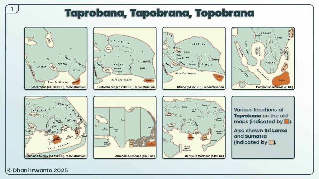
The mystery of Taprobana has captivated scholars and explorers for centuries. Often appearing on ancient maps as a prominent landmass in the Indian Ocean, Taprobana has been variously identified as Sri Lanka, Sumatra, and even Madagascar. Yet, these identifications have always left certain historical and geographical inconsistencies unresolved.
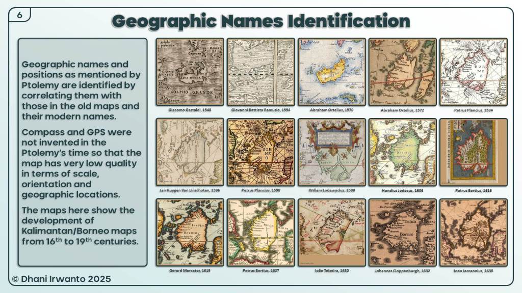
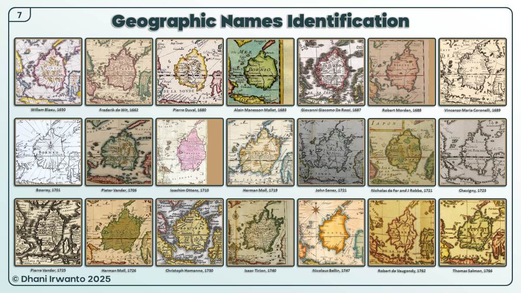
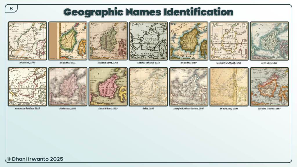
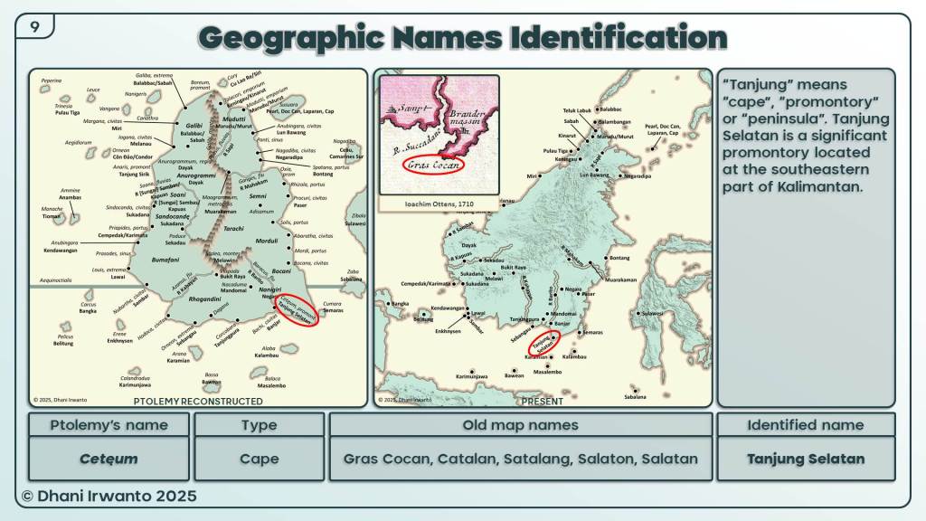
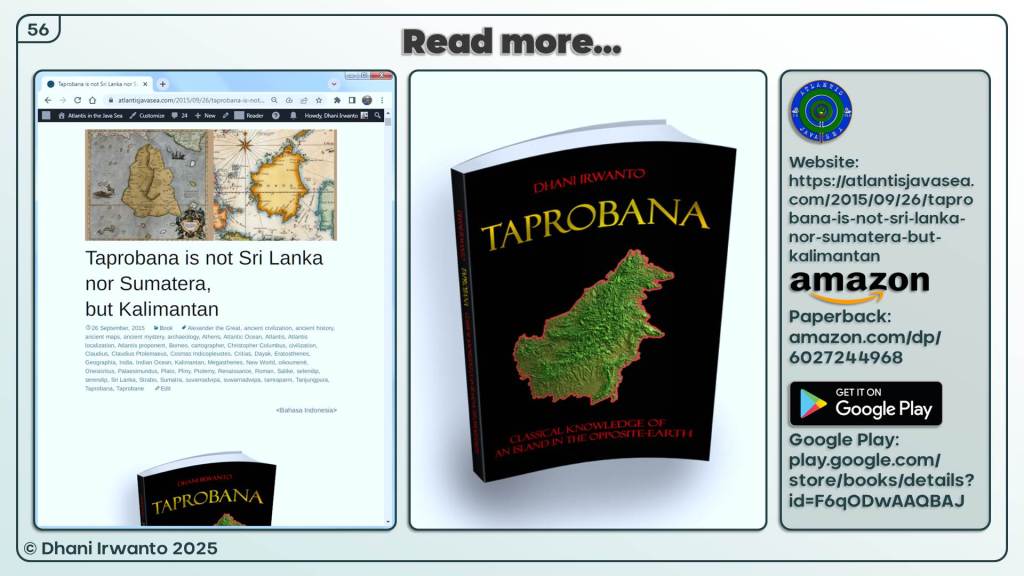
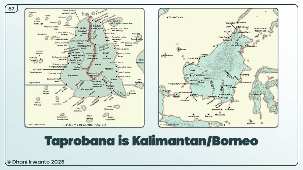
This presentation is the culmination of years of research, beginning in 2015, dedicated to answering the question: What is the true identity of Taprobana? Drawing upon classical sources—including the works of Eratosthenes, Strabo, Pliny, and Ptolemy—this study undertakes a comprehensive analysis of ancient texts, old maps, geographic features, and local place names. The investigation meticulously correlates Ptolemy’s list of locations with modern maps, cross-examines ancient measurements and descriptions, and evaluates environmental, cultural, and economic clues.
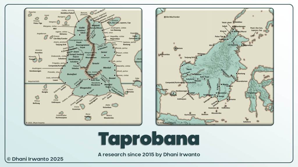
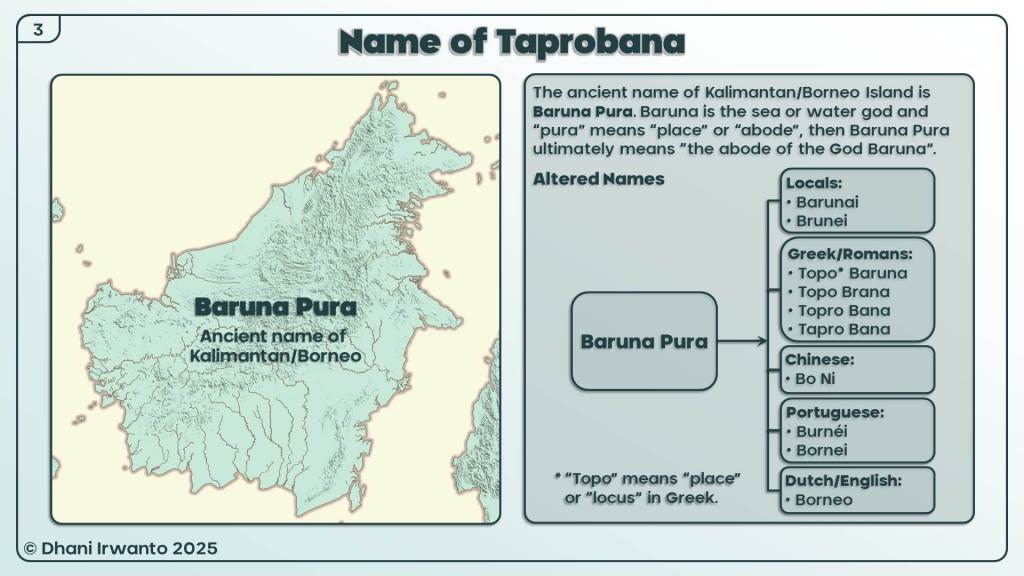
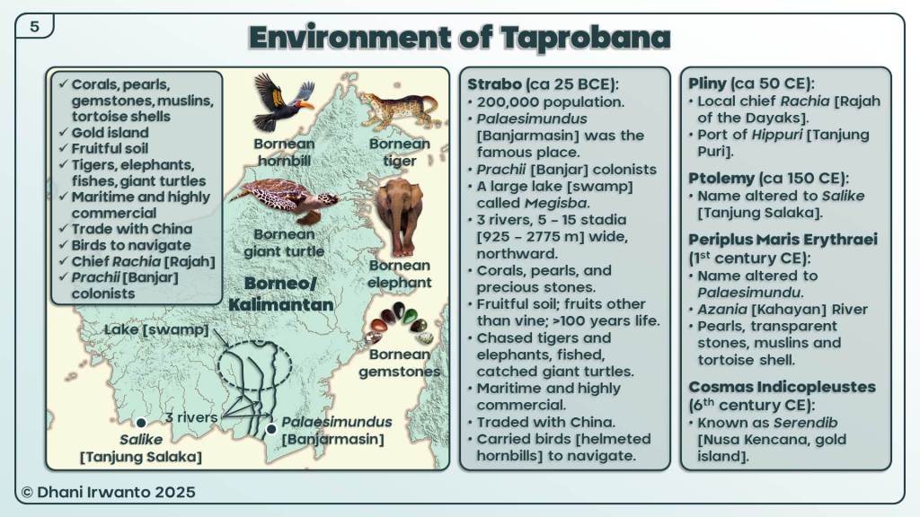
The findings presented here point unmistakably to Kalimantan, or Borneo, as the ancient Taprobana. Several compelling pieces of evidence support this conclusion: Borneo is the only large island in the region to straddle both sides of the equator—thus uniquely experiencing two summers and two winters as described in classical sources; the island’s size, shape, river systems, and biodiversity closely match the historical records; and the persistence of ancient names, places, and kingdoms further strengthens the identification.
This work not only challenges long-held assumptions but also enriches our understanding of Southeast Asia’s place in world history. By reclaiming Kalimantan’s legacy as the fabled Taprobana, this research invites a re-examination of the maritime, cultural, and economic history of the region, and offers new perspectives on the movement of people, goods, and ideas across the ancient world.